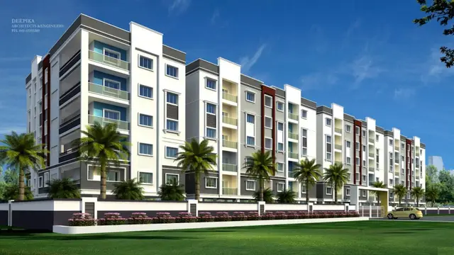
Shreya-Green Fields Phase-III
SHREYA INFRA DEVELOPERS PRIVATE LIMITED · Rangareddy · RERA P02400011315
SHREYA-GREEN FIELDS PHASE-III is a plotted development in PENDYAL, Maheshwaram mandal, Ranga Reddy district, developed by the registered promoter SHREYA INFAR DEVELOEPRS PRIVATE LIMITED. The registered site extent is 26304.20 sq. m, and the offering is plots; the supplied record does not state a plot count or plot-size configurations. TG-RERA registration number P02400011315 was granted for the project, with a proposed completion date of 07-Aug-2029.
01What we found
Read from TG-RERA filings, approvals, land and registration records and court records. A court case is counted only when the court record states this project's survey number with its village, or names the project.
02Check before you pay
8 items to check before you pay, 3 high - from the title chain, court records and approvals, each with what to ask the builder or your advocate. An item may not be a problem with the project: records can be incomplete.
Project at a glance
Project identity
| Field | Record |
|---|---|
| Registered project name | SHREYA-GREEN FIELDS PHASE-III RERA record |
| Project type | Plotted development / open-plot layout RERA record |
| Phase / registered portion | Phase III; the registration certificate identifies the project by this name. A separate phase-boundary description is not stated in the supplied record. RERA record |
| TG-RERA registration | P02400011315; registration granted under section 5. Approvals record |
| Registration validity | 07/08/2026 to 07/08/2029 (three years, according to the certificate). This is registration validity, not a statement that the layout is complete or occupancy-certified. Approvals record |
| Registered promoter | SHREYA INFAR DEVELOEPRS PRIVATE LIMITED RERA record |
| RERA status in supplied record | Registered; certificate issued 16/10/2026. Approvals record |
Land and geographic identity
| Field | Record |
|---|---|
| Locality / revenue village | PENDYAL / Pendyala; the supplied record identifies one revenue village. RERA record RERA filing |
| Mandal / district / PIN | Maheshwaram / Ranga Reddy / 509325 RERA record |
| Survey numbers and subdivisions | 131/A2, 131/A3, 131/A4, 131/A5, 131/A/1/1, 131/P RERA record Land records |
| Registered site extent | 26304.20 sq. m (also stated as 26304.2 Sqmt in the layout-approval record). RERA filing |
| Net / total layout area | 26304.2 sq. m; the supplied layout area statement gives the same figure as total net layout. Layout record |
| Boundaries | East: SY NO 131 PART AND ROAD; west: ROAD; north: ROAD; south: DUBBACHERLA VIL BOUNDARY. RERA filing |
| Project location point | Cadastral parcel centroid: 17.12259, 78.39983. Location record |
Development identity
| Field | Record |
|---|---|
| Sanctioning authority | Hyderabad Metropolitan Development Authority (HMDA); the draft layout letter records forwarding to Pendyal Gram Panchayat for release of proceedings and plans. Approvals record |
| Principal layout approval | 2393/HMDA/SWDL/2026, dated 07/08/2026; recorded as a draft layout permission/letter for a proposed open-plot layout. Approvals record |
| HMDA application reference | 016892/HMDA/04361/SWDL/SHZ/2026 Approvals record |
| Approved built-up area | 17157.36 sq. m is recorded in the RERA filing as approved built-up area. The supplied material does not explain its relationship to the layout’s plotted-area figure. RERA filing |
| Buildings / floors | Not applicable as a stated building configuration for this plotted-development record; no tower, floor or building-count schedule is supplied. RERA record |
| Common parking area in layout statement | 0.0 sq. m |
| Plot count / approved plot inventory | Not established by the supplied RERA unit data. The layout drawing is software-read, its plot count is incomplete, and no plot sizes were measured. Layout record |
Offering and status
| Field | Record |
|---|---|
| Offering | Plots in a plotted layout; unit types, plot-size range, and booked/available counts are not disclosed in the supplied data. RERA record RERA unit table |
| Construction stage | No independently verified site-progress assessment or measured construction stage is supplied. The RERA registration classifies the project as a new project. RERA record |
| Promoter-stated completion deadline | 07-Aug-2029, as stated in the Form B declaration and RERA registration record. |
| Original / revised completion date | The supplied record states 07-Aug-2029; no revised date or extension is recorded. |
| Completion / occupancy certificate | No completion certificate or occupancy certificate is included in the supplied documents. Document index |
The project story
SHREYA-GREEN FIELDS PHASE-III is registered as a plotted development in Pendyala village, Maheshwaram mandal, Ranga Reddy district. The RERA-filed land description covers survey subdivisions 131/A2, 131/A3, 131/A4, 131/A5, 131/A/1/1 and 131/P and records a site extent of 26304.20 sq. m. RERA record Land records
The HMDA record concerns a proposed open-plot layout and describes its permission as a draft layout letter. It records technical approval and forwarding to Pendyal Gram Panchayat for release of proceedings and plans; the supplied record does not establish that final layout proceedings have been released. The promoter’s stated completion date is 07-Aug-2029. No independently verified construction-progress report or completion/occupancy certificate is provided here. Document index
Master plan, architecture & building design
The layout’s stated total net area is 26304.2 sq. m. The layout area statement allocates 17157.36 sq. m to plots, 6141.43 sq. m to roads, 1973.32 sq. m to open space, 714.14 sq. m to social infrastructure and 317.88 sq. m to utilities. It records 0.0 sq. m for common parking and amenities. These are areas stated in the layout record; the supplied drawing-derived data cautions that plot count and sizes are incomplete and should be checked against the drawing. Layout record
The record is for a plotted layout, not a multi-storey residential building. No tower arrangement, building footprint, floor configuration, building height, or dwelling-unit floor plans are supplied. The separate RERA filing lists 17157.36 sq. m as approved built-up area; the supplied documents do not define that figure further. RERA filing Floor plans
Homes, configurations & floor plans
The RERA record identifies the offering as plots, but the supplied data does not provide a complete plot inventory, plot-size bands, or booked and available counts. The sole layout sheet is not fully measured: the software-derived record reports no plot sizes and says the plot count is incomplete. RERA record RERA unit table Layout record
| Configuration | Units | Booked | Available | RERA saleable area | Measured carpet area | Loading (if supplied) |
|---|---|---|---|---|---|---|
| Plots | Not disclosed | Not disclosed | Not disclosed | Not disclosed | Not applicable | Not supplied |
A RERA saleable-area figure is not supplied for individual plots. The available drawing-derived information is incomplete and does not establish individual plot dimensions or a verified inventory. RERA unit table Layout record
Parking & vehicle circulation
The layout area statement records 0.0 sq. m of common parking area. No parking-space count, visitor or accessible parking provision, EV charging, parking-allocation terms, or separate parking schedule is supplied. The HMDA draft layout conditions refer to mortgaged plots 1 to 17 and part of 18, measuring 2648.60 sq. m; this is an authority mortgage for layout works, not a statement of buyer parking allocation.
The layout record requires road formation and pedestrian footpaths, but no detailed circulation drawing or vehicle-entry/exit arrangement is available in the supplied material.
Amenities, recreation & open spaces
The RERA amenities record marks several infrastructure items as available (“YES”) but reports 0 progress for the listed items. Those entries describe the filing; they do not independently verify that the facilities have been completed. RERA amenities
| Description / size | No clubhouse or indoor amenity is identified in the supplied record. |
|---|---|
| Evidence source | RERA amenities Layout record |
| Declared progress / verified status | Not disclosed |
| Description / size | No specific sports facility is identified. |
|---|---|
| Evidence source | RERA amenities |
| Declared progress / verified status | Not disclosed |
| Description / size | Layout statement: 1973.32 sq. m open space (7.5%); RERA amenities list “Green Strip/TOT LOT/Park” and aggregate recreational open space as YES. |
|---|---|
| Evidence source | RERA amenities |
| Declared progress / verified status | Filing-listed; progress shown as 0; completion not independently verified |
| Description / size | Layout statement: 714.14 sq. m social infrastructure; amenities list “Community Buildings” without an area or progress figure. |
|---|---|
| Evidence source | RERA amenities |
| Declared progress / verified status | Area recorded in layout; facility details and completion not verified |
| Description / size | No separately specified convenience facility is identified. |
|---|---|
| Evidence source | RERA amenities |
| Declared progress / verified status | Not disclosed |
Utilities, building services & safety
The HMDA draft layout conditions describe proposed layout infrastructure, including internal water-supply lines and an overhead tank, a protected water-supply system and assured source, drainage, underground sewerage lines with a common septic tank/STP, storm-water drainage, electrical lines, transformer and street lighting, rainwater-harvesting pits, and solid-waste handling. These are stated as development requirements; the supplied evidence does not verify installation or operational capacity.
| What the supplied record says | Internal supply pipelines and overhead tank; an assured water source and connection arrangements are required by the draft layout conditions. |
|---|---|
| Status in supplied evidence | Proposed/required; source, storage capacity and completion not verified. |
| What the supplied record says | Underground drainage/sewerage lines and a common septic tank/STP are stated; storm-water drainage and NALA channelization are also required. |
|---|---|
| Status in supplied evidence | Proposed/required; capacity and completed status not supplied. |
| What the supplied record says | Electrical supply lines, transformer/transformer yard and street lighting are specified; the conditions call for LED street lighting. |
|---|---|
| Status in supplied evidence | Proposed/required; installation and supply capacity not verified. |
| What the supplied record says | The draft layout conditions call for solid-waste disposal, source segregation and a bio-compost unit. |
|---|---|
| Status in supplied evidence | Proposed/required; operational status not verified. |
| What the supplied record says | Fire protection and fire-safety requirements appear in the RERA amenities list, without system details or progress. |
|---|---|
| Status in supplied evidence | No system specification or completion evidence supplied. RERA amenities |
| What the supplied record says | The draft conditions refer to roads, paved footpaths, pedestrian space and cycling tracks. |
|---|---|
| Status in supplied evidence | Required/proposed; detailed design and completion not verified. |
| What the supplied record says | No building or lift schedule is supplied for this plotted layout. |
|---|---|
| Status in supplied evidence | Not disclosed. Floor plans |
Location, access & connectivity
The registered location is PENDYAL, Pendyala revenue village, Maheshwaram mandal, Ranga Reddy district, PIN 509325. The cadastral parcel centroid supplied is 17.12259, 78.39983. RERA record Location record
The nearest sampled Outer Ring Road interchange is listed at approximately 12.4 km. This is a supplied location-data distance, not a travel-time estimate. No further approach-road, public-transport or landmark details are supplied. Location record
Developer & development status
The registered promoter is SHREYA INFAR DEVELOEPRS PRIVATE LIMITED, a company; its GSTIN is 36AAKCS7493N1ZD. The project registration certificate lists the promoter office as Village/Mandal/District: Hyderabad, PIN 500085. The project filing separately lists the address as FIRST FLOOR, B007, BLOCK B, THE ANNEX APTS, PENDYAL, with Pendyala/Maheshwaram/Ranga Reddy details; the supplied information does not provide a verified phone number or email address. Corporate record RERA filing RERA filing
The RERA filing names ASHWIN KUMAR RAMESH BHAI PANDYA and MANGALAGIRI MAHESH as landowners under area-share arrangements. The registered supplementary development agreement describes plot allocations among the landowners and developer. This is a project-party disclosure, not a statement that the developer owns all project land. Parties record
The promoter’s Form B declaration states a completion date of 07-Aug-2029. No independently verified progress measurement or completion/occupancy certificate is present in the supplied record. Document index
Approvals, official records & documents
| Evidence supplied | Form C certificate; P02400011315; valid 07/08/2026–07/08/2029. |
|---|---|
| Scope / status | Project registration for SHREYA-GREEN FIELDS PHASE-III. |
| Evidence supplied | 2393/HMDA/SWDL/2026, dated 07/08/2026; application 016892/HMDA/04361/SWDL/SHZ/2026. |
|---|---|
| Scope / status | Draft layout letter for the proposed plotted layout; it records technical approval and forwarding to the Gram Panchayat. The supplied record does not establish release of final proceedings/plans. |
| Evidence supplied | Draft layout letter concerning the HMDA layout permission and the listed survey numbers. |
|---|---|
| Scope / status | Records delegation/forwarding in connection with layout proceedings; final release is not established by the supplied extract. |
| Evidence supplied | Mortgage deed 13912/2026, dated 03/08/2026; project filing records 2648.60 sq. m covering plots 1 to 17 and part of 18. |
|---|---|
| Scope / status | HMDA security for layout works; the draft layout conditions restrict sale of mortgaged plots until release. |
| Evidence supplied | Form B affidavit by authorised signatory BEZGAM SUBASH, dated 11-August-2026. |
|---|---|
| Scope / status | Promoter-declared title, encumbrance and completion undertakings. |
| Evidence supplied | One layout sheet is recorded; area statement supplied in the approval extract. |
|---|---|
| Scope / status | Drawing-derived plot inventory is incomplete; the approved-layout portal lookup is unavailable in the supplied evidence. Layout record HMDA |
| Evidence supplied | No certificate supplied. |
|---|---|
| Scope / status | Completion and occupancy certification are not established by the documents reviewed here. Document index |
Project at a glance
Project identity
Registered project name: SHREYA-GREEN FIELDS PHASE-III
Project type: Plotted development / open-plot layout
Phase / registered portion: Phase III; the registration certificate identifies the project by this name. A separate phase-boundary description is not stated in the supplied record.
TG-RERA registration: P02400011315; registration granted under section 5.
Registration validity: 07/08/2026 to 07/08/2029 (three years, according to the certificate). This is registration validity, not a statement that the layout is complete or occupancy-certified.
Registered promoter: SHREYA INFAR DEVELOEPRS PRIVATE LIMITED
RERA status in supplied record: Registered; certificate issued 16/10/2026.
Land and geographic identity
Locality / revenue village: PENDYAL / Pendyala; the supplied record identifies one revenue village.
Mandal / district / PIN: Maheshwaram / Ranga Reddy / 509325
Survey numbers and subdivisions: 131/A2, 131/A3, 131/A4, 131/A5, 131/A/1/1, 131/P
Registered site extent: 26304.20 sq. m (also stated as 26304.2 Sqmt in the layout-approval record).
Net / total layout area: 26304.2 sq. m; the supplied layout area statement gives the same figure as total net layout.
Boundaries: East: SY NO 131 PART AND ROAD; west: ROAD; north: ROAD; south: DUBBACHERLA VIL BOUNDARY.
Project location point: Cadastral parcel centroid: 17.12259, 78.39983.
Development identity
Sanctioning authority: Hyderabad Metropolitan Development Authority (HMDA); the draft layout letter records forwarding to Pendyal Gram Panchayat for release of proceedings and plans.
Principal layout approval: 2393/HMDA/SWDL/2026, dated 07/08/2026; recorded as a draft layout permission/letter for a proposed open-plot layout.
HMDA application reference: 016892/HMDA/04361/SWDL/SHZ/2026
Approved built-up area: 17157.36 sq. m is recorded in the RERA filing as approved built-up area. The supplied material does not explain its relationship to the layout’s plotted-area figure.
Buildings / floors: Not applicable as a stated building configuration for this plotted-development record; no tower, floor or building-count schedule is supplied.
Common parking area in layout statement: 0.0 sq. m
Plot count / approved plot inventory: Not established by the supplied RERA unit data. The layout drawing is software-read, its plot count is incomplete, and no plot sizes were measured.
Offering and status
Offering: Plots in a plotted layout; unit types, plot-size range, and booked/available counts are not disclosed in the supplied data.
Construction stage: No independently verified site-progress assessment or measured construction stage is supplied. The RERA registration classifies the project as a new project.
Promoter-stated completion deadline: 07-Aug-2029, as stated in the Form B declaration and RERA registration record.
Original / revised completion date: The supplied record states 07-Aug-2029; no revised date or extension is recorded.
Completion / occupancy certificate: No completion certificate or occupancy certificate is included in the supplied documents.
The project story
SHREYA-GREEN FIELDS PHASE-III is registered as a plotted development in Pendyala village, Maheshwaram mandal, Ranga Reddy district. The RERA-filed land description covers survey subdivisions 131/A2, 131/A3, 131/A4, 131/A5, 131/A/1/1 and 131/P and records a site extent of 26304.20 sq. m.
The HMDA record concerns a proposed open-plot layout and describes its permission as a draft layout letter. It records technical approval and forwarding to Pendyal Gram Panchayat for release of proceedings and plans; the supplied record does not establish that final layout proceedings have been released. The promoter’s stated completion date is 07-Aug-2029. No independently verified construction-progress report or completion/occupancy certificate is provided here.
Master plan, architecture & building design
The layout’s stated total net area is 26304.2 sq. m. The layout area statement allocates 17157.36 sq. m to plots, 6141.43 sq. m to roads, 1973.32 sq. m to open space, 714.14 sq. m to social infrastructure and 317.88 sq. m to utilities. It records 0.0 sq. m for common parking and amenities. These are areas stated in the layout record; the supplied drawing-derived data cautions that plot count and sizes are incomplete and should be checked against the drawing.
The record is for a plotted layout, not a multi-storey residential building. No tower arrangement, building footprint, floor configuration, building height, or dwelling-unit floor plans are supplied. The separate RERA filing lists 17157.36 sq. m as approved built-up area; the supplied documents do not define that figure further.
Homes, configurations & floor plans
The RERA record identifies the offering as plots, but the supplied data does not provide a complete plot inventory, plot-size bands, or booked and available counts. The sole layout sheet is not fully measured: the software-derived record reports no plot sizes and says the plot count is incomplete.
| Configuration | Units | Booked | Available | RERA saleable area | Measured carpet area | Loading (if supplied) |
|---|---|---|---|---|---|---|
| Plots | Not disclosed | Not disclosed | Not disclosed | Not disclosed | Not applicable | Not supplied |
A RERA saleable-area figure is not supplied for individual plots. The available drawing-derived information is incomplete and does not establish individual plot dimensions or a verified inventory.
Parking & vehicle circulation
The layout area statement records 0.0 sq. m of common parking area. No parking-space count, visitor or accessible parking provision, EV charging, parking-allocation terms, or separate parking schedule is supplied. The HMDA draft layout conditions refer to mortgaged plots 1 to 17 and part of 18, measuring 2648.60 sq. m; this is an authority mortgage for layout works, not a statement of buyer parking allocation.
The layout record requires road formation and pedestrian footpaths, but no detailed circulation drawing or vehicle-entry/exit arrangement is available in the supplied material.
Amenities, recreation & open spaces
The RERA amenities record marks several infrastructure items as available (“YES”) but reports 0 progress for the listed items. Those entries describe the filing; they do not independently verify that the facilities have been completed.
| Facility | Description / size | Evidence source | Declared progress / verified status |
|---|---|---|---|
| Clubhouse / indoor | No clubhouse or indoor amenity is identified in the supplied record. | Not disclosed | |
| Sports / recreation | No specific sports facility is identified. | Not disclosed | |
| Park / open space | Layout statement: 1973.32 sq. m open space (7.5%); RERA amenities list “Green Strip/TOT LOT/Park” and aggregate recreational open space as YES. | Filing-listed; progress shown as 0; completion not independently verified | |
| Community buildings / social infrastructure | Layout statement: 714.14 sq. m social infrastructure; amenities list “Community Buildings” without an area or progress figure. | Area recorded in layout; facility details and completion not verified | |
| Convenience / community | No separately specified convenience facility is identified. | Not disclosed |
Utilities, building services & safety
The HMDA draft layout conditions describe proposed layout infrastructure, including internal water-supply lines and an overhead tank, a protected water-supply system and assured source, drainage, underground sewerage lines with a common septic tank/STP, storm-water drainage, electrical lines, transformer and street lighting, rainwater-harvesting pits, and solid-waste handling. These are stated as development requirements; the supplied evidence does not verify installation or operational capacity.
| What the supplied record says | Internal supply pipelines and overhead tank; an assured water source and connection arrangements are required by the draft layout conditions. |
|---|---|
| Status in supplied evidence | Proposed/required; source, storage capacity and completion not verified. |
| What the supplied record says | Underground drainage/sewerage lines and a common septic tank/STP are stated; storm-water drainage and NALA channelization are also required. |
|---|---|
| Status in supplied evidence | Proposed/required; capacity and completed status not supplied. |
| What the supplied record says | Electrical supply lines, transformer/transformer yard and street lighting are specified; the conditions call for LED street lighting. |
|---|---|
| Status in supplied evidence | Proposed/required; installation and supply capacity not verified. |
| What the supplied record says | The draft layout conditions call for solid-waste disposal, source segregation and a bio-compost unit. |
|---|---|
| Status in supplied evidence | Proposed/required; operational status not verified. |
| What the supplied record says | Fire protection and fire-safety requirements appear in the RERA amenities list, without system details or progress. |
|---|---|
| Status in supplied evidence | No system specification or completion evidence supplied. |
| What the supplied record says | The draft conditions refer to roads, paved footpaths, pedestrian space and cycling tracks. |
|---|---|
| Status in supplied evidence | Required/proposed; detailed design and completion not verified. |
| What the supplied record says | No building or lift schedule is supplied for this plotted layout. |
|---|---|
| Status in supplied evidence | Not disclosed. |
Location, access & connectivity
The registered location is PENDYAL, Pendyala revenue village, Maheshwaram mandal, Ranga Reddy district, PIN 509325. The cadastral parcel centroid supplied is 17.12259, 78.39983.
The nearest sampled Outer Ring Road interchange is listed at approximately 12.4 km. This is a supplied location-data distance, not a travel-time estimate. No further approach-road, public-transport or landmark details are supplied.
Developer & development status
The registered promoter is SHREYA INFAR DEVELOEPRS PRIVATE LIMITED, a company; its GSTIN is 36AAKCS7493N1ZD. The project registration certificate lists the promoter office as Village/Mandal/District: Hyderabad, PIN 500085. The project filing separately lists the address as FIRST FLOOR, B007, BLOCK B, THE ANNEX APTS, PENDYAL, with Pendyala/Maheshwaram/Ranga Reddy details; the supplied information does not provide a verified phone number or email address.
The RERA filing names ASHWIN KUMAR RAMESH BHAI PANDYA and MANGALAGIRI MAHESH as landowners under area-share arrangements. The registered supplementary development agreement describes plot allocations among the landowners and developer. This is a project-party disclosure, not a statement that the developer owns all project land.
The promoter’s Form B declaration states a completion date of 07-Aug-2029. No independently verified progress measurement or completion/occupancy certificate is present in the supplied record.
Approvals, official records & documents
| Evidence supplied | Form C certificate; P02400011315; valid 07/08/2026–07/08/2029. |
|---|---|
| Scope / status | Project registration for SHREYA-GREEN FIELDS PHASE-III. |
| Evidence supplied | 2393/HMDA/SWDL/2026, dated 07/08/2026; application 016892/HMDA/04361/SWDL/SHZ/2026. |
|---|---|
| Scope / status | Draft layout letter for the proposed plotted layout; it records technical approval and forwarding to the Gram Panchayat. The supplied record does not establish release of final proceedings/plans. |
| Evidence supplied | Draft layout letter concerning the HMDA layout permission and the listed survey numbers. |
|---|---|
| Scope / status | Records delegation/forwarding in connection with layout proceedings; final release is not established by the supplied extract. |
| Evidence supplied | Mortgage deed 13912/2026, dated 03/08/2026; project filing records 2648.60 sq. m covering plots 1 to 17 and part of 18. |
|---|---|
| Scope / status | HMDA security for layout works; the draft layout conditions restrict sale of mortgaged plots until release. |
| Evidence supplied | Form B affidavit by authorised signatory BEZGAM SUBASH, dated 11-August-2026. |
|---|---|
| Scope / status | Promoter-declared title, encumbrance and completion undertakings. |
| Evidence supplied | One layout sheet is recorded; area statement supplied in the approval extract. |
|---|---|
| Scope / status | Drawing-derived plot inventory is incomplete; the approved-layout portal lookup is unavailable in the supplied evidence. |
| Evidence supplied | No certificate supplied. |
|---|---|
| Scope / status | Completion and occupancy certification are not established by the documents reviewed here. |
Frequently asked questions
Is SHREYA-GREEN FIELDS PHASE-III registered with Telangana RERA?
Yes. SHREYA-GREEN FIELDS PHASE-III is registered with the Telangana Real Estate Regulatory Authority as P02400011315; the registration status is New Project.
Who is the developer of SHREYA-GREEN FIELDS PHASE-III?
The promoter named in the RERA registration is SHREYA INFRA DEVELOPERS PRIVATE LIMITED.
Where is SHREYA-GREEN FIELDS PHASE-III located?
SHREYA-GREEN FIELDS PHASE-III is in PENDYAL, Pendyala, Maheshwaram, Rangareddy, Telangana (509325).
When will SHREYA-GREEN FIELDS PHASE-III be completed?
The promoter's proposed date of completion filed with RERA is 07/08/2029. This is the promoter's declaration, not a guarantee.
More projects in Pendyala