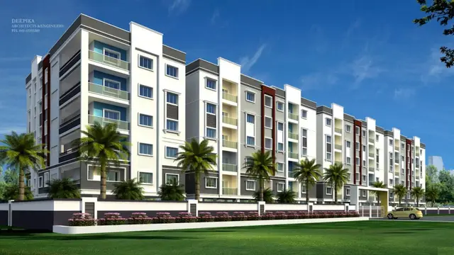
Green Meadows
M/S SHREYA INFRA · Rangareddy · RERA P02400000550
GREEN MEADOWS is a plotted development for open plots at MANSANPALLY X ROAD, Pendyala village, Maheshwaram, Ranga Reddy. The registered promoter developing it is M/S SHREYA INFRA. The project has a total site area of 48,723.637 sq. m and a net area of 46,997.21 sq. m; the drawing-derived reading identifies 146 numbered residential plots, with no buildings, floors or towers stated. Its TG-RERA registration is P02400000550, and the registration certificate gives 10/01/2022 as the proposed completion end date.
01What we found
Read from TG-RERA filings, approvals, land and registration records and court records. A court case is counted only when the court record states this project's survey number with its village, or names the project.
02Check before you pay
8 items to check before you pay, 4 high - from the title chain, court records and approvals, each with what to ask the builder or your advocate. An item may not be a problem with the project: records can be incomplete.
1. Project at a glance
Project identity
| Item | Record |
|---|---|
| Registered project name | GREEN MEADOWS |
| Project type | Plotted development / layout for open plots RERA record |
| Phase / registered portion | No phase is identified; the registration covers the plotted project in Survey No. 82/EE RERA record |
| TG-RERA registration | P02400000550; registration certificate issued 27/03/2019, valid through 10/01/2022; the supplied certificate says it is not extended |
| Registered promoter | M/S SHREYA INFRA, recorded as a partnership RERA record Corporate record |
| RERA status | The recorded registration validity has ended; the supplied materials do not establish a later extension or current registration status |
Land and geographic identity
| Item | Record |
|---|---|
| Locality | MANSANPALLY X ROAD RERA record |
| Revenue village | Pendyala; the layout approval refers to Pendyal Village RERA record |
| Mandal / district / PIN | Maheshwaram, Ranga Reddy, 501359 RERA record |
| Project survey identity | 82/EE in the RERA record; the layout approval describes the land as Sy. No. 82 Part RERA record |
| RERA-filed site area | Total area 48,723.637 sq. m; affected area 1,726.43 sq. m; net area 46,997.21 sq. m RERA filing |
| Layout-approval area statement | Total site area 48723.64; net site area 46997.21; master plan road affected area 0, as stated in the approval extract |
| Boundaries recorded in RERA fields | East: NEIGHBOURS LAND; West: 100 FT ROAD; North: 33FT ROAD; South: NEIGHBOURS LAND RERA filing |
Development identity
| Item | Record |
|---|---|
| Sanctioning authority | Hyderabad Metropolitan Development Authority (HMDA) RERA record |
| Principal layout approval | Draft layout permit 000011/LO/Plg/HMDA/2019, dated 11 January, 2019 |
| Approved layout area | Net site area 46997.21 sq. m in the approval extract |
| Approved built-up area | RERA fields state 46997.21 sq. m as “Approved Built up Area”; the evidence identifies this as a plotted layout and provides no building plans or building configuration RERA filing |
| Plot arrangement | The supplied software reading of the layout drawing identifies plot numbers 1 to 146; the plot-size schedule is not complete in the supplied drawing-derived data Layout record |
| Floor configuration / buildings | Not applicable to the evidenced plotted-layout proposal; no building count, floors or tower information is supplied |
| Parking | No parking count or parking layout is disclosed in the supplied record Document index |
Offering and status
| Item | Record |
|---|---|
| Offered unit type | Residential plots; the RERA-filed agreement form is for a plot, but its specific allottee and plot particulars are blank |
| RERA unit counts / booked and available | Not disclosed in the supplied project data |
| Plot count in drawing-derived reading | 146 numbered plots; software-read from the layout drawing and not a complete verified plot schedule Layout record |
| Construction stage | No independently verified site progress is supplied. RERA completion undertaking and registration certificate give 10/01/2022 as the project completion end date |
| Registration validity | Through 10/01/2022; separate from the completion undertaking |
| Completion deadline | Promoter’s Form B states completion “with in three years”; the registration certificate gives the end date as 10/01/2022 |
| OC / completion certificate | No occupancy or completion certificate is supplied. This is a plotted layout; the supplied approval is described as a draft layout |
2. The project story
- GREEN MEADOWS is registered as a plotted development in Pendyala, Maheshwaram Mandal, Ranga Reddy District, associated with MANSANPALLY X ROAD. The registered land identity is Survey No. 82/EE, while HMDA’s draft layout letter describes the proposal as Survey No. 82 Part. RERA record
- The filed approval material describes a layout for open plots with a net site area of 46997.21 sq. m. The drawing-derived reading identifies numbered plots 1 to 146, but the plot-size schedule is incomplete, and the supplied record does not establish current bookings, plot availability or site completion. Layout record
- The HMDA document is a draft layout approval subject to development and handover conditions, including infrastructure works and transfer of specified roads, open spaces and social-infrastructure land before final layout release. No final layout release or independent verification of completed works is included in the supplied evidence.
3. Master plan, architecture & building design
- This is a plotted layout, not a building or apartment scheme in the supplied approval record. The HMDA draft layout letter states a total site area of 48723.64, net site area of 46997.21, plotted area of 29046.79, layout road area of 12837.31, park area of 3880.89, and social-infrastructure area of 1232.24. It also records open space of 1232.24 in a separate land-use line; the supplied extract does not explain that line’s relationship to the separately stated park and social-infrastructure figures.
- The software reading of the approved layout drawing reports the following land-use split against a 48723.64 sq. m base: plots 29046.79 sq. m; roads 12837.31 sq. m; parks/open space 3880.89 sq. m; social infrastructure 1232.24 sq. m; amenities 0.0 sq. m. These are drawing-derived readings, not a complete plot schedule. Layout record
- The drawing-derived reading identifies plots numbered 1 to 146. It does not provide verified plot dimensions or sizes. No building footprints, floor levels, parking levels or residential/commercial building distribution are evidenced. Layout record
- The HMDA letter identifies 25 plots—Nos. 92 to 100, 101 to 108 and 125 to 132—as mortgaged to HMDA over 4442.75 Sq. Mtrs pending the stated layout-development and release conditions.
4. Homes, configurations & floor plans
The offering evidenced in the RERA-filed material is plots; the supplied agreement form is an uncompleted plot-sale form. No RERA configuration schedule, booked/available inventory, or verified plot-size schedule is supplied. Document index
| Configuration | Units | Booked | Available | RERA saleable area | Measured carpet area | Loading (if supplied) |
|---|---|---|---|---|---|---|
| Residential plots | Not disclosed in supplied RERA unit data; drawing-derived plot-number reading: 146 | Not disclosed | Not disclosed | Not disclosed | Not applicable | Not supplied |
The layout drawing reading reports plot numbers 1 to 146, but the plot-size schedule is incomplete and no plot dimensions can be reported from the supplied data. The project’s floor-plan data concerns no homes: 3 drawings are recorded, with 2 having no flats and 1 scan pending. Layout record Floor plans
5. Parking & vehicle circulation
No project parking count, visitor or accessible parking provision, parking allocation terms, or parking drawing is supplied. The HMDA approval requires roads to be opened for accessibility to neighbouring sites and describes road development, but the supplied materials do not establish completed road works or provide circulation dimensions. Document index
6. Amenities, recreation & open spaces
| Description / size | Listed as available in the RERA amenity data; layout approval requires road formation and black-topping, including the approach road to the nearest existing public road |
|---|---|
| Evidence source | RERA amenities |
| Declared progress / verified status | RERA amenity field shows 0% progress; completion not independently verified |
| Description / size | Storm-water drains and Nala channelization are included in the layout conditions |
|---|---|
| Evidence source | RERA amenities |
| Declared progress / verified status | RERA amenity field shows 0% progress; completion not independently verified |
| Description / size | Park area 3880.89 sq. m in the layout approval; organised open space is also stated as 3880.89 Sq.mtrs (8.26%) |
|---|---|
| Evidence source | Layout record |
| Declared progress / verified status | Transfer to the local body is required before final layout release; completion not independently verified |
| Description / size | 1232.24 sq. m stated in the layout approval |
|---|---|
| Declared progress / verified status | Transfer to the local body is required before final layout release; completion not independently verified |
| Description / size | Listed in RERA amenity data |
|---|---|
| Evidence source | RERA amenities |
| Declared progress / verified status | RERA amenity field shows 0% progress; size and completion status not supplied |
| Description / size | Rain-water harvesting pits required by the layout conditions and listed in RERA amenity data |
|---|---|
| Evidence source | RERA amenities |
| Declared progress / verified status | RERA amenity field shows 0% progress; completion not independently verified |
| Description / size | Promoter-site amenity claims; not established in the supplied RERA layout approval extract |
|---|---|
| Evidence source | Promoter website |
| Declared progress / verified status | Marketing claims; no progress or independent completion evidence supplied |
The amenity data lists 14 categories, including water supply, sewerage, street lighting, community buildings, energy management, fire protection and electrical meter/substation facilities. Where a progress percentage is supplied, it is 0; the data does not establish completed delivery. RERA amenities
7. Utilities, building services & safety
HMDA’s draft layout conditions require road formation, storm-water drainage and Nala channelization; underground drainage lines and a common septic tank/STP; internal water-supply pipelines, an overhead tank and an assured water source; electrical lines, street lighting and a transformer; avenue planting; park development; and rainwater-harvesting pits. These are approval conditions, not evidence that the works are complete.
The RERA amenity record lists water supply, sewerage, storm-water drains, street lighting, water conservation/rainwater harvesting and electrical meter-room/substation/receiving-station facilities, each with 0% progress where recorded. It provides no capacities, supply source, storage volumes or operating details. RERA amenities
Fire protection and safety requirements appear as an amenity category, but no project-specific fire-system design, clearance or completion evidence is supplied. No building lifts, backup power, waste-management arrangements, CCTV implementation or accessibility details are documented in the supplied RERA approval materials. RERA amenities Document index
8. Location, access & connectivity
The registered location is MANSANPALLY X ROAD, Pendyala village, Maheshwaram Mandal, Ranga Reddy District, Telangana, PIN 501359. The RERA fields describe the site’s west boundary as a 100 FT ROAD and north boundary as a 33FT ROAD. RERA record RERA filing
The location data gives Outer Ring Road (nearest sampled interchange, approx): 12.4 km. Location record
The layout approval refers to an existing BT road and requires a 15.0 mts distance from the center of that road, as well as development of the approach road to the nearest existing public road. These are approval-document statements; completion of the road works is not independently verified.
9. Developer & development status
The registered promoter is M/S SHREYA INFRA, recorded as a partnership. The supplied promoter address is B10, INDU ANNEX APARTMENTS, INDU FORTUNE FIELDS, KONDAPALAKALA VILLAGE ROAD, MANSANPALLY X ROAD, Maheshwaram, Ranga Reddy, 501359. RERA record Corporate record Parties record
The project record names SUBASH B and PRAKASH RAO P as authorised signatories. The Form B affidavit is signed by B Subash on behalf of M/S Shreya Infra and states a completion undertaking of “with in three years”; the registration certificate records validity through 10/01/2022. Parties record
The supplied data does not establish present site progress, plot sales or availability, final layout release, or completion of the required infrastructure works. The promoter website is recorded as https://www.shreyainfragroup.com/plots/green-meadows; no official contact details beyond those in the project data are verified here. Parties record Promoter website
10. Approvals, official records & documents
| Record | Supplied evidence |
|---|---|
| TG-RERA registration | Form C registration certificate for GREEN MEADOWS, No. P02400000550, issued 27/03/2019, valid through 10/01/2022; certificate states the promoter must maintain the separate-account arrangement |
| HMDA layout approval | Draft layout permit 000011/LO/Plg/HMDA/2019, dated 11 January, 2019, for the plotted proposal; the document identifies Sy. No. 82 Part |
| HMDA application | Application No. 016166/SMD/LT/U6/HMDA/09102018, dated 09 October, 2018 |
| HMDA mortgage record | Mortgage deed 24383/2018, dated 24-12-2018, for the specified 25 plots and 4442.75 Sq. Mtrs |
| Nala buffer gift deed | Gift deed 24384/2018, dated 24/12/2018; the approval states that 1726.43Sq.mtrs of Nala buffer area was handed over to the local body |
| Irrigation & CAD NOC reference | LR No. EE/IB/HYD/DB/HD/D6/2018-19/2050, dated 27-09-2018, cited by the layout approval |
| Title and promoter declarations | Advocate title-search report dated 21-01-2019 and Form B affidavit dated 30* day of January,2019 are among the supplied project documents |
| Sale-agreement form | Partially completed agreement for sale dated 15 February 2019; allottee and specific plot particulars are blank |
| Final layout release / completion evidence | No final layout release, site-completion record, or occupancy/completion certificate is supplied Document index |
1. Project at a glance
Project identity
Registered project name: GREEN MEADOWS
Project type: Plotted development / layout for open plots
Phase / registered portion: No phase is identified; the registration covers the plotted project in Survey No. 82/EE
TG-RERA registration: P02400000550; registration certificate issued 27/03/2019, valid through 10/01/2022; the supplied certificate says it is not extended
Registered promoter: M/S SHREYA INFRA, recorded as a partnership
RERA status: The recorded registration validity has ended; the supplied materials do not establish a later extension or current registration status
Land and geographic identity
Locality: MANSANPALLY X ROAD
Revenue village: Pendyala; the layout approval refers to Pendyal Village
Mandal / district / PIN: Maheshwaram, Ranga Reddy, 501359
Project survey identity: 82/EE in the RERA record; the layout approval describes the land as Sy. No. 82 Part
RERA-filed site area: Total area 48,723.637 sq. m; affected area 1,726.43 sq. m; net area 46,997.21 sq. m
Layout-approval area statement: Total site area 48723.64; net site area 46997.21; master plan road affected area 0, as stated in the approval extract
Boundaries recorded in RERA fields: East: NEIGHBOURS LAND; West: 100 FT ROAD; North: 33FT ROAD; South: NEIGHBOURS LAND
Development identity
Sanctioning authority: Hyderabad Metropolitan Development Authority (HMDA)
Principal layout approval: Draft layout permit 000011/LO/Plg/HMDA/2019, dated 11 January, 2019
Approved layout area: Net site area 46997.21 sq. m in the approval extract
Approved built-up area: RERA fields state 46997.21 sq. m as “Approved Built up Area”; the evidence identifies this as a plotted layout and provides no building plans or building configuration
Plot arrangement: The supplied software reading of the layout drawing identifies plot numbers 1 to 146; the plot-size schedule is not complete in the supplied drawing-derived data
Floor configuration / buildings: Not applicable to the evidenced plotted-layout proposal; no building count, floors or tower information is supplied
Parking: No parking count or parking layout is disclosed in the supplied record
Offering and status
Offered unit type: Residential plots; the RERA-filed agreement form is for a plot, but its specific allottee and plot particulars are blank
RERA unit counts / booked and available: Not disclosed in the supplied project data
Plot count in drawing-derived reading: 146 numbered plots; software-read from the layout drawing and not a complete verified plot schedule
Construction stage: No independently verified site progress is supplied. RERA completion undertaking and registration certificate give 10/01/2022 as the project completion end date
Registration validity: Through 10/01/2022; separate from the completion undertaking
Completion deadline: Promoter’s Form B states completion “with in three years”; the registration certificate gives the end date as 10/01/2022
OC / completion certificate: No occupancy or completion certificate is supplied. This is a plotted layout; the supplied approval is described as a draft layout
2. The project story
- GREEN MEADOWS is registered as a plotted development in Pendyala, Maheshwaram Mandal, Ranga Reddy District, associated with MANSANPALLY X ROAD. The registered land identity is Survey No. 82/EE, while HMDA’s draft layout letter describes the proposal as Survey No. 82 Part.
- The filed approval material describes a layout for open plots with a net site area of 46997.21 sq. m. The drawing-derived reading identifies numbered plots 1 to 146, but the plot-size schedule is incomplete, and the supplied record does not establish current bookings, plot availability or site completion.
- The HMDA document is a draft layout approval subject to development and handover conditions, including infrastructure works and transfer of specified roads, open spaces and social-infrastructure land before final layout release. No final layout release or independent verification of completed works is included in the supplied evidence.
3. Master plan, architecture & building design
- This is a plotted layout, not a building or apartment scheme in the supplied approval record. The HMDA draft layout letter states a total site area of 48723.64, net site area of 46997.21, plotted area of 29046.79, layout road area of 12837.31, park area of 3880.89, and social-infrastructure area of 1232.24. It also records open space of 1232.24 in a separate land-use line; the supplied extract does not explain that line’s relationship to the separately stated park and social-infrastructure figures.
- The software reading of the approved layout drawing reports the following land-use split against a 48723.64 sq. m base: plots 29046.79 sq. m; roads 12837.31 sq. m; parks/open space 3880.89 sq. m; social infrastructure 1232.24 sq. m; amenities 0.0 sq. m. These are drawing-derived readings, not a complete plot schedule.
- The drawing-derived reading identifies plots numbered 1 to 146. It does not provide verified plot dimensions or sizes. No building footprints, floor levels, parking levels or residential/commercial building distribution are evidenced.
- The HMDA letter identifies 25 plots—Nos. 92 to 100, 101 to 108 and 125 to 132—as mortgaged to HMDA over 4442.75 Sq. Mtrs pending the stated layout-development and release conditions.
4. Homes, configurations & floor plans
The offering evidenced in the RERA-filed material is plots; the supplied agreement form is an uncompleted plot-sale form. No RERA configuration schedule, booked/available inventory, or verified plot-size schedule is supplied.
| Configuration | Units | Booked | Available | RERA saleable area | Measured carpet area | Loading (if supplied) |
|---|---|---|---|---|---|---|
| Residential plots | Not disclosed in supplied RERA unit data; drawing-derived plot-number reading: 146 | Not disclosed | Not disclosed | Not disclosed | Not applicable | Not supplied |
The layout drawing reading reports plot numbers 1 to 146, but the plot-size schedule is incomplete and no plot dimensions can be reported from the supplied data. The project’s floor-plan data concerns no homes: 3 drawings are recorded, with 2 having no flats and 1 scan pending.
5. Parking & vehicle circulation
No project parking count, visitor or accessible parking provision, parking allocation terms, or parking drawing is supplied. The HMDA approval requires roads to be opened for accessibility to neighbouring sites and describes road development, but the supplied materials do not establish completed road works or provide circulation dimensions.
6. Amenities, recreation & open spaces
| Description / size | Listed as available in the RERA amenity data; layout approval requires road formation and black-topping, including the approach road to the nearest existing public road |
|---|---|
| Declared progress / verified status | RERA amenity field shows 0% progress; completion not independently verified |
| Description / size | Storm-water drains and Nala channelization are included in the layout conditions |
|---|---|
| Declared progress / verified status | RERA amenity field shows 0% progress; completion not independently verified |
| Description / size | Park area 3880.89 sq. m in the layout approval; organised open space is also stated as 3880.89 Sq.mtrs (8.26%) |
|---|---|
| Declared progress / verified status | Transfer to the local body is required before final layout release; completion not independently verified |
| Description / size | 1232.24 sq. m stated in the layout approval |
|---|---|
| Declared progress / verified status | Transfer to the local body is required before final layout release; completion not independently verified |
| Description / size | Listed in RERA amenity data |
|---|---|
| Declared progress / verified status | RERA amenity field shows 0% progress; size and completion status not supplied |
| Description / size | Rain-water harvesting pits required by the layout conditions and listed in RERA amenity data |
|---|---|
| Declared progress / verified status | RERA amenity field shows 0% progress; completion not independently verified |
| Description / size | Promoter-site amenity claims; not established in the supplied RERA layout approval extract |
|---|---|
| Declared progress / verified status | Marketing claims; no progress or independent completion evidence supplied |
The amenity data lists 14 categories, including water supply, sewerage, street lighting, community buildings, energy management, fire protection and electrical meter/substation facilities. Where a progress percentage is supplied, it is 0; the data does not establish completed delivery.
7. Utilities, building services & safety
HMDA’s draft layout conditions require road formation, storm-water drainage and Nala channelization; underground drainage lines and a common septic tank/STP; internal water-supply pipelines, an overhead tank and an assured water source; electrical lines, street lighting and a transformer; avenue planting; park development; and rainwater-harvesting pits. These are approval conditions, not evidence that the works are complete.
The RERA amenity record lists water supply, sewerage, storm-water drains, street lighting, water conservation/rainwater harvesting and electrical meter-room/substation/receiving-station facilities, each with 0% progress where recorded. It provides no capacities, supply source, storage volumes or operating details.
Fire protection and safety requirements appear as an amenity category, but no project-specific fire-system design, clearance or completion evidence is supplied. No building lifts, backup power, waste-management arrangements, CCTV implementation or accessibility details are documented in the supplied RERA approval materials.
8. Location, access & connectivity
The registered location is MANSANPALLY X ROAD, Pendyala village, Maheshwaram Mandal, Ranga Reddy District, Telangana, PIN 501359. The RERA fields describe the site’s west boundary as a 100 FT ROAD and north boundary as a 33FT ROAD.
The location data gives Outer Ring Road (nearest sampled interchange, approx): 12.4 km.
The layout approval refers to an existing BT road and requires a 15.0 mts distance from the center of that road, as well as development of the approach road to the nearest existing public road. These are approval-document statements; completion of the road works is not independently verified.
9. Developer & development status
The registered promoter is M/S SHREYA INFRA, recorded as a partnership. The supplied promoter address is B10, INDU ANNEX APARTMENTS, INDU FORTUNE FIELDS, KONDAPALAKALA VILLAGE ROAD, MANSANPALLY X ROAD, Maheshwaram, Ranga Reddy, 501359.
The project record names SUBASH B and PRAKASH RAO P as authorised signatories. The Form B affidavit is signed by B Subash on behalf of M/S Shreya Infra and states a completion undertaking of “with in three years”; the registration certificate records validity through 10/01/2022.
The supplied data does not establish present site progress, plot sales or availability, final layout release, or completion of the required infrastructure works. The promoter website is recorded as https://www.shreyainfragroup.com/plots/green-meadows; no official contact details beyond those in the project data are verified here.
10. Approvals, official records & documents
TG-RERA registration: Form C registration certificate for GREEN MEADOWS, No. P02400000550, issued 27/03/2019, valid through 10/01/2022; certificate states the promoter must maintain the separate-account arrangement
HMDA layout approval: Draft layout permit 000011/LO/Plg/HMDA/2019, dated 11 January, 2019, for the plotted proposal; the document identifies Sy. No. 82 Part
HMDA application: Application No. 016166/SMD/LT/U6/HMDA/09102018, dated 09 October, 2018
HMDA mortgage record: Mortgage deed 24383/2018, dated 24-12-2018, for the specified 25 plots and 4442.75 Sq. Mtrs
Nala buffer gift deed: Gift deed 24384/2018, dated 24/12/2018; the approval states that 1726.43Sq.mtrs of Nala buffer area was handed over to the local body
Irrigation & CAD NOC reference: LR No. EE/IB/HYD/DB/HD/D6/2018-19/2050, dated 27-09-2018, cited by the layout approval
Title and promoter declarations: Advocate title-search report dated 21-01-2019 and Form B affidavit dated 30* day of January,2019 are among the supplied project documents
Sale-agreement form: Partially completed agreement for sale dated 15 February 2019; allottee and specific plot particulars are blank
Final layout release / completion evidence: No final layout release, site-completion record, or occupancy/completion certificate is supplied
Frequently asked questions
Is GREEN MEADOWS registered with Telangana RERA?
Yes. GREEN MEADOWS is registered with the Telangana Real Estate Regulatory Authority as P02400000550; the registration status is New Project.
Who is the developer of GREEN MEADOWS?
The promoter named in the RERA registration is M/S SHREYA INFRA.
Where is GREEN MEADOWS located?
GREEN MEADOWS is in MANSANPALLY X ROAD, Pendyala, Maheshwaram, Rangareddy, Telangana (501359).
When will GREEN MEADOWS be completed?
The promoter's proposed date of completion filed with RERA is 10/01/2022. This is the promoter's declaration, not a guarantee.
More projects in Pendyala