Anjali Hills
LANDINDIA DEVELOPERS PRIVATE LIMITED · Rangareddy · RERA P02400000358
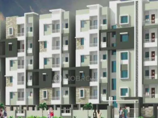
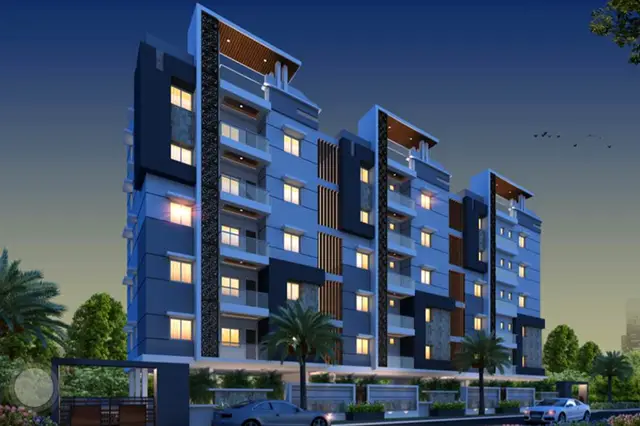
ANJALI HILLS is a residential apartment project in Puppalguda, Gandipet, Ranga Reddy District, developed by registered promoter LANDINDIA DEVELOPERS PRIVATE LIMITED. The registered site area is 660.78 sq. m., with one building comprising 1 Stilt + 5 upper floors and 15 apartments, all in a 2BHK configuration. The project is registered under TG-RERA number P02400000358, with proposed completion on 06/11/2020.
📘 Project brochure from the promoter’s website ↗More from Landindia Developers Pvt Ltd · 6 projects →
01What we found
Read from TG-RERA filings, approvals, land and registration records and court records. A court case is counted only when the court record states this project's survey number with its village, or names the project.
02Check before you pay
12 items to check before you pay, 6 high - from the title chain, court records and approvals, each with what to ask the builder or your advocate. An item may not be a problem with the project: records can be incomplete.

1. Project at a glance
Project identity
| Field | Project record |
|---|---|
| Registered name | ANJALI HILLS RERA record |
| Project type | Residential apartment project RERA record RERA filing |
| Phase / registered portion | A single registered project is identified; a separate phase name is not disclosed. The registration covers the project recorded at Puppalguda. RERA record |
| TG-RERA registration | P02400000358 RERA record |
| Registration validity | 01/03/2019 to 06/11/2020; the certificate records no extension. This is the registration period, not a construction or occupancy certificate. RERA record |
| Registered promoter | LANDINDIA DEVELOPERS PRIVATE LIMITED RERA record |
| RERA status | Recorded as “On-Going Project”; the registered completion date is 06/11/2020. RERA record RERA filing |
Land and geographic identity
| Field | Project record |
|---|---|
| Locality | Puppalguda / PUPPAGUDA RERA record RERA filing |
| Revenue village | Puppalguda (also rendered “Puppalguda Village” in the registration certificate and approval records). RERA record |
| Mandal / district / PIN | Gandipet / Ranga Reddy / 500089 RERA record |
| Project survey numbers and subdivisions, as recorded | 455 TO 460, 460,/1, 460/2 AND 461 RERA record RERA filing |
| Survey-number rendering in the building approval | 455 TO 460, 460/1, 460/2, 461 |
| Registered site extent | 660.78 sq. m. is recorded in the RERA land details and the HMDA approval extracts. RERA filing |
| Total / net area; affected area | Total area 660.78 sq. m.; net area 660.78 sq. m.; recorded area affected by road widening/FTL/Nala widening: 0. RERA filing |
| Boundaries | East: PLOT NO 175 AND 176; west: ROAD WIDTH 9; north: PLOT NO 170 PART; south: PLOT NO 169 PART. RERA filing |
Development identity
| Field | Project record |
|---|---|
| Sanctioning authority | Hyderabad Metropolitan Development Authority (HMDA). The technical approval says building plans are also to be sanctioned by the Executive Authority in conformity with HMDA’s technically approved plans. Approvals record |
| Principal approval | HMDA technical approval / file 000871/SKP/R1/U6/HMDA/22052017, dated 06/11/2017. Approvals record |
| Approved built-up area | The approval extract records 1498.2 sq. m. as built-up area; the plan extract separately records total built-up area 1797.84 sq. m., deductions 299.64 sq. m., and proposed net built-up area 1498.20 sq. m. These are the area labels used in the source records. |
| Building count and configuration | One residential building: 1 Stilt + 5 upper floors. The plan extract identifies it as non-highrise. RERA filing |
| Recorded height | The area-statement drawing records 20.26 mt. Total Ht., 17.82 mt. from GL, and 14.85 mt. Excluding Stilt Floor. |
| Parking levels / spaces | Stilt is shown in the building configuration. The supplied records do not establish a parking-space count or a unit-by-unit parking allocation. |
| Unit count | The RERA-recorded configuration has 15 apartments; the HMDA plan extract also records 15 dwelling units. RERA unit table |
Offering and status
| Field | Project record |
|---|---|
| RERA-filed configuration | 2BHK, 15 units RERA unit table |
| RERA-filed saleable area | 81.94 sq. m. per unit, as supplied for this configuration RERA unit table |
| Booked / available | 0 booked / 15 available, according to the TG-RERA portal data; the portal snapshot has no as-of date, so these counts are indicative. RERA unit table |
| Construction progress | RERA amenity/infrastructure entries show 20% for water supply, sewerage, storm-water drains, green strip/TOT LOT/park, solid-waste management, and rainwater harvesting. The supplied data does not establish independently verified overall construction progress or site completion. RERA amenities |
| Original / revised completion date | 06/11/2020 / 06/11/2020 RERA record RERA filing |
| Occupancy / completion certificate | No occupancy or completion certificate is identified in the supplied project records. The project is recorded as ongoing; certificate status is therefore not evidenced here. RERA record Document index |
2. The project story
ANJALI HILLS is a registered residential apartment project at Puppalguda, Gandipet Mandal, Ranga Reddy District. The registered site is recorded as 660.78 sq. m. and the sanctioned scheme is one stilt-plus-five-upper-floor building. The project record identifies 15 apartments in a single 2BHK configuration. RERA record RERA filing RERA unit table
The HMDA material describes a proposed building and technical approval, while the TG-RERA record gives the project a completion date of 06/11/2020 and lists it as ongoing. Some infrastructure items in the RERA progress data are recorded at 20%; that is a portal-reported figure, not an independent site inspection. No occupancy or completion certificate, or independently verified present-day construction stage, is established by the supplied evidence. RERA record RERA amenities Document index
3. Master plan, architecture & building design
The supplied approval material describes one residential building, named “BUILDING (GOGINENI MANIKYAMBA),” with a stilt floor and five upper floors. It records a site extent of 660.78 sq. m. and 15 dwelling units. The HMDA technical approval is subject to further local-authority sanction in conformity with the technically approved plans.
The area statements distinguish several measures: 1498.2 sq. m. built-up area in the technical approval; 1797.84 sq. m. total built-up area, 299.64 sq. m. deductions, and 1498.20 sq. m. proposed net built-up area in the plan extract; and 1500.80 sq. m. total proposed net BUA in the area statement. The records also show a proposed coverage area of 299.64 sq. m. and mortgage area of 155.78 sq. m. These source labels are retained; the supplied material does not include a drawing-based breakdown of flat-by-flat floor areas, circulation, lift/stair arrangement, landscape/open-space layout, or phase organization.
The area-statement drawing records a 9.00-wide abutting road and heights of 20.26 mt. Total Ht., 17.82 mt. from GL, and 14.85 mt. Excluding Stilt Floor. The technical approval also specifies a minimum 4.5 meters entry and exit width and a height clearance of 5 meters.
4. Homes, configurations & floor plans
| Configuration | Units | Booked | Available | RERA saleable area | Measured carpet area | Loading (if supplied) |
|---|---|---|---|---|---|---|
| 2BHK | 15 | 0 | 15 | 81.94 sq. m. | Not measured in the supplied floor-plan records | Not supplied |
The unit count, booking count, availability and saleable area are RERA-filed figures; the booking snapshot has no supplied as-of date. The floor-plan data says two drawings were reviewed, but none was measured and the records identify no flats in those drawings. Accordingly, no software-measured carpet area or room dimensions can be reported. Carpet area and saleable area are different measures; the latter can include the home’s share of common areas, and no loading figure is supplied here. RERA unit table RERA unit details Floor plans
5. Parking & vehicle circulation
The sanctioned scheme includes a stilt floor, but the supplied project records do not establish the number of car or two-wheeler spaces, visitor or accessible parking provision, mechanical or basement parking, or individual flat parking allocations. A parking-space ratio therefore cannot be stated. The HMDA technical approval requires one entry and one exit to the premises, each with a minimum width of 4.5 meters and height clearance of 5 meters; this is an approval condition, not evidence of completed vehicle circulation works.
6. Amenities, recreation & open spaces
The following items are recorded in TG-RERA infrastructure data. The percentages are portal-reported progress values; they do not establish independent verification of completion. RERA amenities
| Facility | Description / size | Evidence source | Declared progress / verified status |
|---|---|---|---|
| Green strip / TOT LOT / park | Size not supplied | TG-RERA infrastructure record RERA amenities | Recorded as available: YES; progress 20%; not independently verified |
| Community buildings | No facility description supplied | TG-RERA infrastructure record RERA amenities | Progress 0% |
| Aggregate recreational open space | Size not supplied | TG-RERA infrastructure record RERA amenities | Progress 0% |
7. Utilities, building services & safety
The HMDA technical approval identifies a transformer, garbage house, generator and septic tank as amenities/utilities in the approval material. It also specifies a septic tank, a generator as an alternate electricity source, emergency lighting in corridors/common passages and staircases, and fire-safety provisions including fire extinguishers, a manually operated alarm system, fire-resistant swing doors for collapsible lifts, and sprinkler provision if the basement area exceeds 200 sq. m. The approval requires the applicant to follow Fire Service Department norms; these are approval conditions, not proof that the systems have been installed or certified.
The RERA infrastructure record marks water supply, sewerage/septic tank/STP, storm-water drains, solid-waste management and disposal, and water conservation/rainwater harvesting as available, each with 20% progress recorded. It does not give capacities, water sources, storage volumes, treatment/reuse details or independent completion verification. RERA amenities
The developer brochure describes an RO drinking-water plant, intercom with video calling, solar fencing with CCTV, generator backup and a multipurpose hall. These are promoter-marketed claims, not established as sanctioned or delivered facilities in the supplied evidence. Promoter website
8. Location, access & connectivity
The registered project location is Puppalguda, Gandipet Mandal, Ranga Reddy District, PIN 500089. The project’s recorded boundaries include a 9-wide road on the west; the HMDA area-statement drawing also notes a 9.00-wide abutting road. The locality is not accompanied by a supplied approach-road map or public-transport information. RERA record RERA filing
A supplied location record identifies Financial District (Nanakramguda) at 2.0 km. This is the only measured connectivity distance in the project location data. Location record
9. Developer & development status
The registered legal promoter is LANDINDIA DEVELOPERS PRIVATE LIMITED, recorded as a company. Its supplied GSTIN is 36AACCL3746P2ZZ. The RERA record lists the promoter address as Capital Green Apartments, Secretariat Colony, Puppalguda, Gandipet, Ranga Reddy, Telangana, 500089. RERA record Corporate record Parties record
The developer website supplied for the project is thelandindia.in; brochure sales contact details are [email protected] and +91 79977 99991. The brochure uses the brand name “LANDINDIA”; the registered entity is the legal promoter identified above. Parties record Promoter website
The registered completion date is 06/11/2020, and the project remains recorded as ongoing in the supplied RERA data. Infrastructure progress is available only as the portal-reported item-level figures noted above; no independently verified overall construction percentage, current site inspection, or occupancy/completion certificate is supplied. RERA record RERA amenities Document index
10. Approvals, official records & documents
| Record | What the supplied evidence establishes |
|---|---|
| TG-RERA registration certificate, P02400000358 | Form C for ANJALI HILLS; registration from 01/03/2019 to 06/11/2020; promoter Landindia Developers Private Limited; records survey numbers 455 TO 460, 460,/1, 460/2, 461. No extension is recorded in the supplied certificate. |
| HMDA technical approval, 000871/SKP/R1/U6/HMDA/22052017 | Dated 06/11/2017; technical approval for a residential 1 Stilt + 5-floor building on the stated Puppalguda survey land, subject to conditions including local-authority sanction. |
| Building plan / area statement | HMDA-filed plan extract records 15 dwelling units, stilt plus five upper floors, and area statements. The supplied records do not establish a separate layout approval number. |
| Mortgage recorded in approval material | The approval records mortgage document 6666/2017 and 155.78 sq. m. (10.40% of built-up area) in favour of the Metropolitan Commissioner, HMDA. |
| Form B declaration | Project affidavit records promoter declarations concerning title/development documentation, encumbrances, project funds, audit, approvals and completion undertaking. These are declarations by the declarant, not independent verification. |
| Other commencement-certificate upload | Document 38371 contains OCR references to rules and conditions but no legible approval particulars sufficient to identify the authority, applicant, approved land or building details. |
| Occupancy / completion certificate | No such certificate is identified in the supplied project documents. Document index |
1. Project at a glance
Project identity
Registered name: ANJALI HILLS
Project type: Residential apartment project
Phase / registered portion: A single registered project is identified; a separate phase name is not disclosed. The registration covers the project recorded at Puppalguda.
TG-RERA registration: P02400000358
Registration validity: 01/03/2019 to 06/11/2020; the certificate records no extension. This is the registration period, not a construction or occupancy certificate.
Registered promoter: LANDINDIA DEVELOPERS PRIVATE LIMITED
RERA status: Recorded as “On-Going Project”; the registered completion date is 06/11/2020.
Land and geographic identity
Locality: Puppalguda / PUPPAGUDA
Revenue village: Puppalguda (also rendered “Puppalguda Village” in the registration certificate and approval records).
Mandal / district / PIN: Gandipet / Ranga Reddy / 500089
Project survey numbers and subdivisions, as recorded: 455 TO 460, 460,/1, 460/2 AND 461
Survey-number rendering in the building approval: 455 TO 460, 460/1, 460/2, 461
Registered site extent: 660.78 sq. m. is recorded in the RERA land details and the HMDA approval extracts.
Total / net area; affected area: Total area 660.78 sq. m.; net area 660.78 sq. m.; recorded area affected by road widening/FTL/Nala widening: 0.
Boundaries: East: PLOT NO 175 AND 176; west: ROAD WIDTH 9; north: PLOT NO 170 PART; south: PLOT NO 169 PART.
Development identity
Sanctioning authority: Hyderabad Metropolitan Development Authority (HMDA). The technical approval says building plans are also to be sanctioned by the Executive Authority in conformity with HMDA’s technically approved plans.
Principal approval: HMDA technical approval / file 000871/SKP/R1/U6/HMDA/22052017, dated 06/11/2017.
Approved built-up area: The approval extract records 1498.2 sq. m. as built-up area; the plan extract separately records total built-up area 1797.84 sq. m., deductions 299.64 sq. m., and proposed net built-up area 1498.20 sq. m. These are the area labels used in the source records.
Building count and configuration: One residential building: 1 Stilt + 5 upper floors. The plan extract identifies it as non-highrise.
Recorded height: The area-statement drawing records 20.26 mt. Total Ht., 17.82 mt. from GL, and 14.85 mt. Excluding Stilt Floor.
Parking levels / spaces: Stilt is shown in the building configuration. The supplied records do not establish a parking-space count or a unit-by-unit parking allocation.
Unit count: The RERA-recorded configuration has 15 apartments; the HMDA plan extract also records 15 dwelling units.
Offering and status
RERA-filed configuration: 2BHK, 15 units
RERA-filed saleable area: 81.94 sq. m. per unit, as supplied for this configuration
Booked / available: 0 booked / 15 available, according to the TG-RERA portal data; the portal snapshot has no as-of date, so these counts are indicative.
Construction progress: RERA amenity/infrastructure entries show 20% for water supply, sewerage, storm-water drains, green strip/TOT LOT/park, solid-waste management, and rainwater harvesting. The supplied data does not establish independently verified overall construction progress or site completion.
Original / revised completion date: 06/11/2020 / 06/11/2020
Occupancy / completion certificate: No occupancy or completion certificate is identified in the supplied project records. The project is recorded as ongoing; certificate status is therefore not evidenced here.
2. The project story
ANJALI HILLS is a registered residential apartment project at Puppalguda, Gandipet Mandal, Ranga Reddy District. The registered site is recorded as 660.78 sq. m. and the sanctioned scheme is one stilt-plus-five-upper-floor building. The project record identifies 15 apartments in a single 2BHK configuration.
The HMDA material describes a proposed building and technical approval, while the TG-RERA record gives the project a completion date of 06/11/2020 and lists it as ongoing. Some infrastructure items in the RERA progress data are recorded at 20%; that is a portal-reported figure, not an independent site inspection. No occupancy or completion certificate, or independently verified present-day construction stage, is established by the supplied evidence.
3. Master plan, architecture & building design
The supplied approval material describes one residential building, named “BUILDING (GOGINENI MANIKYAMBA),” with a stilt floor and five upper floors. It records a site extent of 660.78 sq. m. and 15 dwelling units. The HMDA technical approval is subject to further local-authority sanction in conformity with the technically approved plans.
The area statements distinguish several measures: 1498.2 sq. m. built-up area in the technical approval; 1797.84 sq. m. total built-up area, 299.64 sq. m. deductions, and 1498.20 sq. m. proposed net built-up area in the plan extract; and 1500.80 sq. m. total proposed net BUA in the area statement. The records also show a proposed coverage area of 299.64 sq. m. and mortgage area of 155.78 sq. m. These source labels are retained; the supplied material does not include a drawing-based breakdown of flat-by-flat floor areas, circulation, lift/stair arrangement, landscape/open-space layout, or phase organization.
The area-statement drawing records a 9.00-wide abutting road and heights of 20.26 mt. Total Ht., 17.82 mt. from GL, and 14.85 mt. Excluding Stilt Floor. The technical approval also specifies a minimum 4.5 meters entry and exit width and a height clearance of 5 meters.
4. Homes, configurations & floor plans
| Configuration | Units | Booked | Available | RERA saleable area | Measured carpet area | Loading (if supplied) |
|---|---|---|---|---|---|---|
| 2BHK | 15 | 0 | 15 | 81.94 sq. m. | Not measured in the supplied floor-plan records | Not supplied |
The unit count, booking count, availability and saleable area are RERA-filed figures; the booking snapshot has no supplied as-of date. The floor-plan data says two drawings were reviewed, but none was measured and the records identify no flats in those drawings. Accordingly, no software-measured carpet area or room dimensions can be reported. Carpet area and saleable area are different measures; the latter can include the home’s share of common areas, and no loading figure is supplied here.
5. Parking & vehicle circulation
The sanctioned scheme includes a stilt floor, but the supplied project records do not establish the number of car or two-wheeler spaces, visitor or accessible parking provision, mechanical or basement parking, or individual flat parking allocations. A parking-space ratio therefore cannot be stated. The HMDA technical approval requires one entry and one exit to the premises, each with a minimum width of 4.5 meters and height clearance of 5 meters; this is an approval condition, not evidence of completed vehicle circulation works.
6. Amenities, recreation & open spaces
The following items are recorded in TG-RERA infrastructure data. The percentages are portal-reported progress values; they do not establish independent verification of completion.
| Facility | Description / size | Evidence source | Declared progress / verified status |
|---|---|---|---|
| Green strip / TOT LOT / park | Size not supplied | TG-RERA infrastructure record | Recorded as available: YES; progress 20%; not independently verified |
| Community buildings | No facility description supplied | TG-RERA infrastructure record | Progress 0% |
| Aggregate recreational open space | Size not supplied | TG-RERA infrastructure record | Progress 0% |
7. Utilities, building services & safety
The HMDA technical approval identifies a transformer, garbage house, generator and septic tank as amenities/utilities in the approval material. It also specifies a septic tank, a generator as an alternate electricity source, emergency lighting in corridors/common passages and staircases, and fire-safety provisions including fire extinguishers, a manually operated alarm system, fire-resistant swing doors for collapsible lifts, and sprinkler provision if the basement area exceeds 200 sq. m. The approval requires the applicant to follow Fire Service Department norms; these are approval conditions, not proof that the systems have been installed or certified.
The RERA infrastructure record marks water supply, sewerage/septic tank/STP, storm-water drains, solid-waste management and disposal, and water conservation/rainwater harvesting as available, each with 20% progress recorded. It does not give capacities, water sources, storage volumes, treatment/reuse details or independent completion verification.
The developer brochure describes an RO drinking-water plant, intercom with video calling, solar fencing with CCTV, generator backup and a multipurpose hall. These are promoter-marketed claims, not established as sanctioned or delivered facilities in the supplied evidence.
8. Location, access & connectivity
The registered project location is Puppalguda, Gandipet Mandal, Ranga Reddy District, PIN 500089. The project’s recorded boundaries include a 9-wide road on the west; the HMDA area-statement drawing also notes a 9.00-wide abutting road. The locality is not accompanied by a supplied approach-road map or public-transport information.
A supplied location record identifies Financial District (Nanakramguda) at 2.0 km. This is the only measured connectivity distance in the project location data.
9. Developer & development status
The registered legal promoter is LANDINDIA DEVELOPERS PRIVATE LIMITED, recorded as a company. Its supplied GSTIN is 36AACCL3746P2ZZ. The RERA record lists the promoter address as Capital Green Apartments, Secretariat Colony, Puppalguda, Gandipet, Ranga Reddy, Telangana, 500089.
The developer website supplied for the project is thelandindia.in; brochure sales contact details are [email protected] and +91 79977 99991. The brochure uses the brand name “LANDINDIA”; the registered entity is the legal promoter identified above.
The registered completion date is 06/11/2020, and the project remains recorded as ongoing in the supplied RERA data. Infrastructure progress is available only as the portal-reported item-level figures noted above; no independently verified overall construction percentage, current site inspection, or occupancy/completion certificate is supplied.
10. Approvals, official records & documents
TG-RERA registration certificate, P02400000358: Form C for ANJALI HILLS; registration from 01/03/2019 to 06/11/2020; promoter Landindia Developers Private Limited; records survey numbers 455 TO 460, 460,/1, 460/2, 461. No extension is recorded in the supplied certificate.
HMDA technical approval, 000871/SKP/R1/U6/HMDA/22052017: Dated 06/11/2017; technical approval for a residential 1 Stilt + 5-floor building on the stated Puppalguda survey land, subject to conditions including local-authority sanction.
Building plan / area statement: HMDA-filed plan extract records 15 dwelling units, stilt plus five upper floors, and area statements. The supplied records do not establish a separate layout approval number.
Mortgage recorded in approval material: The approval records mortgage document 6666/2017 and 155.78 sq. m. (10.40% of built-up area) in favour of the Metropolitan Commissioner, HMDA.
Form B declaration: Project affidavit records promoter declarations concerning title/development documentation, encumbrances, project funds, audit, approvals and completion undertaking. These are declarations by the declarant, not independent verification.
Other commencement-certificate upload: Document 38371 contains OCR references to rules and conditions but no legible approval particulars sufficient to identify the authority, applicant, approved land or building details.
Occupancy / completion certificate: No such certificate is identified in the supplied project documents.
Frequently asked questions
Is ANJALI HILLS registered with Telangana RERA?
Yes. ANJALI HILLS is registered with the Telangana Real Estate Regulatory Authority as P02400000358; the registration status is On-Going Project.
Who is the developer of ANJALI HILLS?
The promoter named in the RERA registration is LANDINDIA DEVELOPERS PRIVATE LIMITED.
Where is ANJALI HILLS located?
ANJALI HILLS is in PUPPAGUDA, Puppalguda, Gandipet, Rangareddy, Telangana (500089).
When will ANJALI HILLS be completed?
The promoter's proposed date of completion filed with RERA is 06/11/2020. This is the promoter's declaration, not a guarantee.
More projects in Puppalguda