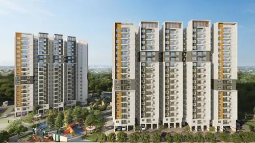
Manjeera Township
KUBERA INFRA AND DEVELOPERS AND RAASHA REALTY · Sangareddy · RERA P01100008533
MANJEERA TOWNSHIP is a plotted development at Taddanpally Gram Panchayat, PULKAL Mandal, Sangareddy District. The registered promoters are Kubera Infra And Developers and Raasha Realty. The project covers 73851.08 sq m and the filed layout describes 242 plots; no plot configurations are stated. It is registered under TG-RERA number P01100008533, with a proposed completion date of 30/11/2026.
01What we found
Read from TG-RERA filings, approvals, land and registration records and court records. A court case is counted only when the court record states this project's survey number with its village, or names the project.
02Check before you pay
10 items to check before you pay, 4 high - from the title chain, court records and approvals, each with what to ask the builder or your advocate. An item may not be a problem with the project: records can be incomplete.
1. Project at a glance
Project identity
| Field | Record |
|---|---|
| Registered project name | MANJEERA TOWNSHIP RERA record |
| Project type | Plotted development RERA record |
| Phase / registered portion | Phase not separately identified; registration covers the plotted project on the survey numbers listed below |
| TG-RERA registration | P01100008533 RERA record |
| Registration validity | 27/07/2024 to 21/04/2026, subject to extension by the Authority |
| Registered promoter(s) | Kubera Infra And Developers and Raasha Realty |
| RERA status in supplied record | New Project; registration certificate supplied RERA record |
Land and geographic identity
| Field | Record |
|---|---|
| Locality | Taddanpally Gram Panchayat RERA record |
| Revenue village | THADANPALLY RERA record |
| Mandal | PULKAL in the RERA project record; Choutakur/Chowtkur appears in the filed layout-permission documents RERA record |
| District / PIN | Sangareddy / 502293 RERA record |
| Project survey numbers and subdivisions | 31/P, 36/P, 37/P and 39/P RERA record |
| Registered site extent | RERA land record: 73851.08 sq m RERA record Land records |
| Layout areas stated in filed approval | Layout area Ac. 18.249 Cents; 88325.16 Sq. Yds; net layout area Ac. 18.056 Cents; 87391.04 Sq. Yds. |
| Boundaries | East: EXISTING ROAD; West: OTHERS LAND; North: EXISTING ROAD; South: OTHERS LAND RERA record Land records |
Development identity
| Field | Record |
|---|---|
| Sanctioning authority named in layout documents | Director of Town and Country Planning, with layout permission delegated to Taddanpally Gram Panchayat |
| Principal layout reference | Draft Technical Layout Pattern Draft-TLP No.58/2024/H; filed approval document states 22/04/2024 |
| Plots in filed layout extraction | 242 plots |
| Approved built-up area | Not disclosed in the supplied layout approval material. The RERA record contains 42220.85 sq m as “Approved Built up Area”; its relationship to any final layout approval or built form is not further explained in the supplied evidence RERA record |
| Buildings / floors | Not established in the supplied RERA and layout records; this is a plotted layout, and no reliable building count or floor configuration is supplied |
| Roads and land-use areas in filed layout | Open space: Ac. 1.806 Cents; 8741.04 Sq. Yds (10.00%); road area: Ac. 5.817 Cents; 28154.28 Sq. Yds. (32.21%); plotted area: Ac. 10.433 Cents; 50495.72 Sq. Yds. (57.79%) |
| Mortgage area shown in layout approval | Ac. 1.718 Cents; 8315.12 Sq. Yds. (15.40%), identified as plots reserved/mortgaged to Taddanpally Gram Panchayat |
Offering and status
| Field | Record |
|---|---|
| Offering | Plots; no RERA-filed plot-size schedule or unit-type table is supplied here RERA record |
| Booked / available counts | Not established in the supplied project record |
| Construction / development stage | No independently verified site-progress record supplied. The filed Form B contains a promoter undertaking to complete by 21/04/2026 |
| Completion date in project header | 30/11/2026 RERA record |
| Occupancy / completion certificate | No occupancy or completion certificate is supplied; for a plotted layout, the supplied evidence instead concerns draft layout permission and conditions for final layout release |
Registration validity, the completion undertaking/date and the status of any completion or occupancy certificate are separate matters. The supplied evidence does not establish that the layout has received final release or that development works are complete.
2. The project story
MANJEERA TOWNSHIP is registered as a plotted-development project at Taddanpally Gram Panchayat, in the revenue village of THADANPALLY, Pulkal Mandal, Sangareddy District. The RERA certificate identifies the project land as 31/P, 36/P, 37/P and 39/P and names Kubera Infra And Developers and Raasha Realty as promoter(s).
The filed layout material describes a proposed 242-plot residential layout, with internal roads and open space. The approval is identified as a draft technical layout pattern and includes conditions for development works and for transfer of roads and open space to the Gram Panchayat by registered gift deed before final layout release. It also describes land reserved as mortgage security to the Gram Panchayat. These are features and conditions of the filed layout record, not evidence that the works, handovers or final release have been completed.
The record includes a promoter-signed Form B undertaking completion by 21/04/2026 and a project-header completion date of 30/11/2026. No site inspection, independently verified construction progress, final layout release, or completion/occupancy certificate is included in the supplied evidence. RERA record
3. Master plan, architecture & building design
The development evidenced in the RERA-filed approval material is a plotted residential layout rather than a documented multi-storey building scheme. The layout approval extraction states a layout area of Ac. 18.249 Cents; 88325.16 Sq. Yds and a net layout area of Ac. 18.056 Cents; 87391.04 Sq. Yds. It allocates 10.00% to open space, 32.21% to roads and 57.79% to plotted area; a 15.40% mortgage area is also identified.
The filed layout conditions identify proposed road widths of 40'-0" and 33'-0", alongside an existing 40'-0" wide road. The layout conditions also call for roads to be formed, drains and nala channels to be constructed, open spaces to be fenced, and avenue planting and rainwater-harvesting pits to be provided. These are approval conditions, not verification that the work has been carried out.
No reliable plot-by-plot schedule, plot dimensions, final released layout drawing, building configuration, or approved floor plans are available in the supplied evidence. The RERA record lists approved built-up area as 42220.85 sq m, but the supplied documents do not explain its scope or connect it to a building or plot schedule. RERA record
4. Homes, configurations & floor plans
This project is recorded as plotted development. The supplied evidence does not provide a RERA-filed plot-size schedule, booked or available plot counts, or plot-wise saleable areas, so a configuration table cannot be completed from the record.
Two floor-plan drawings are noted, but both are scans pending measurement; no measured carpet-area figures are available. The vendor record contains a “2 BHK” and “saleable 1200 sqft” entry, but that is not a RERA-filed plot or unit schedule and is not used here to describe the registered offering. Floor plans Promoter website
5. Parking & vehicle circulation
The filed layout material identifies internal roads and road widths of 40'-0" and 33'-0", and refers to an existing 40'-0" wide road. It does not establish a sanctioned parking-space count, visitor or accessible parking provision, parking levels, or plot-wise parking allocation.
The supplied RERA layout record does not establish that any drawn or reserved area is an exclusive parking space for a purchaser. Parking arrangements and any legal allocation should therefore be confirmed from the final layout and the relevant sale documents.
6. Amenities, recreation & open spaces
The layout approval material includes open space and specified infrastructure or landscaping conditions. The record does not include verified completion status for these items.
| Facility | Description / size | Evidence source | Declared progress / verified status |
|---|---|---|---|
| Open space | Ac. 1.806 Cents; 8741.04 Sq. Yds (10.00%) | Required to be handed over to the Gram Panchayat by registered gift deed before final layout release; completion/transfer not verified | |
| Roads | Ac. 5.817 Cents; 28154.28 Sq. Yds. (32.21%); road widths stated as 40'-0" and 33'-0" | Approval conditions require formation and transfer by registered gift deed before final release; completed status not verified | |
| Avenue plantation / greenery | No area or quantity stated | Required by the filed layout conditions; completion not verified | |
| Rainwater-harvesting pits | Quantity and capacity not stated | Required by the filed layout conditions; completion not verified |
A vendor listing separately mentions a common garden, clubhouse, swimming pool, gym and children’s play area; these are not established as RERA-filed or completed facilities in the supplied project record and are not treated as confirmed project provisions. Promoter website
7. Utilities, building services & safety
The layout approval conditions call for street lighting and electricity facilities, a sewerage-disposal system, protected water supply, storm-water drainage and nala channelization, and rainwater-harvesting pits. The supplied material does not specify capacities, technical designs or completion evidence for these services.
The RERA amenities record marks internal roads and footpaths, water supply, sewerage, storm-water drains, green strip/park, street lighting, water conservation/rainwater harvesting, and an electrical meter room/sub-station/receiving station as “YES,” with progress shown as 0 in the supplied record. Other listed service categories have no “YES” entry. These filing fields do not independently verify installation or operation. RERA amenities
No project-specific evidence establishes water-source capacity or storage, treatment capacity, waste-management arrangements, power backup, EV charging, fire systems, security/CCTV, or accessibility provisions. The vendor listing’s service and amenity statements are not treated as verified RERA disclosures. RERA amenities Promoter website
8. Location, access & connectivity
The registered location is THADANPALLY, PULKAL, Sangareddy, 502293, with the locality described in the project record as TADDANPALLY GRAMPANCHAYAT. The layout record identifies roads on the north and east boundaries and a proposed internal road network. RERA record
A supplied location record gives coordinates 17.7381031, 77.9875989 and an approximate 37.0 km distance to the nearest sampled Outer Ring Road interchange. The record does not provide public-transport details, measured distances to local services, or a verified travel-time assessment. Location record
9. Developer & development status
The registration certificate names Kubera Infra And Developers and Raasha Realty as the project promoters. The supplied RERA record classifies the promoter organization type as “Others”; a more specific legal-entity type and a verified corporate identifier for each entity are not established here. Corporate record
The registration certificate lists the promoters’ registered-office details only as Village/Mandal/District: Sangareddy, PIN 502032. The supplied record does not provide verified official contact details or an official project website.
A Form B affidavit signed by Kasam Madhusudhan Reddy as authorized signatory of M/s. Kubera Infra And Developers states a completion undertaking of 21/04/2026. The project header separately lists 30/11/2026 as the proposed completion date. No project-specific, independently verified physical-progress statement is supplied. RERA record
10. Approvals, official records & documents
| What the supplied evidence establishes | MANJEERA TOWNSHIP registered as P01100008533; identifies the promoters, project type, location and survey numbers, and states registration validity of 27/07/2024 to 21/04/2026 unless extended |
|---|
| What the supplied evidence establishes | Draft Technical Layout Pattern Draft-TLP No.58/2024/H, for a proposed 242-plot layout in 31/P, 36/P, 37/P and 39/P; the filed extraction records approval date 22/04/2024 and conditions for development and final release |
|---|
| What the supplied evidence establishes | Layout approval material names the Director of Town and Country Planning and Taddanpally Gram Panchayat; the supplied extraction describes roads, open space and reserved/mortgaged plots |
|---|
| What the supplied evidence establishes | Communication concerning TLP.NO. 58/2024/H and mortgage deed numbers 564/24, 565/2024, dated 17/06/2024; the extracted text does not provide further legible sanctioned layout particulars |
|---|
| What the supplied evidence establishes | Form B affidavit by the authorized signatory includes the promoter’s completion undertaking and project-fund, audit and approval declarations |
|---|
The supplied record does not include a final layout release certificate, completion/occupancy certificate, or an independently verified record of completed layout works.
1. Project at a glance
Project identity
Registered project name: MANJEERA TOWNSHIP
Project type: Plotted development
Phase / registered portion: Phase not separately identified; registration covers the plotted project on the survey numbers listed below
TG-RERA registration: P01100008533
Registration validity: 27/07/2024 to 21/04/2026, subject to extension by the Authority
Registered promoter(s): Kubera Infra And Developers and Raasha Realty
RERA status in supplied record: New Project; registration certificate supplied
Land and geographic identity
Locality: Taddanpally Gram Panchayat
Revenue village: THADANPALLY
Mandal: PULKAL in the RERA project record; Choutakur/Chowtkur appears in the filed layout-permission documents
District / PIN: Sangareddy / 502293
Project survey numbers and subdivisions: 31/P, 36/P, 37/P and 39/P
Registered site extent: RERA land record: 73851.08 sq m
Layout areas stated in filed approval: Layout area Ac. 18.249 Cents; 88325.16 Sq. Yds; net layout area Ac. 18.056 Cents; 87391.04 Sq. Yds.
Boundaries: East: EXISTING ROAD; West: OTHERS LAND; North: EXISTING ROAD; South: OTHERS LAND
Development identity
Sanctioning authority named in layout documents: Director of Town and Country Planning, with layout permission delegated to Taddanpally Gram Panchayat
Principal layout reference: Draft Technical Layout Pattern Draft-TLP No.58/2024/H; filed approval document states 22/04/2024
Plots in filed layout extraction: 242 plots
Approved built-up area: Not disclosed in the supplied layout approval material. The RERA record contains 42220.85 sq m as “Approved Built up Area”; its relationship to any final layout approval or built form is not further explained in the supplied evidence
Buildings / floors: Not established in the supplied RERA and layout records; this is a plotted layout, and no reliable building count or floor configuration is supplied
Roads and land-use areas in filed layout: Open space: Ac. 1.806 Cents; 8741.04 Sq. Yds (10.00%); road area: Ac. 5.817 Cents; 28154.28 Sq. Yds. (32.21%); plotted area: Ac. 10.433 Cents; 50495.72 Sq. Yds. (57.79%)
Mortgage area shown in layout approval: Ac. 1.718 Cents; 8315.12 Sq. Yds. (15.40%), identified as plots reserved/mortgaged to Taddanpally Gram Panchayat
Offering and status
Offering: Plots; no RERA-filed plot-size schedule or unit-type table is supplied here
Booked / available counts: Not established in the supplied project record
Construction / development stage: No independently verified site-progress record supplied. The filed Form B contains a promoter undertaking to complete by 21/04/2026
Completion date in project header: 30/11/2026
Occupancy / completion certificate: No occupancy or completion certificate is supplied; for a plotted layout, the supplied evidence instead concerns draft layout permission and conditions for final layout release
Registration validity, the completion undertaking/date and the status of any completion or occupancy certificate are separate matters. The supplied evidence does not establish that the layout has received final release or that development works are complete.
2. The project story
MANJEERA TOWNSHIP is registered as a plotted-development project at Taddanpally Gram Panchayat, in the revenue village of THADANPALLY, Pulkal Mandal, Sangareddy District. The RERA certificate identifies the project land as 31/P, 36/P, 37/P and 39/P and names Kubera Infra And Developers and Raasha Realty as promoter(s).
The filed layout material describes a proposed 242-plot residential layout, with internal roads and open space. The approval is identified as a draft technical layout pattern and includes conditions for development works and for transfer of roads and open space to the Gram Panchayat by registered gift deed before final layout release. It also describes land reserved as mortgage security to the Gram Panchayat. These are features and conditions of the filed layout record, not evidence that the works, handovers or final release have been completed.
The record includes a promoter-signed Form B undertaking completion by 21/04/2026 and a project-header completion date of 30/11/2026. No site inspection, independently verified construction progress, final layout release, or completion/occupancy certificate is included in the supplied evidence.
3. Master plan, architecture & building design
The development evidenced in the RERA-filed approval material is a plotted residential layout rather than a documented multi-storey building scheme. The layout approval extraction states a layout area of Ac. 18.249 Cents; 88325.16 Sq. Yds and a net layout area of Ac. 18.056 Cents; 87391.04 Sq. Yds. It allocates 10.00% to open space, 32.21% to roads and 57.79% to plotted area; a 15.40% mortgage area is also identified.
The filed layout conditions identify proposed road widths of 40'-0" and 33'-0", alongside an existing 40'-0" wide road. The layout conditions also call for roads to be formed, drains and nala channels to be constructed, open spaces to be fenced, and avenue planting and rainwater-harvesting pits to be provided. These are approval conditions, not verification that the work has been carried out.
No reliable plot-by-plot schedule, plot dimensions, final released layout drawing, building configuration, or approved floor plans are available in the supplied evidence. The RERA record lists approved built-up area as 42220.85 sq m, but the supplied documents do not explain its scope or connect it to a building or plot schedule.
4. Homes, configurations & floor plans
This project is recorded as plotted development. The supplied evidence does not provide a RERA-filed plot-size schedule, booked or available plot counts, or plot-wise saleable areas, so a configuration table cannot be completed from the record.
Two floor-plan drawings are noted, but both are scans pending measurement; no measured carpet-area figures are available. The vendor record contains a “2 BHK” and “saleable 1200 sqft” entry, but that is not a RERA-filed plot or unit schedule and is not used here to describe the registered offering.
5. Parking & vehicle circulation
The filed layout material identifies internal roads and road widths of 40'-0" and 33'-0", and refers to an existing 40'-0" wide road. It does not establish a sanctioned parking-space count, visitor or accessible parking provision, parking levels, or plot-wise parking allocation.
The supplied RERA layout record does not establish that any drawn or reserved area is an exclusive parking space for a purchaser. Parking arrangements and any legal allocation should therefore be confirmed from the final layout and the relevant sale documents.
6. Amenities, recreation & open spaces
The layout approval material includes open space and specified infrastructure or landscaping conditions. The record does not include verified completion status for these items.
| Facility | Description / size | Evidence source | Declared progress / verified status |
|---|---|---|---|
| Open space | Ac. 1.806 Cents; 8741.04 Sq. Yds (10.00%) | Required to be handed over to the Gram Panchayat by registered gift deed before final layout release; completion/transfer not verified | |
| Roads | Ac. 5.817 Cents; 28154.28 Sq. Yds. (32.21%); road widths stated as 40'-0" and 33'-0" | Approval conditions require formation and transfer by registered gift deed before final release; completed status not verified | |
| Avenue plantation / greenery | No area or quantity stated | Required by the filed layout conditions; completion not verified | |
| Rainwater-harvesting pits | Quantity and capacity not stated | Required by the filed layout conditions; completion not verified |
A vendor listing separately mentions a common garden, clubhouse, swimming pool, gym and children’s play area; these are not established as RERA-filed or completed facilities in the supplied project record and are not treated as confirmed project provisions.
7. Utilities, building services & safety
The layout approval conditions call for street lighting and electricity facilities, a sewerage-disposal system, protected water supply, storm-water drainage and nala channelization, and rainwater-harvesting pits. The supplied material does not specify capacities, technical designs or completion evidence for these services.
The RERA amenities record marks internal roads and footpaths, water supply, sewerage, storm-water drains, green strip/park, street lighting, water conservation/rainwater harvesting, and an electrical meter room/sub-station/receiving station as “YES,” with progress shown as 0 in the supplied record. Other listed service categories have no “YES” entry. These filing fields do not independently verify installation or operation.
No project-specific evidence establishes water-source capacity or storage, treatment capacity, waste-management arrangements, power backup, EV charging, fire systems, security/CCTV, or accessibility provisions. The vendor listing’s service and amenity statements are not treated as verified RERA disclosures.
8. Location, access & connectivity
The registered location is THADANPALLY, PULKAL, Sangareddy, 502293, with the locality described in the project record as TADDANPALLY GRAMPANCHAYAT. The layout record identifies roads on the north and east boundaries and a proposed internal road network.
A supplied location record gives coordinates 17.7381031, 77.9875989 and an approximate 37.0 km distance to the nearest sampled Outer Ring Road interchange. The record does not provide public-transport details, measured distances to local services, or a verified travel-time assessment.
9. Developer & development status
The registration certificate names Kubera Infra And Developers and Raasha Realty as the project promoters. The supplied RERA record classifies the promoter organization type as “Others”; a more specific legal-entity type and a verified corporate identifier for each entity are not established here.
The registration certificate lists the promoters’ registered-office details only as Village/Mandal/District: Sangareddy, PIN 502032. The supplied record does not provide verified official contact details or an official project website.
A Form B affidavit signed by Kasam Madhusudhan Reddy as authorized signatory of M/s. Kubera Infra And Developers states a completion undertaking of 21/04/2026. The project header separately lists 30/11/2026 as the proposed completion date. No project-specific, independently verified physical-progress statement is supplied.
10. Approvals, official records & documents
| What the supplied evidence establishes | MANJEERA TOWNSHIP registered as P01100008533; identifies the promoters, project type, location and survey numbers, and states registration validity of 27/07/2024 to 21/04/2026 unless extended |
|---|
| What the supplied evidence establishes | Draft Technical Layout Pattern Draft-TLP No.58/2024/H, for a proposed 242-plot layout in 31/P, 36/P, 37/P and 39/P; the filed extraction records approval date 22/04/2024 and conditions for development and final release |
|---|
| What the supplied evidence establishes | Layout approval material names the Director of Town and Country Planning and Taddanpally Gram Panchayat; the supplied extraction describes roads, open space and reserved/mortgaged plots |
|---|
| What the supplied evidence establishes | Communication concerning TLP.NO. 58/2024/H and mortgage deed numbers 564/24, 565/2024, dated 17/06/2024; the extracted text does not provide further legible sanctioned layout particulars |
|---|
| What the supplied evidence establishes | Form B affidavit by the authorized signatory includes the promoter’s completion undertaking and project-fund, audit and approval declarations |
|---|
The supplied record does not include a final layout release certificate, completion/occupancy certificate, or an independently verified record of completed layout works.
Frequently asked questions
Is MANJEERA TOWNSHIP registered with Telangana RERA?
Yes. MANJEERA TOWNSHIP is registered with the Telangana Real Estate Regulatory Authority as P01100008533; the registration status is New Project.
Who is the developer of MANJEERA TOWNSHIP?
The promoter named in the RERA registration is KUBERA INFRA AND DEVELOPERS AND RAASHA REALTY.
Where is MANJEERA TOWNSHIP located?
MANJEERA TOWNSHIP is in TADDANPALLY GRAMPANCHAYAT, THADANPALLY, PULKAL, Sangareddy, Telangana (502293).
When will MANJEERA TOWNSHIP be completed?
The promoter's proposed date of completion filed with RERA is 30/11/2026. This is the promoter's declaration, not a guarantee.
More projects in Pulkal