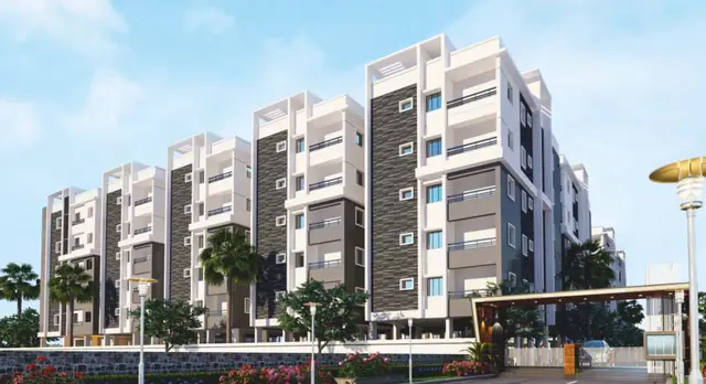
Maruthi Springfield County
MARUTHI CORPORATION LIMITED · Rangareddy · RERA P02400001602
MARUTHI SPRINGFIELD COUNTY is a plotted development in Shadnagar, Farooqnagar Mandal, Ranga Reddy District, developed by registered promoter MARUTHI CORPORATION LIMITED. The filed draft layout approval states a layout area of Ac. 16.7875 Cents; 81,251.50 Sq. Yds. and 216 plots; building or tower counts and floors are not disclosed. Plot-size configurations are not established in the supplied RERA unit records. TG-RERA registration number P02400001602 gives a proposed completion date of 31/12/2021.
More from Maruthi Corporation Ltd · 2 projects →
01What we found
Read from TG-RERA filings, approvals, land and registration records and court records. A court case is counted only when the court record states this project's survey number with its village, or names the project.
02Check before you pay
9 items to check before you pay, 4 high - from the title chain, court records and approvals, each with what to ask the builder or your advocate. An item may not be a problem with the project: records can be incomplete.
1. Project at a glance
Project identity
| Field | Record |
|---|---|
| Registered project name | MARUTHI SPRINGFIELD COUNTY RERA record |
| Project type | Plotted development RERA record RERA filing |
| Phase / registered portion | Phase not disclosed; registration is for the project named above. RERA record |
| TG-RERA registration | P02400001602 RERA record Approvals record |
| Registration validity | 09/02/2020 to 31/12/2021; certificate records no extension. This is the registration-validity period, not a current completion or occupancy certificate. Approvals record |
| Registered promoter | MARUTHI CORPORATION LIMITED, a public limited company. RERA record Corporate record |
| RERA status | The record identifies the project as “New Project.” Registration validity ended on 31/12/2021; the evidence supplied does not establish a later extension or current registration status. RERA record |
Land and geographic identity
| Field | Record |
|---|---|
| Locality | Shadnagar RERA record RERA filing |
| Revenue village(s) | Annaram appears in the filed layout approval and title materials; Shadnagar appears as the project locality and in the project identity record. The evidence does not establish that these are the same revenue-village designation. RERA filing |
| Mandal | Farooqnagar in the project record; the layout approval describes Shadnagar (M). RERA record RERA filing |
| District / PIN | Ranga Reddy / 509216 RERA record |
| Project survey numbers and subdivisions | Sy. Nos. 8/P, 10/P and 13/P in the layout approval. The RERA land record names Sy. Nos. 8, 10 and 13 without subdivisions. Land records |
| Registered site extent | The RERA land record states total area 67,936.60 sq. m, area affected 26,417.87 sq. m, and net area 41,518.73 sq. m. RERA filing Land records |
| Layout area in filed approval | Ac. 16.7875 Cents; 81,251.50 Sq. Yds. |
| Boundaries | North: ROAD; East: ROAD; South: NEIGHBOR LAND; West: NEIGHBOR LAND. RERA filing Land records |
Development identity
| Field | Record |
|---|---|
| Sanctioning authority | Director of Town and Country Planning; the layout approval is delegated to Annaram Gram Panchayat. Approvals record |
| Principal approval | TLP.No.228/2019/H, approved 11-10-2019; file reference Lr.Roc.No.12287/140/e-Panchayat. The document identifies this as a Draft Technical Layout Pattern – Approved. Approvals record |
| Approved built-up area | 41,518.73 sq. m is recorded as approved built-up area in the project fields; the supplied material does not explain how this figure applies to a plotted layout. RERA filing |
| Building / tower count and floors | Not disclosed. No building or floor configuration is established in the supplied project evidence. Document index |
| Layout and plots | The filed draft layout approval states 216 plots. |
| Layout land-use split in approval | Plotted area: Ac. 10.2595 Cents; 49,655.98 Sq. Yds. (61.11%); road area: Ac. 4.85 Cents; 23,474.00 Sq. Yds. (28.89%); open space: Ac. 1.678 Cents; 8,121.52 Sq. Yds. (10.00%). |
| Mortgage provision in approval | Plot Nos. 72 to 106, extent Ac. 1.57 Cents; 7,598.80 Sq. Yds., specified for mortgage in favour of the Gram Panchayat. |
Offering and status
| Field | Record |
|---|---|
| Unit type | Plots; RERA-filed plot count in the layout approval is 216. RERA record |
| Plot-size range / configurations | Not established from the RERA unit records supplied. Third-party listing figures are not used as RERA-filed offering data. RERA unit table |
| Booked / available counts | Not disclosed in the supplied evidence. RERA unit table |
| Construction / development stage | Current site progress is not established. The layout document describes a draft technical layout pattern and sets out steps before developmental works and final layout approval. |
| Completion dates | RERA record: proposed completion 31/12/2021. The Form B completion undertaking is OCR-truncated (“_202k.”) and does not provide a reliable date. No revised completion date is established. RERA record |
| Occupancy / completion certificate | No project occupancy or completion certificate is supplied. The project is a plotted development; the evidence does not establish a phase-wise or parcel-wise completion-certificate status. Document index |
2. The project story
- MARUTHI SPRINGFIELD COUNTY is registered as a plotted development in the Shadnagar area, with the layout approval identifying land at Annaram Gram Panchayat, in Survey Nos. 8/P, 10/P and 13/P. The RERA land record separately lists Sy. Nos. 8, 10 and 13. The supplied evidence does not confirm the revenue-village designation beyond the names used in these records. RERA record Land records
- The filed layout approval describes a 216-plot draft layout and allocates land among plots, roads and open space. It also identifies plots reserved for mortgage in favour of the Gram Panchayat. The approval requires demarcation, mortgage and related submissions before release of the draft layout for developmental works, followed by completion of the works and submission of proposals for final layout approval. The available evidence does not establish whether those steps were completed or independently verify on-site progress.
- The RERA record gives 31/12/2021 as the proposed completion date. Registration validity also ended on that date, but registration validity, project completion and certification of completion are distinct matters; the supplied evidence does not establish an extension, completed works or a completion certificate. RERA record
3. Master plan, architecture & building design
- This is a plotted layout rather than a building project in the supplied records. The filed draft layout approval gives a layout area of Ac. 16.7875 Cents; 81,251.50 Sq. Yds. and identifies 216 plots, with 61.11% allocated to plotted area, 28.89% to roads and 10.00% to open space. It separately identifies Plot Nos. 72 to 106, measuring Ac. 1.57 Cents; 7,598.80 Sq. Yds., for mortgage to the Gram Panchayat.
- The RERA land fields report total site area 67,936.60 sq. m, affected area 26,417.87 sq. m and net area 41,518.73 sq. m. The project fields also report an approved built-up area of 41,518.73 sq. m, but no supplied drawing or extraction explains the application of that figure to the plotted development. RERA filing RERA filing
- No plot-by-plot schedule, plot-size distribution, detailed road widths, utility-land schedule, or complete final layout drawing is available in the supplied material. The HMDA master-plan sheet is image-only and does not establish a survey-specific zoning determination; the public layout-status lookup is recorded as unavailable. HMDA Document index
4. Homes, configurations & floor plans
The RERA evidence identifies a plotted project and the layout approval states a total of 216 plots. No RERA unit-type schedule with plot-size bands, booked/available counts or saleable areas is supplied, so those values cannot be stated here. RERA record RERA unit table
| Configuration | Units | Booked | Available | RERA saleable area | Measured carpet area | Loading (if supplied) |
|---|---|---|---|---|---|---|
| Plots | 216, as stated in the filed draft layout approval | Not disclosed | Not disclosed | Not disclosed | Not applicable | Not supplied |
The two drawing records listed for floor-plan review are scans pending measurement and contain no flat layouts. No software-measured plot areas or room dimensions are available. The third-party listing figures are not RERA-filed plot-size data and are therefore not presented as the project’s registered offering. Floor plans Promoter website
5. Parking & vehicle circulation
No sanctioned parking count, visitor or accessible parking provision, parking allocation, or parking arrangement is established in the supplied evidence. For this plotted development, the layout approval provides a road-area allocation but does not supply detailed road widths, vehicle-entry arrangements or parking-bay plans. Document index
6. Amenities, recreation & open spaces
The project record includes layout-infrastructure entries, but these are recorded as available at 100% in the supplied amenity data; that database status is not independent confirmation of completion. The draft layout approval itself identifies open space but does not specify named recreational facilities or their equipment. RERA amenities
| Description / size | Listed as available at 100%; the draft layout approval allocates Ac. 1.678 Cents; 8,121.52 Sq. Yds. (10.00%) to open space. |
|---|---|
| Evidence source | RERA amenities |
| Declared progress / verified status | Recorded as available in the supplied amenity data; not independently verified as complete. |
| Description / size | No description or size supplied. |
|---|---|
| Evidence source | RERA amenities |
| Declared progress / verified status | Listed at 0%; delivery status not established. |
| Description / size | The vendor record lists a play area and kids’ play areas, without sizes or quantities. |
|---|---|
| Evidence source | Promoter website |
| Declared progress / verified status | Third-party/vendor description only; not established as sanctioned, delivered or independently verified. |
| Description / size | No dimensions or quantities supplied. |
|---|---|
| Evidence source | Promoter website |
| Declared progress / verified status | Third-party/vendor descriptions only; not independently verified. |
7. Utilities, building services & safety
The supplied RERA amenity data records internal roads and footpaths, water supply, sewerage infrastructure, storm-water drains, street lighting, water conservation/rainwater harvesting, an electrical meter room/sub-station/receiving station, and aggregate recreational open space as available at 100%. These are record entries, not independent site verification; the data does not provide capacities, system specifications or commissioning evidence. RERA amenities
| Service | Supplied evidence |
|---|---|
| Water | Water supply is listed at 100%; source, storage capacity and treatment details are not disclosed. The vendor record also lists “24Hrs Water Supply” and “24/7 water supply,” which are not independently verified. RERA amenities Promoter website |
| Sewerage / drainage | Sewerage infrastructure (chamber, lines, septic tank, STP) and storm-water drains are listed at 100%. Treatment and disposal of sewage and sullage water is listed at 0%; no system capacity or completion evidence is supplied. RERA amenities |
| Rainwater harvesting | Listed at 100%; design, capacity and commissioning details are not supplied. RERA amenities |
| Electrical | Electrical meter room/sub-station/receiving station is listed at 100%; supply capacity and backup arrangements are not disclosed. RERA amenities |
| Fire and life safety | Fire protection and fire-safety requirements are listed at 0%. No fire-system details or clearances are supplied. RERA amenities |
| Waste and security | Solid-waste management and disposal is listed at 0%. The vendor mentions security, without system details or independent verification. RERA amenities Promoter website |
| Accessibility / vertical transportation | Ramps, accessible circulation, lifts and service lifts are not disclosed; the project is recorded as a plotted development. RERA record Document index |
8. Location, access & connectivity
The registered project location is Shadnagar, Farooqnagar Mandal, Ranga Reddy District, PIN 509216. The layout approval identifies Annaram Gram Panchayat and Survey Nos. 8/P, 10/P and 13/P. Its stated boundaries are north and east by roads, and south and west by neighbouring land. RERA record RERA filing RERA filing
The supplied location record includes a cadastral parcel-centroid coordinate of 17.41528, 78.35459. It does not provide a verified approach-road description, public-transport information or measured distances to landmarks. Location record
9. Developer & development status
The registered promoter is MARUTHI CORPORATION LIMITED, identified as a public limited company. The supplied corporate record identifies the legal entity; the RERA registration certificate gives a promoter office at Village: AMBEDKAR NAGAR (Banjara Hills), Mandal: Shaikpet, District: Hyderabad, PIN: 500034. Corporate record
The project record names KASU RAM REDDY as managing director and authorized signatory. A filed authorization letter records authority for Dr. K Ram Reddy to execute project documents. Parties record
The RERA record’s proposed completion date is 31/12/2021; the evidence supplied does not establish revised timelines, current work progress, completion or occupancy certification. The layout approval’s stated development and final-layout steps remain unverified in the supplied records. RERA record
10. Approvals, official records & documents
| Record | What the supplied document establishes |
|---|---|
| TG-RERA registration certificate — P02400001602 | Form C registration for MARUTHI SPRINGFIELD COUNTY, dated 09/02/2020, with validity through 31/12/2021; no extension is recorded in the certificate. |
| Draft layout approval — TLP.No.228/2019/H | Director of Town and Country Planning approval dated 11-10-2019, for the draft technical layout pattern covering Sy. Nos. 8/P, 10/P and 13/P, Annaram Gram Panchayat. It states 216 plots, land-use allocations and conditions for developmental works and final layout proposals. |
| Layout file reference | Lr.Roc.No.12287/140/e-Panchayat. |
| Form B declaration | Filed by K. RAM REDDY and dated 05th day of November 2019; it contains promoter declarations concerning title, encumbrances, project funds, approvals and completion. Its completion undertaking is OCR-truncated and is not a reliable date. |
| Legal title report | Advocate’s title scrutiny report concerning land in Sy. Nos. 8, 10 and 13 at Annaram Village, Farooqnagar Mandal. |
| Encumbrance statement | RERA-filed encumbrance statement is supplied, but no current verification date or fresh current search is established in this overview. |
| Approved layout-plan record | The RERA document list includes a layout-plan item, but the supplied file is not extracted; a final, stamped layout plan is not established by that item. |
| Commencement / occupancy / completion certificates | The document list labels an item as “Commencement Certificates for each building in each phase,” but its extracted content is a draft layout approval. No building-specific commencement certificate or occupancy/completion certificate is established in the supplied evidence. Document index |
| Master-plan and layout lookup | HMDA’s Farooqnagar Master Plan 2031 sheet is image-only; the exact survey-level zone is not established. The HMDA DPMS layout lookup is recorded as unavailable from the public channel. HMDA |
1. Project at a glance
Project identity
Registered project name: MARUTHI SPRINGFIELD COUNTY
Project type: Plotted development
Phase / registered portion: Phase not disclosed; registration is for the project named above.
TG-RERA registration: P02400001602
Registration validity: 09/02/2020 to 31/12/2021; certificate records no extension. This is the registration-validity period, not a current completion or occupancy certificate.
Registered promoter: MARUTHI CORPORATION LIMITED, a public limited company.
RERA status: The record identifies the project as “New Project.” Registration validity ended on 31/12/2021; the evidence supplied does not establish a later extension or current registration status.
Land and geographic identity
Locality: Shadnagar
Revenue village(s): Annaram appears in the filed layout approval and title materials; Shadnagar appears as the project locality and in the project identity record. The evidence does not establish that these are the same revenue-village designation.
Mandal: Farooqnagar in the project record; the layout approval describes Shadnagar (M).
District / PIN: Ranga Reddy / 509216
Project survey numbers and subdivisions: Sy. Nos. 8/P, 10/P and 13/P in the layout approval. The RERA land record names Sy. Nos. 8, 10 and 13 without subdivisions.
Registered site extent: The RERA land record states total area 67,936.60 sq. m, area affected 26,417.87 sq. m, and net area 41,518.73 sq. m.
Layout area in filed approval: Ac. 16.7875 Cents; 81,251.50 Sq. Yds.
Boundaries: North: ROAD; East: ROAD; South: NEIGHBOR LAND; West: NEIGHBOR LAND.
Development identity
Sanctioning authority: Director of Town and Country Planning; the layout approval is delegated to Annaram Gram Panchayat.
Principal approval: TLP.No.228/2019/H, approved 11-10-2019; file reference Lr.Roc.No.12287/140/e-Panchayat. The document identifies this as a Draft Technical Layout Pattern – Approved.
Approved built-up area: 41,518.73 sq. m is recorded as approved built-up area in the project fields; the supplied material does not explain how this figure applies to a plotted layout.
Building / tower count and floors: Not disclosed. No building or floor configuration is established in the supplied project evidence.
Layout and plots: The filed draft layout approval states 216 plots.
Layout land-use split in approval: Plotted area: Ac. 10.2595 Cents; 49,655.98 Sq. Yds. (61.11%); road area: Ac. 4.85 Cents; 23,474.00 Sq. Yds. (28.89%); open space: Ac. 1.678 Cents; 8,121.52 Sq. Yds. (10.00%).
Mortgage provision in approval: Plot Nos. 72 to 106, extent Ac. 1.57 Cents; 7,598.80 Sq. Yds., specified for mortgage in favour of the Gram Panchayat.
Offering and status
Unit type: Plots; RERA-filed plot count in the layout approval is 216.
Plot-size range / configurations: Not established from the RERA unit records supplied. Third-party listing figures are not used as RERA-filed offering data.
Booked / available counts: Not disclosed in the supplied evidence.
Construction / development stage: Current site progress is not established. The layout document describes a draft technical layout pattern and sets out steps before developmental works and final layout approval.
Completion dates: RERA record: proposed completion 31/12/2021. The Form B completion undertaking is OCR-truncated (“_202k.”) and does not provide a reliable date. No revised completion date is established.
Occupancy / completion certificate: No project occupancy or completion certificate is supplied. The project is a plotted development; the evidence does not establish a phase-wise or parcel-wise completion-certificate status.
2. The project story
- MARUTHI SPRINGFIELD COUNTY is registered as a plotted development in the Shadnagar area, with the layout approval identifying land at Annaram Gram Panchayat, in Survey Nos. 8/P, 10/P and 13/P. The RERA land record separately lists Sy. Nos. 8, 10 and 13. The supplied evidence does not confirm the revenue-village designation beyond the names used in these records.
- The filed layout approval describes a 216-plot draft layout and allocates land among plots, roads and open space. It also identifies plots reserved for mortgage in favour of the Gram Panchayat. The approval requires demarcation, mortgage and related submissions before release of the draft layout for developmental works, followed by completion of the works and submission of proposals for final layout approval. The available evidence does not establish whether those steps were completed or independently verify on-site progress.
- The RERA record gives 31/12/2021 as the proposed completion date. Registration validity also ended on that date, but registration validity, project completion and certification of completion are distinct matters; the supplied evidence does not establish an extension, completed works or a completion certificate.
3. Master plan, architecture & building design
- This is a plotted layout rather than a building project in the supplied records. The filed draft layout approval gives a layout area of Ac. 16.7875 Cents; 81,251.50 Sq. Yds. and identifies 216 plots, with 61.11% allocated to plotted area, 28.89% to roads and 10.00% to open space. It separately identifies Plot Nos. 72 to 106, measuring Ac. 1.57 Cents; 7,598.80 Sq. Yds., for mortgage to the Gram Panchayat.
- The RERA land fields report total site area 67,936.60 sq. m, affected area 26,417.87 sq. m and net area 41,518.73 sq. m. The project fields also report an approved built-up area of 41,518.73 sq. m, but no supplied drawing or extraction explains the application of that figure to the plotted development.
- No plot-by-plot schedule, plot-size distribution, detailed road widths, utility-land schedule, or complete final layout drawing is available in the supplied material. The HMDA master-plan sheet is image-only and does not establish a survey-specific zoning determination; the public layout-status lookup is recorded as unavailable.
4. Homes, configurations & floor plans
The RERA evidence identifies a plotted project and the layout approval states a total of 216 plots. No RERA unit-type schedule with plot-size bands, booked/available counts or saleable areas is supplied, so those values cannot be stated here.
| Configuration | Units | Booked | Available | RERA saleable area | Measured carpet area | Loading (if supplied) |
|---|---|---|---|---|---|---|
| Plots | 216, as stated in the filed draft layout approval | Not disclosed | Not disclosed | Not disclosed | Not applicable | Not supplied |
The two drawing records listed for floor-plan review are scans pending measurement and contain no flat layouts. No software-measured plot areas or room dimensions are available. The third-party listing figures are not RERA-filed plot-size data and are therefore not presented as the project’s registered offering.
5. Parking & vehicle circulation
No sanctioned parking count, visitor or accessible parking provision, parking allocation, or parking arrangement is established in the supplied evidence. For this plotted development, the layout approval provides a road-area allocation but does not supply detailed road widths, vehicle-entry arrangements or parking-bay plans.
6. Amenities, recreation & open spaces
The project record includes layout-infrastructure entries, but these are recorded as available at 100% in the supplied amenity data; that database status is not independent confirmation of completion. The draft layout approval itself identifies open space but does not specify named recreational facilities or their equipment.
| Description / size | Listed as available at 100%; the draft layout approval allocates Ac. 1.678 Cents; 8,121.52 Sq. Yds. (10.00%) to open space. |
|---|---|
| Declared progress / verified status | Recorded as available in the supplied amenity data; not independently verified as complete. |
| Description / size | No description or size supplied. |
|---|---|
| Declared progress / verified status | Listed at 0%; delivery status not established. |
| Description / size | The vendor record lists a play area and kids’ play areas, without sizes or quantities. |
|---|---|
| Declared progress / verified status | Third-party/vendor description only; not established as sanctioned, delivered or independently verified. |
| Description / size | No dimensions or quantities supplied. |
|---|---|
| Declared progress / verified status | Third-party/vendor descriptions only; not independently verified. |
7. Utilities, building services & safety
The supplied RERA amenity data records internal roads and footpaths, water supply, sewerage infrastructure, storm-water drains, street lighting, water conservation/rainwater harvesting, an electrical meter room/sub-station/receiving station, and aggregate recreational open space as available at 100%. These are record entries, not independent site verification; the data does not provide capacities, system specifications or commissioning evidence.
Water: Water supply is listed at 100%; source, storage capacity and treatment details are not disclosed. The vendor record also lists “24Hrs Water Supply” and “24/7 water supply,” which are not independently verified.
Sewerage / drainage: Sewerage infrastructure (chamber, lines, septic tank, STP) and storm-water drains are listed at 100%. Treatment and disposal of sewage and sullage water is listed at 0%; no system capacity or completion evidence is supplied.
Rainwater harvesting: Listed at 100%; design, capacity and commissioning details are not supplied.
Electrical: Electrical meter room/sub-station/receiving station is listed at 100%; supply capacity and backup arrangements are not disclosed.
Fire and life safety: Fire protection and fire-safety requirements are listed at 0%. No fire-system details or clearances are supplied.
Waste and security: Solid-waste management and disposal is listed at 0%. The vendor mentions security, without system details or independent verification.
Accessibility / vertical transportation: Ramps, accessible circulation, lifts and service lifts are not disclosed; the project is recorded as a plotted development.
8. Location, access & connectivity
The registered project location is Shadnagar, Farooqnagar Mandal, Ranga Reddy District, PIN 509216. The layout approval identifies Annaram Gram Panchayat and Survey Nos. 8/P, 10/P and 13/P. Its stated boundaries are north and east by roads, and south and west by neighbouring land.
The supplied location record includes a cadastral parcel-centroid coordinate of 17.41528, 78.35459. It does not provide a verified approach-road description, public-transport information or measured distances to landmarks.
9. Developer & development status
The registered promoter is MARUTHI CORPORATION LIMITED, identified as a public limited company. The supplied corporate record identifies the legal entity; the RERA registration certificate gives a promoter office at Village: AMBEDKAR NAGAR (Banjara Hills), Mandal: Shaikpet, District: Hyderabad, PIN: 500034.
The project record names KASU RAM REDDY as managing director and authorized signatory. A filed authorization letter records authority for Dr. K Ram Reddy to execute project documents.
The RERA record’s proposed completion date is 31/12/2021; the evidence supplied does not establish revised timelines, current work progress, completion or occupancy certification. The layout approval’s stated development and final-layout steps remain unverified in the supplied records.
10. Approvals, official records & documents
TG-RERA registration certificate — P02400001602: Form C registration for MARUTHI SPRINGFIELD COUNTY, dated 09/02/2020, with validity through 31/12/2021; no extension is recorded in the certificate.
Draft layout approval — TLP.No.228/2019/H: Director of Town and Country Planning approval dated 11-10-2019, for the draft technical layout pattern covering Sy. Nos. 8/P, 10/P and 13/P, Annaram Gram Panchayat. It states 216 plots, land-use allocations and conditions for developmental works and final layout proposals.
Layout file reference: Lr.Roc.No.12287/140/e-Panchayat.
Form B declaration: Filed by K. RAM REDDY and dated 05th day of November 2019; it contains promoter declarations concerning title, encumbrances, project funds, approvals and completion. Its completion undertaking is OCR-truncated and is not a reliable date.
Legal title report: Advocate’s title scrutiny report concerning land in Sy. Nos. 8, 10 and 13 at Annaram Village, Farooqnagar Mandal.
Encumbrance statement: RERA-filed encumbrance statement is supplied, but no current verification date or fresh current search is established in this overview.
Approved layout-plan record: The RERA document list includes a layout-plan item, but the supplied file is not extracted; a final, stamped layout plan is not established by that item.
Commencement / occupancy / completion certificates: The document list labels an item as “Commencement Certificates for each building in each phase,” but its extracted content is a draft layout approval. No building-specific commencement certificate or occupancy/completion certificate is established in the supplied evidence.
Master-plan and layout lookup: HMDA’s Farooqnagar Master Plan 2031 sheet is image-only; the exact survey-level zone is not established. The HMDA DPMS layout lookup is recorded as unavailable from the public channel.
Frequently asked questions
Is MARUTHI SPRINGFIELD COUNTY registered with Telangana RERA?
Yes. MARUTHI SPRINGFIELD COUNTY is registered with the Telangana Real Estate Regulatory Authority as P02400001602; the registration status is New Project.
Who is the developer of MARUTHI SPRINGFIELD COUNTY?
The promoter named in the RERA registration is MARUTHI CORPORATION LIMITED.
Where is MARUTHI SPRINGFIELD COUNTY located?
MARUTHI SPRINGFIELD COUNTY is in SHADNAGAR, Farooqnagar, Rangareddy, Telangana (509216).
When will MARUTHI SPRINGFIELD COUNTY be completed?
The promoter's proposed date of completion filed with RERA is 31/12/2021. This is the promoter's declaration, not a guarantee.
More projects in Shadnagar