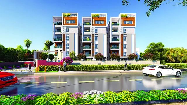
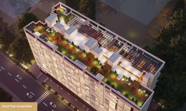
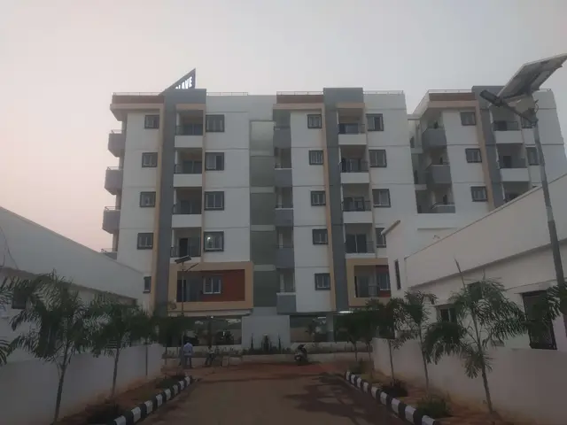
Suprabhat Heights
NALLA PRASHANTH · Yadadri Bhuvanagiri · RERA P02000003119
SUPRABHAT HEIGHTS is a plotted development in Bhongir, Bhongir mandal, Yadadri Bhuvanagiri district. The registered promoter is NALLA PRASHANTH. The project has a total site area of 214073.05 sq. m and a net site area of 206429.84 sq. m; it is a plot layout, with no plot configurations stated. It is registered under TG-RERA registration P02000003119, with a proposed completion date of 18/03/2024.
📘 Project brochure from the promoter’s website ↗01What we found
Read from TG-RERA filings, approvals, land and registration records and court records. A court case is counted only when the court record states this project's survey number with its village, or names the project.
02Check before you pay
7 items to check before you pay, 4 high - from the title chain, court records and approvals, each with what to ask the builder or your advocate. An item may not be a problem with the project: records can be incomplete.
1. Project at a glance
Project identity
| Item | Project record |
|---|---|
| Registered name | SUPRABHAT HEIGHTS RERA record |
| Project type | Plotted development / open-plot layout RERA record RERA filing |
| Phase / registered portion | Phase not separately identified; registration is recorded for the project RERA record |
| TG-RERA registration | P02000003119 RERA record |
| Registration validity | 24/07/2021 to 18/03/2024; certificate states validity for 2 years. This is the registration period, not a statement of the project’s completion or occupancy status. Approvals record |
| Registered promoter | NALLA PRASHANTH RERA record RERA filing |
| RERA status | RERA record describes the project as On-Going Project. The registration certificate’s stated validity ended 18/03/2024; no extension is evidenced in the supplied material. RERA record RERA filing |
Land and geographic identity
| Item | Project record |
|---|---|
| Locality | Bhongir / Bhuvanagiri RERA record RERA filing Land records |
| Revenue village | Bhongir (also rendered as Bhuvanagiri in filed documents) RERA record Land records |
| Mandal | Bhongir RERA record Land records |
| District | Yadadri Bhuvanagiri RERA record Land records |
| PIN | 508116 RERA record |
| Project survey number(s) and subdivision(s) | 39/P RERA record Land records |
| Total site area | 214073.05 sq. m RERA filing Layout record |
| Road-widening / master-plan-road affected area | 7643.21 sq. m RERA filing Layout record |
| Net site / layout area | 206429.84 sq. m RERA filing Layout record |
| Boundaries | East: SY NO 24; West: SY NO 41; North: SY NO 23; South: SY NO 38 RERA filing |
Development identity
| Item | Project record |
|---|---|
| Sanctioning authority | Hyderabad Metropolitan Development Authority (HMDA); the filed approval records delegation to Bhongir Municipality. Approvals record |
| Principal approval | HMDA approval No. 0001, dated 18 March, 2021; file reference Lr.No.032541/GHT/LT/U6/HMDA/04012020. Approvals record |
| Approval described in document | Draft open-plot layout approval for Survey No. 39/P. |
| Approved built-up area | Not disclosed in the supplied plotted-layout record. RERA filing |
| Building / block count and floors | Not applicable to the layout approval information supplied; no plot-by-plot building configuration is provided. |
| Layout land-use figures in filed approval | Plotted area 115221.75 sq. m; layout roads 63558.75 sq. m; open space including HT-line area and utility 22475.23 sq. m; social infrastructure 5165.07 sq. m. |
| Mortgage area identified in HMDA record | 17573.86 sq. m, comprising plots 239 to 269 & 273 to 324, stated as 83 plots, in favour of HMDA. |
Offering and status
| Item | Project record |
|---|---|
| Purchase type | Plots; plot-level unit inventory, RERA saleable areas, booked/available counts and plot-size schedule are not supplied in the RERA data provided here. RERA record RERA unit table |
| RERA-declared plot count | Not available in the supplied RERA fields. |
| Drawing-derived plot count | Software-reading of the layout drawing identifies plots numbered 1 to 508; the drawing extraction says the plot list is incomplete and plot sizes were not measured. This is a drawing-derived count, not a RERA-declared inventory count. Layout record |
| Construction / development stage | RERA record labels the project “On-Going Project”; a supplied Form–1A architect’s certificate states that the project is complete and identifies an occupancy-certificate reference dated 30.05.2026. The certificate’s scope is described as the registered project, but an independently verified final layout/occupancy record is not established by this material. RERA record |
| Original / revised completion date | 18/03/2024 / 18/03/2024 RERA record RERA filing |
| Occupancy / completion certificate status | The architect’s certificate records LR.NO.G1/1473/2021 dated 30.05.2026 and certifies completion. The supplied municipality letter concerns a draft open-plot layout and handing over of specified areas; it does not itself provide an unambiguous final-layout/occupancy certificate for a stated phase or plot. |
2. The project story
- SUPRABHAT HEIGHTS is registered as a plotted development on Survey No. 39/P, in Bhongir/Bhuvanagiri village, Bhongir mandal, Yadadri Bhuvanagiri district. The project record identifies a total site area of 214073.05 sq. m, of which 7643.21 sq. m is affected by road widening and 206429.84 sq. m is recorded as net area. RERA record Land records
- The filed HMDA approval is for a draft open-plot layout. It records 115221.75 sq. m of plotted area and identifies layout roads, open space/utility and social-infrastructure areas. The plan also identifies 83 mortgaged plots by number. No tower, apartment or villa construction schedule is supplied for this plotted project.
- The RERA project status is “On-Going Project,” with a proposed and revised completion date of 18/03/2024. Separately, the supplied architect’s Form–1A states that the project is complete and gives an occupancy-certificate reference dated 30.05.2026. These are different types of records: the RERA status and completion date are project-registration disclosures; the later completion statement is an architect’s certificate. The supplied material does not establish independent site verification of the claimed completion. RERA record
3. Master plan, architecture & building design
This is a plotted layout, not an apartment-building scheme in the supplied approval record. The HMDA approval describes an open-plot layout in Survey No. 39/P and records a total site area of 214073.05 sq. m, net site area of 206429.84 sq. m, and road-widening area of 7643.21 sq. m.
The approval record’s layout area statement identifies:
| Layout component | Area recorded |
|---|---|
| Plotted area | 115221.75 sq. m |
| Layout roads | 63558.75 sq. m |
| Open space, including HT-line area and utility | 22475.23 sq. m |
| Social infrastructure | 5165.07 sq. m |
The separate layout-drawing extraction reads plot numbers 1 to 508 from the drawing, but says the plot list is incomplete and plot sizes were not measured. It records the plotted area as 115221.75 sq. m and amenity area as 0.00 in the drawing’s own area statement. The plot count is therefore a software-derived drawing reading, not a RERA-filed inventory count. Layout record
No approved building count, floor configuration, building footprint, apartment mix, building height or building-level circulation information is available in the supplied records. The layout approval lists road widths of 30.00, 30, 18 M, 9 M and 10 M in the drawing extraction; the approval letter itself refers to a 30 meters master-plan road.
4. Homes, configurations & floor plans
- The registered offering is plots. The supplied evidence does not include RERA-filed plot inventory by size, plot-wise booked or available counts, or plot-level saleable areas. The layout drawing extraction identifies plot numbers 1 to 508, but explicitly notes that plot extraction is incomplete and no plot sizes were measured. RERA record RERA unit table Layout record
| Configuration | Units | Booked | Available | RERA saleable area | Measured carpet area | Loading (if supplied) |
|---|---|---|---|---|---|---|
| Plots | Not disclosed in supplied RERA inventory | Not disclosed | Not disclosed | Not disclosed | Not applicable | Not supplied |
- No apartment floor plans or software-measured carpet areas are supplied. The layout-drawing reading is not a substitute for plot dimensions or a RERA-filed sales schedule. Floor plans Layout record
5. Parking & vehicle circulation
- No RERA-filed count or allocation of resident, visitor or accessible parking spaces is available in the supplied evidence. The layout approval identifies internal layout roads and road widths, but does not establish parking allotment rights for individual plots.
- The HMDA approval records 83 plots (239 to 269 & 273 to 324) as mortgaged in favour of HMDA; this is a mortgage-area disclosure, not a parking provision or plot-sale allocation.
6. Amenities, recreation & open spaces
The supplied RERA amenity record lists 15 infrastructure and facility categories, with progress shown as 0 for each. “YES” is recorded for internal roads and footpaths, sewerage infrastructure, aggregate recreational open space and site levelling/filling; these entries do not establish independent completion or delivery. RERA amenities
| Description / size | Area not stated in the RERA amenity list; HMDA approval records open space including HT-line area and utility of 22475.23 sq. m. |
|---|---|
| Evidence source | RERA amenities |
| Declared progress / verified status | RERA list: “YES,” progress 0; no independent completion verification supplied. |
| Description / size | HMDA approval records 22475.23 sq. m as open space including HT-line area and utility. |
|---|---|
| Declared progress / verified status | Approval-record area; completion not independently verified in supplied material. |
| Description / size | 5165.07 sq. m in the HMDA approval area statement. |
|---|---|
| Declared progress / verified status | Approval-record area; facility type and delivery status not specified. |
| Description / size | No description or size supplied. |
|---|---|
| Evidence source | RERA amenities |
| Declared progress / verified status | Listed in RERA amenity record; progress 0. |
| Description / size | No description or size supplied. |
|---|---|
| Evidence source | RERA amenities |
| Declared progress / verified status | Listed in RERA amenity record; progress 0. |
No clubhouse or indoor-recreation facility is identified in the supplied RERA or approval records. RERA amenities
7. Utilities, building services & safety
The HMDA approval record lists planned layout infrastructure including storm-water drains, underground drainage lines, a common septic tank/STP, internal water-supply pipelines, an overhead tank, electrical supply lines, street lights, a transformer, avenue plantation, park development, rainwater-harvesting pits, sewage treatment and solid-waste/bio-compost facilities. The approval document describes these as infrastructure requirements; the supplied material does not independently establish installation, capacity or operation.
| Evidence in supplied records | Internal water-supply pipelines and overhead tank are listed in the HMDA approval record. |
|---|---|
| Status limitation | Capacity, source and completion are not supplied. |
| Evidence in supplied records | Underground drainage lines, common septic tank/STP and storm-water drains are listed. |
|---|---|
| Status limitation | Capacity, commissioning and actual reuse arrangements are not supplied. |
| Evidence in supplied records | Rainwater-harvesting pits are listed. |
|---|---|
| Status limitation | Quantity, capacity and completion are not supplied. |
| Evidence in supplied records | Electrical supply lines, street lights and transformer are listed. |
|---|---|
| Status limitation | Transformer capacity, backup supply and completion are not supplied. |
| Evidence in supplied records | Solid-waste and bio-compost unit is listed. |
|---|---|
| Status limitation | Operating arrangements and completion are not supplied. |
| Evidence in supplied records | A fire-protection/fire-safety category appears in the RERA amenity record. |
|---|---|
| Status limitation | No system details, design capacity or completion evidence is supplied. RERA amenities |
| Evidence in supplied records | No project-specific access-control, CCTV, accessible-circulation or security-system details are evidenced in the supplied RERA/approval records. |
|---|---|
| Status limitation | Not established by the supplied material. |
8. Location, access & connectivity
- The registered location is Bhongir, Bhongir mandal, Yadadri Bhuvanagiri district, Telangana, PIN 508116. The project parcel is identified as Survey No. 39/P. RERA record Land records
- The supplied project-location record includes a cadastral parcel centroid and nearby-place measurements, but the coordinate is not a verified project entrance location. It lists the Financial District (Nanakramguda) at 1.2 km, IndusInd Bank at 0.4 km, an unnamed bus station at 2.2 km, Manuu Polytechnic Hyderabad at 1.6 km, Sankaraya Eye Hospital at 1.6 km, ADP at 0.0 km, South India Shopping Mall at 2.6 km, an unnamed park at 1.2 km, and Nanakramguda Government Primary School at 0.5 km. These are supplied location-record distances, not travel-time estimates. Location record
9. Developer & development status
- The registered promoter is NALLA PRASHANTH; the RERA record describes the organization type as “Others” and the description as “4 INDIVIDUALS.” A complete legal-entity name, entity registration number and verified corporate identifier are not supplied. RERA record RERA filing Corporate record
- The registration certificate gives the promoter office as “Village: Mandal: District: Hyderabad, Pin: 500007,” without a complete street address. The project evidence separately records a promoter address in Bhongir, Yadadri Bhuvanagiri district; no official contact details for the registered promoter are supplied. RERA filing
- The Form B file contains declarations by six individuals—NALLA NARASIMHA REDDY, NALLA LEELA, NALLA PRASHANT, NALLA SINDHU, VELMA VIDYASAGAR REDDY and VELMA VISHAL BABU—including a stated three-year completion undertaking. The supplied extraction says that Form B does not identify the project name or registration number, so those declarations are not independently tied to this registration by that document alone.
10. Approvals, official records & documents
| Identifier / date | P02000003119; issued 24/07/2021; stated validity through 18/03/2024 |
|---|---|
| What the supplied record establishes | Registration of SUPRABHAT HEIGHTS as a project under section 5, with separate-account and other promoter conditions. |
| Identifier / date | Approval No. 0001, dated 18 March, 2021; file reference Lr.No.032541/GHT/LT/U6/HMDA/04012020 |
|---|---|
| What the supplied record establishes | Approval described as a draft open-plot layout for Survey No. 39/P; the record also states that the permission is not proof of land title. |
| Identifier / date | File reference 032541/GHT/LT/U6/HMDA/04012020 |
|---|---|
| What the supplied record establishes | Drawing records area and layout details and identifies 83 plots as mortgage area; the extracted drawing text does not provide a separate permit number, validity or applicant. |
| Identifier / date | LR.NO.G1/1473/2021, dated 30.05.2026 |
|---|---|
| What the supplied record establishes | Architect’s certificate states completion of the project and identifies the survey, village, mandal and district. |
| Identifier / date | Lr.No.G1/1473/2021, dated 30.05.2026; refers to gift deed Doc.No.1788/2026, dated 16.03.2026 |
|---|---|
| What the supplied record establishes | Letter concerns HMDA technical approval of a draft open-plot layout and reports that open-space, utility, social-infrastructure and road areas were handed over to the municipality. |
| Identifier / date | Dated “19* day of May 2021” in the extraction |
|---|---|
| What the supplied record establishes | Six individual declarations; extracted document does not state the project name or RERA number. |
| Identifier / date | Form under rule 38; project, land, unit and execution particulars blank |
|---|---|
| What the supplied record establishes | Template only; it does not establish a completed plot sale or allotment. |
1. Project at a glance
Project identity
Registered name: SUPRABHAT HEIGHTS
Project type: Plotted development / open-plot layout
Phase / registered portion: Phase not separately identified; registration is recorded for the project
TG-RERA registration: P02000003119
Registration validity: 24/07/2021 to 18/03/2024; certificate states validity for 2 years. This is the registration period, not a statement of the project’s completion or occupancy status.
Registered promoter: NALLA PRASHANTH
RERA status: RERA record describes the project as On-Going Project. The registration certificate’s stated validity ended 18/03/2024; no extension is evidenced in the supplied material.
Land and geographic identity
Locality: Bhongir / Bhuvanagiri
Revenue village: Bhongir (also rendered as Bhuvanagiri in filed documents)
Mandal: Bhongir
District: Yadadri Bhuvanagiri
PIN: 508116
Project survey number(s) and subdivision(s): 39/P
Total site area: 214073.05 sq. m
Road-widening / master-plan-road affected area: 7643.21 sq. m
Net site / layout area: 206429.84 sq. m
Boundaries: East: SY NO 24; West: SY NO 41; North: SY NO 23; South: SY NO 38
Development identity
Sanctioning authority: Hyderabad Metropolitan Development Authority (HMDA); the filed approval records delegation to Bhongir Municipality.
Principal approval: HMDA approval No. 0001, dated 18 March, 2021; file reference Lr.No.032541/GHT/LT/U6/HMDA/04012020.
Approval described in document: Draft open-plot layout approval for Survey No. 39/P.
Approved built-up area: Not disclosed in the supplied plotted-layout record.
Building / block count and floors: Not applicable to the layout approval information supplied; no plot-by-plot building configuration is provided.
Layout land-use figures in filed approval: Plotted area 115221.75 sq. m; layout roads 63558.75 sq. m; open space including HT-line area and utility 22475.23 sq. m; social infrastructure 5165.07 sq. m.
Mortgage area identified in HMDA record: 17573.86 sq. m, comprising plots 239 to 269 & 273 to 324, stated as 83 plots, in favour of HMDA.
Offering and status
Purchase type: Plots; plot-level unit inventory, RERA saleable areas, booked/available counts and plot-size schedule are not supplied in the RERA data provided here.
RERA-declared plot count: Not available in the supplied RERA fields.
Drawing-derived plot count: Software-reading of the layout drawing identifies plots numbered 1 to 508; the drawing extraction says the plot list is incomplete and plot sizes were not measured. This is a drawing-derived count, not a RERA-declared inventory count.
Construction / development stage: RERA record labels the project “On-Going Project”; a supplied Form–1A architect’s certificate states that the project is complete and identifies an occupancy-certificate reference dated 30.05.2026. The certificate’s scope is described as the registered project, but an independently verified final layout/occupancy record is not established by this material.
Original / revised completion date: 18/03/2024 / 18/03/2024
Occupancy / completion certificate status: The architect’s certificate records LR.NO.G1/1473/2021 dated 30.05.2026 and certifies completion. The supplied municipality letter concerns a draft open-plot layout and handing over of specified areas; it does not itself provide an unambiguous final-layout/occupancy certificate for a stated phase or plot.
2. The project story
- SUPRABHAT HEIGHTS is registered as a plotted development on Survey No. 39/P, in Bhongir/Bhuvanagiri village, Bhongir mandal, Yadadri Bhuvanagiri district. The project record identifies a total site area of 214073.05 sq. m, of which 7643.21 sq. m is affected by road widening and 206429.84 sq. m is recorded as net area.
- The filed HMDA approval is for a draft open-plot layout. It records 115221.75 sq. m of plotted area and identifies layout roads, open space/utility and social-infrastructure areas. The plan also identifies 83 mortgaged plots by number. No tower, apartment or villa construction schedule is supplied for this plotted project.
- The RERA project status is “On-Going Project,” with a proposed and revised completion date of 18/03/2024. Separately, the supplied architect’s Form–1A states that the project is complete and gives an occupancy-certificate reference dated 30.05.2026. These are different types of records: the RERA status and completion date are project-registration disclosures; the later completion statement is an architect’s certificate. The supplied material does not establish independent site verification of the claimed completion.
3. Master plan, architecture & building design
This is a plotted layout, not an apartment-building scheme in the supplied approval record. The HMDA approval describes an open-plot layout in Survey No. 39/P and records a total site area of 214073.05 sq. m, net site area of 206429.84 sq. m, and road-widening area of 7643.21 sq. m.
The approval record’s layout area statement identifies:
Plotted area: 115221.75 sq. m
Layout roads: 63558.75 sq. m
Open space, including HT-line area and utility: 22475.23 sq. m
Social infrastructure: 5165.07 sq. m
The separate layout-drawing extraction reads plot numbers 1 to 508 from the drawing, but says the plot list is incomplete and plot sizes were not measured. It records the plotted area as 115221.75 sq. m and amenity area as 0.00 in the drawing’s own area statement. The plot count is therefore a software-derived drawing reading, not a RERA-filed inventory count.
No approved building count, floor configuration, building footprint, apartment mix, building height or building-level circulation information is available in the supplied records. The layout approval lists road widths of 30.00, 30, 18 M, 9 M and 10 M in the drawing extraction; the approval letter itself refers to a 30 meters master-plan road.
4. Homes, configurations & floor plans
- The registered offering is plots. The supplied evidence does not include RERA-filed plot inventory by size, plot-wise booked or available counts, or plot-level saleable areas. The layout drawing extraction identifies plot numbers 1 to 508, but explicitly notes that plot extraction is incomplete and no plot sizes were measured.
| Configuration | Units | Booked | Available | RERA saleable area | Measured carpet area | Loading (if supplied) |
|---|---|---|---|---|---|---|
| Plots | Not disclosed in supplied RERA inventory | Not disclosed | Not disclosed | Not disclosed | Not applicable | Not supplied |
- No apartment floor plans or software-measured carpet areas are supplied. The layout-drawing reading is not a substitute for plot dimensions or a RERA-filed sales schedule.
5. Parking & vehicle circulation
- No RERA-filed count or allocation of resident, visitor or accessible parking spaces is available in the supplied evidence. The layout approval identifies internal layout roads and road widths, but does not establish parking allotment rights for individual plots.
- The HMDA approval records 83 plots (239 to 269 & 273 to 324) as mortgaged in favour of HMDA; this is a mortgage-area disclosure, not a parking provision or plot-sale allocation.
6. Amenities, recreation & open spaces
The supplied RERA amenity record lists 15 infrastructure and facility categories, with progress shown as 0 for each. “YES” is recorded for internal roads and footpaths, sewerage infrastructure, aggregate recreational open space and site levelling/filling; these entries do not establish independent completion or delivery.
| Facility | Description / size | Evidence source | Declared progress / verified status |
|---|---|---|---|
| Aggregate recreational open space | Area not stated in the RERA amenity list; HMDA approval records open space including HT-line area and utility of 22475.23 sq. m. | RERA list: “YES,” progress 0; no independent completion verification supplied. | |
| Park / open space | HMDA approval records 22475.23 sq. m as open space including HT-line area and utility. | Approval-record area; completion not independently verified in supplied material. | |
| Social infrastructure | 5165.07 sq. m in the HMDA approval area statement. | Approval-record area; facility type and delivery status not specified. | |
| Community buildings | No description or size supplied. | Listed in RERA amenity record; progress 0. | |
| Green strip / tot lot / park | No description or size supplied. | Listed in RERA amenity record; progress 0. |
No clubhouse or indoor-recreation facility is identified in the supplied RERA or approval records.
7. Utilities, building services & safety
The HMDA approval record lists planned layout infrastructure including storm-water drains, underground drainage lines, a common septic tank/STP, internal water-supply pipelines, an overhead tank, electrical supply lines, street lights, a transformer, avenue plantation, park development, rainwater-harvesting pits, sewage treatment and solid-waste/bio-compost facilities. The approval document describes these as infrastructure requirements; the supplied material does not independently establish installation, capacity or operation.
| Evidence in supplied records | Internal water-supply pipelines and overhead tank are listed in the HMDA approval record. |
|---|---|
| Status limitation | Capacity, source and completion are not supplied. |
| Evidence in supplied records | Underground drainage lines, common septic tank/STP and storm-water drains are listed. |
|---|---|
| Status limitation | Capacity, commissioning and actual reuse arrangements are not supplied. |
| Evidence in supplied records | Rainwater-harvesting pits are listed. |
|---|---|
| Status limitation | Quantity, capacity and completion are not supplied. |
| Evidence in supplied records | Electrical supply lines, street lights and transformer are listed. |
|---|---|
| Status limitation | Transformer capacity, backup supply and completion are not supplied. |
| Evidence in supplied records | Solid-waste and bio-compost unit is listed. |
|---|---|
| Status limitation | Operating arrangements and completion are not supplied. |
| Evidence in supplied records | A fire-protection/fire-safety category appears in the RERA amenity record. |
|---|---|
| Status limitation | No system details, design capacity or completion evidence is supplied. |
| Evidence in supplied records | No project-specific access-control, CCTV, accessible-circulation or security-system details are evidenced in the supplied RERA/approval records. |
|---|---|
| Status limitation | Not established by the supplied material. |
8. Location, access & connectivity
- The registered location is Bhongir, Bhongir mandal, Yadadri Bhuvanagiri district, Telangana, PIN 508116. The project parcel is identified as Survey No. 39/P.
- The supplied project-location record includes a cadastral parcel centroid and nearby-place measurements, but the coordinate is not a verified project entrance location. It lists the Financial District (Nanakramguda) at 1.2 km, IndusInd Bank at 0.4 km, an unnamed bus station at 2.2 km, Manuu Polytechnic Hyderabad at 1.6 km, Sankaraya Eye Hospital at 1.6 km, ADP at 0.0 km, South India Shopping Mall at 2.6 km, an unnamed park at 1.2 km, and Nanakramguda Government Primary School at 0.5 km. These are supplied location-record distances, not travel-time estimates.
9. Developer & development status
- The registered promoter is NALLA PRASHANTH; the RERA record describes the organization type as “Others” and the description as “4 INDIVIDUALS.” A complete legal-entity name, entity registration number and verified corporate identifier are not supplied.
- The registration certificate gives the promoter office as “Village: Mandal: District: Hyderabad, Pin: 500007,” without a complete street address. The project evidence separately records a promoter address in Bhongir, Yadadri Bhuvanagiri district; no official contact details for the registered promoter are supplied.
- The Form B file contains declarations by six individuals—NALLA NARASIMHA REDDY, NALLA LEELA, NALLA PRASHANT, NALLA SINDHU, VELMA VIDYASAGAR REDDY and VELMA VISHAL BABU—including a stated three-year completion undertaking. The supplied extraction says that Form B does not identify the project name or registration number, so those declarations are not independently tied to this registration by that document alone.
10. Approvals, official records & documents
| Identifier / date | P02000003119; issued 24/07/2021; stated validity through 18/03/2024 |
|---|---|
| What the supplied record establishes | Registration of SUPRABHAT HEIGHTS as a project under section 5, with separate-account and other promoter conditions. |
| Identifier / date | Approval No. 0001, dated 18 March, 2021; file reference Lr.No.032541/GHT/LT/U6/HMDA/04012020 |
|---|---|
| What the supplied record establishes | Approval described as a draft open-plot layout for Survey No. 39/P; the record also states that the permission is not proof of land title. |
| Identifier / date | File reference 032541/GHT/LT/U6/HMDA/04012020 |
|---|---|
| What the supplied record establishes | Drawing records area and layout details and identifies 83 plots as mortgage area; the extracted drawing text does not provide a separate permit number, validity or applicant. |
| Identifier / date | LR.NO.G1/1473/2021, dated 30.05.2026 |
|---|---|
| What the supplied record establishes | Architect’s certificate states completion of the project and identifies the survey, village, mandal and district. |
| Identifier / date | Lr.No.G1/1473/2021, dated 30.05.2026; refers to gift deed Doc.No.1788/2026, dated 16.03.2026 |
|---|---|
| What the supplied record establishes | Letter concerns HMDA technical approval of a draft open-plot layout and reports that open-space, utility, social-infrastructure and road areas were handed over to the municipality. |
| Identifier / date | Dated “19* day of May 2021” in the extraction |
|---|---|
| What the supplied record establishes | Six individual declarations; extracted document does not state the project name or RERA number. |
| Identifier / date | Form under rule 38; project, land, unit and execution particulars blank |
|---|---|
| What the supplied record establishes | Template only; it does not establish a completed plot sale or allotment. |
Other registrations of Suprabhat Heights
Frequently asked questions
Is SUPRABHAT HEIGHTS registered with Telangana RERA?
Yes. SUPRABHAT HEIGHTS is registered with the Telangana Real Estate Regulatory Authority as P02000003119; the registration status is On-Going Project.
Who is the developer of SUPRABHAT HEIGHTS?
The promoter named in the RERA registration is NALLA PRASHANTH.
Where is SUPRABHAT HEIGHTS located?
SUPRABHAT HEIGHTS is in Bhongir, Yadadri Bhuvanagiri, Telangana (508116).
When will SUPRABHAT HEIGHTS be completed?
The promoter's proposed date of completion filed with RERA is 18/03/2024. This is the promoter's declaration, not a guarantee.
More projects in Bhongir