Orange County
CYBER NEST REALTY PRIVATE LIMITED · Rangareddy · RERA P02400007701
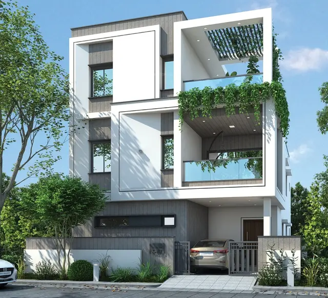
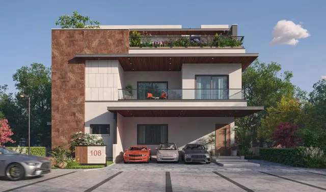
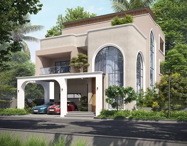
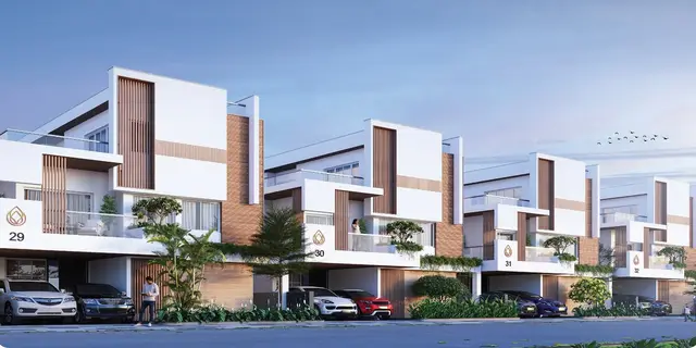
ORANGE COUNTY is a residential gated-community villa layout in Mankhal Village, Maheshwaram Mandal, Ranga Reddy District, developed by CYBER NEST REALTY PRIVATE LIMITED. The site measures 12,048.07 sq.mt., and the layout comprises 39 plots/villas with residential buildings shown as ground, first and second floors. The RERA schedule records 38 “VILLA” units and 1 “VIILA” unit, with saleable areas of 307.15 sq.m. and 306.85 sq.m., respectively. Its TG-RERA registration number is P02400007701, and the proposed completion date recorded in the project header is 30/04/2029.
01What we found
Read from TG-RERA filings, approvals, land and registration records and court records. A court case is counted only when the court record states this project's survey number with its village, or names the project.
02Check before you pay
9 items to check before you pay, 5 high - from the title chain, court records and approvals, each with what to ask the builder or your advocate. An item may not be a problem with the project: records can be incomplete.
1. Project at a glance
Project identity
| Item | Record |
|---|---|
| Registered project name | ORANGE COUNTY RERA record |
| Project type / registered portion | Residential gated-community villa layout; the RERA record identifies a new project. The registered portion is the development on Survey Nos. 603/P and 604/P; no separate phase name is disclosed. RERA record RERA filing |
| TG-RERA registration | P02400007701; valid from 10/02/2024 to 31/12/2028. The certificate records a four-year validity period and no extension. Registration validity is distinct from the project completion deadline. Approvals record |
| Registered promoter | CYBER NEST REALTY PRIVATE LIMITED, company. RERA record Corporate record |
| RERA status | Registered. The certificate requires quarterly updates; this status does not establish construction progress or occupancy certification. |
Land and geographic identity
| Item | Record |
|---|---|
| Locality / revenue village | Mankhal / Mankal (the project records use both spellings); revenue village stated in the layout documents: Mankhal Village. RERA record RERA filing |
| Mandal / district / PIN | Maheshwaram / Ranga Reddy / 501359. RERA record RERA filing |
| Project survey numbers | 603/P and 604/P. RERA record Land records |
| Site areas | Total site area: 12,048.07 sq.mt.; road-affected area: 134.23; net site area: 11,913.84 sq.mt. The layout extraction also records 11,913.85 as net site area. RERA filing |
| Boundaries in RERA filing | East: Neighbours Land and Road; West: Neighbours Land; North: Neighbours Land; South: Neighbours Land. RERA filing |
Development identity
| Item | Record |
|---|---|
| Sanctioning authority | Hyderabad Metropolitan Development Authority (HMDA). Approvals record |
| Principal layout permission | TS/030051/2023, dated 29-04-2023, as shown on the layout plan; the HMDA draft layout permission is also recorded as 005609/LO/HMDA/1204/SMD/2023, dated 31 December, 2023. Approvals record |
| Approved development | Layout for 39 plots/villas; the drawing’s building details show residential buildings with ground, first and second floors, and a building height of 10.35 MT. |
| Built-up area | The approval extraction states TOTAL PROPOSED BUILT UP AREA INCLUDING PARKING 11978.70. This is the approved built-up figure, not a saleable-area or carpet-area figure. RERA filing |
| Parking | The layout plan states PROPOSED NUMBER OF PARKINGS 0. No separate resident or visitor parking count or allocation is established in the supplied record. |
| Mortgage area | 1,424.48 sq.m. is recorded in the RERA land details as mortgage area; HMDA documents identify Plot/Villa Nos. 33 and 36 as mortgaged to HMDA. RERA filing |
Offering and status
| Item | Record |
|---|---|
| Unit types and count | RERA records 38 units filed as “VILLA” and 1 filed as “VIILA”; the latter label is reproduced as filed and is not reclassified here. RERA unit table RERA unit table |
| Booked / available | Portal-derived counts show 0 booked and 38 available for “VILLA,” and 0 booked and 1 available for “VIILA.” The portal record has no as-of date, so these counts are indicative rather than a current inventory confirmation. RERA unit table RERA unit table |
| RERA-filed saleable area | “VILLA”: 307.15 sq.m.; “VIILA”: 306.85 sq.m. RERA unit table RERA unit table |
| Completion deadline | The RERA Form B declaration undertakes completion by 31st December 2028. The project header separately records proposed completion as 30/04/2029; the evidence supplied does not explain the difference. RERA record |
| Construction / occupancy status | The project is recorded as a New Project. No occupancy certificate or completion certificate is supplied. No independently verified construction-stage assessment is included. RERA filing Document index |
2. The project story
ORANGE COUNTY is registered as a residential gated-community development on Survey Nos. 603/P and 604/P in Mankhal/Mankal, Maheshwaram Mandal, Ranga Reddy District. The HMDA layout documents describe a 39-plot/villa scheme, with individual residential buildings shown as ground plus two upper floors. The RERA record classifies the offering as villas, rather than apartments. RERA record RERA filing
The site measures 12,048.07 sq.mt. in total, with 134.23 recorded as road affected and a net area recorded as 11,913.84 sq.mt. in the RERA land details. The layout plan allocates land to plots, roads, open space and utilities. HMDA’s draft permission makes development of the layout infrastructure and handover of roads, open spaces and utilities part of the approval process; the supplied evidence does not establish that these works are complete. RERA filing
The RERA registration certificate is valid through 31/12/2028; the promoter’s Form B declares completion by 31st December 2028, while the project header lists 30/04/2029 as proposed completion. No supplied site-progress certificate or occupancy/completion certificate establishes the present construction stage or that any villa is ready for occupation. RERA record
3. Master plan, architecture & building design
The filed HMDA layout plan depicts a gated residential villa layout with 39 plots and residential buildings. Its drawing-derived building entries include ground, first and second floors; one example records a total height of 10.35mt. The plan does not provide a separate, verified tower/block arrangement applicable to apartment buildings.
| Layout component | Area / share stated in the plan |
|---|---|
| Plotted area | 6932.79 sq.m. (58.19%) |
| Road area | 3668.64 sq.m. (30.79%) |
| Organized open space / park | 1192.47 sq.m. (10.01%) |
| Utility area | 120.22 sq.m. (1.01%) |
| Total net layout in area statement | 11914.12 sq.m. |
| Social infrastructure / amenity area | 0.00 sq.m. |
The table reproduces the drawing’s area statement; the figures are not independently surveyed measurements. The layout extraction separately records the site’s total and net site areas. Layout record
The approved-layout extraction states total proposed built-up area, including parking, of 11978.70. Individual drawing entries include per-building built-up-area values and ground, first and second floors. The supplied record does not establish FSI-counted area, carpet area for RERA-listed villas, or a complete villa-by-villa building schedule suitable for treating those measurements as independently checked.
The layout drawing identifies internal road widths including 9.00 mt., 12.00 mt., 30.00 MT, 16' and 30'-0". HMDA’s draft permission also requires the 40 feet internal road connected to the main public road to remain open to the public as a peripheral road.
4. Homes, configurations & floor plans
The RERA unit schedule records one configuration as “VILLA” and one unit using the filed label “VIILA.” The portal-derived booking counts lack an as-of date. RERA unit table RERA unit table
| Configuration | Units | Booked | Available | RERA saleable area | Measured carpet area | Loading (if supplied) |
|---|---|---|---|---|---|---|
| VILLA | 38 | 0 | 38 | 307.15 sq.m. | Not established from the supplied approved villa drawings | Not supplied |
| VIILA (filed label) | 1 | 0 | 1 | 306.85 sq.m. | Not established from the supplied approved villa drawings | Not supplied |
The approved drawing extraction supplies ground-, first- and second-floor building details, but the floor-plan measurement data supplied does not provide a verified villa carpet-area schedule. RERA saleable area and carpet area are distinct measures; no loading figure is supplied for these villas. The promoter’s vendor material contains villa carpet-area claims, but these are not used as RERA-filed or drawing-verified measurements in this Overview. RERA unit details Floor plans Promoter website
5. Parking & vehicle circulation
The HMDA layout plan records PROPOSED NUMBER OF PARKINGS 0. It does not establish a separate resident, visitor or accessible parking count, nor a parking allocation for individual purchasers. The drawing’s reference to built-up area “including parking” does not itself identify parking spaces or convey exclusive parking rights.
The layout includes internal roads and footpaths in its RERA amenity schedule; the HMDA permission requires road formation and accessibility, including keeping the specified 40 feet internal road open to the public. The supplied documents do not establish parking ramps, mechanical or basement parking, EV charging, or pedestrian-vehicle separation. RERA amenities
6. Amenities, recreation & open spaces
The RERA amenity schedule marks several infrastructure categories as available, but records 0% progress for the listed items. That is a filed status, not independent confirmation of construction or delivery. The HMDA documents specify layout-development works and facilities; the evidence supplied does not verify their completion. RERA amenities
| Facility | Organized open space / park |
|---|---|
| Description / size | 1192.47 sq.m.; 10.01% of the drawing’s area statement |
| Declared progress / verified status | Shown in layout; completion not independently verified |
| Facility | Green strip / tot-lot / park |
|---|---|
| Description / size | No separate size supplied |
| Evidence source | RERA amenity schedule RERA amenities |
| Declared progress / verified status | Marked available; progress 0% |
| Facility | Tot-lot / park development |
|---|---|
| Description / size | No size or capacity supplied |
| Declared progress / verified status | Required / described in approval documents; completion not independently verified |
| Facility | Utilities area |
|---|---|
| Description / size | 120.22 sq.m.; 1.01% |
| Declared progress / verified status | Shown in layout; completion not independently verified |
| Facility | Roads |
|---|---|
| Description / size | 3668.64 sq.m. in the layout drawing area statement |
| Declared progress / verified status | Shown in layout; handover to local body is required before final layout release |
| Facility | Community buildings / amenity area |
|---|---|
| Description / size | No community-building facility or amenity area is quantified in the layout area statement; amenity area is 0.00 sq.m. |
| Evidence source | RERA amenities |
| Declared progress / verified status | No completion status established |
7. Utilities, building services & safety
HMDA’s draft layout permission describes proposed site infrastructure including internal water-supply pipelines and an overhead tank, an assured water-supply source, underground drainage and storm-water systems, a common septic tank/STP, rainwater-harvesting pits, electrical supply lines, street lighting and a transformer. The RERA amenity schedule marks water supply, sewerage, storm-water drains, street lighting, rainwater harvesting and an electrical meter room/sub-station category as available, but shows 0% progress for those entries. Neither source establishes completed operation or capacity. RERA amenities
The approval documents also refer to avenue planting, park development, underground utility ducting, solid-waste disposal and a bio-compost unit. The supplied materials do not state water storage capacity, STP capacity, electrical load, backup provision, lift provision, fire-safety systems, escape stairs, CCTV, access-control arrangements or accessible circulation. No statutory-compliance conclusion can be drawn from the layout descriptions alone. RERA amenities
8. Location, access & connectivity
The registered project location is Mankhal/Mankal, Maheshwaram Mandal, Ranga Reddy District, PIN 501359, on Survey Nos. 603/P and 604/P. RERA record
The supplied location record gives the Outer Ring Road nearest sampled interchange as approximately 5.0 km, Lakshmi Hospital as 1.2 km, an unnamed park as 2.1 km, and an unnamed school as 2.6 km. These are supplied location-record distances; the evidence does not include road-route measurements or travel times. The layout documents require road accessibility to neighbouring sites and describe a 40 feet internal road connected to the main public road as an open peripheral road. Location record
9. Developer & development status
The registered legal promoter is CYBER NEST REALTY PRIVATE LIMITED, a company; GSTIN 36AAJCC3819M1ZA. The RERA record gives its address as Raintree Park, KPHB Road, Mankhal, Maheshwaram, Ranga Reddy, 501359. The RERA registration certificate separately records the promoter office as Village Kukatpally, Mandal Kukatpally, Medchal-Malkajgiri, PIN 500085. Corporate record Parties record
The promoter’s Form B, dated January 2024 with the day left blank, declares completion by 31st December 2028. The registration certificate is valid until 31/12/2028. The header records a proposed completion date of 30/04/2029. No supplied progress report establishes construction completion, and no occupancy certificate is supplied. RERA record Document index
10. Approvals, official records & documents
| Identifier / date | P02400007701; issued 10/02/2024; valid to 31/12/2028 |
|---|---|
| What it establishes in this Overview | Project registration and recorded registration conditions. |
| Identifier / date | TS/030051/2023; 29-04-2023 |
|---|---|
| What it establishes in this Overview | Filed layout drawing and plan-derived layout particulars for Survey Nos. 603/P and 604/P. |
| Identifier / date | 005609/LO/HMDA/1204/SMD/2023; 31 December, 2023 |
|---|---|
| What it establishes in this Overview | Draft layout permission and infrastructure/handover conditions; the document states that permission is not proof of land title. |
| Identifier / date | January 2024; day not stated |
|---|---|
| What it establishes in this Overview | Promoter declaration including completion undertaking and project-account commitments. |
| Identifier / date | Not supplied |
|---|---|
| What it establishes in this Overview | The available document set does not establish issuance of an OC or completion certificate. Document index |
The supplied approval record is for the layout; no separate building-wise commencement certificate or occupancy/completion certificate is evidenced in the materials reviewed for this Overview.
1. Project at a glance
Project identity
Registered project name: ORANGE COUNTY
Project type / registered portion: Residential gated-community villa layout; the RERA record identifies a new project. The registered portion is the development on Survey Nos. 603/P and 604/P; no separate phase name is disclosed.
TG-RERA registration: P02400007701; valid from 10/02/2024 to 31/12/2028. The certificate records a four-year validity period and no extension. Registration validity is distinct from the project completion deadline.
Registered promoter: CYBER NEST REALTY PRIVATE LIMITED, company.
RERA status: Registered. The certificate requires quarterly updates; this status does not establish construction progress or occupancy certification.
Land and geographic identity
Locality / revenue village: Mankhal / Mankal (the project records use both spellings); revenue village stated in the layout documents: Mankhal Village.
Mandal / district / PIN: Maheshwaram / Ranga Reddy / 501359.
Project survey numbers: 603/P and 604/P.
Site areas: Total site area: 12,048.07 sq.mt.; road-affected area: 134.23; net site area: 11,913.84 sq.mt. The layout extraction also records 11,913.85 as net site area.
Boundaries in RERA filing: East: Neighbours Land and Road; West: Neighbours Land; North: Neighbours Land; South: Neighbours Land.
Development identity
Sanctioning authority: Hyderabad Metropolitan Development Authority (HMDA).
Principal layout permission: TS/030051/2023, dated 29-04-2023, as shown on the layout plan; the HMDA draft layout permission is also recorded as 005609/LO/HMDA/1204/SMD/2023, dated 31 December, 2023.
Approved development: Layout for 39 plots/villas; the drawing’s building details show residential buildings with ground, first and second floors, and a building height of 10.35 MT.
Built-up area: The approval extraction states TOTAL PROPOSED BUILT UP AREA INCLUDING PARKING 11978.70. This is the approved built-up figure, not a saleable-area or carpet-area figure.
Parking: The layout plan states PROPOSED NUMBER OF PARKINGS 0. No separate resident or visitor parking count or allocation is established in the supplied record.
Mortgage area: 1,424.48 sq.m. is recorded in the RERA land details as mortgage area; HMDA documents identify Plot/Villa Nos. 33 and 36 as mortgaged to HMDA.
Offering and status
Unit types and count: RERA records 38 units filed as “VILLA” and 1 filed as “VIILA”; the latter label is reproduced as filed and is not reclassified here.
Booked / available: Portal-derived counts show 0 booked and 38 available for “VILLA,” and 0 booked and 1 available for “VIILA.” The portal record has no as-of date, so these counts are indicative rather than a current inventory confirmation.
RERA-filed saleable area: “VILLA”: 307.15 sq.m.; “VIILA”: 306.85 sq.m.
Completion deadline: The RERA Form B declaration undertakes completion by 31st December 2028. The project header separately records proposed completion as 30/04/2029; the evidence supplied does not explain the difference.
Construction / occupancy status: The project is recorded as a New Project. No occupancy certificate or completion certificate is supplied. No independently verified construction-stage assessment is included.
2. The project story
ORANGE COUNTY is registered as a residential gated-community development on Survey Nos. 603/P and 604/P in Mankhal/Mankal, Maheshwaram Mandal, Ranga Reddy District. The HMDA layout documents describe a 39-plot/villa scheme, with individual residential buildings shown as ground plus two upper floors. The RERA record classifies the offering as villas, rather than apartments.
The site measures 12,048.07 sq.mt. in total, with 134.23 recorded as road affected and a net area recorded as 11,913.84 sq.mt. in the RERA land details. The layout plan allocates land to plots, roads, open space and utilities. HMDA’s draft permission makes development of the layout infrastructure and handover of roads, open spaces and utilities part of the approval process; the supplied evidence does not establish that these works are complete.
The RERA registration certificate is valid through 31/12/2028; the promoter’s Form B declares completion by 31st December 2028, while the project header lists 30/04/2029 as proposed completion. No supplied site-progress certificate or occupancy/completion certificate establishes the present construction stage or that any villa is ready for occupation.
3. Master plan, architecture & building design
The filed HMDA layout plan depicts a gated residential villa layout with 39 plots and residential buildings. Its drawing-derived building entries include ground, first and second floors; one example records a total height of 10.35mt. The plan does not provide a separate, verified tower/block arrangement applicable to apartment buildings.
Plotted area: 6932.79 sq.m. (58.19%)
Road area: 3668.64 sq.m. (30.79%)
Organized open space / park: 1192.47 sq.m. (10.01%)
Utility area: 120.22 sq.m. (1.01%)
Total net layout in area statement: 11914.12 sq.m.
Social infrastructure / amenity area: 0.00 sq.m.
The table reproduces the drawing’s area statement; the figures are not independently surveyed measurements. The layout extraction separately records the site’s total and net site areas.
The approved-layout extraction states total proposed built-up area, including parking, of 11978.70. Individual drawing entries include per-building built-up-area values and ground, first and second floors. The supplied record does not establish FSI-counted area, carpet area for RERA-listed villas, or a complete villa-by-villa building schedule suitable for treating those measurements as independently checked.
The layout drawing identifies internal road widths including 9.00 mt., 12.00 mt., 30.00 MT, 16' and 30'-0". HMDA’s draft permission also requires the 40 feet internal road connected to the main public road to remain open to the public as a peripheral road.
4. Homes, configurations & floor plans
The RERA unit schedule records one configuration as “VILLA” and one unit using the filed label “VIILA.” The portal-derived booking counts lack an as-of date.
| Configuration | Units | Booked | Available | RERA saleable area | Measured carpet area | Loading (if supplied) |
|---|---|---|---|---|---|---|
| VILLA | 38 | 0 | 38 | 307.15 sq.m. | Not established from the supplied approved villa drawings | Not supplied |
| VIILA (filed label) | 1 | 0 | 1 | 306.85 sq.m. | Not established from the supplied approved villa drawings | Not supplied |
The approved drawing extraction supplies ground-, first- and second-floor building details, but the floor-plan measurement data supplied does not provide a verified villa carpet-area schedule. RERA saleable area and carpet area are distinct measures; no loading figure is supplied for these villas. The promoter’s vendor material contains villa carpet-area claims, but these are not used as RERA-filed or drawing-verified measurements in this Overview.
5. Parking & vehicle circulation
The HMDA layout plan records PROPOSED NUMBER OF PARKINGS 0. It does not establish a separate resident, visitor or accessible parking count, nor a parking allocation for individual purchasers. The drawing’s reference to built-up area “including parking” does not itself identify parking spaces or convey exclusive parking rights.
The layout includes internal roads and footpaths in its RERA amenity schedule; the HMDA permission requires road formation and accessibility, including keeping the specified 40 feet internal road open to the public. The supplied documents do not establish parking ramps, mechanical or basement parking, EV charging, or pedestrian-vehicle separation.
6. Amenities, recreation & open spaces
The RERA amenity schedule marks several infrastructure categories as available, but records 0% progress for the listed items. That is a filed status, not independent confirmation of construction or delivery. The HMDA documents specify layout-development works and facilities; the evidence supplied does not verify their completion.
| Facility | Organized open space / park |
|---|---|
| Description / size | 1192.47 sq.m.; 10.01% of the drawing’s area statement |
| Declared progress / verified status | Shown in layout; completion not independently verified |
| Facility | Green strip / tot-lot / park |
|---|---|
| Description / size | No separate size supplied |
| Evidence source | RERA amenity schedule |
| Declared progress / verified status | Marked available; progress 0% |
| Facility | Tot-lot / park development |
|---|---|
| Description / size | No size or capacity supplied |
| Declared progress / verified status | Required / described in approval documents; completion not independently verified |
| Facility | Utilities area |
|---|---|
| Description / size | 120.22 sq.m.; 1.01% |
| Declared progress / verified status | Shown in layout; completion not independently verified |
| Facility | Roads |
|---|---|
| Description / size | 3668.64 sq.m. in the layout drawing area statement |
| Declared progress / verified status | Shown in layout; handover to local body is required before final layout release |
| Facility | Community buildings / amenity area |
|---|---|
| Description / size | No community-building facility or amenity area is quantified in the layout area statement; amenity area is 0.00 sq.m. |
| Declared progress / verified status | No completion status established |
7. Utilities, building services & safety
HMDA’s draft layout permission describes proposed site infrastructure including internal water-supply pipelines and an overhead tank, an assured water-supply source, underground drainage and storm-water systems, a common septic tank/STP, rainwater-harvesting pits, electrical supply lines, street lighting and a transformer. The RERA amenity schedule marks water supply, sewerage, storm-water drains, street lighting, rainwater harvesting and an electrical meter room/sub-station category as available, but shows 0% progress for those entries. Neither source establishes completed operation or capacity.
The approval documents also refer to avenue planting, park development, underground utility ducting, solid-waste disposal and a bio-compost unit. The supplied materials do not state water storage capacity, STP capacity, electrical load, backup provision, lift provision, fire-safety systems, escape stairs, CCTV, access-control arrangements or accessible circulation. No statutory-compliance conclusion can be drawn from the layout descriptions alone.
8. Location, access & connectivity
The registered project location is Mankhal/Mankal, Maheshwaram Mandal, Ranga Reddy District, PIN 501359, on Survey Nos. 603/P and 604/P.
The supplied location record gives the Outer Ring Road nearest sampled interchange as approximately 5.0 km, Lakshmi Hospital as 1.2 km, an unnamed park as 2.1 km, and an unnamed school as 2.6 km. These are supplied location-record distances; the evidence does not include road-route measurements or travel times. The layout documents require road accessibility to neighbouring sites and describe a 40 feet internal road connected to the main public road as an open peripheral road.
9. Developer & development status
The registered legal promoter is CYBER NEST REALTY PRIVATE LIMITED, a company; GSTIN 36AAJCC3819M1ZA. The RERA record gives its address as Raintree Park, KPHB Road, Mankhal, Maheshwaram, Ranga Reddy, 501359. The RERA registration certificate separately records the promoter office as Village Kukatpally, Mandal Kukatpally, Medchal-Malkajgiri, PIN 500085.
The promoter’s Form B, dated January 2024 with the day left blank, declares completion by 31st December 2028. The registration certificate is valid until 31/12/2028. The header records a proposed completion date of 30/04/2029. No supplied progress report establishes construction completion, and no occupancy certificate is supplied.
10. Approvals, official records & documents
| Identifier / date | P02400007701; issued 10/02/2024; valid to 31/12/2028 |
|---|---|
| What it establishes in this Overview | Project registration and recorded registration conditions. |
| Identifier / date | TS/030051/2023; 29-04-2023 |
|---|---|
| What it establishes in this Overview | Filed layout drawing and plan-derived layout particulars for Survey Nos. 603/P and 604/P. |
| Identifier / date | 005609/LO/HMDA/1204/SMD/2023; 31 December, 2023 |
|---|---|
| What it establishes in this Overview | Draft layout permission and infrastructure/handover conditions; the document states that permission is not proof of land title. |
| Identifier / date | January 2024; day not stated |
|---|---|
| What it establishes in this Overview | Promoter declaration including completion undertaking and project-account commitments. |
| Identifier / date | Not supplied |
|---|---|
| What it establishes in this Overview | The available document set does not establish issuance of an OC or completion certificate. |
The supplied approval record is for the layout; no separate building-wise commencement certificate or occupancy/completion certificate is evidenced in the materials reviewed for this Overview.
Frequently asked questions
Is ORANGE COUNTY registered with Telangana RERA?
Yes. ORANGE COUNTY is registered with the Telangana Real Estate Regulatory Authority as P02400007701; the registration status is New Project.
Who is the developer of ORANGE COUNTY?
The promoter named in the RERA registration is CYBER NEST REALTY PRIVATE LIMITED.
Where is ORANGE COUNTY located?
ORANGE COUNTY is in Mankhal, Mankal, Maheshwaram, Rangareddy, Telangana (501359).
When will ORANGE COUNTY be completed?
The promoter's proposed date of completion filed with RERA is 30/04/2029. This is the promoter's declaration, not a guarantee.
More projects in Mankal