Saikrishna Avenues
SAI KRISHNA DEVELOPERS · Sangareddy · RERA P01100008157
Saikrishna Avenues is a residential plotted development in Kandi Village, Kandi Mandal, Sangareddy District, developed by registered promoter SAI KRISHNA DEVELOPERS. The site area is 16,278.57 sq.m, and the layout drawing shows 58 residential plots ranging from 126.26 sq.m to 275.09 sq.m; no towers, blocks or floors are identified. It is registered with TG-RERA under P01100008157, and the promoter’s declared completion date is 20 June 2026.
📘 Project brochure from the promoter’s website ↗More from Sai Krishna Developers · 2 projects →
01What we found
Read from TG-RERA filings, approvals, land and registration records and court records. A court case is counted only when the court record states this project's survey number with its village, or names the project.
02Check before you pay
10 items to check before you pay, 3 high - from the title chain, court records and approvals, each with what to ask the builder or your advocate. An item may not be a problem with the project: records can be incomplete.
1. Project at a glance
Project identity
| Field | Record |
|---|---|
| Registered project name | Saikrishna Avenues RERA record |
| Project type | Plotted development / open-plot layout RERA record |
| Phase / registered portion | No separate phase is identified; registration is for the project at Kandi, Survey No. 405p RERA record |
| TG-RERA registration | P01100008157 RERA record |
| Registration validity | 2 May 2024 to 20 June 2026, unless extended by the Authority RERA record |
| Registered promoter | SAI KRISHNA DEVELOPERS RERA record |
| RERA status in supplied record | Registered; no subsequent extension or current-status update is supplied. The stated validity end date has passed, so present registration status should be checked with TG-RERA. RERA record |
Land and geographic identity
| Field | Record |
|---|---|
| Locality / revenue village | Kandi / Kandi Village RERA record |
| Mandal | Kandi RERA record |
| District | Sangareddy (also written “Sanga Reddy” in the approval record) RERA record |
| PIN | 502285 RERA record |
| Project survey number(s) and subdivisions | 405p in the RERA project record and HMDA approval; the layout drawing prints 405P. RERA record Land records |
| Total site area | 16,278.57 sq.m Land records |
| Master-plan road-affected area | 376.83 sq.m Land records |
| Net site area | 15,901.74 sq.m Land records |
| Boundaries in RERA record | East: proposed 100 ft road; west, north and south: open land. Land records |
Development identity
| Field | Record |
|---|---|
| Sanctioning authority | Hyderabad Metropolitan Development Authority (HMDA) Approvals record |
| Principal approval | 000126/LO/Plg/HMDA/2023, dated 22 June 2023; identified as a draft open-plot layout approval. Approvals record |
| Approved built-up area | 1,620.06 sq.m is recorded in the project data as approved built-up area; the supplied layout documents identify this same extent as the mortgaged area comprising plots 48–56. It is not described in these records as building floor area. RERA filing |
| Buildings / floors | Not applicable to the plotted-layout plan; no building count or floor configuration is supplied. |
| Layout area statement | Plotted area: 9,832.90 sq.m; road area: 4,284.53 sq.m; organized open space/park/utility area: 1,386.05 sq.m; social infrastructure: 398.26 sq.m. Layout record |
| Plots shown | The extracted layout drawing records 58 plots; the draft approval letter also refers to plots 48–56 in connection with the mortgage. Layout record |
Offering and status
| Field | Record |
|---|---|
| Offered product | Residential plots; the supplied RERA materials do not provide a unit-type schedule with plot-by-plot saleable areas or booking status. RERA record |
| Drawing-derived plot sizes | Software extraction from the approved layout drawing identifies 58 plots, ranging from 126.26 sq.m (151.0 sq.yd) to 275.09 sq.m (329.0 sq.yd); median 158.86 sq.m (190.0 sq.yd). This is drawing-derived, not a RERA inventory schedule. Layout record |
| Booked / available plots | Not disclosed in the supplied records. Document index |
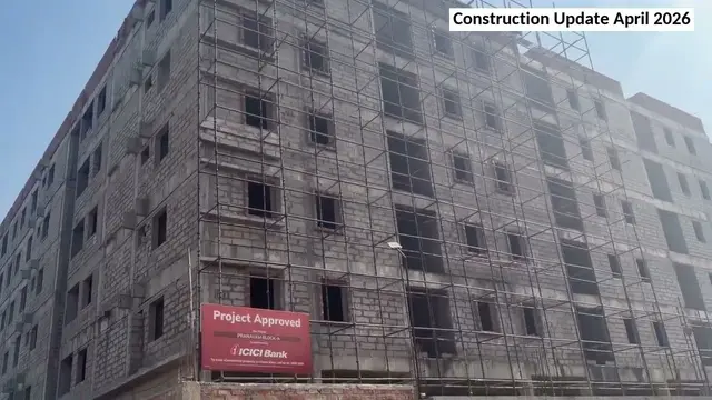
| Construction / development stage | No independently verified site-progress report is supplied. HMDA’s draft approval requires layout infrastructure works and final-layout release steps; the approved-plan document does not establish that these works are complete. |
| Completion timeline | The promoter’s Form B declares completion within three years from the approved plan date and gives 20 June 2026 as the completion date; this is a promoter declaration, not independent confirmation of completion. |
| Occupancy / completion certificate | No occupancy or completion certificate is supplied. For this plotted development, the available record instead refers to HMDA’s draft-layout approval and a future final-layout release process. Document index |
2. The project story
Saikrishna Avenues is a residential plotted layout registered with TG-RERA at Kandi Village, Kandi Mandal, Sangareddy District, on Survey No. 405p. The registered site is stated as 16,278.57 sq.m, including 376.83 sq.m affected by master-plan road widening, with a net area of 15,901.74 sq.m. RERA record Land records
The HMDA-filed layout drawing is an open-layout plan with residential plot use. Its area statement allocates 9,832.90 sq.m to plots, 4,284.53 sq.m to roads, 1,386.05 sq.m to organized open space/park/utility area, and 398.26 sq.m to social infrastructure. The extracted drawing shows 58 plots; plot areas and size bands below are software-measured from that drawing rather than a RERA-filed plot inventory. Layout record
HMDA’s document is expressly a draft layout approval. It calls for infrastructure development and for roads, open space and social-infrastructure land to be gifted to the local body before release of final layout plans. The records provided do not establish completion of those works, release of the final layout, or an independently verified construction stage.
3. Master plan, architecture & building design
This is a plotted layout, not a multi-storey building project. The approved-plan record identifies residential plot use and an open-layout development; no building footprints, tower or block count, floor configuration, building heights, or apartment plans are supplied.
The HMDA layout drawing’s area statement is:
| Layout component | Area |
|---|---|
| Total site area | 16,278.57 sq.m |
| Road-affected area | 376.83 sq.m |
| Net site area | 15,901.74 sq.m |
| Plotted area | 9,832.90 sq.m |
| Layout road area | 4,284.53 sq.m |
| Organized open space / park / utility area | 1,386.05 sq.m |
| Social infrastructure area | 398.26 sq.m |
Land records Layout record
The layout sheet identifies road widths including 30.00 m and 30 m, as well as other printed widths; the complete list of widths is not reproduced here. It also depicts a cycle track, septic tank, sump, transformer and dust-bin symbols. These are drawing features, not evidence that the corresponding works are installed or operational.
Software extraction of the layout drawing identifies 58 plots, with sizes from 126.26 sq.m to 275.09 sq.m; these drawing-derived measurements should be checked against the approved drawing and plot schedule. Layout record
4. Homes, configurations & floor plans
The offering shown by the supplied project records is residential plots. No RERA-filed configuration schedule, booked/available plot counts, plot-by-plot RERA saleable-area schedule, or measured home carpet areas are provided. Carpet-area and apartment floor-plan comparisons do not apply to the supplied plotted-layout evidence. RERA record Document index Floor plans
| Plot information | Drawing-derived value |
|---|---|
| Plot count | 58 |
| Smallest plot | 126.26 sq.m / 151.0 sq.yd |
| Median plot | 158.86 sq.m / 190.0 sq.yd |
| Largest plot | 275.09 sq.m / 329.0 sq.yd |
Layout record
The size-band extraction from the approved layout drawing is: 39 plots at 150–200 sq.yd, 13 at 200–250 sq.yd, 4 at 250–300 sq.yd, and 2 at 300–400 sq.yd. These are software-measured drawing results, not a RERA-filed inventory or booking statement. Layout record
5. Parking & vehicle circulation
No sanctioned parking-space count, visitor or accessible parking provision, parking allocation arrangement, or parking facility is identified in the supplied project records. As this is a plotted layout, the buyer should confirm any plot-specific parking rights or arrangements in the sale documents rather than infer them from the layout plan. Document index
The drawing records internal layout roads and a cycle-track feature. HMDA’s draft conditions state that roads are to remain open for accessibility to neighbouring sites and that the site is not to be enclosed by a compound wall under the draft permission. These are approval conditions; the documents do not establish the current on-site circulation arrangement.
6. Amenities, recreation & open spaces
The following items are identified in the HMDA-filed layout/approval records. The supplied materials do not give verified completion status for these facilities.
| Facility | Description / size | Evidence source | Declared progress / verified status |
|---|---|---|---|
| Organized open space / park / utility area | 1,386.05 sq.m | HMDA layout area statement | Included in the draft layout record; completion and handover are not verified. |
| Social infrastructure | 398.26 sq.m | HMDA layout area statement | Included in the draft layout record; completion and handover are not verified. |
| Cycle track | Shown on layout drawing; no size supplied | HMDA layout drawing | Drawing feature only; built status not verified. |
| Park development | Required in the draft layout conditions; no separate facility size beyond the area statement supplied | HMDA draft approval | Required work; completion not verified. |
| Avenue plantation | Listed among required layout works | HMDA draft approval | Completion not verified. |
No clubhouse or indoor recreational facility is established in the supplied RERA-filed or approval documents. Document index
7. Utilities, building services & safety
HMDA’s draft approval lists layout infrastructure works that include road formation with blacktop, storm-water drains, underground drainage lines and a common septic tank/STP, internal water-supply pipelines and an overhead tank, an assured water-supply source, electrical supply lines, street lights, a transformer, rainwater-harvesting pits and park development. These are approval requirements or specified works; the supplied record does not independently verify installation, capacity, operation or completion.
The layout drawing also labels a septic tank, sump, transformer and dust bin. Their depiction does not establish their construction or operating status. No capacities, water-source details, treatment specifications, backup-power arrangements, fire-safety system details, security systems or accessibility provisions are supplied.
8. Location, access & connectivity
The official project location in the supplied RERA record is Kandi Village, Kandi Mandal, Sangareddy District, Telangana, PIN 502285, on Survey No. 405p. The RERA boundary record identifies a proposed 100 ft road to the east and open land to the north, south and west. RERA record Land records
The layout drawing labels the locality as “Extended area of Erstwhile HUDA (HMDA)” and shows internal roads, including a 30.00 m abutting road width in the extracted approval parameters. An approximate location point is supplied at 17.616620862411725, 77.99102969858377; this is described as a cadastral parcel centroid. Location record
The location data supplies one measured connectivity reference: the nearest sampled Outer Ring Road interchange is approximately 30.1 km away. No further independently measured route distances or public-transport details are supplied. Location record
9. Developer & development status
The registered promoter is SAI KRISHNA DEVELOPERS, identified in the project records as a partnership. The RERA record gives GSTIN 36ACEFS6904R1ZF and a project/promoter address at Sai Krishna Residency, Jagruti Colony, Kandi, Sangareddy, Telangana, PIN 502285. The supplied records do not establish a separate company registration number or a verified official contact number. RERA record Corporate record Parties record
The TG-RERA registration certificate identifies Sai Krishna Developers as promoter. A Form B declaration signed by K Dora Prasad, described as managing partner and authorised representative, states that the project is to be completed within three years of the approved plan date and gives 20 June 2026 as the completion date. This is the promoter’s declaration; no independent construction-progress verification or completion certificate is supplied.
The registration certificate states a validity period from 2 May 2024 to 20 June 2026. Registration validity and the declared completion date are separate matters; the evidence pack does not include a later TG-RERA extension or status update.
10. Approvals, official records & documents
| Identifier / date | P01100008157; valid from 2 May 2024 to 20 June 2026, unless extended |
|---|---|
| What the supplied record establishes | Form C registration for Saikrishna Avenues, identifying Sai Krishna Developers as promoter and Survey No. 405p at Kandi. |
| Identifier / date | 000126/LO/Plg/HMDA/2023; 22 June 2023 |
|---|---|
| What the supplied record establishes | Draft open-plot layout approval for Survey No. 405p, Kandi; includes site-area statement, layout conditions and reference to plots 48–56 mortgaged to HMDA. |
| Identifier / date | Sheet 01/01, dated 22/06/2023 |
|---|---|
| What the supplied record establishes | Layout plan and area statement; software extraction identifies 58 plots. Layout record |
| Identifier / date | Dated “20** day of Jan 202” in the extracted record |
|---|---|
| What the supplied record establishes | Promoter declaration covering title, encumbrance and completion-related undertakings; the extracted date is incomplete. |
| Identifier / date | 12668/2023, dated 06/06/2023 |
|---|---|
| What the supplied record establishes | Approval records identify plots 48–56, extent 1,620.06 sq.m, as mortgaged in favour of the Metropolitan Commissioner, HMDA. |
| Identifier / date | Not supplied |
|---|---|
| What the supplied record establishes | No such certificate appears in the materials provided. Document index |
The HMDA record describes a draft layout and sets out requirements for infrastructure development and transfer of designated road, open-space and social-infrastructure areas before final layout-plan release. The supplied documents do not establish that final layout release or the required works and handovers have occurred.
1. Project at a glance
Project identity
Registered project name: Saikrishna Avenues
Project type: Plotted development / open-plot layout
Phase / registered portion: No separate phase is identified; registration is for the project at Kandi, Survey No. 405p
TG-RERA registration: P01100008157
Registration validity: 2 May 2024 to 20 June 2026, unless extended by the Authority
Registered promoter: SAI KRISHNA DEVELOPERS
RERA status in supplied record: Registered; no subsequent extension or current-status update is supplied. The stated validity end date has passed, so present registration status should be checked with TG-RERA.
Land and geographic identity
Locality / revenue village: Kandi / Kandi Village
Mandal: Kandi
District: Sangareddy (also written “Sanga Reddy” in the approval record)
PIN: 502285
Project survey number(s) and subdivisions: 405p in the RERA project record and HMDA approval; the layout drawing prints 405P.
Total site area: 16,278.57 sq.m
Master-plan road-affected area: 376.83 sq.m
Net site area: 15,901.74 sq.m
Boundaries in RERA record: East: proposed 100 ft road; west, north and south: open land.
Development identity
Sanctioning authority: Hyderabad Metropolitan Development Authority (HMDA)
Principal approval: 000126/LO/Plg/HMDA/2023, dated 22 June 2023; identified as a draft open-plot layout approval.
Approved built-up area: 1,620.06 sq.m is recorded in the project data as approved built-up area; the supplied layout documents identify this same extent as the mortgaged area comprising plots 48–56. It is not described in these records as building floor area.
Buildings / floors: Not applicable to the plotted-layout plan; no building count or floor configuration is supplied.
Layout area statement: Plotted area: 9,832.90 sq.m; road area: 4,284.53 sq.m; organized open space/park/utility area: 1,386.05 sq.m; social infrastructure: 398.26 sq.m.
Plots shown: The extracted layout drawing records 58 plots; the draft approval letter also refers to plots 48–56 in connection with the mortgage.
Offering and status
Offered product: Residential plots; the supplied RERA materials do not provide a unit-type schedule with plot-by-plot saleable areas or booking status.
Drawing-derived plot sizes: Software extraction from the approved layout drawing identifies 58 plots, ranging from 126.26 sq.m (151.0 sq.yd) to 275.09 sq.m (329.0 sq.yd); median 158.86 sq.m (190.0 sq.yd). This is drawing-derived, not a RERA inventory schedule.
Booked / available plots: Not disclosed in the supplied records.
Construction / development stage: No independently verified site-progress report is supplied. HMDA’s draft approval requires layout infrastructure works and final-layout release steps; the approved-plan document does not establish that these works are complete.
Completion timeline: The promoter’s Form B declares completion within three years from the approved plan date and gives 20 June 2026 as the completion date; this is a promoter declaration, not independent confirmation of completion.
Occupancy / completion certificate: No occupancy or completion certificate is supplied. For this plotted development, the available record instead refers to HMDA’s draft-layout approval and a future final-layout release process.
2. The project story
Saikrishna Avenues is a residential plotted layout registered with TG-RERA at Kandi Village, Kandi Mandal, Sangareddy District, on Survey No. 405p. The registered site is stated as 16,278.57 sq.m, including 376.83 sq.m affected by master-plan road widening, with a net area of 15,901.74 sq.m.
The HMDA-filed layout drawing is an open-layout plan with residential plot use. Its area statement allocates 9,832.90 sq.m to plots, 4,284.53 sq.m to roads, 1,386.05 sq.m to organized open space/park/utility area, and 398.26 sq.m to social infrastructure. The extracted drawing shows 58 plots; plot areas and size bands below are software-measured from that drawing rather than a RERA-filed plot inventory.
HMDA’s document is expressly a draft layout approval. It calls for infrastructure development and for roads, open space and social-infrastructure land to be gifted to the local body before release of final layout plans. The records provided do not establish completion of those works, release of the final layout, or an independently verified construction stage.
3. Master plan, architecture & building design
This is a plotted layout, not a multi-storey building project. The approved-plan record identifies residential plot use and an open-layout development; no building footprints, tower or block count, floor configuration, building heights, or apartment plans are supplied.
The HMDA layout drawing’s area statement is:
Total site area: 16,278.57 sq.m
Road-affected area: 376.83 sq.m
Net site area: 15,901.74 sq.m
Plotted area: 9,832.90 sq.m
Layout road area: 4,284.53 sq.m
Organized open space / park / utility area: 1,386.05 sq.m
Social infrastructure area: 398.26 sq.m
The layout sheet identifies road widths including 30.00 m and 30 m, as well as other printed widths; the complete list of widths is not reproduced here. It also depicts a cycle track, septic tank, sump, transformer and dust-bin symbols. These are drawing features, not evidence that the corresponding works are installed or operational.
Software extraction of the layout drawing identifies 58 plots, with sizes from 126.26 sq.m to 275.09 sq.m; these drawing-derived measurements should be checked against the approved drawing and plot schedule.
4. Homes, configurations & floor plans
The offering shown by the supplied project records is residential plots. No RERA-filed configuration schedule, booked/available plot counts, plot-by-plot RERA saleable-area schedule, or measured home carpet areas are provided. Carpet-area and apartment floor-plan comparisons do not apply to the supplied plotted-layout evidence.
Plot count: 58
Smallest plot: 126.26 sq.m / 151.0 sq.yd
Median plot: 158.86 sq.m / 190.0 sq.yd
Largest plot: 275.09 sq.m / 329.0 sq.yd
The size-band extraction from the approved layout drawing is: 39 plots at 150–200 sq.yd, 13 at 200–250 sq.yd, 4 at 250–300 sq.yd, and 2 at 300–400 sq.yd. These are software-measured drawing results, not a RERA-filed inventory or booking statement.
5. Parking & vehicle circulation
No sanctioned parking-space count, visitor or accessible parking provision, parking allocation arrangement, or parking facility is identified in the supplied project records. As this is a plotted layout, the buyer should confirm any plot-specific parking rights or arrangements in the sale documents rather than infer them from the layout plan.
The drawing records internal layout roads and a cycle-track feature. HMDA’s draft conditions state that roads are to remain open for accessibility to neighbouring sites and that the site is not to be enclosed by a compound wall under the draft permission. These are approval conditions; the documents do not establish the current on-site circulation arrangement.
6. Amenities, recreation & open spaces
The following items are identified in the HMDA-filed layout/approval records. The supplied materials do not give verified completion status for these facilities.
| Facility | Description / size | Evidence source | Declared progress / verified status |
|---|---|---|---|
| Organized open space / park / utility area | 1,386.05 sq.m | HMDA layout area statement | Included in the draft layout record; completion and handover are not verified. |
| Social infrastructure | 398.26 sq.m | HMDA layout area statement | Included in the draft layout record; completion and handover are not verified. |
| Cycle track | Shown on layout drawing; no size supplied | HMDA layout drawing | Drawing feature only; built status not verified. |
| Park development | Required in the draft layout conditions; no separate facility size beyond the area statement supplied | HMDA draft approval | Required work; completion not verified. |
| Avenue plantation | Listed among required layout works | HMDA draft approval | Completion not verified. |
No clubhouse or indoor recreational facility is established in the supplied RERA-filed or approval documents.
7. Utilities, building services & safety
HMDA’s draft approval lists layout infrastructure works that include road formation with blacktop, storm-water drains, underground drainage lines and a common septic tank/STP, internal water-supply pipelines and an overhead tank, an assured water-supply source, electrical supply lines, street lights, a transformer, rainwater-harvesting pits and park development. These are approval requirements or specified works; the supplied record does not independently verify installation, capacity, operation or completion.
The layout drawing also labels a septic tank, sump, transformer and dust bin. Their depiction does not establish their construction or operating status. No capacities, water-source details, treatment specifications, backup-power arrangements, fire-safety system details, security systems or accessibility provisions are supplied.
8. Location, access & connectivity
The official project location in the supplied RERA record is Kandi Village, Kandi Mandal, Sangareddy District, Telangana, PIN 502285, on Survey No. 405p. The RERA boundary record identifies a proposed 100 ft road to the east and open land to the north, south and west.
The layout drawing labels the locality as “Extended area of Erstwhile HUDA (HMDA)” and shows internal roads, including a 30.00 m abutting road width in the extracted approval parameters. An approximate location point is supplied at 17.616620862411725, 77.99102969858377; this is described as a cadastral parcel centroid.
The location data supplies one measured connectivity reference: the nearest sampled Outer Ring Road interchange is approximately 30.1 km away. No further independently measured route distances or public-transport details are supplied.
9. Developer & development status
The registered promoter is SAI KRISHNA DEVELOPERS, identified in the project records as a partnership. The RERA record gives GSTIN 36ACEFS6904R1ZF and a project/promoter address at Sai Krishna Residency, Jagruti Colony, Kandi, Sangareddy, Telangana, PIN 502285. The supplied records do not establish a separate company registration number or a verified official contact number.
The TG-RERA registration certificate identifies Sai Krishna Developers as promoter. A Form B declaration signed by K Dora Prasad, described as managing partner and authorised representative, states that the project is to be completed within three years of the approved plan date and gives 20 June 2026 as the completion date. This is the promoter’s declaration; no independent construction-progress verification or completion certificate is supplied.
The registration certificate states a validity period from 2 May 2024 to 20 June 2026. Registration validity and the declared completion date are separate matters; the evidence pack does not include a later TG-RERA extension or status update.
10. Approvals, official records & documents
| Identifier / date | P01100008157; valid from 2 May 2024 to 20 June 2026, unless extended |
|---|---|
| What the supplied record establishes | Form C registration for Saikrishna Avenues, identifying Sai Krishna Developers as promoter and Survey No. 405p at Kandi. |
| Identifier / date | 000126/LO/Plg/HMDA/2023; 22 June 2023 |
|---|---|
| What the supplied record establishes | Draft open-plot layout approval for Survey No. 405p, Kandi; includes site-area statement, layout conditions and reference to plots 48–56 mortgaged to HMDA. |
| Identifier / date | Sheet 01/01, dated 22/06/2023 |
|---|---|
| What the supplied record establishes | Layout plan and area statement; software extraction identifies 58 plots. |
| Identifier / date | Dated “20** day of Jan 202” in the extracted record |
|---|---|
| What the supplied record establishes | Promoter declaration covering title, encumbrance and completion-related undertakings; the extracted date is incomplete. |
| Identifier / date | 12668/2023, dated 06/06/2023 |
|---|---|
| What the supplied record establishes | Approval records identify plots 48–56, extent 1,620.06 sq.m, as mortgaged in favour of the Metropolitan Commissioner, HMDA. |
| Identifier / date | Not supplied |
|---|---|
| What the supplied record establishes | No such certificate appears in the materials provided. |
The HMDA record describes a draft layout and sets out requirements for infrastructure development and transfer of designated road, open-space and social-infrastructure areas before final layout-plan release. The supplied documents do not establish that final layout release or the required works and handovers have occurred.
Frequently asked questions
Is Saikrishna Avenues registered with Telangana RERA?
Yes. Saikrishna Avenues is registered with the Telangana Real Estate Regulatory Authority as P01100008157; the registration status is New Project.
Who is the developer of Saikrishna Avenues?
The promoter named in the RERA registration is SAI KRISHNA DEVELOPERS.
Where is Saikrishna Avenues located?
Saikrishna Avenues is in Kandi, Sangareddy, Telangana (502285).
When will Saikrishna Avenues be completed?
The promoter's proposed date of completion filed with RERA is 20/06/2026. This is the promoter's declaration, not a guarantee.
More projects in Kandi