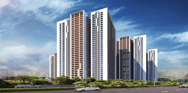
Sri Gokulam
J V S INFRA DEVELOPERS · Rangareddy · RERA P02400000377
SRI GOKULAM is a plotted development in Imamguda, Maheshwaram mandal, Ranga Reddy district. It is being developed by J V S INFRA DEVELOPERS. The registered land area is 242072.64 sq.m and the offering is plots; the supplied RERA record does not establish a complete plot count or sizes, or any towers, blocks or floors. The project is registered with TG-RERA as P02400000377, with a proposed completion date of 04/10/2019.
More from Jvs Infra Developers · 3 projects →
01What we found
Read from TG-RERA filings, approvals, land and registration records and court records. A court case is counted only when the court record states this project's survey number with its village, or names the project.
02Check before you pay
9 items to check before you pay, 5 high - from the title chain, court records and approvals, each with what to ask the builder or your advocate. An item may not be a problem with the project: records can be incomplete.
Project at a glance
Project identity
| Field | Project record |
|---|---|
| Registered name | SRI GOKULAM RERA record |
| Project type | Plotted development RERA record RERA filing |
| Phase / registered portion | Not separately identified in the supplied RERA record; the registration covers the stated project land RERA record |
| TG-RERA registration | P02400000377 RERA record |
| Registration validity | 01/03/2019 to 04/10/2019; the certificate records no extension |
| Registered promoter | J V S INFRA DEVELOPERS (also styled “M/s. JVS INFRA DEVELOPERS” in the filed declaration) RERA record |
| RERA status | Listed as an ongoing project; the supplied record does not establish a current registration extension or completion certificate RERA record |
Land and geographic identity
| Field | Project record |
|---|---|
| Locality | RERA locality is recorded as “X”; the RERA certificate identifies Imamguda. A separate location record gives Imamguda, Maheshwaram, Ranga Reddy RERA record Location record |
| Revenue villages | Imamguda Village and Srinagar Village RERA record |
| Mandal / district / PIN | Maheshwaram / Ranga Reddy / 501359 RERA record |
| Project survey numbers and subdivisions | 17/P, 56/P, 57 OF IMAMGUDA VILLAGE; 210/P, 211/P, 212, 213, 214, 215, 216, 218/P OF SRINAGAR VILLAGE RERA record |
| Registered site extent | 242072.64 sq.m RERA record Land records |
| Total / net area | Total area 242072.64 sq.m; net area 242072.64 sq.m RERA filing Land records |
| Boundaries | East: RAMKY VILLAS VACANT LAND; West: IMAMGUDA RESIDENTIAL VILLAGE; North and South: SRINAGAR VILLAGE VACANT LAND RERA filing |
Development identity
| Field | Project record |
|---|---|
| Sanctioning authority | Hyderabad Metropolitan Development Authority (HMDA) Approvals record |
| Principal layout approval | No. 000205 / 10 / P4/ HMDA /2013, dated 04 October, 2013; the filed document is described as a draft layout letter Approvals record |
| Application reference | 014129/SMD/LT/U6/HMDA/03032013 |
| Approved built-up area | 151094.69 sq.m, as recorded in the RERA project information RERA filing |
| Plots / buildings / floors | Plotted development. The supplied record gives no reliable building, tower or floor configuration; the draft-layout document refers to 21 plots, not a complete project plot count RERA record |
| Parking | No project parking count or parking arrangement is established in the supplied RERA records Document index |
Offering and status
| Field | Project record |
|---|---|
| Unit type | Plots RERA record RERA filing |
| RERA plot count / sizes | Not established in the supplied unit records; the layout drawing’s plot data is incomplete RERA unit table Layout record |
| Construction / infrastructure status | RERA-filed amenity record reports progress figures for selected site infrastructure; these are reported progress values, not independent site verification RERA amenities |
| Original / revised completion dates | 04/10/2019 / 04/10/2019 RERA record |
| Completion certificate / occupancy status | No completion or occupancy certificate is evidenced in the supplied records. The HMDA document is a draft layout approval, not an occupancy certificate RERA record |
The project story
SRI GOKULAM is registered with TG-RERA as a plotted development in the Maheshwaram area of Ranga Reddy district. Its registered land spans Imamguda and Srinagar revenue villages and covers 242072.64 sq.m. The project is associated with an HMDA layout approval dated 04 October, 2013. The filed approval document describes a draft plotted layout and sets out layout-development conditions, including development of open spaces and amenities and a three-year period for development works. RERA record Land records
The RERA record sets a proposed and revised completion date of 04/10/2019. Selected infrastructure progress is recorded in the project’s RERA amenity data, but those percentages should be read as filed reporting—not as an independent inspection of completed works. No completion certificate or occupancy certificate is present in the supplied project records. RERA record RERA amenities Document index
Master plan, architecture & building design
This is a plotted layout, not an apartment or tower project. The registered site and net area are each 242072.64 sq.m. The layout drawing’s software-read area statement allocates that area as follows; the source notes that the drawing-derived figures should be checked against the drawing. Land records Layout record
| Layout use | Area | Share of stated net layout area |
|---|---|---|
| Plots | 151094.69 sq.m | 62.4% |
| Roads | 64189.62 sq.m | 26.5% |
| Parks / open space | 19318.89 sq.m | 8.0% |
| Social infrastructure | 6065.86 sq.m | 2.5% |
| Amenities | 1403.36 sq.m | 0.6% |
The drawing identifies 66 mortgaged plots—plots 2-20, 74-107, 415-427—with a recorded area of 23005.4 sq.m. The RERA land record separately states a mortgage area of 23005.52 sq.m. The layout-data note describes this as mortgage security to the approving authority until roads, drains and open spaces are completed. Layout record Land records
No building footprints, floor configuration, tower heights, apartment arrangements or complete plot schedule can be established from the supplied drawing-derived records. The HMDA-filed draft layout document specifies a road width of 13 mts and lists STP, WTP and an underground tank among the layout facilities.
Homes, configurations & floor plans
The RERA offering is plots; the supplied unit-type data does not establish a complete RERA-filed plot count, plot-size schedule, booked inventory or available inventory. The layout data also says plot extraction is incomplete and contains no plot sizes. RERA record RERA unit table Layout record
| Configuration | Units | Booked | Available | RERA saleable area | Measured carpet area | Loading |
|---|---|---|---|---|---|---|
| Plots | Not established | Not established | Not established | Not established | Not applicable / not measured | Not established |
The floor-plan review contains no measured unit plans and indicates that a scan is pending. Apartment carpet-area and loading comparisons therefore cannot be made for this plotted project. Floor plans
Parking & vehicle circulation
The supplied RERA records do not establish parking counts, visitor or accessible parking, parking allocation to individual plots, or a dedicated parking layout. The layout area statement identifies 64189.62 sq.m as roads, but does not provide a verified vehicle-circulation plan, entry/exit details, pedestrian separation or EV-charging provision. Layout record Document index
A vendor listing mentions “Car Parking,” but that is third-party marketing information, not a verified RERA-filed or sanctioned parking schedule. Promoter website
Amenities, recreation & open spaces
The layout area statement identifies parks/open space, social infrastructure and amenity land. The RERA amenity record provides progress percentages for listed infrastructure, while the HMDA-filed draft layout document lists specific treatment and water facilities. No independent completion verification is supplied. Layout record RERA amenities
| Facility | Description / size | Evidence source | Declared progress / verified status |
|---|---|---|---|
| Parks / open space | 19318.89 sq.m in the software-read layout area statement | Layout record | RERA amenity entry “Green Strip/TOT LOT/Park” reports 0%; not independently verified RERA amenities |
| Social infrastructure | 6065.86 sq.m in the software-read layout area statement | Layout record | No completion status established |
| Amenities land | 1403.36 sq.m in the software-read layout area statement | Layout record | No completion status established |
| Community buildings | No size or facility detail supplied | RERA amenities | RERA amenity entry reports 0% RERA amenities |
| STP | Listed as a layout facility in the HMDA-filed draft layout document | RERA sewerage/STP entry reports 70%; not independently verified RERA amenities | |
| WTP | Listed as a layout facility in the HMDA-filed draft layout document | No separate progress figure supplied | |
| Underground tank | Listed as a layout facility in the HMDA-filed draft layout document | No separate progress figure supplied |
A third-party vendor listing names additional features such as a children’s play area, yoga areas, landscaped garden and party area. These are marketing claims, not established here as sanctioned or delivered project facilities. Promoter website
Utilities, building services & safety
The HMDA-filed draft layout document lists an STP, WTP and underground tank. The RERA-filed infrastructure record reports progress of 75% for water supply, 70% for sewerage (chamber, lines, septic tank, STP), and 100% for water conservation/rainwater harvesting. These are reported figures; independent completion checks are not supplied. RERA amenities
Other RERA-filed infrastructure entries report 70% for internal roads and footpaths and 0% for storm-water drains, street lighting, solid-waste management, electrical meter room/sub-station/receiving station, energy management, fire protection, drinking-water facility and treatment/disposal of sewage and sullage water. The records do not provide system capacities, utility connections, backup power, security systems, accessibility details or fire-clearance evidence. RERA amenities
Location, access & connectivity
The registered project location is identified as Imamguda, Maheshwaram Mandal, Ranga Reddy district, PIN 501359, across the Imamguda and Srinagar revenue villages. The HMDA-filed layout document describes the location as “Tukkuguda-ORR road.” RERA record
The supplied geocode identifies Kandukur X Road, NH765, Kandukur Gate (Western Cluster), Kandukur Cross Road, Kandukur mandal, Ranga Reddy, Telangana. It records the nearest sampled Outer Ring Road interchange at approximately 19.2 km. This is a location-data measurement, not a promoter travel-time claim. Location record
Developer & development status
The registered promoter is J V S INFRA DEVELOPERS, identified in the RERA record as a partnership. The supplied promoter address is N PART, KRANTHI HILLS, Maheshwaram, Ranga Reddy, 501359; the registration certificate separately records the promoter office as Village: VANASTHALIPURAM, Mandal: Hayathnagar, District: Ranga Reddy, Pin: 500070. Corporate record RERA record
The RERA-filed Form B declaration, made by C YADAGIRI REDDY as partner, declares a completion undertaking of 30th July, 2020. The project header records original and revised completion dates of 04/10/2019. These are separate filed records; the supplied evidence does not establish that the later undertaking amended the RERA registration deadline. RERA record
The project’s registration certificate runs from 01/03/2019 to 04/10/2019 and records no extension. The RERA amenity data reports progress for selected infrastructure items, but no independent site inspection or completion/occupancy certification is supplied. RERA amenities Document index
Approvals, official records & documents
| Details | FORM ‘C’; project SRI GOKULAM; registration P02400000377; dated 01/03/2019; valid to 04/10/2019 |
|---|
| Details | Draft layout letter; approval 000205 / 10 / P4/ HMDA /2013; dated 04 October, 2013; application reference 014129/SMD/LT/U6/HMDA/03032013 |
|---|
| Details | Draft layout document includes conditions on open spaces and development works; lists STP, WTP and an underground tank |
|---|
| Details | Filed by C YADAGIRI REDDY as partner; includes title, encumbrance, funds, approvals and completion declarations |
|---|
| Details | Not evidenced in the supplied project documents |
|---|---|
| Source | Document index |
The supplied evidence does not establish a current completion certificate, occupancy certificate or extension of the TG-RERA registration. The HMDA document is identified as a draft layout letter, not a building occupancy certificate.
Project at a glance
Project identity
Registered name: SRI GOKULAM
Project type: Plotted development
Phase / registered portion: Not separately identified in the supplied RERA record; the registration covers the stated project land
TG-RERA registration: P02400000377
Registration validity: 01/03/2019 to 04/10/2019; the certificate records no extension
Registered promoter: J V S INFRA DEVELOPERS (also styled “M/s. JVS INFRA DEVELOPERS” in the filed declaration)
RERA status: Listed as an ongoing project; the supplied record does not establish a current registration extension or completion certificate
Land and geographic identity
Locality: RERA locality is recorded as “X”; the RERA certificate identifies Imamguda. A separate location record gives Imamguda, Maheshwaram, Ranga Reddy
Revenue villages: Imamguda Village and Srinagar Village
Mandal / district / PIN: Maheshwaram / Ranga Reddy / 501359
Project survey numbers and subdivisions: 17/P, 56/P, 57 OF IMAMGUDA VILLAGE; 210/P, 211/P, 212, 213, 214, 215, 216, 218/P OF SRINAGAR VILLAGE
Registered site extent: 242072.64 sq.m
Total / net area: Total area 242072.64 sq.m; net area 242072.64 sq.m
Boundaries: East: RAMKY VILLAS VACANT LAND; West: IMAMGUDA RESIDENTIAL VILLAGE; North and South: SRINAGAR VILLAGE VACANT LAND
Development identity
Sanctioning authority: Hyderabad Metropolitan Development Authority (HMDA)
Principal layout approval: No. 000205 / 10 / P4/ HMDA /2013, dated 04 October, 2013; the filed document is described as a draft layout letter
Application reference: 014129/SMD/LT/U6/HMDA/03032013
Approved built-up area: 151094.69 sq.m, as recorded in the RERA project information
Plots / buildings / floors: Plotted development. The supplied record gives no reliable building, tower or floor configuration; the draft-layout document refers to 21 plots, not a complete project plot count
Parking: No project parking count or parking arrangement is established in the supplied RERA records
Offering and status
Unit type: Plots
RERA plot count / sizes: Not established in the supplied unit records; the layout drawing’s plot data is incomplete
Construction / infrastructure status: RERA-filed amenity record reports progress figures for selected site infrastructure; these are reported progress values, not independent site verification
Original / revised completion dates: 04/10/2019 / 04/10/2019
Completion certificate / occupancy status: No completion or occupancy certificate is evidenced in the supplied records. The HMDA document is a draft layout approval, not an occupancy certificate
The project story
SRI GOKULAM is registered with TG-RERA as a plotted development in the Maheshwaram area of Ranga Reddy district. Its registered land spans Imamguda and Srinagar revenue villages and covers 242072.64 sq.m. The project is associated with an HMDA layout approval dated 04 October, 2013. The filed approval document describes a draft plotted layout and sets out layout-development conditions, including development of open spaces and amenities and a three-year period for development works.
The RERA record sets a proposed and revised completion date of 04/10/2019. Selected infrastructure progress is recorded in the project’s RERA amenity data, but those percentages should be read as filed reporting—not as an independent inspection of completed works. No completion certificate or occupancy certificate is present in the supplied project records.
Master plan, architecture & building design
This is a plotted layout, not an apartment or tower project. The registered site and net area are each 242072.64 sq.m. The layout drawing’s software-read area statement allocates that area as follows; the source notes that the drawing-derived figures should be checked against the drawing.
| Layout use | Area | Share of stated net layout area |
|---|---|---|
| Plots | 151094.69 sq.m | 62.4% |
| Roads | 64189.62 sq.m | 26.5% |
| Parks / open space | 19318.89 sq.m | 8.0% |
| Social infrastructure | 6065.86 sq.m | 2.5% |
| Amenities | 1403.36 sq.m | 0.6% |
The drawing identifies 66 mortgaged plots—plots 2-20, 74-107, 415-427—with a recorded area of 23005.4 sq.m. The RERA land record separately states a mortgage area of 23005.52 sq.m. The layout-data note describes this as mortgage security to the approving authority until roads, drains and open spaces are completed.
No building footprints, floor configuration, tower heights, apartment arrangements or complete plot schedule can be established from the supplied drawing-derived records. The HMDA-filed draft layout document specifies a road width of 13 mts and lists STP, WTP and an underground tank among the layout facilities.
Homes, configurations & floor plans
The RERA offering is plots; the supplied unit-type data does not establish a complete RERA-filed plot count, plot-size schedule, booked inventory or available inventory. The layout data also says plot extraction is incomplete and contains no plot sizes.
| Configuration | Units | Booked | Available | RERA saleable area | Measured carpet area | Loading |
|---|---|---|---|---|---|---|
| Plots | Not established | Not established | Not established | Not established | Not applicable / not measured | Not established |
The floor-plan review contains no measured unit plans and indicates that a scan is pending. Apartment carpet-area and loading comparisons therefore cannot be made for this plotted project.
Parking & vehicle circulation
The supplied RERA records do not establish parking counts, visitor or accessible parking, parking allocation to individual plots, or a dedicated parking layout. The layout area statement identifies 64189.62 sq.m as roads, but does not provide a verified vehicle-circulation plan, entry/exit details, pedestrian separation or EV-charging provision.
A vendor listing mentions “Car Parking,” but that is third-party marketing information, not a verified RERA-filed or sanctioned parking schedule.
Amenities, recreation & open spaces
The layout area statement identifies parks/open space, social infrastructure and amenity land. The RERA amenity record provides progress percentages for listed infrastructure, while the HMDA-filed draft layout document lists specific treatment and water facilities. No independent completion verification is supplied.
| Facility | Description / size | Evidence source | Declared progress / verified status |
|---|---|---|---|
| Parks / open space | 19318.89 sq.m in the software-read layout area statement | RERA amenity entry “Green Strip/TOT LOT/Park” reports 0%; not independently verified | |
| Social infrastructure | 6065.86 sq.m in the software-read layout area statement | No completion status established | |
| Amenities land | 1403.36 sq.m in the software-read layout area statement | No completion status established | |
| Community buildings | No size or facility detail supplied | RERA amenity entry reports 0% | |
| STP | Listed as a layout facility in the HMDA-filed draft layout document | RERA sewerage/STP entry reports 70%; not independently verified | |
| WTP | Listed as a layout facility in the HMDA-filed draft layout document | No separate progress figure supplied | |
| Underground tank | Listed as a layout facility in the HMDA-filed draft layout document | No separate progress figure supplied |
A third-party vendor listing names additional features such as a children’s play area, yoga areas, landscaped garden and party area. These are marketing claims, not established here as sanctioned or delivered project facilities.
Utilities, building services & safety
The HMDA-filed draft layout document lists an STP, WTP and underground tank. The RERA-filed infrastructure record reports progress of 75% for water supply, 70% for sewerage (chamber, lines, septic tank, STP), and 100% for water conservation/rainwater harvesting. These are reported figures; independent completion checks are not supplied.
Other RERA-filed infrastructure entries report 70% for internal roads and footpaths and 0% for storm-water drains, street lighting, solid-waste management, electrical meter room/sub-station/receiving station, energy management, fire protection, drinking-water facility and treatment/disposal of sewage and sullage water. The records do not provide system capacities, utility connections, backup power, security systems, accessibility details or fire-clearance evidence.
Location, access & connectivity
The registered project location is identified as Imamguda, Maheshwaram Mandal, Ranga Reddy district, PIN 501359, across the Imamguda and Srinagar revenue villages. The HMDA-filed layout document describes the location as “Tukkuguda-ORR road.”
The supplied geocode identifies Kandukur X Road, NH765, Kandukur Gate (Western Cluster), Kandukur Cross Road, Kandukur mandal, Ranga Reddy, Telangana. It records the nearest sampled Outer Ring Road interchange at approximately 19.2 km. This is a location-data measurement, not a promoter travel-time claim.
Developer & development status
The registered promoter is J V S INFRA DEVELOPERS, identified in the RERA record as a partnership. The supplied promoter address is N PART, KRANTHI HILLS, Maheshwaram, Ranga Reddy, 501359; the registration certificate separately records the promoter office as Village: VANASTHALIPURAM, Mandal: Hayathnagar, District: Ranga Reddy, Pin: 500070.
The RERA-filed Form B declaration, made by C YADAGIRI REDDY as partner, declares a completion undertaking of 30th July, 2020. The project header records original and revised completion dates of 04/10/2019. These are separate filed records; the supplied evidence does not establish that the later undertaking amended the RERA registration deadline.
The project’s registration certificate runs from 01/03/2019 to 04/10/2019 and records no extension. The RERA amenity data reports progress for selected infrastructure items, but no independent site inspection or completion/occupancy certification is supplied.
Approvals, official records & documents
| Details | FORM ‘C’; project SRI GOKULAM; registration P02400000377; dated 01/03/2019; valid to 04/10/2019 |
|---|
| Details | Draft layout letter; approval 000205 / 10 / P4/ HMDA /2013; dated 04 October, 2013; application reference 014129/SMD/LT/U6/HMDA/03032013 |
|---|
| Details | Draft layout document includes conditions on open spaces and development works; lists STP, WTP and an underground tank |
|---|
| Details | Filed by C YADAGIRI REDDY as partner; includes title, encumbrance, funds, approvals and completion declarations |
|---|
| Details | Not evidenced in the supplied project documents |
|---|
The supplied evidence does not establish a current completion certificate, occupancy certificate or extension of the TG-RERA registration. The HMDA document is identified as a draft layout letter, not a building occupancy certificate.
Frequently asked questions
Is SRI GOKULAM registered with Telangana RERA?
Yes. SRI GOKULAM is registered with the Telangana Real Estate Regulatory Authority as P02400000377; the registration status is On-Going Project.
Who is the developer of SRI GOKULAM?
The promoter named in the RERA registration is J V S INFRA DEVELOPERS.
Where is SRI GOKULAM located?
SRI GOKULAM is in X, Imamguda, Maheshwaram, Rangareddy, Telangana (501359).
When will SRI GOKULAM be completed?
The promoter's proposed date of completion filed with RERA is 04/10/2019. This is the promoter's declaration, not a guarantee.
More projects in Imamguda