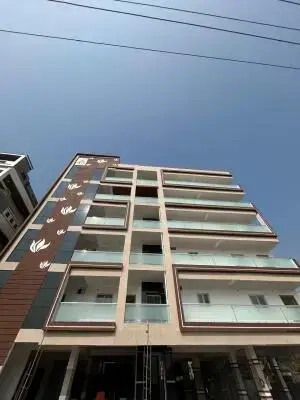
Sri Madhava Heights
CNR SREENIVASAM ESTATES · Suryapet · RERA P00800008793
SRI MADHAVA HEIGHTS is a plotted development / layout with open plots in Kodad, Kodad Mandal, Suryapet District. The registered promoter is CNR SREENIVASAM ESTATES, a partnership. The registered site extent is 41,481.11 sq. m, and the tentative layout approval records 122 plots; no towers, blocks, floors or plot configurations are identified in the supplied project record. The project is registered under TG-RERA registration number P00800008793, and the promoter-declared completion date is 03/01/2026.
01What we found
Read from TG-RERA filings, approvals, land and registration records and court records. A court case is counted only when the court record states this project's survey number with its village, or names the project.
02Check before you pay
6 items to check before you pay, 4 high - from the title chain, court records and approvals, each with what to ask the builder or your advocate. An item may not be a problem with the project: records can be incomplete.
Project at a glance
Project identity
| Item | Record |
|---|---|
| Registered project name | SRI MADHAVA HEIGHTS RERA record |
| Project type | Plotted development / layout with open plots RERA record |
| Phase or registered portion | Phase not separately identified; registration is for the project on the stated survey numbers |
| TG-RERA registration | P00800008793 |
| Registration validity | 21 September 2024 to 3 January 2026, unless extended by the Authority |
| Registered promoter | CNR SREENIVASAM ESTATES, a partnership RERA record Corporate record |
| RERA record status | The project evidence identifies it as a “New Project”; registration is recorded. Current registration status or any extension after the stated validity period is not established by the supplied record. RERA record |
Land and geographic identity
| Item | Record |
|---|---|
| Locality | Kodad; the filed layout describes the site as a residential area under Kodad Municipality limits. RERA record |
| Revenue village | Komarabanda Revenue Village RERA record |
| Mandal / district / PIN | Kodad / Suryapet / 508206 RERA record |
| Project survey numbers as registered | 41/2/C/1, 41/2/3, 41/2/4 |
| Subdivisions appearing in land records | 41/2/3/1, 41/2/3/2; 41/2/4/1, 41/2/4/2; 41/2/C/1/1, 41/2/C/1/2. The filing names the parent survey numbers; these land-record rows do not by themselves establish which individual subdivisions comprise the project parcel. Land records |
| Registered site extent | 41,481.11 sq. m in the RERA land details RERA record Land records |
| Layout-plan area | 41,479.57 sq. m is stated in the approved layout-plan extraction; its area statement separately gives total net layout area as 41,479.24 sq. m. |
| Boundaries recorded in RERA land details | North: 12 19 MT WIDE EXISTING ROAD; south, east and west: LAND OF OTHERS. Land records |
Development identity
| Item | Record |
|---|---|
| Sanctioning authority | TS-DTCP; the layout approval was issued by Kodada Municipality/Municipal Corporation under delegated authority. Approvals record |
| Principal layout approval | Tentative layout approval, application 007086/LO/DTCP/3046/0017/2023, approved 04 January 2024. Approvals record |
| Other approval identifier | File No. MCK/G1/110/2022; LTP licence No. TS/065158/2023. Approvals record |
| Approved built-up area | 0.00 proposed built-up area, both excluding and including parking, in the layout-plan details. |
| Buildings / floors | Not applicable to the filed open-plot layout; no buildings or floor configuration are identified in the supplied project record. |
| Layout scale | 122 plots in the tentative layout approval. |
| Mortgage provision | 19 plots are listed as reserved for mortgage to the Municipality; the layout details state 3,811.48 sq. m required mortgage area and the tentative approval records 0 Acer 37.67 Gts (4,559 Sq. Yds). |
Offering and status
| Item | Record |
|---|---|
| Offering | Plots; the layout schedule contains 122 plots. Layout record |
| Plot size information | Software-read schedule: 122 plots with sizes from 120.09 sq. m to 364.55 sq. m; median 193.63 sq. m. These are drawing-derived measurements, not RERA-filed saleable areas. Layout record |
| Booked / available plots | Not established in the supplied evidence. |
| Construction stage | No independently verified site-progress information is supplied. The tentative approval requires the applicant to complete layout infrastructure and development works. |
| Promoter-declared completion date | 03/01/2026 in Form B. |
| Registration validity | Separately recorded as ending 03/01/2026, unless extended by the Authority. |
| Occupancy / completion certificate | No occupancy or completion certificate is identified in the supplied project evidence. The registered offering is a plotted layout, not a building phase. |
The project story
Sri Madhava Heights is a proposed residential plotted layout in Komarabanda Revenue Village, Kodad Mandal, Suryapet District. Its filed identity covers survey numbers 41/2/C/1, 41/2/3 and 41/2/4. The tentative layout approval records 122 open plots; it does not describe apartment blocks or residential buildings.
The layout area statement allocates land to plots, roads, open space/park, social infrastructure and utilities. The tentative approval requires the applicant to provide layout infrastructure and amenities; the evidence does not establish that those works have been completed. The promoter’s Form B undertakes completion by 3 January 2026, but this is a promoter declaration, not independent verification of progress or completion.
Master plan, architecture & building design
The filed plan is a plotted layout rather than a building plan. It records 41,479.57 sq. m as the layout area and 41,479.24 sq. m as total net layout area in its area statement. Proposed built-up area is recorded as 0.00, both excluding and including parking. No tower, block, building footprint, floor levels or apartment configuration is evidenced.
The layout-plan area statement allocates:
| Layout use | Area | Share stated in layout |
|---|---|---|
| Plotted area | 24,321.73 sq. m | 58.64% |
| Roads | 11,970.69 sq. m | 28.86% |
| Organized open space / park | 3,734.68 sq. m | 9.00% |
| Social infrastructure | 1,037.24 sq. m | 2.50% |
| Utilities | 414.90 sq. m | 1.00% |
| Amenity area | 0.00 sq. m | 0.00% |
| Total net layout | 41,479.24 sq. m | 100.00% |
These are figures from the layout-plan extraction. The supplied drawing-derived record separately reports the plot schedule as 122 plots; those plot-size readings are software-measured and should be checked against the drawing. Layout record
The tentative approval lists road widths of 9.14 m, 18.29 m and 12.19 m (including the stated 12.19 MT entry). It also identifies 19 mortgage-reserved plots: 26, 25, 4, 3, 116, 117, 118, 119, 120, 121, 122, 105, 72, 54, 53, 52, 51, 27 and 28.
Homes, configurations & floor plans
This is a plotted development, not an apartment project. The supplied layout drawing records 122 plots, with the schedule fully read by software. Plot sizes below are drawing-derived software measurements, not RERA-filed saleable areas. No booked or available plot count is established by the supplied records. Layout record
| Plot information | Record |
|---|---|
| Total plots | 122 |
| Smallest measured plot | 120.09 sq. m (143.6 sq. yd) |
| Median measured plot | 193.63 sq. m (231.6 sq. yd) |
| Largest measured plot | 364.55 sq. m (436.0 sq. yd) |
| Measured size band | Plot count |
|---|---|
| 100–150 sq. yd | 1 |
| 150–200 sq. yd | 3 |
| 200–250 sq. yd | 86 |
| 250–300 sq. yd | 23 |
| 300–400 sq. yd | 8 |
| 400–500 sq. yd | 1 |
No apartment carpet area, balcony area or apartment saleable-area schedule is supplied. The apartment floor-plan drawings are reported as layout sheets with no flats. Floor plans
Parking & vehicle circulation
The layout-plan area statement records 0.00 sq. m as common parking area, and the supplied plan extraction does not establish a parking-space count, visitor parking, accessible spaces, mechanical parking or an allocation of parking rights to individual plot buyers.
The tentative approval identifies internal layout roads and requires them to remain open for access to neighbouring sites. It also requires road formation as part of development works. No vehicle-entry arrangement, driveway details or pedestrian-separation design is established in the supplied evidence.
Amenities, recreation & open spaces
The layout approval identifies open space/park, social infrastructure and utility land. It also lists a tot-lot in the layout-plan details. The approval’s infrastructure conditions describe required development works; the supplied evidence does not independently verify completion.
| Facility | Description / size | Evidence source | Declared progress / verified status |
|---|---|---|---|
| Park / organized open space | 3,734.68 sq. m; 9.00% in the layout area statement | Reserved in tentative layout; completion not verified | |
| Tot-lot | Listed; no size stated | Listed in layout details; completion not verified | |
| Social infrastructure area | 1,037.24 sq. m; 2.50% in the layout area statement | Reserved in tentative layout; specific facility and completion status not established | |
| Utility area | 414.90 sq. m; 1.00% in the layout area statement | Reserved in tentative layout; completion not verified |
No clubhouse or indoor recreation facility is identified in the supplied evidence. RERA amenities
Utilities, building services & safety
The tentative layout approval describes the development works required of the applicant. These are approval conditions and proposed works, not evidence that the systems are installed, commissioned or independently verified.
| Service | Evidence in the project record |
|---|---|
| Water | Internal water-supply pipelines, an overhead tank and an assured water-supply source are specified as development works; a water reservoir is also listed. Capacities and completion status are not supplied. |
| Sewerage and drainage | Underground drainage lines and a common septic tank / STP are listed, along with storm-water drains. No capacity or completed/operational status is supplied. |
| Rainwater | Rainwater-harvesting pits are specified; number, capacity and completion status are not supplied. |
| Electrical | Electrical supply lines, street lights and a transformer are specified as works; the RERA amenity record also lists an electrical meter room/sub-station/receiving station. Capacity and completion status are not supplied. RERA amenities |
| Waste management | Solid-waste management is listed in the tentative approval and RERA amenity record; the system’s design, capacity and operating status are not established. RERA amenities |
| Fire and life safety | Fire protection and fire-safety requirements appear in the RERA amenity record, but no project-specific system details or clearance are supplied. RERA amenities |
| Accessibility and security | No project-specific accessible-circulation, CCTV or access-control details are established in the supplied evidence. |
Location, access & connectivity
The registered location is Komarabanda, Kodad, Suryapet, 508206, in Komarabanda Revenue Village, Kodad Mandal. The project boundary information identifies an existing road to the north as “12 19 MT WIDE EXISTING ROAD”; the other listed boundaries are land of others. Land records
The location record gives the cadastral parcel centroid as 17.024655267773948, 79.9256196996726. The nearest sampled Outer Ring Road interchange is listed at 140.5 km; this is a supplied measured-distance estimate, not a travel-time claim. No further public-transport or landmark details are established in the project location evidence. Location record Cadastral map
Developer & development status
The registered promoter is CNR SREENIVASAM ESTATES, identified as a partnership; its GSTIN is 36AAPFC6097E1Z3. The project record lists CHINTHAKUNTLA MADHUKUMAR as authorized signatory and CHINTHAKUNTLA NAGAMANI as partner. Corporate record Parties record
Form B is a promoter-signed declaration that the project will be completed by 03/01/2026. The supplied record does not provide verified construction progress, plot bookings, or evidence that layout infrastructure has been completed. The RERA registration certificate states its validity separately, from 21/09/2024 through 03/01/2026, unless extended by the Authority. No extension or completion certificate is identified in the supplied evidence.
Approvals, official records & documents
| Identifier / date | P00800008793; valid 21/09/2024–03/01/2026 unless extended |
|---|---|
| Scope and evidence | Form C identifies SRI MADHAVA HEIGHTS, CNR SREENIVASAM ESTATES and the registered survey numbers. |
| Identifier / date | Application 007086/LO/DTCP/3046/0017/2023; approved 04 January 2024 |
|---|---|
| Scope and evidence | Issued by Kodada Municipality/Municipal Corporation; covers the plotted layout and records 122 plots and development conditions. |
| Identifier / date | File No. MCK/G1/110/2022; LTP licence TS/065158/2023 |
|---|---|
| Scope and evidence | Approved layout-plan details include the land-use statement, plot count and mortgage-reserved plots. |
| Identifier / date | Filed for the project |
|---|---|
| Scope and evidence | Promoter declaration includes title, encumbrance and completion undertakings. |
| Identifier / date | Not identified in the supplied evidence |
|---|---|
| Scope and evidence | No building-specific occupancy or completion certificate is listed for this plotted-layout project. |
The tentative layout approval expressly states that it is not proof of land title and places responsibility for layout development and stated conditions on the applicant.
Project at a glance
Project identity
Registered project name: SRI MADHAVA HEIGHTS
Project type: Plotted development / layout with open plots
Phase or registered portion: Phase not separately identified; registration is for the project on the stated survey numbers
TG-RERA registration: P00800008793
Registration validity: 21 September 2024 to 3 January 2026, unless extended by the Authority
Registered promoter: CNR SREENIVASAM ESTATES, a partnership
RERA record status: The project evidence identifies it as a “New Project”; registration is recorded. Current registration status or any extension after the stated validity period is not established by the supplied record.
Land and geographic identity
Locality: Kodad; the filed layout describes the site as a residential area under Kodad Municipality limits.
Revenue village: Komarabanda Revenue Village
Mandal / district / PIN: Kodad / Suryapet / 508206
Project survey numbers as registered: 41/2/C/1, 41/2/3, 41/2/4
Subdivisions appearing in land records: 41/2/3/1, 41/2/3/2; 41/2/4/1, 41/2/4/2; 41/2/C/1/1, 41/2/C/1/2. The filing names the parent survey numbers; these land-record rows do not by themselves establish which individual subdivisions comprise the project parcel.
Registered site extent: 41,481.11 sq. m in the RERA land details
Layout-plan area: 41,479.57 sq. m is stated in the approved layout-plan extraction; its area statement separately gives total net layout area as 41,479.24 sq. m.
Boundaries recorded in RERA land details: North: 12 19 MT WIDE EXISTING ROAD; south, east and west: LAND OF OTHERS.
Development identity
Sanctioning authority: TS-DTCP; the layout approval was issued by Kodada Municipality/Municipal Corporation under delegated authority.
Principal layout approval: Tentative layout approval, application 007086/LO/DTCP/3046/0017/2023, approved 04 January 2024.
Other approval identifier: File No. MCK/G1/110/2022; LTP licence No. TS/065158/2023.
Approved built-up area: 0.00 proposed built-up area, both excluding and including parking, in the layout-plan details.
Buildings / floors: Not applicable to the filed open-plot layout; no buildings or floor configuration are identified in the supplied project record.
Layout scale: 122 plots in the tentative layout approval.
Mortgage provision: 19 plots are listed as reserved for mortgage to the Municipality; the layout details state 3,811.48 sq. m required mortgage area and the tentative approval records 0 Acer 37.67 Gts (4,559 Sq. Yds).
Offering and status
Offering: Plots; the layout schedule contains 122 plots.
Plot size information: Software-read schedule: 122 plots with sizes from 120.09 sq. m to 364.55 sq. m; median 193.63 sq. m. These are drawing-derived measurements, not RERA-filed saleable areas.
Booked / available plots: Not established in the supplied evidence.
Construction stage: No independently verified site-progress information is supplied. The tentative approval requires the applicant to complete layout infrastructure and development works.
Promoter-declared completion date: 03/01/2026 in Form B.
Registration validity: Separately recorded as ending 03/01/2026, unless extended by the Authority.
Occupancy / completion certificate: No occupancy or completion certificate is identified in the supplied project evidence. The registered offering is a plotted layout, not a building phase.
The project story
Sri Madhava Heights is a proposed residential plotted layout in Komarabanda Revenue Village, Kodad Mandal, Suryapet District. Its filed identity covers survey numbers 41/2/C/1, 41/2/3 and 41/2/4. The tentative layout approval records 122 open plots; it does not describe apartment blocks or residential buildings.
The layout area statement allocates land to plots, roads, open space/park, social infrastructure and utilities. The tentative approval requires the applicant to provide layout infrastructure and amenities; the evidence does not establish that those works have been completed. The promoter’s Form B undertakes completion by 3 January 2026, but this is a promoter declaration, not independent verification of progress or completion.
Master plan, architecture & building design
The filed plan is a plotted layout rather than a building plan. It records 41,479.57 sq. m as the layout area and 41,479.24 sq. m as total net layout area in its area statement. Proposed built-up area is recorded as 0.00, both excluding and including parking. No tower, block, building footprint, floor levels or apartment configuration is evidenced.
The layout-plan area statement allocates:
| Layout use | Area | Share stated in layout |
|---|---|---|
| Plotted area | 24,321.73 sq. m | 58.64% |
| Roads | 11,970.69 sq. m | 28.86% |
| Organized open space / park | 3,734.68 sq. m | 9.00% |
| Social infrastructure | 1,037.24 sq. m | 2.50% |
| Utilities | 414.90 sq. m | 1.00% |
| Amenity area | 0.00 sq. m | 0.00% |
| Total net layout | 41,479.24 sq. m | 100.00% |
These are figures from the layout-plan extraction. The supplied drawing-derived record separately reports the plot schedule as 122 plots; those plot-size readings are software-measured and should be checked against the drawing.
The tentative approval lists road widths of 9.14 m, 18.29 m and 12.19 m (including the stated 12.19 MT entry). It also identifies 19 mortgage-reserved plots: 26, 25, 4, 3, 116, 117, 118, 119, 120, 121, 122, 105, 72, 54, 53, 52, 51, 27 and 28.
Homes, configurations & floor plans
This is a plotted development, not an apartment project. The supplied layout drawing records 122 plots, with the schedule fully read by software. Plot sizes below are drawing-derived software measurements, not RERA-filed saleable areas. No booked or available plot count is established by the supplied records.
Total plots: 122
Smallest measured plot: 120.09 sq. m (143.6 sq. yd)
Median measured plot: 193.63 sq. m (231.6 sq. yd)
Largest measured plot: 364.55 sq. m (436.0 sq. yd)
100–150 sq. yd: 1
150–200 sq. yd: 3
200–250 sq. yd: 86
250–300 sq. yd: 23
300–400 sq. yd: 8
400–500 sq. yd: 1
No apartment carpet area, balcony area or apartment saleable-area schedule is supplied. The apartment floor-plan drawings are reported as layout sheets with no flats.
Parking & vehicle circulation
The layout-plan area statement records 0.00 sq. m as common parking area, and the supplied plan extraction does not establish a parking-space count, visitor parking, accessible spaces, mechanical parking or an allocation of parking rights to individual plot buyers.
The tentative approval identifies internal layout roads and requires them to remain open for access to neighbouring sites. It also requires road formation as part of development works. No vehicle-entry arrangement, driveway details or pedestrian-separation design is established in the supplied evidence.
Amenities, recreation & open spaces
The layout approval identifies open space/park, social infrastructure and utility land. It also lists a tot-lot in the layout-plan details. The approval’s infrastructure conditions describe required development works; the supplied evidence does not independently verify completion.
| Facility | Description / size | Evidence source | Declared progress / verified status |
|---|---|---|---|
| Park / organized open space | 3,734.68 sq. m; 9.00% in the layout area statement | Reserved in tentative layout; completion not verified | |
| Tot-lot | Listed; no size stated | Listed in layout details; completion not verified | |
| Social infrastructure area | 1,037.24 sq. m; 2.50% in the layout area statement | Reserved in tentative layout; specific facility and completion status not established | |
| Utility area | 414.90 sq. m; 1.00% in the layout area statement | Reserved in tentative layout; completion not verified |
No clubhouse or indoor recreation facility is identified in the supplied evidence.
Utilities, building services & safety
The tentative layout approval describes the development works required of the applicant. These are approval conditions and proposed works, not evidence that the systems are installed, commissioned or independently verified.
Water: Internal water-supply pipelines, an overhead tank and an assured water-supply source are specified as development works; a water reservoir is also listed. Capacities and completion status are not supplied.
Sewerage and drainage: Underground drainage lines and a common septic tank / STP are listed, along with storm-water drains. No capacity or completed/operational status is supplied.
Rainwater: Rainwater-harvesting pits are specified; number, capacity and completion status are not supplied.
Electrical: Electrical supply lines, street lights and a transformer are specified as works; the RERA amenity record also lists an electrical meter room/sub-station/receiving station. Capacity and completion status are not supplied.
Waste management: Solid-waste management is listed in the tentative approval and RERA amenity record; the system’s design, capacity and operating status are not established.
Fire and life safety: Fire protection and fire-safety requirements appear in the RERA amenity record, but no project-specific system details or clearance are supplied.
Accessibility and security: No project-specific accessible-circulation, CCTV or access-control details are established in the supplied evidence.
Location, access & connectivity
The registered location is Komarabanda, Kodad, Suryapet, 508206, in Komarabanda Revenue Village, Kodad Mandal. The project boundary information identifies an existing road to the north as “12 19 MT WIDE EXISTING ROAD”; the other listed boundaries are land of others.
The location record gives the cadastral parcel centroid as 17.024655267773948, 79.9256196996726. The nearest sampled Outer Ring Road interchange is listed at 140.5 km; this is a supplied measured-distance estimate, not a travel-time claim. No further public-transport or landmark details are established in the project location evidence.
Developer & development status
The registered promoter is CNR SREENIVASAM ESTATES, identified as a partnership; its GSTIN is 36AAPFC6097E1Z3. The project record lists CHINTHAKUNTLA MADHUKUMAR as authorized signatory and CHINTHAKUNTLA NAGAMANI as partner.
Form B is a promoter-signed declaration that the project will be completed by 03/01/2026. The supplied record does not provide verified construction progress, plot bookings, or evidence that layout infrastructure has been completed. The RERA registration certificate states its validity separately, from 21/09/2024 through 03/01/2026, unless extended by the Authority. No extension or completion certificate is identified in the supplied evidence.
Approvals, official records & documents
| Identifier / date | P00800008793; valid 21/09/2024–03/01/2026 unless extended |
|---|---|
| Scope and evidence | Form C identifies SRI MADHAVA HEIGHTS, CNR SREENIVASAM ESTATES and the registered survey numbers. |
| Identifier / date | Application 007086/LO/DTCP/3046/0017/2023; approved 04 January 2024 |
|---|---|
| Scope and evidence | Issued by Kodada Municipality/Municipal Corporation; covers the plotted layout and records 122 plots and development conditions. |
| Identifier / date | File No. MCK/G1/110/2022; LTP licence TS/065158/2023 |
|---|---|
| Scope and evidence | Approved layout-plan details include the land-use statement, plot count and mortgage-reserved plots. |
| Identifier / date | Filed for the project |
|---|---|
| Scope and evidence | Promoter declaration includes title, encumbrance and completion undertakings. |
| Identifier / date | Not identified in the supplied evidence |
|---|---|
| Scope and evidence | No building-specific occupancy or completion certificate is listed for this plotted-layout project. |
The tentative layout approval expressly states that it is not proof of land title and places responsibility for layout development and stated conditions on the applicant.
Frequently asked questions
Is SRI MADHAVA HEIGHTS registered with Telangana RERA?
Yes. SRI MADHAVA HEIGHTS is registered with the Telangana Real Estate Regulatory Authority as P00800008793; the registration status is New Project.
Who is the developer of SRI MADHAVA HEIGHTS?
The promoter named in the RERA registration is CNR SREENIVASAM ESTATES.
Where is SRI MADHAVA HEIGHTS located?
SRI MADHAVA HEIGHTS is in KODAD, Komarabanda, Suryapet, Telangana (508206).
When will SRI MADHAVA HEIGHTS be completed?
The promoter's proposed date of completion filed with RERA is 03/01/2026. This is the promoter's declaration, not a guarantee.
More projects in Komarabanda