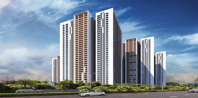
Vasudaika Henley Woods
VASUDAIKA REALTY LLP · Rangareddy · RERA P02400007921
VASUDAIKA HENLEY WOODS is a residential plotted development in Nagireddipalle Village, Maheswaram Mandal, Ranga Reddy District. The registered promoter is VASUDAIKA REALTY LLP. The registered site area is 122854.23 sq.m., and the final layout record identifies 303 residential plots; plot configurations are not disclosed in the supplied records. The project is registered under TG-RERA number P02400007921, with proposed completion recorded as 12/04/2027.
More from Vasudaika Realty LLP · 2 projects →
01What we found
Read from TG-RERA filings, approvals, land and registration records and court records. A court case is counted only when the court record states this project's survey number with its village, or names the project.
02Check before you pay
8 items to check before you pay, 3 high - from the title chain, court records and approvals, each with what to ask the builder or your advocate. An item may not be a problem with the project: records can be incomplete.
1. Project at a glance
Project identity
| Field | Project record |
|---|---|
| Registered name | VASUDAIKA HENLEY WOODS RERA record |
| Project type | Plotted development / residential open layout RERA record RERA filing |
| Phase or registered portion | New Project; no phase name or separately identified phase is disclosed RERA filing |
| TG-RERA registration | P02400007921 |
| Registration validity | 23/03/2024 to 12/12/2026, as stated on the registration certificate |
| Registered promoter | VASUDAIKA REALTY LLP |
| RERA-record status | New Project; the supplied record does not state a current portal status beyond registration and validity dates RERA filing |
Land and geographic identity
| Field | Project record |
|---|---|
| Official locality | Nagireddipalle Village, Maheswaram Mandal, Ranga Reddy District RERA filing |
| Revenue village | Nagireddy pally (also rendered as Nagireddipalle/Nagireddypalle in the project documents) RERA filing |
| Mandal / district / PIN | Maheshwaram / Ranga Reddy / 506331 RERA filing |
| Project survey numbers and subdivisions | 126/P, 150/P, 151, 152/P, 153/P, 154/P, 156, 157, 158, 159, 160, 161 |
| Registered site area | 122854.23 sq.m. stated in the RERA project information RERA filing |
| Layout drawing area figures | Total site area 123672.16 sq.m.; road-affected area 817.93 sq.m.; net site area 122854.23 sq.m. |
| Boundaries on RERA filing | East: others’ land; West: road; North: others’ land; South: others’ land RERA filing |
Development identity
| Field | Project record |
|---|---|
| Sanctioning authority | Hyderabad Metropolitan Development Authority (HMDA) Approvals record |
| Principal draft layout approval | 000184/LO/Plg/HMDA/2023, dated 25 September 2023 Approvals record |
| Final layout permit | 003912/FLT/HMDA/1137/SMD/2025, dated 21 May 2025 Approvals record |
| Approved built-up area | Not disclosed as a building-area figure for this plotted layout. The final layout record separately lists “Total Built up Area” as 415.1 in its utilities-area schedule; the unit of that entry is not stated in the supplied extraction. |
| Buildings, floors and parking levels | Not applicable to the offered plotted layout as documented; no building/floor or parking-level schedule is supplied. |
| Plot count | Final layout record: 303 plots. |
| Approved versus RERA-declared unit count | Final layout record identifies 303 plots; the supplied RERA unit-count table is not available here. |
Offering and status
| Field | Project record |
|---|---|
| Offering | Residential plots; the RERA project record identifies a plotted development. RERA filing |
| Plot-size range | Not disclosed in the supplied RERA or drawing-derived records. |
| Booked / available counts | Not supplied. |
| Construction stage | No independently verified site-progress measurement is supplied. The RERA amenity schedule marks some infrastructure categories “YES” but records 0% progress for those entries. RERA amenities |
| Promoter-declared completion date | 12 December 2026 in the Form B declaration; the project header separately records proposed completion as 12/04/2027. RERA filing |
| Registration validity versus completion | Registration is stated to remain valid through 12/12/2026 unless extended; this is separate from the completion dates above. |
| Occupancy / completion certificate | An architect’s Form-1A states overall project completion and identifies HMDA occupancy certificate 003912/FLT/HMDA/1137/2025, dated 21/5/2025. The final layout permission is also recorded as issued on 21 May 2025. |
2. The project story
- VASUDAIKA HENLEY WOODS is registered as a residential plotted development on land in Nagireddipalle Village, Maheshwaram Mandal, Ranga Reddy District. Its registered survey identity is 126/P, 150/P, 151, 152/P, 153/P, 154/P, 156, 157, 158, 159, 160 and 161. The final HMDA layout record describes 303 residential plots.
- The project’s physical offer is plots rather than completed apartments or villas. The final-layout record restricts the plots to residential use and states that buildings are to be considered for approval under applicable building rules; it does not itself provide a building design or establish that homes have been built.
- The supplied evidence includes an HMDA draft layout approval dated 25 September 2023 and a final layout permit dated 21 May 2025. An architect’s Form-1A records completion in all aspects and identifies an HMDA occupancy certificate dated 21 May 2025. No separate independent site inspection or progress measurement is supplied, so construction or delivery of individual plots’ infrastructure should not be inferred from that certificate alone. RERA amenities
3. Master plan, architecture & building design
- This is a plotted layout, not a multi-storey building scheme in the supplied records. The draft layout drawing records a total site area of 123672.16 sq.m., 817.93 sq.m. affected by master-plan road widening and a net site area of 122854.23 sq.m.
- The draft layout’s land-use schedule records 77374.41 sq.m. as plotted area, 32770.76 sq.m. for layout roads, 9634.74 sq.m. for parks, 3073.07 sq.m. for social infrastructure and 0 for amenities area. The draft approval also lists utility and infrastructure works.
- The final layout record separately lists 77374.42 sq.m. plotted area, 9219.63 sq.m. park/open space, 3073.07 sq.m. social infrastructure, 9219.63 sq.m. layout roads and 415.1 sq.m. utilities area. Its conditions record roads, open spaces, social infrastructure and utilities handed over to the local authority by registered gift deed.
- The supplied layout drawing is a two-sheet source; software extraction does not provide a complete plot-by-plot schedule or plot-size bands. No building footprints, floor configurations, heights, or residential floor plans are available for this plotted project. Layout record Floor plans
4. Homes, configurations & floor plans
- The RERA-filed offering is plots. The supplied material does not include a complete RERA configuration table, booked/available inventory, or plot-size range. The final layout approval records 303 plots.
- The approved layout drawing contains two sheets, but the supplied software extraction reports that plot sizes are not completely captured. The available floor-plan extraction reports no measured carpet areas and no flat plans; those apartment measures therefore do not apply to the evidenced plotted offer. Layout record Floor plans
5. Parking & vehicle circulation
- No sanctioned parking-space count, visitor or accessible parking provision, or plot-level parking allocation is supplied. The project is recorded as a plotted layout, and the available approval extracts do not establish exclusive parking rights for any plot.
- The draft layout approval requires roads to remain open for access to neighbouring sites and prohibits a compound wall or fencing around the site. The final layout record also requires roads to remain open for free public access.
6. Amenities, recreation & open spaces
| Description / size | Layout road area 32770.76 sq.m. in draft schedule |
|---|---|
| Evidence source | HMDA draft layout |
| Declared progress / verified status | Final-layout record states roads were handed over to the local authority by registered gift deed |
| Description / size | Draft schedule: 9634.74 sq.m. park area; final record: 9219.63 sq.m. park/open space |
|---|---|
| Evidence source | HMDA draft and final layout records |
| Declared progress / verified status | Final record states open spaces were handed over to the local authority |
| Description / size | 3073.07 sq.m. |
|---|---|
| Evidence source | HMDA draft and final layout records |
| Declared progress / verified status | Final record states social infrastructure was handed over to the local authority |
| Description / size | 415.1 sq.m. in final layout record |
|---|---|
| Evidence source | Final layout record |
| Declared progress / verified status | Final record states utilities were handed over to the local authority |
| Description / size | Draft approval lists common septic tank/STP, internal water-supply pipelines, overhead tank, electrical lines, street lights, transformer, avenue plantation, park development, rainwater-harvesting pits, utility area, bio-compost unit and cycling tracks |
|---|---|
| Evidence source | HMDA draft layout approval |
| Declared progress / verified status | Listed as approval-stage infrastructure; no independently verified completion status supplied |
| Description / size | Internal roads and footpaths, water supply, sewerage, storm-water drains, green strip/park, street lighting and aggregate recreational open space marked “YES”; each supplied progress value is 0% |
|---|---|
| Evidence source | RERA amenities schedule RERA amenities |
| Declared progress / verified status | RERA schedule declaration; not an independent completion verification |
| Description / size | Promoter-marketed |
|---|---|
| Evidence source | Promoter website/listing data Promoter website |
| Declared progress / verified status | Marketing claim only; not established in the supplied HMDA layout records |
7. Utilities, building services & safety
- The draft layout approval lists common septic tank/STP, internal water-supply pipelines, an overhead tank, electrical supply lines, street lights, a transformer, rainwater-harvesting pits and a bio-compost unit. These are listed as required or planned site infrastructure; the supplied material does not provide capacities or independently verified operating status.
- The final layout record lists water supply, sewerage, drainage disposal systems, street lighting and a rainwater-harvesting structure. It states that roads, open spaces, social infrastructure and utilities were handed over to the local authority by registered gift deed.
- The RERA amenities schedule also names storm-water drains, sewerage/septic tank/STP, waste management, energy management, fire protection and an electrical meter room/sub-station/receiving station; the supplied schedule gives no progress percentage above 0% for its entries. It does not establish the capacities or operational completion of these services. RERA amenities
8. Location, access & connectivity
- The registered location is Nagireddipalle Village, Maheshwaram Mandal, Ranga Reddy District, PIN 506331. The supplied cadastral parcel centroid is 17.16430, 78.35382. Cadastral map
- The HMDA draft layout records an abutting road width of 18.00 and a master-plan road-affected area of 817.93 sq.m. The final layout conditions require roads to remain open for free public access.
- The nearest sampled Outer Ring Road interchange is listed at approximately 10.9 km. This is a supplied location-data measurement, not a promoter travel-time claim. Location record
9. Developer & development status
- The registered legal promoter is VASUDAIKA REALTY LLP, an LLP. The supplied corporate identifier is GSTIN 36AATFV7635H1ZG. The project filing names Venkat Ram Jagarlamudi as an authorized signatory and lists him and Srilatha Jagarlamudi as LLP partners. Corporate record Parties record
- The registration certificate gives the promoter address as Village Madhapur, Mandal Serilingampally, District Ranga Reddy, PIN 500081. The project site itself is identified as Nagireddipalle Village, Maheshwaram Mandal, Ranga Reddy District.
- The promoter’s Form B declaration, dated 8 March 2024, undertakes completion by 12 December 2026. The project header also records a proposed completion date of 12/04/2027. The supplied material does not establish construction progress through an independent site review. RERA filing
10. Approvals, official records & documents
| Identifier / date | P02400007921; valid 23/03/2024–12/12/2026 |
|---|---|
| What the supplied document establishes | Registration of VASUDAIKA HENLEY WOODS with VASUDAIKA REALTY LLP as promoter. |
| Identifier / date | 000184/LO/Plg/HMDA/2023; 25 September 2023 |
|---|---|
| What the supplied document establishes | Draft approval for the open-plot layout and conditions concerning development works, roads/open spaces, mortgage plots and final layout release. |
| Identifier / date | 003912/FLT/HMDA/1137/SMD/2025; 21 May 2025 |
|---|---|
| What the supplied document establishes | Final layout approval; records 303 residential plots and handover of roads, open spaces, social infrastructure and utilities. |
| Identifier / date | 003912/FLT/HMDA/1137/2025; 21/5/2025 |
|---|---|
| What the supplied document establishes | Identified in the architect’s Form-1A, which certifies project completion in all aspects. |
| Identifier / date | Mortgage documents 14628/2023 and 14629/2023; gift deed 14630/2023 |
|---|---|
| What the supplied document establishes | Referenced in the draft layout approval in connection with HMDA security and public-purpose land. |
| Identifier / date | Gift deed 13650/2024, dated 21 August 2024; relinquishment deeds 8662/2025 and 8661/2025, dated 17 May 2025 |
|---|---|
| What the supplied document establishes | Final layout record cites these in relation to roads/open spaces/utilities and relinquishment of mortgaged plots. |
| Identifier / date | Dated 8 March 2024 |
|---|---|
| What the supplied document establishes | Promoter’s declaration including completion undertaking and RERA-account and audit commitments. |
| Identifier / date | Public lookup unavailable in supplied data |
|---|---|
| What the supplied document establishes | The evidence pack records that HMDA’s DPMS approved-layout lookup is not publicly reachable; this does not establish refusal or absence of approval. HMDA |
1. Project at a glance
Project identity
Registered name: VASUDAIKA HENLEY WOODS
Project type: Plotted development / residential open layout
Phase or registered portion: New Project; no phase name or separately identified phase is disclosed
TG-RERA registration: P02400007921
Registration validity: 23/03/2024 to 12/12/2026, as stated on the registration certificate
Registered promoter: VASUDAIKA REALTY LLP
RERA-record status: New Project; the supplied record does not state a current portal status beyond registration and validity dates
Land and geographic identity
Official locality: Nagireddipalle Village, Maheswaram Mandal, Ranga Reddy District
Revenue village: Nagireddy pally (also rendered as Nagireddipalle/Nagireddypalle in the project documents)
Mandal / district / PIN: Maheshwaram / Ranga Reddy / 506331
Project survey numbers and subdivisions: 126/P, 150/P, 151, 152/P, 153/P, 154/P, 156, 157, 158, 159, 160, 161
Registered site area: 122854.23 sq.m. stated in the RERA project information
Layout drawing area figures: Total site area 123672.16 sq.m.; road-affected area 817.93 sq.m.; net site area 122854.23 sq.m.
Boundaries on RERA filing: East: others’ land; West: road; North: others’ land; South: others’ land
Development identity
Sanctioning authority: Hyderabad Metropolitan Development Authority (HMDA)
Principal draft layout approval: 000184/LO/Plg/HMDA/2023, dated 25 September 2023
Final layout permit: 003912/FLT/HMDA/1137/SMD/2025, dated 21 May 2025
Approved built-up area: Not disclosed as a building-area figure for this plotted layout. The final layout record separately lists “Total Built up Area” as 415.1 in its utilities-area schedule; the unit of that entry is not stated in the supplied extraction.
Buildings, floors and parking levels: Not applicable to the offered plotted layout as documented; no building/floor or parking-level schedule is supplied.
Plot count: Final layout record: 303 plots.
Approved versus RERA-declared unit count: Final layout record identifies 303 plots; the supplied RERA unit-count table is not available here.
Offering and status
Offering: Residential plots; the RERA project record identifies a plotted development.
Plot-size range: Not disclosed in the supplied RERA or drawing-derived records.
Booked / available counts: Not supplied.
Construction stage: No independently verified site-progress measurement is supplied. The RERA amenity schedule marks some infrastructure categories “YES” but records 0% progress for those entries.
Promoter-declared completion date: 12 December 2026 in the Form B declaration; the project header separately records proposed completion as 12/04/2027.
Registration validity versus completion: Registration is stated to remain valid through 12/12/2026 unless extended; this is separate from the completion dates above.
Occupancy / completion certificate: An architect’s Form-1A states overall project completion and identifies HMDA occupancy certificate 003912/FLT/HMDA/1137/2025, dated 21/5/2025. The final layout permission is also recorded as issued on 21 May 2025.
2. The project story
- VASUDAIKA HENLEY WOODS is registered as a residential plotted development on land in Nagireddipalle Village, Maheshwaram Mandal, Ranga Reddy District. Its registered survey identity is 126/P, 150/P, 151, 152/P, 153/P, 154/P, 156, 157, 158, 159, 160 and 161. The final HMDA layout record describes 303 residential plots.
- The project’s physical offer is plots rather than completed apartments or villas. The final-layout record restricts the plots to residential use and states that buildings are to be considered for approval under applicable building rules; it does not itself provide a building design or establish that homes have been built.
- The supplied evidence includes an HMDA draft layout approval dated 25 September 2023 and a final layout permit dated 21 May 2025. An architect’s Form-1A records completion in all aspects and identifies an HMDA occupancy certificate dated 21 May 2025. No separate independent site inspection or progress measurement is supplied, so construction or delivery of individual plots’ infrastructure should not be inferred from that certificate alone.
3. Master plan, architecture & building design
- This is a plotted layout, not a multi-storey building scheme in the supplied records. The draft layout drawing records a total site area of 123672.16 sq.m., 817.93 sq.m. affected by master-plan road widening and a net site area of 122854.23 sq.m.
- The draft layout’s land-use schedule records 77374.41 sq.m. as plotted area, 32770.76 sq.m. for layout roads, 9634.74 sq.m. for parks, 3073.07 sq.m. for social infrastructure and 0 for amenities area. The draft approval also lists utility and infrastructure works.
- The final layout record separately lists 77374.42 sq.m. plotted area, 9219.63 sq.m. park/open space, 3073.07 sq.m. social infrastructure, 9219.63 sq.m. layout roads and 415.1 sq.m. utilities area. Its conditions record roads, open spaces, social infrastructure and utilities handed over to the local authority by registered gift deed.
- The supplied layout drawing is a two-sheet source; software extraction does not provide a complete plot-by-plot schedule or plot-size bands. No building footprints, floor configurations, heights, or residential floor plans are available for this plotted project.
4. Homes, configurations & floor plans
- The RERA-filed offering is plots. The supplied material does not include a complete RERA configuration table, booked/available inventory, or plot-size range. The final layout approval records 303 plots.
- The approved layout drawing contains two sheets, but the supplied software extraction reports that plot sizes are not completely captured. The available floor-plan extraction reports no measured carpet areas and no flat plans; those apartment measures therefore do not apply to the evidenced plotted offer.
5. Parking & vehicle circulation
- No sanctioned parking-space count, visitor or accessible parking provision, or plot-level parking allocation is supplied. The project is recorded as a plotted layout, and the available approval extracts do not establish exclusive parking rights for any plot.
- The draft layout approval requires roads to remain open for access to neighbouring sites and prohibits a compound wall or fencing around the site. The final layout record also requires roads to remain open for free public access.
6. Amenities, recreation & open spaces
| Description / size | Layout road area 32770.76 sq.m. in draft schedule |
|---|---|
| Evidence source | HMDA draft layout |
| Declared progress / verified status | Final-layout record states roads were handed over to the local authority by registered gift deed |
| Description / size | Draft schedule: 9634.74 sq.m. park area; final record: 9219.63 sq.m. park/open space |
|---|---|
| Evidence source | HMDA draft and final layout records |
| Declared progress / verified status | Final record states open spaces were handed over to the local authority |
| Description / size | 3073.07 sq.m. |
|---|---|
| Evidence source | HMDA draft and final layout records |
| Declared progress / verified status | Final record states social infrastructure was handed over to the local authority |
| Description / size | 415.1 sq.m. in final layout record |
|---|---|
| Evidence source | Final layout record |
| Declared progress / verified status | Final record states utilities were handed over to the local authority |
| Description / size | Draft approval lists common septic tank/STP, internal water-supply pipelines, overhead tank, electrical lines, street lights, transformer, avenue plantation, park development, rainwater-harvesting pits, utility area, bio-compost unit and cycling tracks |
|---|---|
| Evidence source | HMDA draft layout approval |
| Declared progress / verified status | Listed as approval-stage infrastructure; no independently verified completion status supplied |
| Description / size | Internal roads and footpaths, water supply, sewerage, storm-water drains, green strip/park, street lighting and aggregate recreational open space marked “YES”; each supplied progress value is 0% |
|---|---|
| Evidence source | RERA amenities schedule |
| Declared progress / verified status | RERA schedule declaration; not an independent completion verification |
| Description / size | Promoter-marketed |
|---|---|
| Evidence source | Promoter website/listing data |
| Declared progress / verified status | Marketing claim only; not established in the supplied HMDA layout records |
7. Utilities, building services & safety
- The draft layout approval lists common septic tank/STP, internal water-supply pipelines, an overhead tank, electrical supply lines, street lights, a transformer, rainwater-harvesting pits and a bio-compost unit. These are listed as required or planned site infrastructure; the supplied material does not provide capacities or independently verified operating status.
- The final layout record lists water supply, sewerage, drainage disposal systems, street lighting and a rainwater-harvesting structure. It states that roads, open spaces, social infrastructure and utilities were handed over to the local authority by registered gift deed.
- The RERA amenities schedule also names storm-water drains, sewerage/septic tank/STP, waste management, energy management, fire protection and an electrical meter room/sub-station/receiving station; the supplied schedule gives no progress percentage above 0% for its entries. It does not establish the capacities or operational completion of these services.
8. Location, access & connectivity
- The registered location is Nagireddipalle Village, Maheshwaram Mandal, Ranga Reddy District, PIN 506331. The supplied cadastral parcel centroid is 17.16430, 78.35382.
- The HMDA draft layout records an abutting road width of 18.00 and a master-plan road-affected area of 817.93 sq.m. The final layout conditions require roads to remain open for free public access.
- The nearest sampled Outer Ring Road interchange is listed at approximately 10.9 km. This is a supplied location-data measurement, not a promoter travel-time claim.
9. Developer & development status
- The registered legal promoter is VASUDAIKA REALTY LLP, an LLP. The supplied corporate identifier is GSTIN 36AATFV7635H1ZG. The project filing names Venkat Ram Jagarlamudi as an authorized signatory and lists him and Srilatha Jagarlamudi as LLP partners.
- The registration certificate gives the promoter address as Village Madhapur, Mandal Serilingampally, District Ranga Reddy, PIN 500081. The project site itself is identified as Nagireddipalle Village, Maheshwaram Mandal, Ranga Reddy District.
- The promoter’s Form B declaration, dated 8 March 2024, undertakes completion by 12 December 2026. The project header also records a proposed completion date of 12/04/2027. The supplied material does not establish construction progress through an independent site review.
10. Approvals, official records & documents
| Identifier / date | P02400007921; valid 23/03/2024–12/12/2026 |
|---|---|
| What the supplied document establishes | Registration of VASUDAIKA HENLEY WOODS with VASUDAIKA REALTY LLP as promoter. |
| Identifier / date | 000184/LO/Plg/HMDA/2023; 25 September 2023 |
|---|---|
| What the supplied document establishes | Draft approval for the open-plot layout and conditions concerning development works, roads/open spaces, mortgage plots and final layout release. |
| Identifier / date | 003912/FLT/HMDA/1137/SMD/2025; 21 May 2025 |
|---|---|
| What the supplied document establishes | Final layout approval; records 303 residential plots and handover of roads, open spaces, social infrastructure and utilities. |
| Identifier / date | 003912/FLT/HMDA/1137/2025; 21/5/2025 |
|---|---|
| What the supplied document establishes | Identified in the architect’s Form-1A, which certifies project completion in all aspects. |
| Identifier / date | Mortgage documents 14628/2023 and 14629/2023; gift deed 14630/2023 |
|---|---|
| What the supplied document establishes | Referenced in the draft layout approval in connection with HMDA security and public-purpose land. |
| Identifier / date | Gift deed 13650/2024, dated 21 August 2024; relinquishment deeds 8662/2025 and 8661/2025, dated 17 May 2025 |
|---|---|
| What the supplied document establishes | Final layout record cites these in relation to roads/open spaces/utilities and relinquishment of mortgaged plots. |
| Identifier / date | Dated 8 March 2024 |
|---|---|
| What the supplied document establishes | Promoter’s declaration including completion undertaking and RERA-account and audit commitments. |
| Identifier / date | Public lookup unavailable in supplied data |
|---|---|
| What the supplied document establishes | The evidence pack records that HMDA’s DPMS approved-layout lookup is not publicly reachable; this does not establish refusal or absence of approval. |
Frequently asked questions
Is VASUDAIKA HENLEY WOODS registered with Telangana RERA?
Yes. VASUDAIKA HENLEY WOODS is registered with the Telangana Real Estate Regulatory Authority as P02400007921; the registration status is New Project.
Who is the developer of VASUDAIKA HENLEY WOODS?
The promoter named in the RERA registration is VASUDAIKA REALTY LLP.
Where is VASUDAIKA HENLEY WOODS located?
VASUDAIKA HENLEY WOODS is in Nagireddipalle Village, Maheswaram Mandal, Ranga Reddy Dist., Nagireddy pally, Maheshwaram, Rangareddy, Telangana (506331).
When will VASUDAIKA HENLEY WOODS be completed?
The promoter's proposed date of completion filed with RERA is 12/04/2027. This is the promoter's declaration, not a guarantee.
More projects in Nagireddy Pally