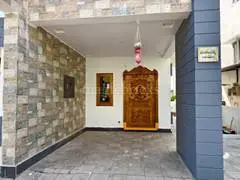
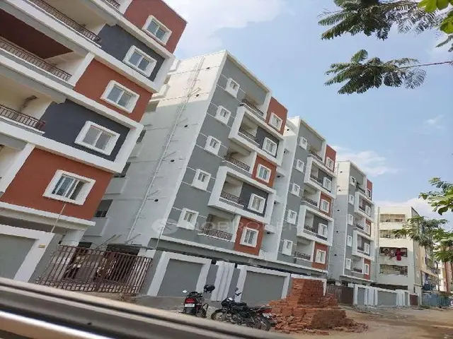
Deepthis Suvarna Sampada
SUVARNABHOOMI INFRA DEVELOPERSPRIVATE LIMITED · Medchal-Malkajgiri · RERA P02200001547
DEEPTHIS SUVARNA SAMPADA is a plotted development in GAGILAPUR, Dundigal Gandimaisamma mandal, Medchal-Malkajgiri district. It is being developed by the registered promoter SUVARNABHOOMI INFRA DEVELOPERSPRIVATE LIMITED. The RERA-filed land details state a total area of 42550.92 sqmts, and the layout drawing is read as showing plots numbered 1 to 145; the project offers plots, with plot sizes not supplied. The project is registered under TG-RERA registration P02200001547, and the promoter’s Form B declaration states a completion period of 09/08/2022.
01What we found
Read from TG-RERA filings, approvals, land and registration records and court records. A court case is counted only when the court record states this project's survey number with its village, or names the project.
02Check before you pay
10 items to check before you pay, 4 high - from the title chain, court records and approvals, each with what to ask the builder or your advocate. An item may not be a problem with the project: records can be incomplete.
1. Project at a glance
Project identity
| Field | Record |
|---|---|
| Registered project name | DEEPTHIS SUVARNA SAMPADA |
| Project type | Plotted development RERA record |
| Phase / registered portion | No separate phase name or phase boundary is disclosed in the supplied record; RERA registration is for the project covering the listed survey numbers |
| TG-RERA registration | P02200001547 |
| Registration validity | Commenced 27/12/2019; certificate states expiry 09/08/2022, unless extended by the Authority. The supplied certificate records no extension |
| Registered promoter | SUVARNABHOOMI INFRA DEVELOPERSPRIVATE LIMITED |
| RERA status | Registration certificate supplied; the stated registration period has elapsed. Current registration status is not established by the supplied evidence |
Land and geographic identity
| Field | Record |
|---|---|
| Locality / revenue village | GAGILAPUR; the approval document also spells the village Gagilapur RERA record |
| Mandal | Dundigal Gandimaisamma RERA record |
| District | Medchal-Malkajgiri RERA record |
| PIN | 501401 RERA record |
| Project survey numbers | 107, 108, 109, 110, 111, 113, 115, 117, 122 & 123 |
| Subdivisions | No project subdivision numbers are stated in the registration certificate; subdivision-level parcel identification is not established here |
| Registered site extent | The certificate’s supplied extraction does not state site extent. The RERA-filed land details state 42550.92 sqmts total area, 705.00 sqmts affected area and 41845.92 sqmts net area RERA filing |
| Boundaries (RERA-filed) | North: ROAD WIDTH 15 24; South: SY NO 236; East: SY NO 118 121 124 129 130 131; West: SY NO 104 105 106 112 114 135 RERA filing |
Development identity
| Field | Record |
|---|---|
| Sanctioning authority | Hyderabad Metropolitan Development Authority (HMDA) is named on the draft layout letter |
| Principal layout approval | HMDA draft layout letter 000243/LO/Plg/HMDA/2019, dated 09 August, 2019 |
| Municipal proceedings | Dundigal Walkajgiri District Municipality proceedings G / 591/TPO /Dun/MPL, dated 17-8-2019, concerning release of the HMDA-approved draft plotted layout |
| Approved built-up area | 24559.88 sqmts is shown in RERA-filed project information as approved built-up area; the supplied record does not establish a building scheme or explain how this figure applies to the plotted project RERA filing |
| Plot count / buildings | The layout drawing is read as showing plots numbered 1 to 145. No apartment towers or building count/configuration are established in the supplied evidence Layout record |
| Floor configuration / parking levels | Not disclosed for this plotted development Document index |
| RERA-declared units | The supplied registration record identifies the project as a plotted development, but does not include a plot inventory or booked/available counts |
Offering and status
| Field | Record |
|---|---|
| Unit type | Plots; plot sizes and a RERA-filed size range are not supplied RERA record |
| Booked / available | Not disclosed in the supplied RERA material Document index |
| Construction / development stage | Current physical progress is not established. The registration certificate and promoter declaration provide dates and commitments, not independently verified site progress |
| Completion date | The promoter’s Form B declaration states 09/08/2022 as the project completion period |
| Occupancy / completion certificate | No project occupancy or completion certificate is supplied. For a plotted layout, the supplied records instead refer to layout release and completion of layout development works; current completion status is not established |
2. The project story
Deepthis Suvarna Sampada is registered as a plotted development at Gagilapur in Dundigal Gandimaisamma mandal, Medchal-Malkajgiri district. Its RERA-listed land spans survey numbers 107, 108, 109, 110, 111, 113, 115, 117, 122 and 123. The approved-layout drawing is software-read as depicting plots numbered 1–145, but the supplied RERA material does not provide a plot-by-plot inventory or establish which plots are booked or available. RERA record Layout record Document index
The RERA-filed Form B declaration gives 09/08/2022 as the promoter’s completion undertaking. This is a declared timeline, not evidence that layout works were completed by that date. The records supplied include an HMDA draft layout letter and municipal proceedings dated 2019, but no current site-progress certification or completion/occupancy certificate.
3. Master plan, architecture & building design
The project is a plotted layout rather than a documented multi-storey building development. The software-read layout drawing records 145 numbered plots; plot dimensions and a complete plot-size schedule are not available in the supplied data. Layout record
The drawing’s area statement uses a net layout area of 41845.03 sqm as its base and records 12484.17 sqm for roads, 3750.62 sqm for parks/open space and 1050.25 sqm for social infrastructure. It records 0.00 sqm for amenity area. These are drawing-derived figures; the plot-count and area readings should be checked against the original approved drawing. Layout record
The RERA-filed land details state a total area of 42550.92 sqmts, an affected area of 705.00 sqmts and net area of 41845.92 sqmts. The draft layout letter also lists 42550.92 as total site area, 705.89 as master plan road-affected area, and 41845.03 as net site area. RERA filing Detailed source interpretation of these area figures is outside this overview.
The HMDA draft layout letter identifies roads and open space and records a mortgage over Plot Nos: 110, 111,112, & 129 TO 145, measuring 3891.44 Sq.Mt. It also refers to roads and open space being gifted to the local body. The municipal proceedings describe the layout as a draft plotted layout and require development works and open-space development.
No building arrangement, floor configuration, building footprint, residential/commercial building mix, or apartment floor plan is evidenced. The 24559.88 sqmts figure appears in RERA-filed information as “Approved Built up Area”; no supporting building design or explanation connecting it to the plotted layout is supplied. RERA filing Document index
4. Homes, configurations & floor plans
The offering evidenced by the registration is plots, not apartments. No RERA-filed plot-size range, booked/available inventory, or complete plot schedule is supplied. The software-read layout drawing identifies 145 plot numbers but reports 0 plots with a size captured in the available data. Layout record
| Configuration | Units | Booked | Available | RERA saleable area | Measured carpet area | Loading (if supplied) |
|---|---|---|---|---|---|---|
| Plots | 145 plot numbers read from drawing (1–145) | Not disclosed | Not disclosed | Not supplied | Not applicable | Not supplied |
The floor-plan record contains two drawing sheets and identifies both as layout sheets with no flats; it has no measured carpet areas. Carpet area is an apartment measurement and is not established for this plotted offering. Floor plans Plot areas and plot-wise dimensions require confirmation from the complete approved layout and project inventory. Layout record
5. Parking & vehicle circulation
The supplied records do not establish a parking-space count, visitor or accessible parking provision, parking allocation, or EV charging provision. A layout condition refers to roads being opened for neighbouring-site access, and the draft layout letter specifies road widths including 18 mts and 60 feet and above roads; it does not provide a full internal circulation or parking schedule. No spaces-per-plot ratio can be established from the evidence.
The municipal proceedings refer to a gift deed for identified roads and open spaces, but this does not establish exclusive parking rights for any plot.
6. Amenities, recreation & open spaces
The layout and filing list several infrastructure items, but the supplied evidence does not confirm their present completion. The listed progress percentages are 0 where provided; these are filing data and are not independent site verification. RERA amenities
| Facility | Description / size | Evidence source | Declared progress / verified status |
|---|---|---|---|
| Parks / open space | Drawing-derived area: 3750.62 sqm | Layout record | Listed as YES in the RERA amenity data; percentage shown as 0. Current completion not independently verified RERA amenities |
| Social infrastructure | Drawing-derived area: 1050.25 sqm | Layout record | RERA amenity data lists community buildings; percentage shown as 0. Current status not verified RERA amenities |
| Amenity area | Drawing area statement: 0.00 sqm | Layout record | No separate amenity-area allocation established Layout record |
| Internal roads and footpaths | Area not separately stated in the amenity list; layout road area: 12484.17 sqm | Layout record RERA amenities | Listed as YES; percentage shown as 0. Current completion not verified RERA amenities |
| Green strip / tot lot / park | No separate size supplied | RERA amenities | Listed as YES; percentage shown as 0. Current status not verified RERA amenities |
| Water conservation / rainwater harvesting | No capacity or count supplied | RERA amenities | Listed as YES; percentage shown as 0. Current status not verified RERA amenities |
| Cycling tracks | No length or area supplied | Listed in the draft layout letter; delivery status not established | |
| Community buildings | No size or capacity supplied | RERA amenities | Listed; percentage shown as 0. Current status not verified RERA amenities |
Vendor-listed facilities such as a gymnasium, swimming pool, clubhouse, library and children’s play area are not established in the supplied RERA filing or layout evidence as sanctioned or delivered facilities, and are therefore not presented as confirmed project provision. Promoter website
7. Utilities, building services & safety
The HMDA draft layout letter lists a common septic tank / STP, internal water-supply pipelines and an overhead tank, transformer, rainwater-harvesting pits, transformer yard and LED lighting as layout infrastructure. These are approval-document listings; the supplied evidence does not establish capacities or current installation/completion.
The RERA amenity data lists water supply, sewerage/septic tank/STP, storm-water drains, sewage and sullage treatment/disposal, solid-waste management, energy management, fire protection and electrical meter room/sub-station/receiving station. The supplied progress percentages are 0 where recorded, and there are no capacities, detailed designs or independent completion confirmations in the evidence. RERA amenities
No evidence is supplied for water source or storage capacity, treated-water reuse, electrical backup, lift services, fire-system specifications, CCTV/security systems or accessible circulation. No statutory compliance conclusion can be drawn from the listed infrastructure items alone.
8. Location, access & connectivity
The registered project location is Gagilapur, Dundigal Gandimaisamma mandal, Medchal-Malkajgiri district, PIN 501401. The RERA-filed layout boundaries identify a northern road boundary as ROAD WIDTH 15 24; the remaining filed boundaries are Sy No. 236 to the south, Sy Nos. 118, 121, 124, 129, 130 and 131 to the east, and Sy Nos. 104, 105, 106, 112, 114 and 135 to the west. RERA record RERA filing
The supplied connectivity data lists these measured distances: ADP 0.0 km; IndusInd Bank 0.4 km; Nanakramguda Govt primary school 0.5 km; Financial District (Nanakramguda) 1.2 km; an unnamed park 1.2 km; Manuu Polytechnic Hyderabad 1.6 km; Sankaraya Eye Hospital 1.6 km; an unnamed bus station 2.2 km; and South india shopping mall 2.6 km. These are location-record measurements, not stated travel times. Location record
9. Developer & development status
The registered legal promoter is SUVARNABHOOMI INFRA DEVELOPERSPRIVATE LIMITED, identified in the project record as a private limited company. The supplied corporate identifier is masked as xxxxxx750P; no company registration number, registered office address or official contact details are available in the evidence provided for this overview. Corporate record RERA filing
B SRIDHAR signed the Form B declaration as the promoter’s authorized signatory. That declaration states the promoter had a legal title basis, declared the land free from encumbrances, undertook to complete the project by 09/08/2022, and undertook to maintain the separate-account and audit arrangements stated in the declaration. These are promoter declarations, not independent verification of title, account operation, site progress or completion.
The registration certificate states that the project registration ran from 27/12/2019 to 09/08/2022, unless extended. It records no extension in the supplied certificate, and no later progress report, extension order, or completion/occupancy certificate is supplied.
10. Approvals, official records & documents
| Supplied evidence | Form C certificate P02200001547, issued 27/12/2019 |
|---|---|
| Scope / note | Project name, promoter, survey numbers and stated registration period |
| Supplied evidence | Draft layout letter 000243/LO/Plg/HMDA/2019, dated 09 August, 2019 |
|---|---|
| Scope / note | Draft open-plot layout proposal for the listed survey numbers; includes development conditions and mortgage details |
| Supplied evidence | G / 591/TPO /Dun/MPL, dated 17-8-2019 |
|---|---|
| Scope / note | Proceedings concerning release of the HMDA-approved draft plotted layout and completion of development works |
| Supplied evidence | Form B, verified at Hyderabad on 23/08/2019 |
|---|---|
| Scope / note | Promoter’s statements and undertaking, including declared completion date |
| Supplied evidence | Not supplied |
|---|---|
| Scope / note | No project completion or occupancy certificate is in the provided records |
| Supplied evidence | Not available from the supplied evidence HMDA |
|---|---|
| Scope / note | The HMDA approved-layout lookup is reported unavailable through the public portal; this is not evidence of refusal |
The approval-document names and conditions are listed here as recorded in the supplied documents; the current status of final layout release and development works is not established by the materials provided.
1. Project at a glance
Project identity
Registered project name: DEEPTHIS SUVARNA SAMPADA
Project type: Plotted development
Phase / registered portion: No separate phase name or phase boundary is disclosed in the supplied record; RERA registration is for the project covering the listed survey numbers
TG-RERA registration: P02200001547
Registration validity: Commenced 27/12/2019; certificate states expiry 09/08/2022, unless extended by the Authority. The supplied certificate records no extension
Registered promoter: SUVARNABHOOMI INFRA DEVELOPERSPRIVATE LIMITED
RERA status: Registration certificate supplied; the stated registration period has elapsed. Current registration status is not established by the supplied evidence
Land and geographic identity
Locality / revenue village: GAGILAPUR; the approval document also spells the village Gagilapur
Mandal: Dundigal Gandimaisamma
District: Medchal-Malkajgiri
PIN: 501401
Project survey numbers: 107, 108, 109, 110, 111, 113, 115, 117, 122 & 123
Subdivisions: No project subdivision numbers are stated in the registration certificate; subdivision-level parcel identification is not established here
Registered site extent: The certificate’s supplied extraction does not state site extent. The RERA-filed land details state 42550.92 sqmts total area, 705.00 sqmts affected area and 41845.92 sqmts net area
Boundaries (RERA-filed): North: ROAD WIDTH 15 24; South: SY NO 236; East: SY NO 118 121 124 129 130 131; West: SY NO 104 105 106 112 114 135
Development identity
Sanctioning authority: Hyderabad Metropolitan Development Authority (HMDA) is named on the draft layout letter
Principal layout approval: HMDA draft layout letter 000243/LO/Plg/HMDA/2019, dated 09 August, 2019
Municipal proceedings: Dundigal Walkajgiri District Municipality proceedings G / 591/TPO /Dun/MPL, dated 17-8-2019, concerning release of the HMDA-approved draft plotted layout
Approved built-up area: 24559.88 sqmts is shown in RERA-filed project information as approved built-up area; the supplied record does not establish a building scheme or explain how this figure applies to the plotted project
Plot count / buildings: The layout drawing is read as showing plots numbered 1 to 145. No apartment towers or building count/configuration are established in the supplied evidence
Floor configuration / parking levels: Not disclosed for this plotted development
RERA-declared units: The supplied registration record identifies the project as a plotted development, but does not include a plot inventory or booked/available counts
Offering and status
Unit type: Plots; plot sizes and a RERA-filed size range are not supplied
Booked / available: Not disclosed in the supplied RERA material
Construction / development stage: Current physical progress is not established. The registration certificate and promoter declaration provide dates and commitments, not independently verified site progress
Completion date: The promoter’s Form B declaration states 09/08/2022 as the project completion period
Occupancy / completion certificate: No project occupancy or completion certificate is supplied. For a plotted layout, the supplied records instead refer to layout release and completion of layout development works; current completion status is not established
2. The project story
Deepthis Suvarna Sampada is registered as a plotted development at Gagilapur in Dundigal Gandimaisamma mandal, Medchal-Malkajgiri district. Its RERA-listed land spans survey numbers 107, 108, 109, 110, 111, 113, 115, 117, 122 and 123. The approved-layout drawing is software-read as depicting plots numbered 1–145, but the supplied RERA material does not provide a plot-by-plot inventory or establish which plots are booked or available.
The RERA-filed Form B declaration gives 09/08/2022 as the promoter’s completion undertaking. This is a declared timeline, not evidence that layout works were completed by that date. The records supplied include an HMDA draft layout letter and municipal proceedings dated 2019, but no current site-progress certification or completion/occupancy certificate.
3. Master plan, architecture & building design
The project is a plotted layout rather than a documented multi-storey building development. The software-read layout drawing records 145 numbered plots; plot dimensions and a complete plot-size schedule are not available in the supplied data.
The drawing’s area statement uses a net layout area of 41845.03 sqm as its base and records 12484.17 sqm for roads, 3750.62 sqm for parks/open space and 1050.25 sqm for social infrastructure. It records 0.00 sqm for amenity area. These are drawing-derived figures; the plot-count and area readings should be checked against the original approved drawing.
The RERA-filed land details state a total area of 42550.92 sqmts, an affected area of 705.00 sqmts and net area of 41845.92 sqmts. The draft layout letter also lists 42550.92 as total site area, 705.89 as master plan road-affected area, and 41845.03 as net site area. Detailed source interpretation of these area figures is outside this overview.
The HMDA draft layout letter identifies roads and open space and records a mortgage over Plot Nos: 110, 111,112, & 129 TO 145, measuring 3891.44 Sq.Mt. It also refers to roads and open space being gifted to the local body. The municipal proceedings describe the layout as a draft plotted layout and require development works and open-space development.
No building arrangement, floor configuration, building footprint, residential/commercial building mix, or apartment floor plan is evidenced. The 24559.88 sqmts figure appears in RERA-filed information as “Approved Built up Area”; no supporting building design or explanation connecting it to the plotted layout is supplied.
4. Homes, configurations & floor plans
The offering evidenced by the registration is plots, not apartments. No RERA-filed plot-size range, booked/available inventory, or complete plot schedule is supplied. The software-read layout drawing identifies 145 plot numbers but reports 0 plots with a size captured in the available data.
| Configuration | Units | Booked | Available | RERA saleable area | Measured carpet area | Loading (if supplied) |
|---|---|---|---|---|---|---|
| Plots | 145 plot numbers read from drawing (1–145) | Not disclosed | Not disclosed | Not supplied | Not applicable | Not supplied |
The floor-plan record contains two drawing sheets and identifies both as layout sheets with no flats; it has no measured carpet areas. Carpet area is an apartment measurement and is not established for this plotted offering. Plot areas and plot-wise dimensions require confirmation from the complete approved layout and project inventory.
5. Parking & vehicle circulation
The supplied records do not establish a parking-space count, visitor or accessible parking provision, parking allocation, or EV charging provision. A layout condition refers to roads being opened for neighbouring-site access, and the draft layout letter specifies road widths including 18 mts and 60 feet and above roads; it does not provide a full internal circulation or parking schedule. No spaces-per-plot ratio can be established from the evidence.
The municipal proceedings refer to a gift deed for identified roads and open spaces, but this does not establish exclusive parking rights for any plot.
6. Amenities, recreation & open spaces
The layout and filing list several infrastructure items, but the supplied evidence does not confirm their present completion. The listed progress percentages are 0 where provided; these are filing data and are not independent site verification.
| Facility | Description / size | Evidence source | Declared progress / verified status |
|---|---|---|---|
| Parks / open space | Drawing-derived area: 3750.62 sqm | Listed as YES in the RERA amenity data; percentage shown as 0. Current completion not independently verified | |
| Social infrastructure | Drawing-derived area: 1050.25 sqm | RERA amenity data lists community buildings; percentage shown as 0. Current status not verified | |
| Amenity area | Drawing area statement: 0.00 sqm | No separate amenity-area allocation established | |
| Internal roads and footpaths | Area not separately stated in the amenity list; layout road area: 12484.17 sqm | Listed as YES; percentage shown as 0. Current completion not verified | |
| Green strip / tot lot / park | No separate size supplied | Listed as YES; percentage shown as 0. Current status not verified | |
| Water conservation / rainwater harvesting | No capacity or count supplied | Listed as YES; percentage shown as 0. Current status not verified | |
| Cycling tracks | No length or area supplied | Listed in the draft layout letter; delivery status not established | |
| Community buildings | No size or capacity supplied | Listed; percentage shown as 0. Current status not verified |
Vendor-listed facilities such as a gymnasium, swimming pool, clubhouse, library and children’s play area are not established in the supplied RERA filing or layout evidence as sanctioned or delivered facilities, and are therefore not presented as confirmed project provision.
7. Utilities, building services & safety
The HMDA draft layout letter lists a common septic tank / STP, internal water-supply pipelines and an overhead tank, transformer, rainwater-harvesting pits, transformer yard and LED lighting as layout infrastructure. These are approval-document listings; the supplied evidence does not establish capacities or current installation/completion.
The RERA amenity data lists water supply, sewerage/septic tank/STP, storm-water drains, sewage and sullage treatment/disposal, solid-waste management, energy management, fire protection and electrical meter room/sub-station/receiving station. The supplied progress percentages are 0 where recorded, and there are no capacities, detailed designs or independent completion confirmations in the evidence.
No evidence is supplied for water source or storage capacity, treated-water reuse, electrical backup, lift services, fire-system specifications, CCTV/security systems or accessible circulation. No statutory compliance conclusion can be drawn from the listed infrastructure items alone.
8. Location, access & connectivity
The registered project location is Gagilapur, Dundigal Gandimaisamma mandal, Medchal-Malkajgiri district, PIN 501401. The RERA-filed layout boundaries identify a northern road boundary as ROAD WIDTH 15 24; the remaining filed boundaries are Sy No. 236 to the south, Sy Nos. 118, 121, 124, 129, 130 and 131 to the east, and Sy Nos. 104, 105, 106, 112, 114 and 135 to the west.
The supplied connectivity data lists these measured distances: ADP 0.0 km; IndusInd Bank 0.4 km; Nanakramguda Govt primary school 0.5 km; Financial District (Nanakramguda) 1.2 km; an unnamed park 1.2 km; Manuu Polytechnic Hyderabad 1.6 km; Sankaraya Eye Hospital 1.6 km; an unnamed bus station 2.2 km; and South india shopping mall 2.6 km. These are location-record measurements, not stated travel times.
9. Developer & development status
The registered legal promoter is SUVARNABHOOMI INFRA DEVELOPERSPRIVATE LIMITED, identified in the project record as a private limited company. The supplied corporate identifier is masked as xxxxxx750P; no company registration number, registered office address or official contact details are available in the evidence provided for this overview.
B SRIDHAR signed the Form B declaration as the promoter’s authorized signatory. That declaration states the promoter had a legal title basis, declared the land free from encumbrances, undertook to complete the project by 09/08/2022, and undertook to maintain the separate-account and audit arrangements stated in the declaration. These are promoter declarations, not independent verification of title, account operation, site progress or completion.
The registration certificate states that the project registration ran from 27/12/2019 to 09/08/2022, unless extended. It records no extension in the supplied certificate, and no later progress report, extension order, or completion/occupancy certificate is supplied.
10. Approvals, official records & documents
| Supplied evidence | Form C certificate P02200001547, issued 27/12/2019 |
|---|---|
| Scope / note | Project name, promoter, survey numbers and stated registration period |
| Supplied evidence | Draft layout letter 000243/LO/Plg/HMDA/2019, dated 09 August, 2019 |
|---|---|
| Scope / note | Draft open-plot layout proposal for the listed survey numbers; includes development conditions and mortgage details |
| Supplied evidence | G / 591/TPO /Dun/MPL, dated 17-8-2019 |
|---|---|
| Scope / note | Proceedings concerning release of the HMDA-approved draft plotted layout and completion of development works |
| Supplied evidence | Form B, verified at Hyderabad on 23/08/2019 |
|---|---|
| Scope / note | Promoter’s statements and undertaking, including declared completion date |
| Supplied evidence | Not supplied |
|---|---|
| Scope / note | No project completion or occupancy certificate is in the provided records |
| Supplied evidence | Not available from the supplied evidence |
|---|---|
| Scope / note | The HMDA approved-layout lookup is reported unavailable through the public portal; this is not evidence of refusal |
The approval-document names and conditions are listed here as recorded in the supplied documents; the current status of final layout release and development works is not established by the materials provided.
Frequently asked questions
Is DEEPTHIS SUVARNA SAMPADA registered with Telangana RERA?
Yes. DEEPTHIS SUVARNA SAMPADA is registered with the Telangana Real Estate Regulatory Authority as P02200001547; the registration status is New Project.
Who is the developer of DEEPTHIS SUVARNA SAMPADA?
The promoter named in the RERA registration is SUVARNABHOOMI INFRA DEVELOPERSPRIVATE LIMITED.
Where is DEEPTHIS SUVARNA SAMPADA located?
DEEPTHIS SUVARNA SAMPADA is in GAGILAPUR, Dundigal Gandimaisamma, Medchal-Malkajgiri, Telangana (501401).
When will DEEPTHIS SUVARNA SAMPADA be completed?
The promoter's proposed date of completion filed with RERA is 09/08/2022. This is the promoter's declaration, not a guarantee.
More projects in Gagilapur