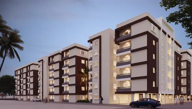
Kesineni Northscape
KESINENI INFRA DEVELOPERS LLP & OTHERS · Medchal-Malkajgiri · RERA P02200010116
KESINENI NORTHSCAPE is a plotted development in Dundigal, Dundigal Gandimaisamma mandal, Medchal-Malkajgiri district. The registered promoter is KESINENI INFRA DEVELOPERS LLP & OTHERS. The project has a registered total site extent of 363372.53 sq.mt and HMDA’s draft layout letter states 996 plots; no building count or floor configuration is disclosed. The drawing-derived plot size range is 135.94–1843.02 sq.m (162.6–2204.2 sq.yd). Its TG-RERA registration is P02200010116, and the project fields state a proposed completion date of 17/10/2030.
01What we found
Read from TG-RERA filings, approvals, land and registration records and court records. A court case is counted only when the court record states this project's survey number with its village, or names the project.
02Check before you pay
8 items to check before you pay, 4 high - from the title chain, court records and approvals, each with what to ask the builder or your advocate. An item may not be a problem with the project: records can be incomplete.
1. Project at a glance
Project identity
| Field | Record |
|---|---|
| Registered project name | KESINENI NORTHSCAPE RERA record |
| Project type | Plotted development / open plotted layout RERA record |
| Phase or registered portion | No separate phase is identified in the supplied records; registration is for the project as described in the certificate. RERA record |
| TG-RERA registration | P02200010116 RERA record |
| Registration validity | 18 June 2025 to 17 June 2030. This is the registration period, not a statement that the project is complete. RERA record |
| Registered promoter | KESINENI INFRA DEVELOPERS LLP & OTHERS RERA record |
| RERA status | New project; the supplied record shows a TG-RERA registration certificate. RERA record |
Land and geographic identity
| Field | Record |
|---|---|
| Locality | Dundigal RERA record |
| Revenue village | Dundigal-Tanda in the TG-RERA project identity; the HMDA layout document identifies Dundigal. RERA record |
| Mandal | Dundigal Gandimaisamma RERA record |
| District | Medchal-Malkajgiri RERA record |
| PIN | 500043 RERA record |
| Project survey numbers and subdivisions | 271Part, 272, 273part, 336, 337Part, 338, 339, 340, 341, 343, 344, 346 RERA record |
| Registered total site extent | 363372.53 sq.mt RERA filing |
| Road-affected / widening area | 25917.9 sq.m in the RERA project fields; HMDA’s layout document states 25917.9 Sq.Mtrs. RERA filing |
| Net area | 337454.63 sq.m in the RERA project fields and layout drawing area statement. The HMDA draft letter separately states a Net Site Area of 337047.9 Sq.Mtrs. RERA filing Layout record |
| Boundaries | Not supplied in the reviewed project fields or extracts. RERA filing |
Development identity
| Field | Record |
|---|---|
| Sanctioning authority | Hyderabad Metropolitan Development Authority (HMDA) Approvals record |
| Principal layout approval | 010284/LO/HMDA/2676/MED/2024, dated 18 June 2025; the extracted instrument is titled “DRAFT LAYOUT LETTER.” Approvals record |
| Approved built-up area | The layout-plan extract records proposed built-up area, excluding and including parking, as 0.00; no building or apartment construction is described in that plan. |
| Plots | HMDA’s draft layout letter states 996 plots. |
| Building count / floors | No building count or floor configuration is disclosed for this plotted layout. |
| Parking | No approved parking-space count or parking levels are stated in the supplied layout extracts. |
Offering and status
| Field | Record |
|---|---|
| Offering | Plots; the approved-layout extract states 996 plots. |
| Plot size range | The layout drawing’s software-read schedule gives 135.94–1843.02 sq.m ( 162.6–2204.2 sq.yd); these are drawing-derived measurements, not RERA-filed unit areas. Layout record |
| Booked / available counts | Not disclosed in the supplied evidence. RERA record |
| Construction stage | No independently verified site-progress information is supplied. TG-RERA amenity/infrastructure data records internal roads and footpaths at 60%; the other listed progress percentages are 0%. RERA amenities |
| Completion date | TG-RERA project fields state 17/10/2030; the Form-B declaration states completion by “17day of June, 2030.” RERA filing |
| Occupancy / completion certificate | The project is a plotted layout; the supplied HMDA extract states that completion is not certified. No occupancy or completion certificate is supplied. |
2. The project story
KESINENI NORTHSCAPE is registered as a plotted development at Dundigal, in the Dundigal Gandimaisamma mandal of Medchal-Malkajgiri district. The registered survey schedule is 271Part, 272, 273part, 336, 337Part, 338, 339, 340, 341, 343, 344 and 346. RERA record
HMDA’s draft layout letter describes an open plotted layout with 996 plots, internal roads, parks/open space, social-infrastructure land, amenities and utilities. The approved layout extract includes proposed roads of 9.14 m, 12 m, 18 m and 45 m widths, as well as a 12.00 MT wide existing road. The evidence identifies the land and plot offering, but does not provide a building or floor programme.
The HMDA extract says layout development works are to be completed within five years and that roads, open spaces, social-infrastructure and utilities land are to be handed over by registered gift deed before release of final layout plans. The extract also states that completion is not certified. The only stated progress figure in the supplied RERA infrastructure data is 60% for internal roads and footpaths; the other listed items are recorded at 0%. These are filed progress figures, not independent site verification. RERA amenities
3. Master plan, architecture & building design
The supplied HMDA layout material concerns a plotted scheme, not an apartment or villa building plan. It records 363372.53 sq.mt as total site area and 25917.9 sq.m as road-affected/widening area. The RERA project fields and layout drawing area statement give a net area of 337454.63 sq.m; the HMDA draft layout letter separately describes 337047.9 Sq.Mtrs as net site area. RERA filing Layout record
The HMDA draft letter’s land-use figures are:
| Layout component | Area |
|---|---|
| Plotted area | 205583.92 sq.m |
| Open space | 31155.67 sq.m |
| Layout road area | 80833.35 sq.m |
| Amenities area | 5153.64 sq.m |
| Utilities area | 4312.27 sq.m |
| Social infrastructure | 8467.05 sq.m |
| Master-plan road-affected area | 25917.9 sq.m |
The layout drawing identifies a tot-lot, sump, transformer, STP, cycle track, gas pipeline, amenity area, social-infrastructure area and utility land. The approval extract also refers to parks and a common septic tank/STP and overhead tank. These are plan or approval-file references; the supplied material does not establish that these facilities are complete.
The drawing-derived plot schedule contains 996 plots, with sizes from 135.94 sq.m to 1843.02 sq.m. The software-read size bands are: 450 plots in 150–200 sq.yd, 333 in 200–250 sq.yd, 29 in 250–300 sq.yd, 133 in 300–400 sq.yd, 19 in 400–500 sq.yd, 14 in 500–1000 sq.yd, and 18 in 1000+ sq.yd. These are software-measured from the layout drawing and should be checked against the drawing schedule. Layout record
4. Homes, configurations & floor plans
This project is presented in the supplied TG-RERA and HMDA records as a plotted development. No RERA-filed apartment configurations or saleable-area schedule is supplied. The layout drawing provides a software-read plot schedule, not RERA-filed unit areas. RERA record Layout record
| Plot size band | Number of plots | Measurement basis |
|---|---|---|
| 150–200 sq.yd (125–167 sq.m) | 450 | Software-measured from layout drawing |
| 200–250 sq.yd (167–209 sq.m) | 333 | Software-measured from layout drawing |
| 250–300 sq.yd (209–251 sq.m) | 29 | Software-measured from layout drawing |
| 300–400 sq.yd (251–334 sq.m) | 133 | Software-measured from layout drawing |
| 400–500 sq.yd (334–418 sq.m) | 19 | Software-measured from layout drawing |
| 500–1000 sq.yd (418–836 sq.m) | 14 | Software-measured from layout drawing |
| 1000+ sq.yd (836+ sq.m) | 18 | Software-measured from layout drawing |
Layout record
The software-read schedule reports a smallest plot of 135.94 sq.m (162.6 sq.yd), median of 167.34 sq.m (200.1 sq.yd) and largest of 1843.02 sq.m (2204.2 sq.yd). The drawing-derived areas are not RERA-filed saleable areas. No carpet-area or loading figures apply in the supplied plotted-layout evidence. Layout record
5. Parking & vehicle circulation
The supplied layout extracts do not state a parking-space count, visitor or accessible parking provision, or parking-allotment arrangements. They identify proposed and existing roads, but do not establish separate pedestrian routes or parking facilities.
The draft layout letter identifies 149 plots measuring 30872.14 Sq. Mtrs as mortgaged to HMDA, and says plots or area mortgaged in favour of HMDA are not permitted to be sold while so mortgaged. This is an approval-file restriction on identified plots, not evidence of individual buyer parking allocation.
6. Amenities, recreation & open spaces
| Facility | Description / size | Evidence source | Declared progress / verified status |
|---|---|---|---|
| Internal roads and footpaths | Layout road area 80833.35 sq.m; drawing lists road widths of 9.14 m, 12 m, 18 m and 45 m, and a 12.00 MT wide existing road. | RERA infrastructure data records 60%; not independently verified. RERA amenities | |
| Parks / open space | 31155.67 sq.m in the HMDA draft layout letter. | RERA infrastructure data records 0% for Green Strip/TOT LOT/Park and recreational open space. RERA amenities | |
| Tot-lot | Listed in the layout-plan amenities/utilities. | No completed status supplied. | |
| Cycle track | Listed in the layout-plan amenities/utilities. | No completed status supplied. | |
| Amenity land | 5153.64 sq.m. | No completed status supplied. | |
| Social-infrastructure land | 8467.05 sq.m. | No completed status supplied. | |
| Utility land | 4312.27 sq.m. | No completed status supplied. |
The HMDA draft letter requires roads, open spaces, social infrastructure and utilities to be handed over by registered gift deed before release of final layout plans.
7. Utilities, building services & safety
The layout drawing identifies a sump, transformer, STP, gas pipeline and utility land. The HMDA draft letter refers to a common septic tank/STP, overhead tank, transformer and park. These records identify planned or approval-file facilities; they do not provide capacities or establish completion.
The RERA infrastructure data lists water supply, sewerage, storm-water drains, sewage/sullage treatment, solid-waste management, rainwater harvesting, energy management, fire-protection requirements and an electrical meter room/sub-station/receiving station. Each is recorded at 0% in that data, including items marked “YES” as available; the supplied evidence does not clarify the meaning of those availability labels or independently verify installation. RERA amenities
No utility capacities, backup-power arrangement, security system, accessibility features or fire-system specifications are disclosed in the supplied project records.
8. Location, access & connectivity
The registered project location is Dundigal-Tanda, Dundigal Gandimaisamma, Medchal-Malkajgiri, Telangana 500043. RERA record The HMDA layout extract identifies the site village as Dundigal.
The layout drawing lists a 12.00 MT wide existing road and proposed roads of 9.14 m, 12 m, 18 m and 45 m. The supplied location record identifies the nearest sampled Outer Ring Road interchange at 7.3 km (approx). Location record No public-transport details or independently measured distances to other landmarks are supplied. The promoter’s website location phrase and travel-time claims are not used as verified connectivity facts.
9. Developer & development status
The registered promoter is KESINENI INFRA DEVELOPERS LLP & OTHERS, an LLP, with GSTIN 36AATFK2208BIZK. The supplied promoter address is SOUCHA MARVEL, Survey No. I, Khajaguda, Dundigal, Dundigal Gandimaisamma, Medchal-Malkajgiri, 500043. RERA record Corporate record Parties record
The TG-RERA certificate records registration P02200010116, valid from 18 June 2025 to 17 June 2030. The project fields state a proposed completion date of 17/10/2030; the Form-B affidavit separately undertakes completion by “17day of June, 2030.” RERA record RERA filing These are distinct registration and completion records; the supplied material does not provide independently verified construction progress or a completion certificate.
The TG-RERA infrastructure data records internal roads and footpaths at 60%, with the other listed infrastructure items at 0%. No independent site verification is supplied. RERA amenities
10. Approvals, official records & documents
| Record | Supplied evidence |
|---|---|
| TG-RERA registration | Form C certificate for KESINENI NORTHSCAPE, registration P02200010116; validity 18/06/2025–17/06/2030. |
| Principal layout approval | HMDA layout approval number 010284/LO/HMDA/2676/MED/2024, dated 18 June 2025; extracted document is titled “DRAFT LAYOUT LETTER.” |
| Layout drawing | Layout-plan document filed with TG-RERA; drawing-derived plot count and layout schedule are described above. |
| Mortgage documents | HMDA draft letter identifies mortgage documents 11533/2025, 11534/2025 and 11535/2025, dated 28 May 2025, covering 149 plots. |
| Promoter declaration | Form-B affidavit dated 09-09-2025, signed by authorized signatory Vanukuru Pratap, includes the promoter’s completion undertaking and project-account declarations. |
| Occupancy / completion certificate | No occupancy certificate is supplied; the HMDA extract states that completion is not certified. |
The supplied approval extracts describe layout conditions, including the requirement to complete development works within five years and to hand over specified roads, open spaces, social-infrastructure and utilities land before final layout release.
1. Project at a glance
Project identity
Registered project name: KESINENI NORTHSCAPE
Project type: Plotted development / open plotted layout
Phase or registered portion: No separate phase is identified in the supplied records; registration is for the project as described in the certificate.
TG-RERA registration: P02200010116
Registration validity: 18 June 2025 to 17 June 2030. This is the registration period, not a statement that the project is complete.
Registered promoter: KESINENI INFRA DEVELOPERS LLP & OTHERS
RERA status: New project; the supplied record shows a TG-RERA registration certificate.
Land and geographic identity
Locality: Dundigal
Revenue village: Dundigal-Tanda in the TG-RERA project identity; the HMDA layout document identifies Dundigal.
Mandal: Dundigal Gandimaisamma
District: Medchal-Malkajgiri
PIN: 500043
Project survey numbers and subdivisions: 271Part, 272, 273part, 336, 337Part, 338, 339, 340, 341, 343, 344, 346
Registered total site extent: 363372.53 sq.mt
Road-affected / widening area: 25917.9 sq.m in the RERA project fields; HMDA’s layout document states 25917.9 Sq.Mtrs.
Net area: 337454.63 sq.m in the RERA project fields and layout drawing area statement. The HMDA draft letter separately states a Net Site Area of 337047.9 Sq.Mtrs.
Boundaries: Not supplied in the reviewed project fields or extracts.
Development identity
Sanctioning authority: Hyderabad Metropolitan Development Authority (HMDA)
Principal layout approval: 010284/LO/HMDA/2676/MED/2024, dated 18 June 2025; the extracted instrument is titled “DRAFT LAYOUT LETTER.”
Approved built-up area: The layout-plan extract records proposed built-up area, excluding and including parking, as 0.00; no building or apartment construction is described in that plan.
Plots: HMDA’s draft layout letter states 996 plots.
Building count / floors: No building count or floor configuration is disclosed for this plotted layout.
Parking: No approved parking-space count or parking levels are stated in the supplied layout extracts.
Offering and status
Offering: Plots; the approved-layout extract states 996 plots.
Plot size range: The layout drawing’s software-read schedule gives 135.94–1843.02 sq.m ( 162.6–2204.2 sq.yd); these are drawing-derived measurements, not RERA-filed unit areas.
Booked / available counts: Not disclosed in the supplied evidence.
Construction stage: No independently verified site-progress information is supplied. TG-RERA amenity/infrastructure data records internal roads and footpaths at 60%; the other listed progress percentages are 0%.
Completion date: TG-RERA project fields state 17/10/2030; the Form-B declaration states completion by “17day of June, 2030.”
Occupancy / completion certificate: The project is a plotted layout; the supplied HMDA extract states that completion is not certified. No occupancy or completion certificate is supplied.
2. The project story
KESINENI NORTHSCAPE is registered as a plotted development at Dundigal, in the Dundigal Gandimaisamma mandal of Medchal-Malkajgiri district. The registered survey schedule is 271Part, 272, 273part, 336, 337Part, 338, 339, 340, 341, 343, 344 and 346.
HMDA’s draft layout letter describes an open plotted layout with 996 plots, internal roads, parks/open space, social-infrastructure land, amenities and utilities. The approved layout extract includes proposed roads of 9.14 m, 12 m, 18 m and 45 m widths, as well as a 12.00 MT wide existing road. The evidence identifies the land and plot offering, but does not provide a building or floor programme.
The HMDA extract says layout development works are to be completed within five years and that roads, open spaces, social-infrastructure and utilities land are to be handed over by registered gift deed before release of final layout plans. The extract also states that completion is not certified. The only stated progress figure in the supplied RERA infrastructure data is 60% for internal roads and footpaths; the other listed items are recorded at 0%. These are filed progress figures, not independent site verification.
3. Master plan, architecture & building design
The supplied HMDA layout material concerns a plotted scheme, not an apartment or villa building plan. It records 363372.53 sq.mt as total site area and 25917.9 sq.m as road-affected/widening area. The RERA project fields and layout drawing area statement give a net area of 337454.63 sq.m; the HMDA draft layout letter separately describes 337047.9 Sq.Mtrs as net site area.
The HMDA draft letter’s land-use figures are:
Plotted area: 205583.92 sq.m
Open space: 31155.67 sq.m
Layout road area: 80833.35 sq.m
Amenities area: 5153.64 sq.m
Utilities area: 4312.27 sq.m
Social infrastructure: 8467.05 sq.m
Master-plan road-affected area: 25917.9 sq.m
The layout drawing identifies a tot-lot, sump, transformer, STP, cycle track, gas pipeline, amenity area, social-infrastructure area and utility land. The approval extract also refers to parks and a common septic tank/STP and overhead tank. These are plan or approval-file references; the supplied material does not establish that these facilities are complete.
The drawing-derived plot schedule contains 996 plots, with sizes from 135.94 sq.m to 1843.02 sq.m. The software-read size bands are: 450 plots in 150–200 sq.yd, 333 in 200–250 sq.yd, 29 in 250–300 sq.yd, 133 in 300–400 sq.yd, 19 in 400–500 sq.yd, 14 in 500–1000 sq.yd, and 18 in 1000+ sq.yd. These are software-measured from the layout drawing and should be checked against the drawing schedule.
4. Homes, configurations & floor plans
This project is presented in the supplied TG-RERA and HMDA records as a plotted development. No RERA-filed apartment configurations or saleable-area schedule is supplied. The layout drawing provides a software-read plot schedule, not RERA-filed unit areas.
| Plot size band | Number of plots | Measurement basis |
|---|---|---|
| 150–200 sq.yd (125–167 sq.m) | 450 | Software-measured from layout drawing |
| 200–250 sq.yd (167–209 sq.m) | 333 | Software-measured from layout drawing |
| 250–300 sq.yd (209–251 sq.m) | 29 | Software-measured from layout drawing |
| 300–400 sq.yd (251–334 sq.m) | 133 | Software-measured from layout drawing |
| 400–500 sq.yd (334–418 sq.m) | 19 | Software-measured from layout drawing |
| 500–1000 sq.yd (418–836 sq.m) | 14 | Software-measured from layout drawing |
| 1000+ sq.yd (836+ sq.m) | 18 | Software-measured from layout drawing |
The software-read schedule reports a smallest plot of 135.94 sq.m (162.6 sq.yd), median of 167.34 sq.m (200.1 sq.yd) and largest of 1843.02 sq.m (2204.2 sq.yd). The drawing-derived areas are not RERA-filed saleable areas. No carpet-area or loading figures apply in the supplied plotted-layout evidence.
5. Parking & vehicle circulation
The supplied layout extracts do not state a parking-space count, visitor or accessible parking provision, or parking-allotment arrangements. They identify proposed and existing roads, but do not establish separate pedestrian routes or parking facilities.
The draft layout letter identifies 149 plots measuring 30872.14 Sq. Mtrs as mortgaged to HMDA, and says plots or area mortgaged in favour of HMDA are not permitted to be sold while so mortgaged. This is an approval-file restriction on identified plots, not evidence of individual buyer parking allocation.
6. Amenities, recreation & open spaces
| Facility | Description / size | Evidence source | Declared progress / verified status |
|---|---|---|---|
| Internal roads and footpaths | Layout road area 80833.35 sq.m; drawing lists road widths of 9.14 m, 12 m, 18 m and 45 m, and a 12.00 MT wide existing road. | RERA infrastructure data records 60%; not independently verified. | |
| Parks / open space | 31155.67 sq.m in the HMDA draft layout letter. | RERA infrastructure data records 0% for Green Strip/TOT LOT/Park and recreational open space. | |
| Tot-lot | Listed in the layout-plan amenities/utilities. | No completed status supplied. | |
| Cycle track | Listed in the layout-plan amenities/utilities. | No completed status supplied. | |
| Amenity land | 5153.64 sq.m. | No completed status supplied. | |
| Social-infrastructure land | 8467.05 sq.m. | No completed status supplied. | |
| Utility land | 4312.27 sq.m. | No completed status supplied. |
The HMDA draft letter requires roads, open spaces, social infrastructure and utilities to be handed over by registered gift deed before release of final layout plans.
7. Utilities, building services & safety
The layout drawing identifies a sump, transformer, STP, gas pipeline and utility land. The HMDA draft letter refers to a common septic tank/STP, overhead tank, transformer and park. These records identify planned or approval-file facilities; they do not provide capacities or establish completion.
The RERA infrastructure data lists water supply, sewerage, storm-water drains, sewage/sullage treatment, solid-waste management, rainwater harvesting, energy management, fire-protection requirements and an electrical meter room/sub-station/receiving station. Each is recorded at 0% in that data, including items marked “YES” as available; the supplied evidence does not clarify the meaning of those availability labels or independently verify installation.
No utility capacities, backup-power arrangement, security system, accessibility features or fire-system specifications are disclosed in the supplied project records.
8. Location, access & connectivity
The registered project location is Dundigal-Tanda, Dundigal Gandimaisamma, Medchal-Malkajgiri, Telangana 500043. The HMDA layout extract identifies the site village as Dundigal.
The layout drawing lists a 12.00 MT wide existing road and proposed roads of 9.14 m, 12 m, 18 m and 45 m. The supplied location record identifies the nearest sampled Outer Ring Road interchange at 7.3 km (approx). No public-transport details or independently measured distances to other landmarks are supplied. The promoter’s website location phrase and travel-time claims are not used as verified connectivity facts.
9. Developer & development status
The registered promoter is KESINENI INFRA DEVELOPERS LLP & OTHERS, an LLP, with GSTIN 36AATFK2208BIZK. The supplied promoter address is SOUCHA MARVEL, Survey No. I, Khajaguda, Dundigal, Dundigal Gandimaisamma, Medchal-Malkajgiri, 500043.
The TG-RERA certificate records registration P02200010116, valid from 18 June 2025 to 17 June 2030. The project fields state a proposed completion date of 17/10/2030; the Form-B affidavit separately undertakes completion by “17day of June, 2030.” These are distinct registration and completion records; the supplied material does not provide independently verified construction progress or a completion certificate.
The TG-RERA infrastructure data records internal roads and footpaths at 60%, with the other listed infrastructure items at 0%. No independent site verification is supplied.
10. Approvals, official records & documents
TG-RERA registration: Form C certificate for KESINENI NORTHSCAPE, registration P02200010116; validity 18/06/2025–17/06/2030.
Principal layout approval: HMDA layout approval number 010284/LO/HMDA/2676/MED/2024, dated 18 June 2025; extracted document is titled “DRAFT LAYOUT LETTER.”
Layout drawing: Layout-plan document filed with TG-RERA; drawing-derived plot count and layout schedule are described above.
Mortgage documents: HMDA draft letter identifies mortgage documents 11533/2025, 11534/2025 and 11535/2025, dated 28 May 2025, covering 149 plots.
Promoter declaration: Form-B affidavit dated 09-09-2025, signed by authorized signatory Vanukuru Pratap, includes the promoter’s completion undertaking and project-account declarations.
Occupancy / completion certificate: No occupancy certificate is supplied; the HMDA extract states that completion is not certified.
The supplied approval extracts describe layout conditions, including the requirement to complete development works within five years and to hand over specified roads, open spaces, social-infrastructure and utilities land before final layout release.
Frequently asked questions
Is KESINENI NORTHSCAPE registered with Telangana RERA?
Yes. KESINENI NORTHSCAPE is registered with the Telangana Real Estate Regulatory Authority as P02200010116; the registration status is New Project.
Who is the developer of KESINENI NORTHSCAPE?
The promoter named in the RERA registration is KESINENI INFRA DEVELOPERS LLP & OTHERS.
Where is KESINENI NORTHSCAPE located?
KESINENI NORTHSCAPE is in Dundigal, Dundigal-Tanda, Dundigal Gandimaisamma, Medchal-Malkajgiri, Telangana (500043).
When will KESINENI NORTHSCAPE be completed?
The promoter's proposed date of completion filed with RERA is 17/10/2030. This is the promoter's declaration, not a guarantee.
More projects in Dundigal Tanda