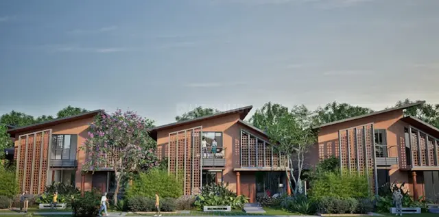
Aparna Vasudha Phase-II
Aparna Farms and Estates LLP · Rangareddy · RERA P02400007150
APARNA VASUDHA PHASE-II is a plotted development in Kesaram, Chevella Mandal, Ranga Reddy District, with land recorded in Kesaram and Kandawada villages. The registered promoter is Aparna Farms and Estates LLP. The registered site extent is 135648.98 sq.m, and HMDA’s final layout permission records 321 residential plots; buildings, towers, floors and plot configurations are not stated in the RERA record. The TG-RERA registration is P02400007150, and the promoter’s Form B undertaking states completion by 31/08/2026.
More from Aparna Farms and Estates LLP · 4 projects →
01What we found
Read from TG-RERA filings, approvals, land and registration records and court records. A court case is counted only when the court record states this project's survey number with its village, or names the project.
02Check before you pay
10 items to check before you pay, 3 high - from the title chain, court records and approvals, each with what to ask the builder or your advocate. An item may not be a problem with the project: records can be incomplete.
1. Project at a glance
Project identity
| Field | Record |
|---|---|
| Registered project name | APARNA VASUDHA PHASE-II RERA record |
| Project type / phase | Plotted development; Phase-II is the registered project portion RERA record |
| TG-RERA registration | P02400007150 |
| Registration validity | 21/10/2023 to 31/08/2026; the certificate says it may be extended by the Authority under the Act and Rules |
| Registered promoter | Aparna Farms and Estates LLP RERA record Corporate record |
| RERA status in supplied record | “New Project”; registration certificate issued RERA record |
Land and geographic identity
| Field | Record |
|---|---|
| Locality / PIN | Kesaram / 501503 RERA record |
| Revenue villages | Kesaram and Kandawada; the draft layout also refers to “Kesavaram (Chevella) Village” RERA record |
| Mandal / district | Chevella / Ranga Reddy RERA record |
| All registered survey numbers and subdivisions | Sy No 100, 114, 114/E, 115, 115/A, 115/AA, 115/E, 116, 116/1, 116/2-116/8, 117 of Kesaram Village; 696, 697, 698 of Kandawada Village |
| Registered total site extent | 135648.98 sq.m RERA filing |
| Registered net area | 132583.51 sq.m RERA filing |
| Registered affected area | 3065.47 sq.m; the field describes this as affected in road widening/FTL of tanks/nala widening RERA filing |
| Registered boundaries | North: Sy No114P 115P 120P 116P; South: Sy No 672P 688P 696P; East: Sy No 100P and 698P; West: Sy No 117P and 118P RERA filing |
Development identity
| Field | Record |
|---|---|
| Sanctioning authority | Hyderabad Metropolitan Development Authority (HMDA) Approvals record |
| Draft layout approval | Layout Permit 000173/LO/Plg/HMDA/2023, dated 01 September 2023 |
| Final layout permit | 012834/FLT/HMDA/3455/SKP/2024, dated 04 April 2025 |
| Approved plot count | 321 plots under the final layout permission |
| Approved built-up area / building count / floor configuration | Not stated as applicable for this open-plot layout; final layout record shows total built-up area as 0 |
| Layout land-use figures in final permission | Total site area 135589.2 sq.m; net site area 132218.08 sq.m; plotted area 75427.16 sq.m; open space (park) 9945.51 sq.m; social infrastructure 3344.33 sq.m; layout roads 43439.69 sq.m; utilities 358.38 sq.m; amenities area 0 |
Offering and status
| Field | Record |
|---|---|
| Offering | Open plots; RERA-filed plot-size bands, booked/available counts and plot-wise saleable areas are not supplied in this evidence set RERA record RERA unit table |
| Promoter-marketed configuration | Vendor material describes open plots of 200 Sq. Yds., with East & West orientations available; this is a marketing claim, not a RERA-filed plot schedule Promoter website |
| Construction stage | The RERA header records 70% completeness; this is a filed progress figure, not independent site verification RERA record |
| Completion date | Promoter’s Form B undertaking states completion by 31/08/2026 |
| Registration validity vs completion date | The registration certificate is valid through 31/08/2026; the promoter’s completion undertaking is also 31/08/2026 |
| Occupancy/completion certificate status | No project occupancy or completion certificate is supplied. The project is a plotted layout; the final layout permission is documented separately Document index |
2. The project story
APARNA VASUDHA PHASE-II is registered as an open-plot development by Aparna Farms and Estates LLP. Its registered land identity covers survey numbers in Kesaram and Kandawada villages, Chevella Mandal, Ranga Reddy District. The RERA-filed land particulars give a total extent of 135648.98 sq.m, with a net area of 132583.51 sq.m. RERA record RERA filing
HMDA’s final layout permission records 321 residential plots and allocates land to plots, roads, open space, social infrastructure and utilities. It states that roads, open spaces, social infrastructure and utilities were taken over by the local authority through registered gift deeds, and that a relinquishment deed concerning mortgaged plots was executed.
The RERA record reports 70% completeness, while the promoter’s Form B sets 31/08/2026 as the completion undertaking. The supplied materials do not independently verify on-site progress or provide a plot-by-plot inventory. No occupancy or completion certificate is included in the materials reviewed. RERA record Document index
3. Master plan, architecture & building design
This is a plotted layout rather than a multi-storey building project. The final HMDA permission records 321 plots and a total built-up area of 0; apartment configuration, building footprints, tower or block count, floor levels and building circulation are therefore not specified in the supplied layout record.
The final layout’s stated land-use allocation is: plotted area 75427.16 sq.m, park/open space 9945.51 sq.m, social infrastructure 3344.33 sq.m, layout roads 43439.69 sq.m, and utilities 358.38 sq.m. The same permission states that amenities area is 0.
The earlier HMDA draft-layout document lists a different land-use schedule, including a net site area of 132583.51 sq.m, layout roads 43452.07 sq.m, open space 10313.16 sq.m, and social infrastructure 3344.52 sq.m. These are figures from that draft document; this Overview does not reconcile approval-stage figures.
The final permission states that the plots are for residential use and that buildings are to comply with Building Rules – 2012 and amended rules. It also specifies a minimum safety distance of 3m (10’0”) between a building and high-tension electricity lines when residential building permissions are considered.
4. Homes, configurations & floor plans
The project offers plots, not apartment configurations. The RERA-filed unit schedule, plot-wise size range, booked and available plot counts, and plot-wise saleable areas are not present in the supplied data. RERA unit table
| Configuration | Units | Booked | Available | RERA saleable area | Measured carpet area | Loading (if supplied) |
|---|---|---|---|---|---|---|
| Residential plots | 321 in the HMDA final layout permission | Not disclosed | Not disclosed | Not disclosed | Not applicable | Not supplied |
Vendor material describes open plots of 200 Sq. Yds. with East & West orientations available; this is promoter-marketed information, not a RERA-filed plot schedule. Promoter website
The supplied drawing review records two drawings, with none measured; both are scans pending. No carpet-area measurements are available, and apartment carpet-area comparisons do not apply to this plotted offering. Floor plans
5. Parking & vehicle circulation
The RERA-filed project information supplied here does not establish parking-space counts, visitor or accessible parking, parking allotments, or a parking layout. HMDA’s draft-layout document lists Open Parking only as a vendor-marketed amenity; it does not establish sanctioned parking capacity or exclusive plot-owner allocation. Promoter website RERA filing
The draft-layout conditions refer to roads being opened for access to neighbouring sites and prohibit a compound wall or fencing around the site. The final permission likewise states that roads are to remain open for free public access. The supplied records do not specify driveway dimensions, separate pedestrian routes, ramps, or EV charging.
6. Amenities, recreation & open spaces
The table distinguishes layout provisions and conditions from any verified delivery. The supplied records do not provide independent completion verification for these facilities.
| Description / size | Final permission records 9945.51 sq.m as park/open space |
|---|---|
| Evidence source | HMDA final layout permission |
| Declared progress / verified status | Recorded in the sanctioned layout; completion not independently verified |
| Description / size | 3344.33 sq.m |
|---|---|
| Evidence source | HMDA final layout permission |
| Declared progress / verified status | Recorded as handed over through registered gift deeds; independently verified completion status not supplied |
| Description / size | Layout roads 43439.69 sq.m; final permission records roads handed over by gift deed |
|---|---|
| Evidence source | HMDA final layout permission |
| Declared progress / verified status | Permission states handover; on-site condition not independently verified |
| Description / size | 358.38 sq.m |
|---|---|
| Evidence source | HMDA final layout permission |
| Declared progress / verified status | Recorded as included in gift-deed handover; facility-level delivery not independently verified |
| Description / size | Rain-water-harvesting structure is listed in the final permission |
|---|---|
| Evidence source | HMDA final layout permission |
| Declared progress / verified status | Requirement/listing in approval; completion not independently verified |
| Description / size | Permission requires open spaces to be developed with plantation and greenery |
|---|---|
| Evidence source | HMDA final layout permission |
| Declared progress / verified status | Condition; completion not independently verified |
| Description / size | Listed in the RERA amenity record without a description or size RERA amenities |
|---|---|
| Evidence source | RERA amenity record |
| Declared progress / verified status | Progress shown as 0%; not independently verified |
| Description / size | Internal roads and footpaths, water supply, sewerage, storm-water drains, green strip/tot lot/park, street lighting, solid-waste management, water conservation/rainwater harvesting, energy management, fire protection, electrical meter room/sub-station/receiving station, recreational open space and sewage-treatment process RERA amenities |
|---|---|
| Evidence source | RERA amenity record |
| Declared progress / verified status | Entries show 0% progress; this is not evidence of completion |
The RERA amenity record includes multiple services and facilities without quantities, technical specifications or completion evidence. RERA amenities
7. Utilities, building services & safety
HMDA’s draft-layout conditions and amenity list identify intended infrastructure for the layout, including potable-water connection and internal water-supply pipelines, underground storm-water drainage, underground utility ducting, electrical supply lines, a transformer yard and LED street lighting. The draft also lists a common septic tank/STP, overhead tank, rainwater-harvesting pits, solid-waste disposal space and a bio-compost unit. These are approval-stage provisions or conditions; their installed capacities and completion are not established in the supplied evidence.
The RERA amenity record lists water supply, sewerage and storm-water drains, sewage treatment, waste management, rainwater harvesting, energy management and electrical infrastructure, but reports 0% progress for the listed entries. No storage, treatment, electrical-load, backup-power, fire-system, security or accessibility capacities are supplied. RERA amenities
The final HMDA permission states that the local body is to maintain water supply, sewerage and drainage disposal systems, street lighting, rainwater-harvesting structure and other civic amenities. It also sets a 3m (10’0”) minimum safety distance from high-tension electricity lines for building-permission consideration.
8. Location, access & connectivity
The registered project location is Kesaram, Chevella Mandal, Ranga Reddy District, PIN 501503, with land recorded in Kesaram and Kandawada villages. RERA record
The supplied location record provides a cadastral parcel-centroid coordinate of 17.12272, 79.63685 and one sampled connectivity distance: the nearest sampled Outer Ring Road interchange is approximately 107.9 km away. This is a software/location-record measurement, not a stated travel time. Location record Cadastral map
HMDA’s draft-layout conditions require roads to be opened for access to neighbouring sites and prohibit a compound wall or fencing around the site. The final permission states that roads are to remain open for free access to the general public and interior lands. The supplied materials do not identify public-transport services or additional landmark distances.
9. Developer & development status
The registered promoter is Aparna Farms and Estates LLP, an LLP. The supplied corporate record gives GSTIN 36ABSFA2904Q1ZV; the project header records PAN as xxxxxx904Q. Corporate record RERA filing
The RERA certificate lists the promoter office as “Village: Mandal: District: Hyderabad, Pin: 500034.” A registered office street address, official project contact details and website are not established in the supplied RERA materials. RERA filing
The promoter’s Form B affidavit, dated 27 September 2023, declares that the project will be completed by 31/08/2026 and that 70% of amounts realised from allottees will be deposited in a separate scheduled-bank account for land and construction costs. These are promoter declarations. The project header reports 70% completeness, but the supplied evidence does not independently verify the site progress. RERA record
10. Approvals, official records & documents
| Identifier / date | P02400007150; issued 21/10/2023; valid through 31/08/2026 |
|---|---|
| What it records | Registration of APARNA VASUDHA PHASE-II and its registered location and survey identity |
| Identifier / date | 000173/LO/Plg/HMDA/2023; 01 September 2023 |
|---|---|
| What it records | Draft layout permission for a plotted development; includes conditions and a registered mortgage over 65 plots, Document No. 6190/2023 |
| Identifier / date | 012834/FLT/HMDA/3455/SKP/2024; 04 April 2025 |
|---|---|
| What it records | Final layout permission recording 321 plots, land-use allocations and conditions |
| Identifier / date | 6262/2024 and 6261/2024; 07 November 2024 |
|---|---|
| What it records | Final permission states roads, open spaces, social infrastructure and utilities were taken over through registered gift deeds |
| Identifier / date | 1626/2025; 27 March 2025 |
|---|---|
| What it records | Final permission records relinquishment concerning mortgaged plots |
| Identifier / date | Dated 27 September 2023 |
|---|---|
| What it records | Promoter’s title-basis, encumbrance and completion declarations |
| Identifier / date | Not supplied Document index |
|---|---|
| What it records | No completion or occupancy certificate is included in the reviewed project documents |
1. Project at a glance
Project identity
Registered project name: APARNA VASUDHA PHASE-II
Project type / phase: Plotted development; Phase-II is the registered project portion
TG-RERA registration: P02400007150
Registration validity: 21/10/2023 to 31/08/2026; the certificate says it may be extended by the Authority under the Act and Rules
Registered promoter: Aparna Farms and Estates LLP
RERA status in supplied record: “New Project”; registration certificate issued
Land and geographic identity
Locality / PIN: Kesaram / 501503
Revenue villages: Kesaram and Kandawada; the draft layout also refers to “Kesavaram (Chevella) Village”
Mandal / district: Chevella / Ranga Reddy
All registered survey numbers and subdivisions: Sy No 100, 114, 114/E, 115, 115/A, 115/AA, 115/E, 116, 116/1, 116/2-116/8, 117 of Kesaram Village; 696, 697, 698 of Kandawada Village
Registered total site extent: 135648.98 sq.m
Registered net area: 132583.51 sq.m
Registered affected area: 3065.47 sq.m; the field describes this as affected in road widening/FTL of tanks/nala widening
Registered boundaries: North: Sy No114P 115P 120P 116P; South: Sy No 672P 688P 696P; East: Sy No 100P and 698P; West: Sy No 117P and 118P
Development identity
Sanctioning authority: Hyderabad Metropolitan Development Authority (HMDA)
Draft layout approval: Layout Permit 000173/LO/Plg/HMDA/2023, dated 01 September 2023
Final layout permit: 012834/FLT/HMDA/3455/SKP/2024, dated 04 April 2025
Approved plot count: 321 plots under the final layout permission
Approved built-up area / building count / floor configuration: Not stated as applicable for this open-plot layout; final layout record shows total built-up area as 0
Layout land-use figures in final permission: Total site area 135589.2 sq.m; net site area 132218.08 sq.m; plotted area 75427.16 sq.m; open space (park) 9945.51 sq.m; social infrastructure 3344.33 sq.m; layout roads 43439.69 sq.m; utilities 358.38 sq.m; amenities area 0
Offering and status
Offering: Open plots; RERA-filed plot-size bands, booked/available counts and plot-wise saleable areas are not supplied in this evidence set
Promoter-marketed configuration: Vendor material describes open plots of 200 Sq. Yds., with East & West orientations available; this is a marketing claim, not a RERA-filed plot schedule
Construction stage: The RERA header records 70% completeness; this is a filed progress figure, not independent site verification
Completion date: Promoter’s Form B undertaking states completion by 31/08/2026
Registration validity vs completion date: The registration certificate is valid through 31/08/2026; the promoter’s completion undertaking is also 31/08/2026
Occupancy/completion certificate status: No project occupancy or completion certificate is supplied. The project is a plotted layout; the final layout permission is documented separately
2. The project story
APARNA VASUDHA PHASE-II is registered as an open-plot development by Aparna Farms and Estates LLP. Its registered land identity covers survey numbers in Kesaram and Kandawada villages, Chevella Mandal, Ranga Reddy District. The RERA-filed land particulars give a total extent of 135648.98 sq.m, with a net area of 132583.51 sq.m.
HMDA’s final layout permission records 321 residential plots and allocates land to plots, roads, open space, social infrastructure and utilities. It states that roads, open spaces, social infrastructure and utilities were taken over by the local authority through registered gift deeds, and that a relinquishment deed concerning mortgaged plots was executed.
The RERA record reports 70% completeness, while the promoter’s Form B sets 31/08/2026 as the completion undertaking. The supplied materials do not independently verify on-site progress or provide a plot-by-plot inventory. No occupancy or completion certificate is included in the materials reviewed.
3. Master plan, architecture & building design
This is a plotted layout rather than a multi-storey building project. The final HMDA permission records 321 plots and a total built-up area of 0; apartment configuration, building footprints, tower or block count, floor levels and building circulation are therefore not specified in the supplied layout record.
The final layout’s stated land-use allocation is: plotted area 75427.16 sq.m, park/open space 9945.51 sq.m, social infrastructure 3344.33 sq.m, layout roads 43439.69 sq.m, and utilities 358.38 sq.m. The same permission states that amenities area is 0.
The earlier HMDA draft-layout document lists a different land-use schedule, including a net site area of 132583.51 sq.m, layout roads 43452.07 sq.m, open space 10313.16 sq.m, and social infrastructure 3344.52 sq.m. These are figures from that draft document; this Overview does not reconcile approval-stage figures.
The final permission states that the plots are for residential use and that buildings are to comply with Building Rules – 2012 and amended rules. It also specifies a minimum safety distance of 3m (10’0”) between a building and high-tension electricity lines when residential building permissions are considered.
4. Homes, configurations & floor plans
The project offers plots, not apartment configurations. The RERA-filed unit schedule, plot-wise size range, booked and available plot counts, and plot-wise saleable areas are not present in the supplied data.
| Configuration | Units | Booked | Available | RERA saleable area | Measured carpet area | Loading (if supplied) |
|---|---|---|---|---|---|---|
| Residential plots | 321 in the HMDA final layout permission | Not disclosed | Not disclosed | Not disclosed | Not applicable | Not supplied |
Vendor material describes open plots of 200 Sq. Yds. with East & West orientations available; this is promoter-marketed information, not a RERA-filed plot schedule.
The supplied drawing review records two drawings, with none measured; both are scans pending. No carpet-area measurements are available, and apartment carpet-area comparisons do not apply to this plotted offering.
5. Parking & vehicle circulation
The RERA-filed project information supplied here does not establish parking-space counts, visitor or accessible parking, parking allotments, or a parking layout. HMDA’s draft-layout document lists Open Parking only as a vendor-marketed amenity; it does not establish sanctioned parking capacity or exclusive plot-owner allocation.
The draft-layout conditions refer to roads being opened for access to neighbouring sites and prohibit a compound wall or fencing around the site. The final permission likewise states that roads are to remain open for free public access. The supplied records do not specify driveway dimensions, separate pedestrian routes, ramps, or EV charging.
6. Amenities, recreation & open spaces
The table distinguishes layout provisions and conditions from any verified delivery. The supplied records do not provide independent completion verification for these facilities.
| Description / size | Final permission records 9945.51 sq.m as park/open space |
|---|---|
| Evidence source | HMDA final layout permission |
| Declared progress / verified status | Recorded in the sanctioned layout; completion not independently verified |
| Description / size | 3344.33 sq.m |
|---|---|
| Evidence source | HMDA final layout permission |
| Declared progress / verified status | Recorded as handed over through registered gift deeds; independently verified completion status not supplied |
| Description / size | Layout roads 43439.69 sq.m; final permission records roads handed over by gift deed |
|---|---|
| Evidence source | HMDA final layout permission |
| Declared progress / verified status | Permission states handover; on-site condition not independently verified |
| Description / size | 358.38 sq.m |
|---|---|
| Evidence source | HMDA final layout permission |
| Declared progress / verified status | Recorded as included in gift-deed handover; facility-level delivery not independently verified |
| Description / size | Rain-water-harvesting structure is listed in the final permission |
|---|---|
| Evidence source | HMDA final layout permission |
| Declared progress / verified status | Requirement/listing in approval; completion not independently verified |
| Description / size | Permission requires open spaces to be developed with plantation and greenery |
|---|---|
| Evidence source | HMDA final layout permission |
| Declared progress / verified status | Condition; completion not independently verified |
| Description / size | Listed in the RERA amenity record without a description or size |
|---|---|
| Evidence source | RERA amenity record |
| Declared progress / verified status | Progress shown as 0%; not independently verified |
| Description / size | Internal roads and footpaths, water supply, sewerage, storm-water drains, green strip/tot lot/park, street lighting, solid-waste management, water conservation/rainwater harvesting, energy management, fire protection, electrical meter room/sub-station/receiving station, recreational open space and sewage-treatment process |
|---|---|
| Evidence source | RERA amenity record |
| Declared progress / verified status | Entries show 0% progress; this is not evidence of completion |
The RERA amenity record includes multiple services and facilities without quantities, technical specifications or completion evidence.
7. Utilities, building services & safety
HMDA’s draft-layout conditions and amenity list identify intended infrastructure for the layout, including potable-water connection and internal water-supply pipelines, underground storm-water drainage, underground utility ducting, electrical supply lines, a transformer yard and LED street lighting. The draft also lists a common septic tank/STP, overhead tank, rainwater-harvesting pits, solid-waste disposal space and a bio-compost unit. These are approval-stage provisions or conditions; their installed capacities and completion are not established in the supplied evidence.
The RERA amenity record lists water supply, sewerage and storm-water drains, sewage treatment, waste management, rainwater harvesting, energy management and electrical infrastructure, but reports 0% progress for the listed entries. No storage, treatment, electrical-load, backup-power, fire-system, security or accessibility capacities are supplied.
The final HMDA permission states that the local body is to maintain water supply, sewerage and drainage disposal systems, street lighting, rainwater-harvesting structure and other civic amenities. It also sets a 3m (10’0”) minimum safety distance from high-tension electricity lines for building-permission consideration.
8. Location, access & connectivity
The registered project location is Kesaram, Chevella Mandal, Ranga Reddy District, PIN 501503, with land recorded in Kesaram and Kandawada villages.
The supplied location record provides a cadastral parcel-centroid coordinate of 17.12272, 79.63685 and one sampled connectivity distance: the nearest sampled Outer Ring Road interchange is approximately 107.9 km away. This is a software/location-record measurement, not a stated travel time.
HMDA’s draft-layout conditions require roads to be opened for access to neighbouring sites and prohibit a compound wall or fencing around the site. The final permission states that roads are to remain open for free access to the general public and interior lands. The supplied materials do not identify public-transport services or additional landmark distances.
9. Developer & development status
The registered promoter is Aparna Farms and Estates LLP, an LLP. The supplied corporate record gives GSTIN 36ABSFA2904Q1ZV; the project header records PAN as xxxxxx904Q.
The RERA certificate lists the promoter office as “Village: Mandal: District: Hyderabad, Pin: 500034.” A registered office street address, official project contact details and website are not established in the supplied RERA materials.
The promoter’s Form B affidavit, dated 27 September 2023, declares that the project will be completed by 31/08/2026 and that 70% of amounts realised from allottees will be deposited in a separate scheduled-bank account for land and construction costs. These are promoter declarations. The project header reports 70% completeness, but the supplied evidence does not independently verify the site progress.
10. Approvals, official records & documents
| Identifier / date | P02400007150; issued 21/10/2023; valid through 31/08/2026 |
|---|---|
| What it records | Registration of APARNA VASUDHA PHASE-II and its registered location and survey identity |
| Identifier / date | 000173/LO/Plg/HMDA/2023; 01 September 2023 |
|---|---|
| What it records | Draft layout permission for a plotted development; includes conditions and a registered mortgage over 65 plots, Document No. 6190/2023 |
| Identifier / date | 012834/FLT/HMDA/3455/SKP/2024; 04 April 2025 |
|---|---|
| What it records | Final layout permission recording 321 plots, land-use allocations and conditions |
| Identifier / date | 6262/2024 and 6261/2024; 07 November 2024 |
|---|---|
| What it records | Final permission states roads, open spaces, social infrastructure and utilities were taken over through registered gift deeds |
| Identifier / date | 1626/2025; 27 March 2025 |
|---|---|
| What it records | Final permission records relinquishment concerning mortgaged plots |
| Identifier / date | Dated 27 September 2023 |
|---|---|
| What it records | Promoter’s title-basis, encumbrance and completion declarations |
| Identifier / date | Not supplied |
|---|---|
| What it records | No completion or occupancy certificate is included in the reviewed project documents |
Other registrations of Aparna Vasudha
Frequently asked questions
Is APARNA VASUDHA PHASE-II registered with Telangana RERA?
Yes. APARNA VASUDHA PHASE-II is registered with the Telangana Real Estate Regulatory Authority as P02400007150; the registration status is New Project.
Who is the developer of APARNA VASUDHA PHASE-II?
The promoter named in the RERA registration is Aparna Farms and Estates LLP.
Where is APARNA VASUDHA PHASE-II located?
APARNA VASUDHA PHASE-II is in Chevella, Kesaram, Rangareddy, Telangana (501503).
When will APARNA VASUDHA PHASE-II be completed?
The promoter's proposed date of completion filed with RERA is 31/08/2026. This is the promoter's declaration, not a guarantee.
More projects in Kesaram