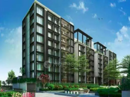
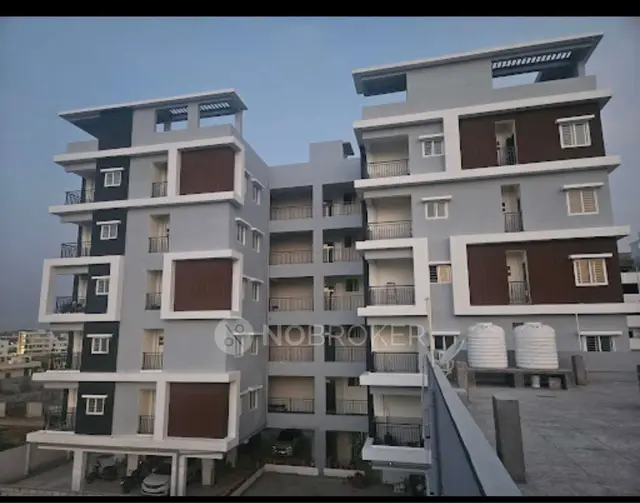
M3 Defence County
MILESTONE DEVELOPERS AND BUILDERS PRIVATE LIMITED · Rangareddy · RERA P02400007931
M3 DEFENCE COUNTY is a residential project at BALAPUR, Balapur mandal, Ranga Reddy district, developed by registered promoter MILESTONE DEVELOPERS AND BUILDERS PRIVATE LIMITED. The registered site extent is 66,064.84 sq.m, and the filed approval describes 201 plots/villas; the TG-RERA unit schedule lists 201 1BHK/1 BVHK homes and 199 2BHK homes. The drawing-derived plan describes residential forms mostly as ground plus one upper floor and a proposed club-house block as ground plus three upper floors. It is registered under TG-RERA P02400007931, with a proposed completion date of 22 May 2029.
More from Milestone Developers And Builders Pvt Ltd · 2 projects →
01What we found
Read from TG-RERA filings, approvals, land and registration records and court records. A court case is counted only when the court record states this project's survey number with its village, or names the project.
02Check before you pay
7 items to check before you pay, 3 high - from the title chain, court records and approvals, each with what to ask the builder or your advocate. An item may not be a problem with the project: records can be incomplete.
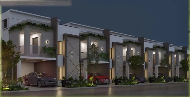
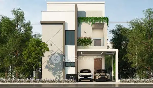
1. Project at a glance
Project identity
| Field | Record |
|---|---|
| Registered project name | M3 DEFENCE COUNTY RERA record |
| Project type | Residential; the filed approval documents describe a gated community with plots/villas. RERA record |
| Phase / registered portion | Phase not separately identified in the supplied record; registration is P02400007931. RERA record |
| TG-RERA registration | P02400007931 RERA record |
| Registration validity | 23 March 2024 to 22 January 2029, subject to any extension by the Authority. This is registration validity, not an occupancy certificate. Approvals record |
| Registered promoter | MILESTONE DEVELOPERS AND BUILDERS PRIVATE LIMITED; company. RERA record Corporate record |
| RERA status | The supplied certificate records registration. No later extension, lapse, revocation or OC record is provided here. |
Land and geographic identity
| Field | Record |
|---|---|
| Locality | BALAPUR RERA record RERA filing |
| Revenue village | Nadargul (also written Nadergul in approval documents) RERA record |
| Mandal / district / PIN | Balapur / Ranga Reddy / 500005 RERA record |
| Project survey numbers and subdivisions | 579/1, 645/1, 646/2, 647, 648, 649, 650, 651, 652 and 653/2 Land records |
| Registered site extent | 66,064.84 sq.m RERA filing |
| Net area and road-affected area | Net layout area: 63,786.74 sq.m in the drawing-derived layout record; the filed approval document states 63,786.75 sq.m. Road-affected area: 2,278.10 sq.m. Layout record |
| Boundaries in RERA record | East: WIDE EXISTING; west, north and south: NEIGHBOURS LAND. RERA filing |
Development identity
| Field | Record |
|---|---|
| Principal approval | Draft Layout Letter, approval/application/proceedings No. 011635/LO/HMDA/2597/SMD/2023; approved date shown as 23 January 2024. The document identifies HMDA as authority and records delegation to Badangpet Municipal Corporation. Approvals record |
| Approved built-up area | 41,951.48 sq.m in the approval extraction; the drawing-derived plan record states proposed built-up area of 41,962.91 sq.m excluding parking and including parking, and its sanctioned-parameters text states grand total 41,962.92 sq.m. |
| Building / plot count | Approval describes 201 plots/villas. The drawing-derived record states 201 buildings and 200 dwelling units. The TG-RERA land record lists 201 building units as per approved plan. RERA filing |
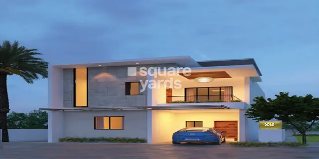
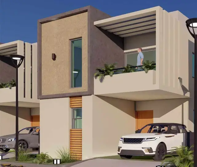
| Floor configuration | Drawing-derived plan text identifies proposed residential plots/gated-community units, mostly described as ground plus one upper floor; it also lists a proposed club-house block with ground plus three upper floors. The supplied record does not establish a completed as-built configuration. |
| Parking | No project-wide resident, visitor or accessible parking-space count or parking-level schedule is established in the supplied data. The approval drawing records mortgage plots/villas; this is not a parking allocation. |
| Approval-stage unit count | 201 plots/villas in the draft layout approval record; a drawing-derived sanctioned-parameters entry states 200 dwelling units. |
| RERA-filed units offered | 400 homes: 201 filed as 1BHK/1 BVHK and 199 as 2BHK. The four additional unit-table rows are common-area entries, not homes for sale. RERA unit table RERA unit details |
| Construction stage / OC | No independently verified construction-stage report, completion certificate or occupancy certificate is included in the supplied material. Document index Approvals record |
Offering and status
| Field | Record |
|---|---|
| RERA-filed configurations | 1BHK/1 BVHK and 2BHK RERA unit table |
| RERA-filed saleable areas | 1BHK/1 BVHK: 101.07–117.04 sq.m; 2BHK: 110.62 sq.m RERA unit table |
| Booked / available | 1BHK/1 BVHK: 0 booked / 201 available; 2BHK: 0 booked / 199 available. These are portal figures with no supplied as-of date and are indicative. RERA unit table |
| Completion date | The promoter’s Form B declaration undertakes completion by 22 January 2029. The header separately records a proposed completion date of 22 May 2029. RERA record |
| OC status | No OC or completion certificate is supplied for the project or any portion. Document index |
2. The project story
M3 DEFENCE COUNTY is registered in the TG-RERA record as a residential project at Nadargul, Balapur mandal, Ranga Reddy district. Its filed layout approval describes a gated community of plots/villas; the project’s RERA unit schedule also lists 1BHK and 2BHK homes. The supplied records therefore describe a development with a plotted/villa layout and a RERA-filed home offering, but do not explain how the filed apartment-style configurations map to the approved plot/villa arrangement. RERA record RERA unit table
The site is recorded as 66,064.84 sq.m, with 2,278.10 sq.m affected by road widening and a net layout area of about 63,786.74–63,786.75 sq.m in the supplied drawing and approval records. The approval document describes 201 plots/villas and requires development of layout infrastructure and transfer of specified roads, open spaces and utility land to the local body before release of final layout plans. It also records that 19 plots/villas, with a stated mortgaged extent of 3,901.92 sq.m, are mortgaged in favour of the Metropolitan Commissioner, HMDA; the approval says mortgaged plots/villas are not to be sold.
The promoter’s Form B declaration gives a completion undertaking of 22 January 2029. That is a declared timeline, not evidence of construction progress. The material provided does not establish whether construction or layout works have commenced, which individual portions are complete, or whether any portion has an OC. Document index
3. Master plan, architecture & building design
The layout plan is a drawing-derived record for a gated community at Nadargul, covering the supplied survey numbers. It shows a net layout area of 63,786.74 sq.m and records the following distribution: plotted area 39,675.73 sq.m (62.20%); layout roads 17,295.56 sq.m (27.11%); organized open space/park 6,433.81 sq.m (10.09%); and utility area 381.54 sq.m (0.60%). The approval extraction reports the corresponding net area as 63,786.75 sq.m. Layout record
The approval record identifies 201 plots/villas. A drawing-derived schedule describes 200 dwelling units and lists residential building forms as ground plus one upper floor, alongside a proposed club-house building described as ground plus three upper floors. The record does not provide a reliable, complete architectural schedule of individual villa layouts, floor plates, building footprints, heights for each unit, or phase-by-phase organization.
The approval letter calls for layout roads, storm-water drains, underground drainage, internal water-supply lines, an overhead tank, electrical supply and street lighting, transformer provision, avenue planting, park development and rainwater-harvesting pits. These are approval conditions or planned works; the supplied material does not certify their completion.
4. Homes, configurations & floor plans
The TG-RERA unit schedule lists 201 units under 1BHK/1 BVHK and 199 under 2BHK. Filed saleable areas are from the RERA record. The 1BHK drawing measurements below are software-measured from the supplied approved floor-plan drawing; they are not RERA-filed carpet-area disclosures and require review against the drawing. RERA unit table RERA unit details Floor plans
| Configuration | Units | Booked | Available | RERA saleable area | Measured carpet area | Loading (if supplied) |
|---|---|---|---|---|---|---|
| 1BHK / 1 BVHK | 201 | 0 | 201 | 101.07–117.04 sq.m | 1BHK drawing measurement: 52.1–107.8 sq.m; median 81.9 sq.m (29 flat designs measured) | Not supplied |
| 2BHK | 199 | 0 | 199 | 110.62 sq.m | Not supplied | Not supplied |
The drawing-based 1BHK measurement record includes one example labelled “GROUND FLOOR PLAN,” flat 01, with kitchen, toilet, guest bedroom and drawing/dining and living spaces; the extracted room areas are drawing measurements, not RERA disclosures. RERA unit details
Carpet area represents measured internal floor area from the drawings in the supplied software analysis. Saleable area is the RERA-filed figure and can include the home’s share of common areas; the supplied data does not give a separate loading figure. Booked and available counts are portal figures without a stated as-of date. Floor plans RERA unit table
5. Parking & vehicle circulation
The supplied records do not establish a count of resident, visitor or accessible parking spaces, parking levels, ramps, or unit-specific parking allocations. The layout approval describes roads, including a 12.00M peripheral road, 9.14M road, 18.28M (60'-0") master-plan road, 45.00 MT proposed road and 18.29 MT existing road; it also requires road formation and access to neighbouring sites. These are layout-road records, not confirmation of completed vehicle circulation or parking facilities.
A drawn or listed plot/villa should not be treated as an individual parking entitlement. No exclusive parking allocation document is supplied. Document index
6. Amenities, recreation & open spaces
The layout drawing and approval record identify planned open-space and community features. The RERA amenity schedule records some utilities as “YES” but shows 0% progress in its supplied entries; these percentages do not establish delivered facilities. No independent completion verification is supplied. RERA amenities Layout record
| Facility | Description / size | Evidence source | Declared progress / verified status |
|---|---|---|---|
| Club house | Proposed club-house block; drawing text includes a ground-plus-three-upper-floor form. No reliable facility-area figure supplied. | Proposed; completion not verified | |
| Park / organized open space | 6,433.81 sq.m; 10.09% of net layout area in the approval record | Layout record | Approval/layout provision; development not verified |
| Green strip / tot-lot | Named in the drawing-derived layout record | Proposed; completion not verified | |
| Walking track | Named in the drawing-derived layout record | Proposed; completion not verified | |
| Community buildings | Listed in the RERA amenity schedule | RERA amenities | 0% recorded; completion not verified |
| Open spaces | Layout allocates 6,433.81 sq.m to organized open space/park | Layout record | Approval/layout provision; completion not verified |
7. Utilities, building services & safety
The approval record requires layout infrastructure including internal water-supply lines, an overhead tank and sumps; underground drainage and a common septic tank/STP; storm-water drainage and NALA channelization; electrical lines, street lighting and a transformer; rainwater-harvesting pits; and solid-waste provisions including source segregation and a bio-compost unit. These are documented requirements or proposed facilities, not confirmation of installation, capacity or operation.
The RERA amenity schedule marks water supply, sewerage/drainage, storm-water drains, rainwater harvesting and electrical meter-room/substation/receiving-station items as “YES,” while the supplied progress values are 0%. No capacities, connection confirmations, completed-service certificates, fire-system details, lifts, emergency access, CCTV, security arrangements or accessibility features are established in the supplied data. RERA amenities
8. Location, access & connectivity
The registered revenue location is Nadargul village, Balapur mandal, Ranga Reddy district, PIN 500005. A supplied cadastral-parcel centroid is 17.28820, 78.56557; the nearest sampled Outer Ring Road interchange is approximately 5.6 km away. This is a mapped approximate distance, not a stated travel time. RERA record Location record
The approval drawing labels a 12.00M-wide peripheral road, a 9.14M-wide road, an 18.28M (60'-0") master-plan road, a 45.00 MT proposed road and an 18.29 MT existing road. The approval record also requires the peripheral and internal roads to remain accessible to neighbouring sites. The supplied evidence does not give public-transport routes or measured distances to other landmarks.
9. Developer & development status
The registered legal promoter is MILESTONE DEVELOPERS AND BUILDERS PRIVATE LIMITED, a company. Its supplied corporate identifier is GSTIN 36AAQCM0964N1ZR. The promoter address in the project record is Plot No. 21, 1st Floor, Gardenia Mabuhay, Pine Valley, Telecom Nagar, Balapur, Nadargul, Ranga Reddy, Telangana 500005. No official project contact details or promoter website are supplied. Corporate record RERA filing RERA filing
The promoter’s Form B affidavit, dated 21 February 2024, declares a completion date of 22 January 2029 and undertakes to maintain the project separate account and obtain required approvals. The supplied records do not contain a project-specific verified construction-progress update, completion certificate or OC. Document index
10. Approvals, official records & documents
| Reference / scope | M3 DEFENCE COUNTY; P02400007931; validity stated as 23 March 2024–22 January 2029 |
|---|
| Reference / scope | No. 011635/LO/HMDA/2597/SMD/2023; dated 23 January 2024; gated-community layout at Nadargul, with approval record identifying HMDA and delegation to Badangpet Municipal Corporation |
|---|---|
| Evidence | Approvals record |
| Reference / scope | Layout and proposed development drawing; includes site-area distribution, roads, open space, utilities and proposed building/use labels |
|---|
| Reference / scope | Promoter declaration, dated 21 February 2024; includes legal-title, encumbrance and completion declarations |
|---|
| Reference / scope | Documents are indexed under commencement-certificate labels, but the supplied approval extractions describe a draft layout letter; no separate building commencement certificate is established here. |
|---|---|
| Evidence | Document index |
| Reference / scope | Not supplied for the project or a phase/tower. |
|---|---|
| Evidence | Document index |
| Reference / scope | Partially completed allotment-letter and agreement-for-sale materials are on file; the supplied record does not establish an executed buyer-specific agreement. |
|---|
The supplied records do not include a final layout release or an OC. The approval letter sets out development and handover conditions relevant to final layout plans. This Overview records the available evidence only; full approval conditions and title matters are addressed in their respective report sections.
1. Project at a glance
Project identity
Registered project name: M3 DEFENCE COUNTY
Project type: Residential; the filed approval documents describe a gated community with plots/villas.
Phase / registered portion: Phase not separately identified in the supplied record; registration is P02400007931.
TG-RERA registration: P02400007931
Registration validity: 23 March 2024 to 22 January 2029, subject to any extension by the Authority. This is registration validity, not an occupancy certificate.
Registered promoter: MILESTONE DEVELOPERS AND BUILDERS PRIVATE LIMITED; company.
RERA status: The supplied certificate records registration. No later extension, lapse, revocation or OC record is provided here.
Land and geographic identity
Locality: BALAPUR
Revenue village: Nadargul (also written Nadergul in approval documents)
Mandal / district / PIN: Balapur / Ranga Reddy / 500005
Project survey numbers and subdivisions: 579/1, 645/1, 646/2, 647, 648, 649, 650, 651, 652 and 653/2
Registered site extent: 66,064.84 sq.m
Net area and road-affected area: Net layout area: 63,786.74 sq.m in the drawing-derived layout record; the filed approval document states 63,786.75 sq.m. Road-affected area: 2,278.10 sq.m.
Boundaries in RERA record: East: WIDE EXISTING; west, north and south: NEIGHBOURS LAND.
Development identity
Principal approval: Draft Layout Letter, approval/application/proceedings No. 011635/LO/HMDA/2597/SMD/2023; approved date shown as 23 January 2024. The document identifies HMDA as authority and records delegation to Badangpet Municipal Corporation.
Approved built-up area: 41,951.48 sq.m in the approval extraction; the drawing-derived plan record states proposed built-up area of 41,962.91 sq.m excluding parking and including parking, and its sanctioned-parameters text states grand total 41,962.92 sq.m.
Building / plot count: Approval describes 201 plots/villas. The drawing-derived record states 201 buildings and 200 dwelling units. The TG-RERA land record lists 201 building units as per approved plan.
Floor configuration: Drawing-derived plan text identifies proposed residential plots/gated-community units, mostly described as ground plus one upper floor; it also lists a proposed club-house block with ground plus three upper floors. The supplied record does not establish a completed as-built configuration.
Parking: No project-wide resident, visitor or accessible parking-space count or parking-level schedule is established in the supplied data. The approval drawing records mortgage plots/villas; this is not a parking allocation.
Approval-stage unit count: 201 plots/villas in the draft layout approval record; a drawing-derived sanctioned-parameters entry states 200 dwelling units.
RERA-filed units offered: 400 homes: 201 filed as 1BHK/1 BVHK and 199 as 2BHK. The four additional unit-table rows are common-area entries, not homes for sale.
Construction stage / OC: No independently verified construction-stage report, completion certificate or occupancy certificate is included in the supplied material.
Offering and status
RERA-filed configurations: 1BHK/1 BVHK and 2BHK
RERA-filed saleable areas: 1BHK/1 BVHK: 101.07–117.04 sq.m; 2BHK: 110.62 sq.m
Booked / available: 1BHK/1 BVHK: 0 booked / 201 available; 2BHK: 0 booked / 199 available. These are portal figures with no supplied as-of date and are indicative.
Completion date: The promoter’s Form B declaration undertakes completion by 22 January 2029. The header separately records a proposed completion date of 22 May 2029.
OC status: No OC or completion certificate is supplied for the project or any portion.
2. The project story
M3 DEFENCE COUNTY is registered in the TG-RERA record as a residential project at Nadargul, Balapur mandal, Ranga Reddy district. Its filed layout approval describes a gated community of plots/villas; the project’s RERA unit schedule also lists 1BHK and 2BHK homes. The supplied records therefore describe a development with a plotted/villa layout and a RERA-filed home offering, but do not explain how the filed apartment-style configurations map to the approved plot/villa arrangement.
The site is recorded as 66,064.84 sq.m, with 2,278.10 sq.m affected by road widening and a net layout area of about 63,786.74–63,786.75 sq.m in the supplied drawing and approval records. The approval document describes 201 plots/villas and requires development of layout infrastructure and transfer of specified roads, open spaces and utility land to the local body before release of final layout plans. It also records that 19 plots/villas, with a stated mortgaged extent of 3,901.92 sq.m, are mortgaged in favour of the Metropolitan Commissioner, HMDA; the approval says mortgaged plots/villas are not to be sold.
The promoter’s Form B declaration gives a completion undertaking of 22 January 2029. That is a declared timeline, not evidence of construction progress. The material provided does not establish whether construction or layout works have commenced, which individual portions are complete, or whether any portion has an OC.
3. Master plan, architecture & building design
The layout plan is a drawing-derived record for a gated community at Nadargul, covering the supplied survey numbers. It shows a net layout area of 63,786.74 sq.m and records the following distribution: plotted area 39,675.73 sq.m (62.20%); layout roads 17,295.56 sq.m (27.11%); organized open space/park 6,433.81 sq.m (10.09%); and utility area 381.54 sq.m (0.60%). The approval extraction reports the corresponding net area as 63,786.75 sq.m.
The approval record identifies 201 plots/villas. A drawing-derived schedule describes 200 dwelling units and lists residential building forms as ground plus one upper floor, alongside a proposed club-house building described as ground plus three upper floors. The record does not provide a reliable, complete architectural schedule of individual villa layouts, floor plates, building footprints, heights for each unit, or phase-by-phase organization.
The approval letter calls for layout roads, storm-water drains, underground drainage, internal water-supply lines, an overhead tank, electrical supply and street lighting, transformer provision, avenue planting, park development and rainwater-harvesting pits. These are approval conditions or planned works; the supplied material does not certify their completion.
4. Homes, configurations & floor plans
The TG-RERA unit schedule lists 201 units under 1BHK/1 BVHK and 199 under 2BHK. Filed saleable areas are from the RERA record. The 1BHK drawing measurements below are software-measured from the supplied approved floor-plan drawing; they are not RERA-filed carpet-area disclosures and require review against the drawing.
| Configuration | Units | Booked | Available | RERA saleable area | Measured carpet area | Loading (if supplied) |
|---|---|---|---|---|---|---|
| 1BHK / 1 BVHK | 201 | 0 | 201 | 101.07–117.04 sq.m | 1BHK drawing measurement: 52.1–107.8 sq.m; median 81.9 sq.m (29 flat designs measured) | Not supplied |
| 2BHK | 199 | 0 | 199 | 110.62 sq.m | Not supplied | Not supplied |
The drawing-based 1BHK measurement record includes one example labelled “GROUND FLOOR PLAN,” flat 01, with kitchen, toilet, guest bedroom and drawing/dining and living spaces; the extracted room areas are drawing measurements, not RERA disclosures.
Carpet area represents measured internal floor area from the drawings in the supplied software analysis. Saleable area is the RERA-filed figure and can include the home’s share of common areas; the supplied data does not give a separate loading figure. Booked and available counts are portal figures without a stated as-of date.
5. Parking & vehicle circulation
The supplied records do not establish a count of resident, visitor or accessible parking spaces, parking levels, ramps, or unit-specific parking allocations. The layout approval describes roads, including a 12.00M peripheral road, 9.14M road, 18.28M (60'-0") master-plan road, 45.00 MT proposed road and 18.29 MT existing road; it also requires road formation and access to neighbouring sites. These are layout-road records, not confirmation of completed vehicle circulation or parking facilities.
A drawn or listed plot/villa should not be treated as an individual parking entitlement. No exclusive parking allocation document is supplied.
6. Amenities, recreation & open spaces
The layout drawing and approval record identify planned open-space and community features. The RERA amenity schedule records some utilities as “YES” but shows 0% progress in its supplied entries; these percentages do not establish delivered facilities. No independent completion verification is supplied.
| Facility | Description / size | Evidence source | Declared progress / verified status |
|---|---|---|---|
| Club house | Proposed club-house block; drawing text includes a ground-plus-three-upper-floor form. No reliable facility-area figure supplied. | Proposed; completion not verified | |
| Park / organized open space | 6,433.81 sq.m; 10.09% of net layout area in the approval record | Approval/layout provision; development not verified | |
| Green strip / tot-lot | Named in the drawing-derived layout record | Proposed; completion not verified | |
| Walking track | Named in the drawing-derived layout record | Proposed; completion not verified | |
| Community buildings | Listed in the RERA amenity schedule | 0% recorded; completion not verified | |
| Open spaces | Layout allocates 6,433.81 sq.m to organized open space/park | Approval/layout provision; completion not verified |
7. Utilities, building services & safety
The approval record requires layout infrastructure including internal water-supply lines, an overhead tank and sumps; underground drainage and a common septic tank/STP; storm-water drainage and NALA channelization; electrical lines, street lighting and a transformer; rainwater-harvesting pits; and solid-waste provisions including source segregation and a bio-compost unit. These are documented requirements or proposed facilities, not confirmation of installation, capacity or operation.
The RERA amenity schedule marks water supply, sewerage/drainage, storm-water drains, rainwater harvesting and electrical meter-room/substation/receiving-station items as “YES,” while the supplied progress values are 0%. No capacities, connection confirmations, completed-service certificates, fire-system details, lifts, emergency access, CCTV, security arrangements or accessibility features are established in the supplied data.
8. Location, access & connectivity
The registered revenue location is Nadargul village, Balapur mandal, Ranga Reddy district, PIN 500005. A supplied cadastral-parcel centroid is 17.28820, 78.56557; the nearest sampled Outer Ring Road interchange is approximately 5.6 km away. This is a mapped approximate distance, not a stated travel time.
The approval drawing labels a 12.00M-wide peripheral road, a 9.14M-wide road, an 18.28M (60'-0") master-plan road, a 45.00 MT proposed road and an 18.29 MT existing road. The approval record also requires the peripheral and internal roads to remain accessible to neighbouring sites. The supplied evidence does not give public-transport routes or measured distances to other landmarks.
9. Developer & development status
The registered legal promoter is MILESTONE DEVELOPERS AND BUILDERS PRIVATE LIMITED, a company. Its supplied corporate identifier is GSTIN 36AAQCM0964N1ZR. The promoter address in the project record is Plot No. 21, 1st Floor, Gardenia Mabuhay, Pine Valley, Telecom Nagar, Balapur, Nadargul, Ranga Reddy, Telangana 500005. No official project contact details or promoter website are supplied.
The promoter’s Form B affidavit, dated 21 February 2024, declares a completion date of 22 January 2029 and undertakes to maintain the project separate account and obtain required approvals. The supplied records do not contain a project-specific verified construction-progress update, completion certificate or OC.
10. Approvals, official records & documents
| Reference / scope | M3 DEFENCE COUNTY; P02400007931; validity stated as 23 March 2024–22 January 2029 |
|---|
| Reference / scope | No. 011635/LO/HMDA/2597/SMD/2023; dated 23 January 2024; gated-community layout at Nadargul, with approval record identifying HMDA and delegation to Badangpet Municipal Corporation |
|---|
| Reference / scope | Layout and proposed development drawing; includes site-area distribution, roads, open space, utilities and proposed building/use labels |
|---|
| Reference / scope | Promoter declaration, dated 21 February 2024; includes legal-title, encumbrance and completion declarations |
|---|
| Reference / scope | Documents are indexed under commencement-certificate labels, but the supplied approval extractions describe a draft layout letter; no separate building commencement certificate is established here. |
|---|
| Reference / scope | Not supplied for the project or a phase/tower. |
|---|
| Reference / scope | Partially completed allotment-letter and agreement-for-sale materials are on file; the supplied record does not establish an executed buyer-specific agreement. |
|---|
The supplied records do not include a final layout release or an OC. The approval letter sets out development and handover conditions relevant to final layout plans. This Overview records the available evidence only; full approval conditions and title matters are addressed in their respective report sections.
Frequently asked questions
Is M3 DEFENCE COUNTY registered with Telangana RERA?
Yes. M3 DEFENCE COUNTY is registered with the Telangana Real Estate Regulatory Authority as P02400007931; the registration status is New Project.
Who is the developer of M3 DEFENCE COUNTY?
The promoter named in the RERA registration is MILESTONE DEVELOPERS AND BUILDERS PRIVATE LIMITED.
Where is M3 DEFENCE COUNTY located?
M3 DEFENCE COUNTY is in BALAPUR, Nadargul, Rangareddy, Telangana (500005).
When will M3 DEFENCE COUNTY be completed?
The promoter's proposed date of completion filed with RERA is 22/05/2029. This is the promoter's declaration, not a guarantee.
More projects in Nadargul