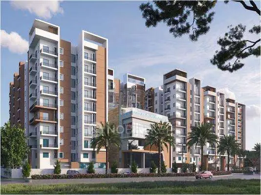
Northstar Sanctuary
NORTHSTAR HOMES AND SPACES PRIVATE LIMITED · Rangareddy · RERA P02400006975
NORTHSTAR SANCTUARY is a plotted development at Mohabatnagar, Maheshwaram Mandal, Ranga Reddy District. The registered promoter is NORTHSTAR HOMES AND SPACES PRIVATE LIMITED. The registered site extent is 52,031.31 sq. m total and 51,875.66 sq. m net; the supplied record does not state a number of plots, towers or blocks, floors, or plot configurations. The project is registered with TG-RERA as P02400006975, with proposed completion recorded as 30/11/2026.
More from Northstar Homes And Spaces Pvt Ltd · 3 projects →
01What we found
Read from TG-RERA filings, approvals, land and registration records and court records. A court case is counted only when the court record states this project's survey number with its village, or names the project.
02Check before you pay
8 items to check before you pay, 3 high - from the title chain, court records and approvals, each with what to ask the builder or your advocate. An item may not be a problem with the project: records can be incomplete.
1. Project at a glance
Project identity
| Item | Project record |
|---|---|
| Registered name | NORTHSTAR SANCTUARY RERA record |
| Project type | Plotted development / open-plot layout RERA record RERA filing |
| Phase / registered portion | Phase not identified in the TG-RERA record; registration is for the project identified by the survey numbers below. RERA record |
| TG-RERA registration | P02400006975; certificate issued under section 5 on 16/09/2023; valid from 16/09/2023 to 24/04/2026, unless extended by the Authority. RERA record |
| Registered promoter | NORTHSTAR HOMES AND SPACES PRIVATE LIMITED RERA record Corporate record |
| RERA status | The supplied certificate records registration; no extension is recorded in the supplied evidence. Its stated validity ended on 24/04/2026. RERA record |
Land and geographic identity
| Item | Project record |
|---|---|
| Locality / revenue village | Mohabatnagar (also rendered “Mohabathnagar” in some filed documents); village spelling should be checked against the relevant revenue records. RERA record Land records |
| Mandal / district / PIN | Maheshwaram, Ranga Reddy, 501359. RERA record RERA filing |
| Project survey numbers | 38p, 39p, 40p, 41p, 43p, 45p, 46p & 47p. The draft layout drawing lists 38P, 39P, 40P, 43P, 45P, 46P and 47P; the HMDA letter, Gram Panchayat letter and RERA certificate also include 41p. RERA record |
| Registered site extent | 52,031.31 sq. m total and 51,875.66 sq. m net, as recorded in the RERA land details. RERA filing Land records |
| Drawing area figures | The layout drawing states a plot area of 47,752.96 sq. m, net area of 34,829.82 sq. m, and road-widening area of 929.45 sq. m. These are drawing-stated figures. |
| Boundaries | East: SRISAILAM HIGHWAY; west: ROAD; north and south: NEIGHBOURS LAND. RERA filing |
| Cadastral record | A Bhu Bharati GIS record is supplied for survey 38p as a whole-survey extent of 68,677.16 sq. m; it is not a project-extent measurement. Cadastral map |
Development identity
| Item | Project record |
|---|---|
| Layout authority / principal approval | HMDA Draft Layout Letter, approval number 000052/LO/Plg/HMDA/2023, dated 25 April, 2023. It records technical approval and forwarding to the local authority for further action and release of the draft permission. |
| Local-authority document | Mohabatnagar Gram Panchayat letter dated 27/06/2023, referring to 000082/LO/PLG/HMDA/2023 and recording release of the HMDA draft open-plot layout. |
| Approved built-up area | 51,875.66 sq. m is entered in the RERA record as “Approved Built up Area”; no building configuration or building count is supplied. RERA filing |
| Buildings / floors | Not disclosed in the supplied project record. This is a plotted layout; no residential-building floor configuration is established here. RERA filing Document index |
| Plot and land-use information | The drawing’s area statement lists 22,528.57 sq. m plotted area, 8,469.92 sq. m road area, 2,960.54 sq. m organized open space/park/utility area, and 870.75 sq. m social infrastructure area. |
| Authority-mortgaged plots | Plots 8, 9, 10, 11 and 12, stated as 3,669.63 sq. m in total, are shown as mortgage area in the draft layout drawing. |
Offering and status
| Item | Project record |
|---|---|
| Unit type | Plots / open plots. RERA unit counts, plot-size schedule and booked/available inventory are not supplied in the evidence reviewed for this Overview. RERA record RERA filing Document index |
| Construction / development stage | No independently verified site-progress record is supplied. The RERA amenity entries show 0% progress for each listed item. RERA amenities |
| Promoter-stated completion | 30/11/2026 in the project header. Form B states completion within three years, with the date 24/04/2026. RERA record |
| Occupancy / completion certificate | No occupancy or completion certificate is supplied. The available project documents concern a plotted layout, not completed residential buildings. Document index |
2. The project story
NORTHSTAR SANCTUARY is registered with TG-RERA as a plotted development at Mohabatnagar in Maheshwaram Mandal, Ranga Reddy District. The registered land description covers survey numbers 38p, 39p, 40p, 41p, 43p, 45p, 46p and 47p. The project record describes a site adjoining Srisailam Highway on the east and a road on the west. RERA record RERA filing
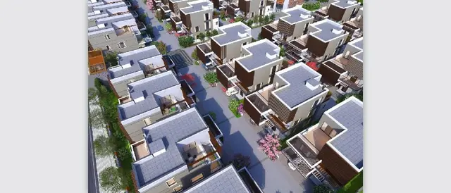
The filed drawing depicts an open-plot layout, with land allocated to plots, roads, organized open space/park/utility, and social infrastructure. It marks plots 8–12 as mortgage area in favour of the development authority. These are drawing-stated layout features; the supplied material does not establish which plots are currently available for purchase, the number of plots offered under the registered project, or plot-by-plot sale status. Document index
The project has a TG-RERA certificate and supplied HMDA and Gram Panchayat layout documents. No site inspection, independent construction-progress certification, or occupancy/completion certificate is provided here. The RERA-listed infrastructure and open-space entries each show 0% progress, so this evidence does not establish that those works have been completed. RERA amenities
3. Master plan, architecture & building design
The supplied drawing is a proposed residential draft layout plan with open plots, rather than a building-floor plan. It identifies one layout sheet, numbered 01/01, at scale 1:800. Its area statement gives a plot area of 47,752.96 sq. m and a net area of 34,829.82 sq. m; it separately lists road-widening area of 929.45 sq. m and accessory-use area of 59.88 sq. m.
The drawing’s land-use schedule records 22,528.57 sq. m plotted area, 8,469.92 sq. m road area, 2,960.54 sq. m organized open space/park/utility area, and 870.75 sq. m social infrastructure area. The drawing also shows road-width labels 60.00, 12M(40'), 20.32M, 32.81M, 37.31M, 43.44M, 39.16M and 40.97M. These are transcription/extraction of the drawing, not independent measurements.
The project record supplies no building count, building footprint, floors, parking levels, or residential-building arrangement. The RERA filing labels 51,875.66 sq. m as “Approved Built up Area”; it should not be treated as a disclosed carpet or saleable area for plots. RERA filing Document index
4. Homes, configurations & floor plans
This is a plotted project. The supplied RERA evidence does not include a plot-by-plot unit schedule with plot counts, sizes, booked units, available units, or RERA saleable areas. Accordingly, no RERA configuration table or measured carpet-area figures can be established from the available project record. RERA record Document index Floor plans
The approved-layout drawing gives an aggregate plotted area of 22,528.57 sq. m and marks plots 8, 9, 10, 11 and 12 as authority-mortgaged plots, with a stated area of 3,669.63 sq. m. It does not supply a complete plot schedule or establish present availability or sale allocation.
The supplied drawing-measurement record reports three drawings, of which two are scans pending measurement, one has no flats, and zero are measured. Carpet-area measurements therefore are not available; in any event, apartment carpet-area measurements are not applicable to the plotted offering described in the filed layout. Floor plans
5. Parking & vehicle circulation
No vehicle-parking space count, visitor or accessible parking allocation, parking-level design, or plot-specific parking entitlement is established in the supplied RERA record. The layout drawing labels roads and road widths, but does not provide a complete vehicle-circulation or parking schedule. Document index
The drawing shows 8,469.92 sq. m of road area and includes road-width labels 60.00, 12M(40'), 20.32M, 32.81M, 37.31M, 43.44M, 39.16M and 40.97M. These are layout-drawing figures; the supplied evidence does not identify parking allotments to individual plot purchasers.
6. Amenities, recreation & open spaces
The RERA record lists infrastructure and common-facility categories, with 0% progress shown for every listed item. The project materials do not provide independent evidence that any listed facility is complete. RERA amenities
| Description / size | Listed as available: YES; no dimensions in this RERA amenity entry. |
|---|---|
| Evidence source | RERA amenity record RERA amenities |
| Declared progress / verified status | 0%; completion not independently verified |
| Description / size | Listed as available: YES. The layout drawing separately states 2,960.54 sq. m for organized open space/park/utility area. |
|---|---|
| Evidence source | RERA amenity record RERA amenities; layout |
| Declared progress / verified status | 0%; completion not independently verified |
| Description / size | RERA lists community buildings without an availability value; the layout drawing states 870.75 sq. m social infrastructure area. |
|---|---|
| Evidence source | RERA amenity record RERA amenities; layout |
| Declared progress / verified status | 0%; provision and completion not independently verified |
| Description / size | Listed as available: YES; no additional area stated in the RERA amenity entry. |
|---|---|
| Evidence source | RERA amenity record RERA amenities |
| Declared progress / verified status | 0%; completion not independently verified |
The supplied project brochures advertise additional leisure and recreation facilities, including a clubhouse, pool, gym and sports areas. These are promoter-marketed claims, not evidence in the supplied record that those facilities are sanctioned, RERA-declared as project commitments, or delivered.
7. Utilities, building services & safety
The RERA amenity record lists water supply, sewerage (including chamber, lines, septic tank and STP), storm-water drains, treatment and disposal of sewage and sullage water, solid-waste management and disposal, water conservation/rainwater harvesting, street lighting, and an electrical meter room/sub-station/receiving station. The record shows 0% progress for these entries; it does not provide capacities, engineering specifications, or independent completion verification. RERA amenities
The same RERA schedule includes energy management and fire-protection/fire-safety requirements but provides no availability value or progress beyond 0%. No fire-system design details, approvals, accessible-circulation specifications, water-storage capacity, treatment capacity, backup-power capacity, or security-system particulars are established by the supplied RERA material. RERA amenities
8. Location, access & connectivity
The registered location is Mohabatnagar, Maheshwaram Mandal, Ranga Reddy District, Telangana, PIN 501359. The RERA land details identify SRISAILAM HIGHWAY as the eastern boundary and a road as the western boundary. The supplied project record does not provide public-transport details or verified travel times to landmarks. RERA record RERA filing
The supplied location record places the cadastral parcel centroid at 17.16019, 78.47874 and lists the nearest sampled Outer Ring Road interchange at approximately 9.3 km. This is a location-data distance, not a travel-time estimate. Location record
9. Developer & development status
The registered legal promoter is NORTHSTAR HOMES AND SPACES PRIVATE LIMITED, a private limited company, GSTIN 36AAICN4857H1Z3. The supplied company address is PLOT NO 8-2-293/82/A/1057/F1, ROAD NO 45, above SBI Bank, Mohabatnagar, Maheshwaram, Ranga Reddy, Telangana, 501359. Corporate record RERA filing RERA filing
The RERA record identifies UTTAM KUMAR REDDY KORUPOL as both Managing Director and Authorized Signatory. The filed Form B is signed by K. Uttam Kumar Reddy on behalf of the promoter and states a completion undertaking of three years, specifying 24/04/2026. The project header separately records proposed completion as 30/11/2026. No site-progress report or completion/occupancy certificate is supplied to establish the current physical stage. Parties record RERA record Document index
The evidence does not establish a phase-wise construction programme for buildings; the project is described in the RERA record as a plotted development. The promoter’s official contact details and website are not independently established in the supplied structured RERA fields. RERA record Corporate record
10. Approvals, official records & documents
| Record | Supplied evidence and scope |
|---|---|
| TG-RERA registration | Form C for NORTHSTAR SANCTUARY, registration P02400006975, issued 16/09/2023; stated validity through 24/04/2026. The certificate includes the standard separate-account condition. |
| HMDA layout document | Draft Layout Letter, 000052/LO/Plg/HMDA/2023, dated 25 April, 2023; records technical approval and forwarding to the local authority for further action and release of the draft layout permission. |
| Layout drawing | Proposed residential draft layout with open plots, area statement, roads and authority-mortgaged plots 8–12; drawing reference file 026573/SMD/LT/U6/HMDA/05082019. |
| Gram Panchayat letter | Mohabatnagar Gram Panchayat letter dated 27/06/2023, recording release of the HMDA draft open-plot layout and citing 000082/LO/PLG/HMDA/2023. |
| Form B declaration | Promoter declaration by K. Uttam Kumar Reddy, representing Northstar Homes & Spaces Private Limited; states the title basis, project-account and approval undertakings, and a completion undertaking. |
| Occupancy / completion certificate | None supplied; no building-level occupancy or completion status can be confirmed from the materials reviewed. Document index |
1. Project at a glance
Project identity
Registered name: NORTHSTAR SANCTUARY
Project type: Plotted development / open-plot layout
Phase / registered portion: Phase not identified in the TG-RERA record; registration is for the project identified by the survey numbers below.
TG-RERA registration: P02400006975; certificate issued under section 5 on 16/09/2023; valid from 16/09/2023 to 24/04/2026, unless extended by the Authority.
Registered promoter: NORTHSTAR HOMES AND SPACES PRIVATE LIMITED
RERA status: The supplied certificate records registration; no extension is recorded in the supplied evidence. Its stated validity ended on 24/04/2026.
Land and geographic identity
Locality / revenue village: Mohabatnagar (also rendered “Mohabathnagar” in some filed documents); village spelling should be checked against the relevant revenue records.
Mandal / district / PIN: Maheshwaram, Ranga Reddy, 501359.
Project survey numbers: 38p, 39p, 40p, 41p, 43p, 45p, 46p & 47p. The draft layout drawing lists 38P, 39P, 40P, 43P, 45P, 46P and 47P; the HMDA letter, Gram Panchayat letter and RERA certificate also include 41p.
Registered site extent: 52,031.31 sq. m total and 51,875.66 sq. m net, as recorded in the RERA land details.
Drawing area figures: The layout drawing states a plot area of 47,752.96 sq. m, net area of 34,829.82 sq. m, and road-widening area of 929.45 sq. m. These are drawing-stated figures.
Boundaries: East: SRISAILAM HIGHWAY; west: ROAD; north and south: NEIGHBOURS LAND.
Cadastral record: A Bhu Bharati GIS record is supplied for survey 38p as a whole-survey extent of 68,677.16 sq. m; it is not a project-extent measurement.
Development identity
Layout authority / principal approval: HMDA Draft Layout Letter, approval number 000052/LO/Plg/HMDA/2023, dated 25 April, 2023. It records technical approval and forwarding to the local authority for further action and release of the draft permission.
Local-authority document: Mohabatnagar Gram Panchayat letter dated 27/06/2023, referring to 000082/LO/PLG/HMDA/2023 and recording release of the HMDA draft open-plot layout.
Approved built-up area: 51,875.66 sq. m is entered in the RERA record as “Approved Built up Area”; no building configuration or building count is supplied.
Buildings / floors: Not disclosed in the supplied project record. This is a plotted layout; no residential-building floor configuration is established here.
Plot and land-use information: The drawing’s area statement lists 22,528.57 sq. m plotted area, 8,469.92 sq. m road area, 2,960.54 sq. m organized open space/park/utility area, and 870.75 sq. m social infrastructure area.
Authority-mortgaged plots: Plots 8, 9, 10, 11 and 12, stated as 3,669.63 sq. m in total, are shown as mortgage area in the draft layout drawing.
Offering and status
Unit type: Plots / open plots. RERA unit counts, plot-size schedule and booked/available inventory are not supplied in the evidence reviewed for this Overview.
Construction / development stage: No independently verified site-progress record is supplied. The RERA amenity entries show 0% progress for each listed item.
Promoter-stated completion: 30/11/2026 in the project header. Form B states completion within three years, with the date 24/04/2026.
Occupancy / completion certificate: No occupancy or completion certificate is supplied. The available project documents concern a plotted layout, not completed residential buildings.
2. The project story
NORTHSTAR SANCTUARY is registered with TG-RERA as a plotted development at Mohabatnagar in Maheshwaram Mandal, Ranga Reddy District. The registered land description covers survey numbers 38p, 39p, 40p, 41p, 43p, 45p, 46p and 47p. The project record describes a site adjoining Srisailam Highway on the east and a road on the west.
The filed drawing depicts an open-plot layout, with land allocated to plots, roads, organized open space/park/utility, and social infrastructure. It marks plots 8–12 as mortgage area in favour of the development authority. These are drawing-stated layout features; the supplied material does not establish which plots are currently available for purchase, the number of plots offered under the registered project, or plot-by-plot sale status.
The project has a TG-RERA certificate and supplied HMDA and Gram Panchayat layout documents. No site inspection, independent construction-progress certification, or occupancy/completion certificate is provided here. The RERA-listed infrastructure and open-space entries each show 0% progress, so this evidence does not establish that those works have been completed.
3. Master plan, architecture & building design
The supplied drawing is a proposed residential draft layout plan with open plots, rather than a building-floor plan. It identifies one layout sheet, numbered 01/01, at scale 1:800. Its area statement gives a plot area of 47,752.96 sq. m and a net area of 34,829.82 sq. m; it separately lists road-widening area of 929.45 sq. m and accessory-use area of 59.88 sq. m.
The drawing’s land-use schedule records 22,528.57 sq. m plotted area, 8,469.92 sq. m road area, 2,960.54 sq. m organized open space/park/utility area, and 870.75 sq. m social infrastructure area. The drawing also shows road-width labels 60.00, 12M(40'), 20.32M, 32.81M, 37.31M, 43.44M, 39.16M and 40.97M. These are transcription/extraction of the drawing, not independent measurements.
The project record supplies no building count, building footprint, floors, parking levels, or residential-building arrangement. The RERA filing labels 51,875.66 sq. m as “Approved Built up Area”; it should not be treated as a disclosed carpet or saleable area for plots.
4. Homes, configurations & floor plans
This is a plotted project. The supplied RERA evidence does not include a plot-by-plot unit schedule with plot counts, sizes, booked units, available units, or RERA saleable areas. Accordingly, no RERA configuration table or measured carpet-area figures can be established from the available project record.
The approved-layout drawing gives an aggregate plotted area of 22,528.57 sq. m and marks plots 8, 9, 10, 11 and 12 as authority-mortgaged plots, with a stated area of 3,669.63 sq. m. It does not supply a complete plot schedule or establish present availability or sale allocation.
The supplied drawing-measurement record reports three drawings, of which two are scans pending measurement, one has no flats, and zero are measured. Carpet-area measurements therefore are not available; in any event, apartment carpet-area measurements are not applicable to the plotted offering described in the filed layout.
5. Parking & vehicle circulation
No vehicle-parking space count, visitor or accessible parking allocation, parking-level design, or plot-specific parking entitlement is established in the supplied RERA record. The layout drawing labels roads and road widths, but does not provide a complete vehicle-circulation or parking schedule.
The drawing shows 8,469.92 sq. m of road area and includes road-width labels 60.00, 12M(40'), 20.32M, 32.81M, 37.31M, 43.44M, 39.16M and 40.97M. These are layout-drawing figures; the supplied evidence does not identify parking allotments to individual plot purchasers.
6. Amenities, recreation & open spaces
The RERA record lists infrastructure and common-facility categories, with 0% progress shown for every listed item. The project materials do not provide independent evidence that any listed facility is complete.
| Description / size | Listed as available: YES; no dimensions in this RERA amenity entry. |
|---|---|
| Evidence source | RERA amenity record |
| Declared progress / verified status | 0%; completion not independently verified |
| Description / size | Listed as available: YES. The layout drawing separately states 2,960.54 sq. m for organized open space/park/utility area. |
|---|---|
| Evidence source | RERA amenity record; layout |
| Declared progress / verified status | 0%; completion not independently verified |
| Description / size | RERA lists community buildings without an availability value; the layout drawing states 870.75 sq. m social infrastructure area. |
|---|---|
| Evidence source | RERA amenity record; layout |
| Declared progress / verified status | 0%; provision and completion not independently verified |
| Description / size | Listed as available: YES; no additional area stated in the RERA amenity entry. |
|---|---|
| Evidence source | RERA amenity record |
| Declared progress / verified status | 0%; completion not independently verified |
The supplied project brochures advertise additional leisure and recreation facilities, including a clubhouse, pool, gym and sports areas. These are promoter-marketed claims, not evidence in the supplied record that those facilities are sanctioned, RERA-declared as project commitments, or delivered.
7. Utilities, building services & safety
The RERA amenity record lists water supply, sewerage (including chamber, lines, septic tank and STP), storm-water drains, treatment and disposal of sewage and sullage water, solid-waste management and disposal, water conservation/rainwater harvesting, street lighting, and an electrical meter room/sub-station/receiving station. The record shows 0% progress for these entries; it does not provide capacities, engineering specifications, or independent completion verification.
The same RERA schedule includes energy management and fire-protection/fire-safety requirements but provides no availability value or progress beyond 0%. No fire-system design details, approvals, accessible-circulation specifications, water-storage capacity, treatment capacity, backup-power capacity, or security-system particulars are established by the supplied RERA material.
8. Location, access & connectivity
The registered location is Mohabatnagar, Maheshwaram Mandal, Ranga Reddy District, Telangana, PIN 501359. The RERA land details identify SRISAILAM HIGHWAY as the eastern boundary and a road as the western boundary. The supplied project record does not provide public-transport details or verified travel times to landmarks.
The supplied location record places the cadastral parcel centroid at 17.16019, 78.47874 and lists the nearest sampled Outer Ring Road interchange at approximately 9.3 km. This is a location-data distance, not a travel-time estimate.
9. Developer & development status
The registered legal promoter is NORTHSTAR HOMES AND SPACES PRIVATE LIMITED, a private limited company, GSTIN 36AAICN4857H1Z3. The supplied company address is PLOT NO 8-2-293/82/A/1057/F1, ROAD NO 45, above SBI Bank, Mohabatnagar, Maheshwaram, Ranga Reddy, Telangana, 501359.
The RERA record identifies UTTAM KUMAR REDDY KORUPOL as both Managing Director and Authorized Signatory. The filed Form B is signed by K. Uttam Kumar Reddy on behalf of the promoter and states a completion undertaking of three years, specifying 24/04/2026. The project header separately records proposed completion as 30/11/2026. No site-progress report or completion/occupancy certificate is supplied to establish the current physical stage.
The evidence does not establish a phase-wise construction programme for buildings; the project is described in the RERA record as a plotted development. The promoter’s official contact details and website are not independently established in the supplied structured RERA fields.
10. Approvals, official records & documents
TG-RERA registration: Form C for NORTHSTAR SANCTUARY, registration P02400006975, issued 16/09/2023; stated validity through 24/04/2026. The certificate includes the standard separate-account condition.
HMDA layout document: Draft Layout Letter, 000052/LO/Plg/HMDA/2023, dated 25 April, 2023; records technical approval and forwarding to the local authority for further action and release of the draft layout permission.
Layout drawing: Proposed residential draft layout with open plots, area statement, roads and authority-mortgaged plots 8–12; drawing reference file 026573/SMD/LT/U6/HMDA/05082019.
Gram Panchayat letter: Mohabatnagar Gram Panchayat letter dated 27/06/2023, recording release of the HMDA draft open-plot layout and citing 000082/LO/PLG/HMDA/2023.
Form B declaration: Promoter declaration by K. Uttam Kumar Reddy, representing Northstar Homes & Spaces Private Limited; states the title basis, project-account and approval undertakings, and a completion undertaking.
Occupancy / completion certificate: None supplied; no building-level occupancy or completion status can be confirmed from the materials reviewed.
Frequently asked questions
Is NORTHSTAR SANCTUARY registered with Telangana RERA?
Yes. NORTHSTAR SANCTUARY is registered with the Telangana Real Estate Regulatory Authority as P02400006975; the registration status is New Project.
Who is the developer of NORTHSTAR SANCTUARY?
The promoter named in the RERA registration is NORTHSTAR HOMES AND SPACES PRIVATE LIMITED.
Where is NORTHSTAR SANCTUARY located?
NORTHSTAR SANCTUARY is in MOHABATNAGAR, Maheshwaram, Rangareddy, Telangana (501359).
When will NORTHSTAR SANCTUARY be completed?
The promoter's proposed date of completion filed with RERA is 30/11/2026. This is the promoter's declaration, not a guarantee.
More projects in Mohabathnager