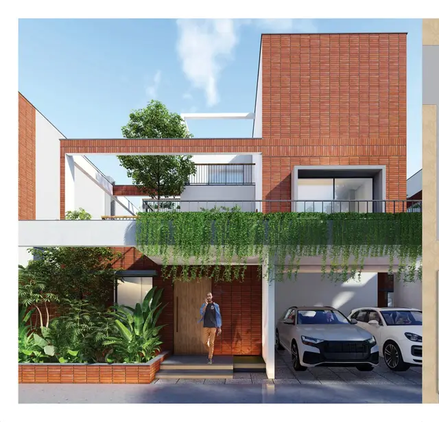
Sathya Enclave
M/S TARA CONSTRUCTIONS · Hanamkonda · RERA P00300008343
SATHYA ENCLAVE is a plotted development on BHATTUPALLI ROAD in Shayampet revenue village, Khazipet mandal, Warangal Urban district. The registered promoter is M/S TARA CONSTRUCTIONS. The RERA record reports a land area of 16071.83 sq.mts and an approved residential layout of 49 plots; no tower, floor or plot configuration details are stated in the supplied RERA extract. The project is registered under TG-RERA P00300008343, with a proposed completion date of 19/10/2026.
More from Tara Constructions · 2 projects →
01What we found
Read from TG-RERA filings, approvals, land and registration records and court records. A court case is counted only when the court record states this project's survey number with its village, or names the project.
02Check before you pay
12 items to check before you pay, 3 high - from the title chain, court records and approvals, each with what to ask the builder or your advocate. An item may not be a problem with the project: records can be incomplete.
1. Project at a glance
Project identity
| Field | Record |
|---|---|
| Registered project name | SATHYA ENCLAVE RERA record |
| Project type | Plotted development RERA record |
| Phase / registered portion | Phase not separately identified; registration covers the project land identified by the survey numbers below |
| TG-RERA registration | P00300008343 |
| Registration validity | 7 June 2024 to 19 October 2026, unless extended by the Authority |
| Registered promoter | M/S TARA CONSTRUCTIONS RERA record |
| RERA status | Registered; the supplied certificate records the stated validity period |
Land and geographic identity
| Field | Record |
|---|---|
| Locality | BHATTUPALLI ROAD RERA record |
| Revenue village | Shayampet; the approval documents also render this as “SHYAMPET(J)” / “Shyampet (J) Revenue Village” RERA record |
| Mandal | Khazipet RERA record |
| District | Warangal Urban RERA record |
| PIN | 506001 RERA record |
| RERA-identified survey numbers | 519 PART, 521 PART, 523 PART, 524 PART, 525 PART, 526 PART |
| Subdivision numbers listed in the layout-plan documents | 524/A/1/4, 526/C/5, 525/A/6, 526/A/4, 525/A/1/2, 519/D/4, 526/B/1, 526/C/4, 523/D/2/6, 524/C/5, 525/A/4, 526/C/6, 521/A/2/4, 521/D/1, 523/C/2, 524/A/1/2, 526/C/3, 526/E/3, 523/D/2, 524/C/4, 524/A/3, 524/A/1/5, 525/A/7, 526/E/4, 525/A/1/3, 524/A/4, 524/A/4/3, 524/A/4/4, 526/A/2/2 |
| RERA land area | Total and net area reported as 16071.83 sq.mts RERA record |
| Layout-plan area | 16071.68 sq.mt |
| Boundaries in RERA record | East and north: Municipal Road; west: land of Sri K Yellaiah, Sri Ganta Srinivas and others; south: land of others RERA record |
Development identity
| Field | Record |
|---|---|
| Principal sanctioning authority | Greater Warangal Municipal Corporation (GWMC); the layout record also identifies TS-DTCP file no. TS/044544/2023 Approvals record |
| Tentative layout approval | 0229/LO/3006/2023, dated 19 October 2023 Approvals record |
| Final layout approval | 0020/FLT/3006/2025, proceedings no. 000703/FLT/GWMC/3006/0021/2025, dated 16 March 2025 Approvals record |
| Approved development form | Open-plot residential layout; 49 plots |
| Approved built-up area | Not disclosed in the supplied layout records; individual building permissions are to be considered separately under the final-layout conditions |
| Building / floor configuration | No project-wide building, floor or parking-level configuration disclosed; the final layout permits detached single-family dwelling use subject to individual building approval |
| Plot area reserved as municipal mortgage | The tentative layout document states 8 plots and mortgage area required 1418.12 (15%), proposed 1490.51; it identifies plots 36, 41, 40, 37, 39, 38, 16 and 17 |
Offering and status
| Field | Record |
|---|---|
| Unit type | Residential plots; no project-specific plot-by-plot saleable-area schedule is included in the supplied RERA registration extract |
| Booked / available counts | Not disclosed in the supplied evidence Document index |
| Construction stage | The final-layout document includes a completion certification; this is layout-development status, not a statement that homes have been built |
| Promoter-declared completion deadline | 19/10/2026 in the Form B declaration |
| Occupancy certificate | The supplied final-layout extraction says the accompanying architect’s certificate identifies a GWMC occupancy certificate, but the certificate number, date and precise scope are not provided in the extracted facts. This is not evidence of OC coverage for any future individual dwelling |
2. The project story
SATHYA ENCLAVE is a 49-plot residential layout in the Shayampet revenue village, Khazipet mandal, Warangal Urban district. The RERA record identifies the registered site by six part-survey numbers, while the layout approval lists the subdivisions associated with the layout.
The approved plan allocates land to plots, internal roads, park/open space, social infrastructure and utilities. It provides for 9-metre-wide internal roads and identifies 18-metre-wide existing and proposed roads. The final-layout conditions specify detached single-family dwelling use; individual house construction requires separate consideration of building permission.
The final-layout record is dated 16 March 2025 and contains a completion certification for the layout. Separately, the promoter’s Form B declaration undertakes completion by 19 October 2026, and the TG-RERA certificate remains valid through that date unless extended. These are distinct records: layout completion does not establish that individual homes have been built or that each home has an occupancy certificate.
3. Master plan, architecture & building design
The sanctioned development is a plotted layout rather than a project of apartment blocks or a single building. The layout drawing states 16071.68 sq.mt total and net layout area. Its land-use statement records 9436.67 sq.mt of plotted area, 4612.80 sq.mt of roads, 1447.88 sq.mt of organized open space/park, 413.60 sq.mt of social infrastructure and 160.88 sq.mt of utility area; amenity area is recorded as 0.00 sq.mt.
The plan provides 49 plots. Internal roads are labelled 9.00 metres wide for roads 1–5, with an 18.00-metre-wide existing road and an 18.00-metre-wide proposed road also shown. The approval conditions require internal roads to remain open for neighbouring-land access.
The final-layout conditions specify detached single-family dwelling use and prohibit altering or subdividing plot boundaries without prior approval. No project-wide house plans, building footprints, approved built-up area, floor configuration, or common residential/commercial building allocation are provided in the supplied evidence.
4. Homes, configurations & floor plans
This is a plotted development. The supplied RERA evidence does not provide plot-wise RERA saleable areas or booked/available counts. No carpet-area or room-measurement comparison is available: the supplied floor-plan data records two layout sheets and no dwelling floor plans measured. Floor plans Document index
| Configuration | Units | Booked | Available | RERA saleable area | Measured carpet area | Loading (if supplied) |
|---|---|---|---|---|---|---|
| Residential plot | 49 | Not disclosed | Not disclosed | Plot-wise area not disclosed in supplied RERA extract | Not applicable | Not disclosed |
A vendor listing supplies a “built-up 1,650 - 3,205 sq ft” configuration description, but this is not a RERA-filed plot-area schedule and is not used here to describe the registered offering. Promoter website
5. Parking & vehicle circulation
The layout plan records 0.00 sq.mt as common parking area. The final-layout document lists common parking among its amenity/utilities terminology, but the supplied evidence does not specify a sanctioned number of parking spaces, their location or arrangement, or any plot-specific parking allocation.
The plan identifies internal roads and adjoining road connections, but the supplied records do not describe vehicle-entry control, parking bays, pedestrian separation, accessible spaces or EV charging. A parking allotment for an individual plot or future home cannot be established from these documents.
6. Amenities, recreation & open spaces
The layout plan identifies park/open space, social infrastructure and utility land. The RERA amenity record marks internal roads and footpaths, water supply, sewerage, storm-water drains, green strip/tot-lot/park, street lighting, rainwater harvesting, electrical meter room/sub-station/receiving station and recreational open space as available. The supplied record does not independently verify on-site completion of each item. RERA amenities
| Description / size | 1447.88 sq.mt; 9.01% in the layout area statement |
|---|---|
| Evidence source | Approved layout drawing |
| Declared progress / verified status | Shown in the plan; final-layout record includes completion certification, but no facility-by-facility independent verification is supplied |
| Description / size | 413.60 sq.mt; 2.57% |
|---|---|
| Evidence source | Approved layout drawing |
| Declared progress / verified status | Land is allocated; a specific completed building or facility is not identified RERA amenities |
| Description / size | 160.88 sq.mt; 1.00% |
|---|---|
| Evidence source | Approved layout drawing |
| Declared progress / verified status | Land is allocated; specific utility assets are addressed below |
| Description / size | Layout identifies five 9.00 mt. roads, plus an 18.00 MT existing road and an 18.00 MT proposed road |
|---|---|
| Evidence source | Approved layout drawing and RERA amenity record RERA amenities |
| Declared progress / verified status | Marked available in the RERA amenity record; independent site verification not supplied RERA amenities |
| Description / size | Tot-lot is named in the layout record; the RERA amenity record lists “Green Strip/TOT LOT/Park” RERA amenities |
|---|---|
| Evidence source | Layout record and RERA amenity record RERA amenities |
| Declared progress / verified status | Listed in records; no separate size or independent completion verification supplied RERA amenities |
7. Utilities, building services & safety
The tentative-layout conditions describe proposed layout infrastructure including internal water-supply pipelines and an overhead tank, an assured water-supply source, underground drainage and a common septic tank/STP, storm-water drains, electrical supply lines, street lights, a transformer, solid-waste management, avenue planting, park development and rainwater-harvesting pits. These are approval-condition descriptions; the supplied evidence does not state capacities or independently verify operation of each facility.
The RERA amenity record marks water supply, sewerage, storm-water drains, street lighting, rainwater harvesting and electrical meter room/sub-station/receiving station as available. It records solid-waste management and disposal as 0%, while the final-layout amenity/utilities list includes solid-waste management and garbage bin. The supplied records do not establish the completed status, capacity or operating arrangements for waste facilities. RERA amenities
The evidence does not specify backup power, EV charging, lifts, building fire systems, access-control/security equipment or accessible circulation. The final-layout conditions require a minimum 3m (10'-0") vertical and horizontal safety distance between a building and high-tension electricity lines when individual residential building permissions are considered; this is an approval condition, not confirmation of a project-wide safety clearance.
8. Location, access & connectivity
The registered project location is Shayampet, Khazipet, Warangal Urban, PIN 506001, with the locality recorded as BHATTUPALLI ROAD. The RERA boundary description identifies Municipal Roads on the north and east sides. RERA record
The approved layout shows an 18.00 MT WIDE EXISTING road, an 18.00 MT WIDE PROPOSED ROAD, and five internal roads each labelled 9.00 mt. wide. The supplied connectivity data lists the nearest sampled Outer Ring Road interchange at 113.1 km; this is a sampled distance, not a travel-time estimate. Location record
9. Developer & development status
The registered promoter is M/S TARA CONSTRUCTIONS, identified in the project record as a partnership. Its registered address is Tara Nilyam, Excise Colony, Shyampet Jagir Revenue, Bhattupalli Road, Khazipet, Warangal Urban, 506001. The GSTIN recorded for the promoter is 36AAOFT9862B1ZQ. RERA record Corporate record Parties record
The promoter’s Form B declaration, signed by Mandadi Puneeth Reddy as authorized signatory, undertakes completion by 19/10/2026 and contains declarations concerning title basis, encumbrances, project funds, audits and approvals. These are promoter declarations, not independent verification of the declared matters.
The final-layout record identifies Tara Constructions as builder/developer, represented by its managing partner, and includes a layout-completion certification. The supplied records do not report a project-wide construction percentage or confirm construction of individual dwelling homes.
10. Approvals, official records & documents
| Identifier / date | P00300008343; valid 7 June 2024 to 19 October 2026 unless extended |
|---|---|
| What it supports | Project registration, promoter, registered location and land survey numbers |
| Identifier / date | TS/044544/2023 |
|---|---|
| What it supports | Layout-plan file reference |
| Identifier / date | 0229/LO/3006/2023; 19 October 2023 |
|---|---|
| What it supports | Tentative approval for the 49-plot layout, with development, mortgage and handover conditions |
| Identifier / date | 0020/FLT/3006/2025; proceedings 000703/FLT/GWMC/3006/0021/2025; 16 March 2025 |
|---|---|
| What it supports | Final layout plan and completion certification |
| Identifier / date | Document 428953 |
|---|---|
| What it supports | Plot count, area statement, road labels and reserved land |
| Identifier / date | Document 429194 |
|---|---|
| What it supports | Promoter’s completion undertaking and statutory declarations |
| Identifier / date | Document 548492 |
|---|---|
| What it supports | Final-layout particulars and an extracted statement that the accompanying architect’s certificate identifies a GWMC occupancy certificate; certificate number, date and precise scope are not supplied in the extracted facts |
The supplied approval records identify the layout and its conditions. They do not provide individual house-building permissions or a complete, independently verified record of utilities and dwelling construction.
1. Project at a glance
Project identity
Registered project name: SATHYA ENCLAVE
Project type: Plotted development
Phase / registered portion: Phase not separately identified; registration covers the project land identified by the survey numbers below
TG-RERA registration: P00300008343
Registration validity: 7 June 2024 to 19 October 2026, unless extended by the Authority
Registered promoter: M/S TARA CONSTRUCTIONS
RERA status: Registered; the supplied certificate records the stated validity period
Land and geographic identity
Locality: BHATTUPALLI ROAD
Revenue village: Shayampet; the approval documents also render this as “SHYAMPET(J)” / “Shyampet (J) Revenue Village”
Mandal: Khazipet
District: Warangal Urban
PIN: 506001
RERA-identified survey numbers: 519 PART, 521 PART, 523 PART, 524 PART, 525 PART, 526 PART
Subdivision numbers listed in the layout-plan documents: 524/A/1/4, 526/C/5, 525/A/6, 526/A/4, 525/A/1/2, 519/D/4, 526/B/1, 526/C/4, 523/D/2/6, 524/C/5, 525/A/4, 526/C/6, 521/A/2/4, 521/D/1, 523/C/2, 524/A/1/2, 526/C/3, 526/E/3, 523/D/2, 524/C/4, 524/A/3, 524/A/1/5, 525/A/7, 526/E/4, 525/A/1/3, 524/A/4, 524/A/4/3, 524/A/4/4, 526/A/2/2
RERA land area: Total and net area reported as 16071.83 sq.mts
Layout-plan area: 16071.68 sq.mt
Boundaries in RERA record: East and north: Municipal Road; west: land of Sri K Yellaiah, Sri Ganta Srinivas and others; south: land of others
Development identity
Principal sanctioning authority: Greater Warangal Municipal Corporation (GWMC); the layout record also identifies TS-DTCP file no. TS/044544/2023
Tentative layout approval: 0229/LO/3006/2023, dated 19 October 2023
Final layout approval: 0020/FLT/3006/2025, proceedings no. 000703/FLT/GWMC/3006/0021/2025, dated 16 March 2025
Approved development form: Open-plot residential layout; 49 plots
Approved built-up area: Not disclosed in the supplied layout records; individual building permissions are to be considered separately under the final-layout conditions
Building / floor configuration: No project-wide building, floor or parking-level configuration disclosed; the final layout permits detached single-family dwelling use subject to individual building approval
Plot area reserved as municipal mortgage: The tentative layout document states 8 plots and mortgage area required 1418.12 (15%), proposed 1490.51; it identifies plots 36, 41, 40, 37, 39, 38, 16 and 17
Offering and status
Unit type: Residential plots; no project-specific plot-by-plot saleable-area schedule is included in the supplied RERA registration extract
Booked / available counts: Not disclosed in the supplied evidence
Construction stage: The final-layout document includes a completion certification; this is layout-development status, not a statement that homes have been built
Promoter-declared completion deadline: 19/10/2026 in the Form B declaration
Occupancy certificate: The supplied final-layout extraction says the accompanying architect’s certificate identifies a GWMC occupancy certificate, but the certificate number, date and precise scope are not provided in the extracted facts. This is not evidence of OC coverage for any future individual dwelling
2. The project story
SATHYA ENCLAVE is a 49-plot residential layout in the Shayampet revenue village, Khazipet mandal, Warangal Urban district. The RERA record identifies the registered site by six part-survey numbers, while the layout approval lists the subdivisions associated with the layout.
The approved plan allocates land to plots, internal roads, park/open space, social infrastructure and utilities. It provides for 9-metre-wide internal roads and identifies 18-metre-wide existing and proposed roads. The final-layout conditions specify detached single-family dwelling use; individual house construction requires separate consideration of building permission.
The final-layout record is dated 16 March 2025 and contains a completion certification for the layout. Separately, the promoter’s Form B declaration undertakes completion by 19 October 2026, and the TG-RERA certificate remains valid through that date unless extended. These are distinct records: layout completion does not establish that individual homes have been built or that each home has an occupancy certificate.
3. Master plan, architecture & building design
The sanctioned development is a plotted layout rather than a project of apartment blocks or a single building. The layout drawing states 16071.68 sq.mt total and net layout area. Its land-use statement records 9436.67 sq.mt of plotted area, 4612.80 sq.mt of roads, 1447.88 sq.mt of organized open space/park, 413.60 sq.mt of social infrastructure and 160.88 sq.mt of utility area; amenity area is recorded as 0.00 sq.mt.
The plan provides 49 plots. Internal roads are labelled 9.00 metres wide for roads 1–5, with an 18.00-metre-wide existing road and an 18.00-metre-wide proposed road also shown. The approval conditions require internal roads to remain open for neighbouring-land access.
The final-layout conditions specify detached single-family dwelling use and prohibit altering or subdividing plot boundaries without prior approval. No project-wide house plans, building footprints, approved built-up area, floor configuration, or common residential/commercial building allocation are provided in the supplied evidence.
4. Homes, configurations & floor plans
This is a plotted development. The supplied RERA evidence does not provide plot-wise RERA saleable areas or booked/available counts. No carpet-area or room-measurement comparison is available: the supplied floor-plan data records two layout sheets and no dwelling floor plans measured.
| Configuration | Units | Booked | Available | RERA saleable area | Measured carpet area | Loading (if supplied) |
|---|---|---|---|---|---|---|
| Residential plot | 49 | Not disclosed | Not disclosed | Plot-wise area not disclosed in supplied RERA extract | Not applicable | Not disclosed |
A vendor listing supplies a “built-up 1,650 - 3,205 sq ft” configuration description, but this is not a RERA-filed plot-area schedule and is not used here to describe the registered offering.
5. Parking & vehicle circulation
The layout plan records 0.00 sq.mt as common parking area. The final-layout document lists common parking among its amenity/utilities terminology, but the supplied evidence does not specify a sanctioned number of parking spaces, their location or arrangement, or any plot-specific parking allocation.
The plan identifies internal roads and adjoining road connections, but the supplied records do not describe vehicle-entry control, parking bays, pedestrian separation, accessible spaces or EV charging. A parking allotment for an individual plot or future home cannot be established from these documents.
6. Amenities, recreation & open spaces
The layout plan identifies park/open space, social infrastructure and utility land. The RERA amenity record marks internal roads and footpaths, water supply, sewerage, storm-water drains, green strip/tot-lot/park, street lighting, rainwater harvesting, electrical meter room/sub-station/receiving station and recreational open space as available. The supplied record does not independently verify on-site completion of each item.
| Description / size | 1447.88 sq.mt; 9.01% in the layout area statement |
|---|---|
| Evidence source | Approved layout drawing |
| Declared progress / verified status | Shown in the plan; final-layout record includes completion certification, but no facility-by-facility independent verification is supplied |
| Description / size | 413.60 sq.mt; 2.57% |
|---|---|
| Evidence source | Approved layout drawing |
| Declared progress / verified status | Land is allocated; a specific completed building or facility is not identified |
| Description / size | 160.88 sq.mt; 1.00% |
|---|---|
| Evidence source | Approved layout drawing |
| Declared progress / verified status | Land is allocated; specific utility assets are addressed below |
| Description / size | Layout identifies five 9.00 mt. roads, plus an 18.00 MT existing road and an 18.00 MT proposed road |
|---|---|
| Evidence source | Approved layout drawing and RERA amenity record |
| Declared progress / verified status | Marked available in the RERA amenity record; independent site verification not supplied |
| Description / size | Tot-lot is named in the layout record; the RERA amenity record lists “Green Strip/TOT LOT/Park” |
|---|---|
| Evidence source | Layout record and RERA amenity record |
| Declared progress / verified status | Listed in records; no separate size or independent completion verification supplied |
7. Utilities, building services & safety
The tentative-layout conditions describe proposed layout infrastructure including internal water-supply pipelines and an overhead tank, an assured water-supply source, underground drainage and a common septic tank/STP, storm-water drains, electrical supply lines, street lights, a transformer, solid-waste management, avenue planting, park development and rainwater-harvesting pits. These are approval-condition descriptions; the supplied evidence does not state capacities or independently verify operation of each facility.
The RERA amenity record marks water supply, sewerage, storm-water drains, street lighting, rainwater harvesting and electrical meter room/sub-station/receiving station as available. It records solid-waste management and disposal as 0%, while the final-layout amenity/utilities list includes solid-waste management and garbage bin. The supplied records do not establish the completed status, capacity or operating arrangements for waste facilities.
The evidence does not specify backup power, EV charging, lifts, building fire systems, access-control/security equipment or accessible circulation. The final-layout conditions require a minimum 3m (10'-0") vertical and horizontal safety distance between a building and high-tension electricity lines when individual residential building permissions are considered; this is an approval condition, not confirmation of a project-wide safety clearance.
8. Location, access & connectivity
The registered project location is Shayampet, Khazipet, Warangal Urban, PIN 506001, with the locality recorded as BHATTUPALLI ROAD. The RERA boundary description identifies Municipal Roads on the north and east sides.
The approved layout shows an 18.00 MT WIDE EXISTING road, an 18.00 MT WIDE PROPOSED ROAD, and five internal roads each labelled 9.00 mt. wide. The supplied connectivity data lists the nearest sampled Outer Ring Road interchange at 113.1 km; this is a sampled distance, not a travel-time estimate.
9. Developer & development status
The registered promoter is M/S TARA CONSTRUCTIONS, identified in the project record as a partnership. Its registered address is Tara Nilyam, Excise Colony, Shyampet Jagir Revenue, Bhattupalli Road, Khazipet, Warangal Urban, 506001. The GSTIN recorded for the promoter is 36AAOFT9862B1ZQ.
The promoter’s Form B declaration, signed by Mandadi Puneeth Reddy as authorized signatory, undertakes completion by 19/10/2026 and contains declarations concerning title basis, encumbrances, project funds, audits and approvals. These are promoter declarations, not independent verification of the declared matters.
The final-layout record identifies Tara Constructions as builder/developer, represented by its managing partner, and includes a layout-completion certification. The supplied records do not report a project-wide construction percentage or confirm construction of individual dwelling homes.
10. Approvals, official records & documents
| Identifier / date | P00300008343; valid 7 June 2024 to 19 October 2026 unless extended |
|---|---|
| What it supports | Project registration, promoter, registered location and land survey numbers |
| Identifier / date | TS/044544/2023 |
|---|---|
| What it supports | Layout-plan file reference |
| Identifier / date | 0229/LO/3006/2023; 19 October 2023 |
|---|---|
| What it supports | Tentative approval for the 49-plot layout, with development, mortgage and handover conditions |
| Identifier / date | 0020/FLT/3006/2025; proceedings 000703/FLT/GWMC/3006/0021/2025; 16 March 2025 |
|---|---|
| What it supports | Final layout plan and completion certification |
| Identifier / date | Document 428953 |
|---|---|
| What it supports | Plot count, area statement, road labels and reserved land |
| Identifier / date | Document 429194 |
|---|---|
| What it supports | Promoter’s completion undertaking and statutory declarations |
| Identifier / date | Document 548492 |
|---|---|
| What it supports | Final-layout particulars and an extracted statement that the accompanying architect’s certificate identifies a GWMC occupancy certificate; certificate number, date and precise scope are not supplied in the extracted facts |
The supplied approval records identify the layout and its conditions. They do not provide individual house-building permissions or a complete, independently verified record of utilities and dwelling construction.
Frequently asked questions
Is SATHYA ENCLAVE registered with Telangana RERA?
Yes. SATHYA ENCLAVE is registered with the Telangana Real Estate Regulatory Authority as P00300008343; the registration status is New Project.
Who is the developer of SATHYA ENCLAVE?
The promoter named in the RERA registration is M/S TARA CONSTRUCTIONS.
Where is SATHYA ENCLAVE located?
SATHYA ENCLAVE is in BHATTUPALLI ROAD, Shayampet, Khazipet, Hanamkonda, Telangana (506001).
When will SATHYA ENCLAVE be completed?
The promoter's proposed date of completion filed with RERA is 19/10/2026. This is the promoter's declaration, not a guarantee.
More projects in Shayampet