Sree Ambika Nagar
SRI TIRUMALA ESTATES · Yadadri Bhuvanagiri · RERA P02000006999
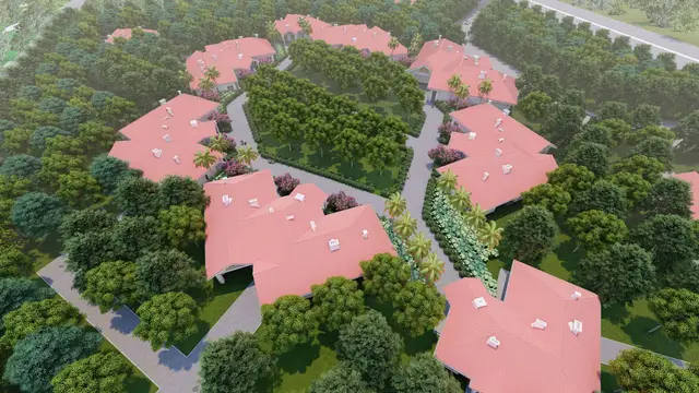
SREE AMBIKA NAGAR is a residential open layout at PANTHANGI, Choutuppal Mandal, Yadadri Bhuvanagiri District. The registered promoter is SRI TIRUMALA ESTATES, a partnership. The registered site extent is 37428.21 sq. m, and the project offers residential plots; the supplied record does not state a confirmed plot count or plot-size range, and towers and floors are not applicable to the recorded open-plot layout. The project is registered under TG-RERA number P02000006999, and the promoter’s Form B declaration states a proposed completion date of 28/04/2026.
More from Sri Tirumala Estates · 3 projects →
01What we found
Read from TG-RERA filings, approvals, land and registration records and court records. A court case is counted only when the court record states this project's survey number with its village, or names the project.
02Check before you pay
8 items to check before you pay, 3 high - from the title chain, court records and approvals, each with what to ask the builder or your advocate. An item may not be a problem with the project: records can be incomplete.
1. Project at a glance
Project identity
| Item | Record |
|---|---|
| Registered project name | SREE AMBIKA NAGAR RERA record |
| Project type | Plotted development / residential open layout RERA record RERA filing |
| Phase or registered portion | Not separately identified as a phase; the registration identifies the project land as Survey No. 612/PART |
| TG-RERA registration number | P02000006999 |
| Registration validity | Certificate states 20/09/2023 to 28/04/2026; this is registration validity, not a statement of project completion or occupancy certification |
| Registered promoter | SRI TIRUMALA ESTATES, a partnership RERA filing Corporate record |
| RERA status in supplied record | Registered; the certificate’s stated validity ended 28/04/2026. No extension document is supplied |
Land and geographic identity
| Item | Record |
|---|---|
| Locality / revenue village | PANTHANGI RERA record RERA filing |
| Mandal | Choutuppal RERA record |
| District | Yadadri Bhuvanagiri RERA record |
| PIN | 508252 RERA record |
| Project survey number(s) / subdivision(s) | 612/PART; the approval documents also describe it as 612 PART or 612/Part Land records |
| Registered site extent | 37428.21 sq. m RERA filing |
| Net / total area in the layout approval | Total site area 37428.21 sq. m; net site area 37428.21 sq. m |
| Land affected / net area in RERA fields | Area affected in road widening/FTL of tanks/nala widening: 11227.87 sq. m; net area: 26200.34 sq. m RERA filing |
| Boundaries | East, west, north and south are each stated as OTHERS LAND RERA filing |
Development identity
| Item | Record |
|---|---|
| Sanctioning authority | Hyderabad Metropolitan Development Authority (HMDA) Approvals record |
| Principal layout approval | 000087/LO/Plg/HMDA/2023, dated 28 April, 2023; application 050769/GHT/LT/U6/HMDA/04122021 Approvals record |
| Development form | Residential open layout / plotted layout |
| Approved area figure | The layout document gives Approved Built up Area (In Sqmts) 26200.34 in the RERA fields; the HMDA layout drawing separately records total/net site area and land-use areas. No building-floor configuration is supplied for this plotted layout RERA filing |
| Plot count | The layout drawing’s plot numbers are read by software as 1 to 99; this is a drawing-derived count and should be checked against the approved drawing. Other document extractions contain different or unclear plot-count readings, so no single count can be confirmed from the supplied records Layout record |
| Towers / floors | Not applicable to the recorded open-plot layout; no tower or floor schedule is supplied |
| Layout roads | HMDA draft-layout record identifies layout road area 11227.87 sq. m (30.00 %) |
Offering and status
| Item | Record |
|---|---|
| Registered offering | Residential plots in an open layout |
| RERA-filed plot count / plot-size range | Not disclosed in the supplied structured RERA fields; individual plot sizes are not available RERA filing Layout record |
| Booked / available plots | Not supplied RERA filing |
| Construction / development stage | No independently verified site-progress record is supplied. The HMDA document is a draft layout approval and requires layout works to be completed |
| Completion deadline | Promoter’s Form B declaration states 28/04/2026 |
| Occupancy / completion certificate | No project completion or occupancy certificate is supplied. This is a plotted-layout project; the supplied records do not establish that the layout works or final layout release are complete Document index |
2. The project story
SREE AMBIKA NAGAR is registered as a residential plotted development at Panthangi, in Choutuppal Mandal, Yadadri Bhuvanagiri District. Its registered land reference is Survey No. 612/PART, with a site extent of 37428.21 sq. m in the RERA land details and HMDA layout record. The layout drawing describes an open layout rather than apartment blocks or villas. RERA record Land records
The HMDA record identifies a draft layout approval dated 28 April, 2023 and requires layout-development works, including infrastructure, before final layout release. It also records that roads, open space and social-infrastructure land are to be handed over to the local body by registered gift deed before release of final layout plans. The available material does not establish completion of those works, final layout release, plot bookings, or site progress; no independent construction-stage verification is supplied.
The promoter’s Form B declaration undertakes completion by 28/04/2026. That declared deadline is distinct from the registration certificate’s stated validity through 28/04/2026 and from any completion or occupancy certificate; no such certificate is in the supplied record.
3. Master plan, architecture & building design
The HMDA drawing describes a residential open layout on 37428.21 sq. m, with total and net site area both stated as 37428.21 sq. m. Its land-use statement records 22023.15 sq. m as plotted area, 11227.87 sq. m as road area, 3227.13 sq. m as organized open space/park/utility area, and 950.06 sq. m as social-infrastructure area. These are drawing/approval-record figures, not measurements of an individual plot.
The RERA land details separately state an affected area of 11227.87 sq. m and net area of 26200.34 sq. m. The supplied evidence does not explain the relationship between that RERA net-area figure and the HMDA drawing’s total/net site area, so they are presented separately here. RERA filing
No apartment or villa building arrangement, floors, building footprint, lifts, stairs or building parking levels are evidenced. The layout drawing is software-read as showing plots numbered 1 to 99, but the extraction is incomplete and plot dimensions are not available; the count should therefore be verified against the stamped drawing. Layout record
4. Homes, configurations & floor plans
The registered project is a plotted layout, not an apartment or villa scheme. The supplied RERA record does not provide plot-size bands, booking counts or availability figures. RERA filing Layout record
The available layout drawing was not processed into individual plot measurements: the extraction reports 99 plot numbers read from the drawing, 0 plots with sizes, and incomplete plot coverage. No plot-size range or plot-by-plot area can therefore be stated. Layout record
The vendor record lists a plot offering with “built-up 1,615 - 3,187 sq ft,” but this is a third-party listing, not a RERA-filed plot-area schedule; it is not used here as a verified plot-size range. Promoter website
5. Parking & vehicle circulation
No resident, visitor or accessible parking count, parking allocation schedule, or vehicle-entry/exit arrangement is supplied for the plotted layout. Document index Layout record
The HMDA record identifies layout roads of 11227.87 sq. m (30.00 %) and specifies road widths in the approval material, including 18 mts and 60 feet and above in one extraction. The drawing-derived road widths and detailed circulation geometry should be checked against the approved plan; the supplied record does not establish parking rights for any individual plot.
6. Amenities, recreation & open spaces
| Facility | Description / size | Evidence source | Declared progress / verified status |
|---|---|---|---|
| Layout roads | 11227.87 sq. m (30.00 %) | HMDA draft-layout record | Required for the layout; completion and handover are not verified |
| Park / organized open space | 3227.13 sq. m (8.62 %) | HMDA draft-layout record | Required to be developed and handed over; completion is not verified |
| Social infrastructure | 950.06 sq. m (2.54 %) | HMDA draft-layout record | Required to be handed over to the local body; completion is not verified |
| Amenity area | 0 in the HMDA land-use extraction | HMDA draft-layout record | No separate amenity-area allocation is recorded in this extraction |
| Community buildings | Listed as an RERA amenity category; no size or facility detail supplied | RERA amenities RERA amenities | RERA amenity progress field shows 0; no independent completion verification |
| Park / green strip / play area | Listed as “Green Strip/TOT LOT/Park”; no additional size detail supplied | RERA amenities RERA amenities | RERA amenity progress field shows 0; no independent completion verification |
7. Utilities, building services & safety
The HMDA draft-layout material lists storm-water drainage, underground drainage lines, a common septic tank/STP, internal water-supply pipelines, an overhead tank, street lights, a transformer, avenue plantation, park development, rainwater-harvesting pits and a transformer yard as layout infrastructure or requirements. It also specifies a mechanism for septage treatment for layouts under 10 acres, underground storm-water drainage, and LED street lighting. These are approval-recorded requirements or listed provisions; the supplied evidence does not verify their installation, capacity or operational status.
The RERA amenity record also lists water supply, sewerage, storm-water drains, street lighting, sewage and sullage treatment, solid-waste management, water conservation/rainwater harvesting, energy management, fire protection and electrical meter/sub-station/receiving facilities. Each supplied progress value is 0. No capacities, water source, treatment details, backup-power specification, fire-system design or accessibility details are provided. RERA amenities
8. Location, access & connectivity
The registered location is PANTHANGI, Choutuppal Mandal, Yadadri Bhuvanagiri District, PIN 508252; the project parcel is identified as Survey No. 612/PART. RERA record
The supplied parcel-centroid geocode is 17.23252, 78.96707. The nearest sampled Outer Ring Road interchange is recorded at approximately 38.1 km; this is a sampled distance, not a travel-time estimate. No other approach-road, public-transport or landmark details are supplied. Location record
9. Developer & development status
The registered promoter is SRI TIRUMALA ESTATES, recorded as a partnership. Its GSTIN is 36ADPFS8824A1ZU. The RERA project fields identify NOMULA KRISHNA as authorized signatory and NOMULA INDRANI as partner. RERA filing Corporate record Parties record
The RERA record gives a promoter address in Panthangi, Choutuppal, Yadadri Bhuvanagiri, PIN 508252. The registration certificate’s promoter-office field instead states “Village: Mandal: District: Hyderabad, Pin: 500036”; the supplied certificate does not provide completed village, mandal or district values in that field. No official phone, email or promoter website is supplied. Parties record
The promoter’s Form B declaration states a completion undertaking of 28/04/2026. The supplied evidence does not include a dated progress report or independent verification of development works, final layout release, or completion certification. Document index
10. Approvals, official records & documents
| Supplied details | SREE AMBIKA NAGAR; P02000006999; certificate issued 20/09/2023, valid through 28/04/2026 |
|---|
| Supplied details | Draft residential open-layout approval 000087/LO/Plg/HMDA/2023, dated 28 April, 2023; application 050769/GHT/LT/U6/HMDA/04122021 |
|---|
| Supplied details | Draft layout plan for Survey No. 612/PART; drawing land-use statement and conditional mortgage reference for plots 01-22 & 44 |
|---|
| Supplied details | Form B affidavit dated 12/09/2023, declaring project completion by 28/04/2026 |
|---|
| Supplied details | Document headed Office of the Grama Panchayath, Panthangi, dated 14/09/2023, referring to Sy.No. 611; the supplied OCR does not establish the approval type or terms for this project |
|---|
| Supplied details | A separate HMDA drawing extraction has unclear approval identifiers and incomplete land-use readings; it is not relied on for project particulars here |
|---|
| Supplied details | Not supplied |
|---|---|
| Evidence | Document index |
The HMDA record describes the layout permission as a draft approval and states that it is not proof of land title. It also records development and handover requirements before final layout release; whether those requirements have been completed is not established by the supplied documents.
1. Project at a glance
Project identity
Registered project name: SREE AMBIKA NAGAR
Project type: Plotted development / residential open layout
Phase or registered portion: Not separately identified as a phase; the registration identifies the project land as Survey No. 612/PART
TG-RERA registration number: P02000006999
Registration validity: Certificate states 20/09/2023 to 28/04/2026; this is registration validity, not a statement of project completion or occupancy certification
Registered promoter: SRI TIRUMALA ESTATES, a partnership
RERA status in supplied record: Registered; the certificate’s stated validity ended 28/04/2026. No extension document is supplied
Land and geographic identity
Locality / revenue village: PANTHANGI
Mandal: Choutuppal
District: Yadadri Bhuvanagiri
PIN: 508252
Project survey number(s) / subdivision(s): 612/PART; the approval documents also describe it as 612 PART or 612/Part
Registered site extent: 37428.21 sq. m
Net / total area in the layout approval: Total site area 37428.21 sq. m; net site area 37428.21 sq. m
Land affected / net area in RERA fields: Area affected in road widening/FTL of tanks/nala widening: 11227.87 sq. m; net area: 26200.34 sq. m
Boundaries: East, west, north and south are each stated as OTHERS LAND
Development identity
Sanctioning authority: Hyderabad Metropolitan Development Authority (HMDA)
Principal layout approval: 000087/LO/Plg/HMDA/2023, dated 28 April, 2023; application 050769/GHT/LT/U6/HMDA/04122021
Development form: Residential open layout / plotted layout
Approved area figure: The layout document gives Approved Built up Area (In Sqmts) 26200.34 in the RERA fields; the HMDA layout drawing separately records total/net site area and land-use areas. No building-floor configuration is supplied for this plotted layout
Plot count: The layout drawing’s plot numbers are read by software as 1 to 99; this is a drawing-derived count and should be checked against the approved drawing. Other document extractions contain different or unclear plot-count readings, so no single count can be confirmed from the supplied records
Towers / floors: Not applicable to the recorded open-plot layout; no tower or floor schedule is supplied
Layout roads: HMDA draft-layout record identifies layout road area 11227.87 sq. m (30.00 %)
Offering and status
Registered offering: Residential plots in an open layout
RERA-filed plot count / plot-size range: Not disclosed in the supplied structured RERA fields; individual plot sizes are not available
Booked / available plots: Not supplied
Construction / development stage: No independently verified site-progress record is supplied. The HMDA document is a draft layout approval and requires layout works to be completed
Completion deadline: Promoter’s Form B declaration states 28/04/2026
Occupancy / completion certificate: No project completion or occupancy certificate is supplied. This is a plotted-layout project; the supplied records do not establish that the layout works or final layout release are complete
2. The project story
SREE AMBIKA NAGAR is registered as a residential plotted development at Panthangi, in Choutuppal Mandal, Yadadri Bhuvanagiri District. Its registered land reference is Survey No. 612/PART, with a site extent of 37428.21 sq. m in the RERA land details and HMDA layout record. The layout drawing describes an open layout rather than apartment blocks or villas.
The HMDA record identifies a draft layout approval dated 28 April, 2023 and requires layout-development works, including infrastructure, before final layout release. It also records that roads, open space and social-infrastructure land are to be handed over to the local body by registered gift deed before release of final layout plans. The available material does not establish completion of those works, final layout release, plot bookings, or site progress; no independent construction-stage verification is supplied.
The promoter’s Form B declaration undertakes completion by 28/04/2026. That declared deadline is distinct from the registration certificate’s stated validity through 28/04/2026 and from any completion or occupancy certificate; no such certificate is in the supplied record.
3. Master plan, architecture & building design
The HMDA drawing describes a residential open layout on 37428.21 sq. m, with total and net site area both stated as 37428.21 sq. m. Its land-use statement records 22023.15 sq. m as plotted area, 11227.87 sq. m as road area, 3227.13 sq. m as organized open space/park/utility area, and 950.06 sq. m as social-infrastructure area. These are drawing/approval-record figures, not measurements of an individual plot.
The RERA land details separately state an affected area of 11227.87 sq. m and net area of 26200.34 sq. m. The supplied evidence does not explain the relationship between that RERA net-area figure and the HMDA drawing’s total/net site area, so they are presented separately here.
No apartment or villa building arrangement, floors, building footprint, lifts, stairs or building parking levels are evidenced. The layout drawing is software-read as showing plots numbered 1 to 99, but the extraction is incomplete and plot dimensions are not available; the count should therefore be verified against the stamped drawing.
4. Homes, configurations & floor plans
The registered project is a plotted layout, not an apartment or villa scheme. The supplied RERA record does not provide plot-size bands, booking counts or availability figures.
The available layout drawing was not processed into individual plot measurements: the extraction reports 99 plot numbers read from the drawing, 0 plots with sizes, and incomplete plot coverage. No plot-size range or plot-by-plot area can therefore be stated.
The vendor record lists a plot offering with “built-up 1,615 - 3,187 sq ft,” but this is a third-party listing, not a RERA-filed plot-area schedule; it is not used here as a verified plot-size range.
5. Parking & vehicle circulation
No resident, visitor or accessible parking count, parking allocation schedule, or vehicle-entry/exit arrangement is supplied for the plotted layout.
The HMDA record identifies layout roads of 11227.87 sq. m (30.00 %) and specifies road widths in the approval material, including 18 mts and 60 feet and above in one extraction. The drawing-derived road widths and detailed circulation geometry should be checked against the approved plan; the supplied record does not establish parking rights for any individual plot.
6. Amenities, recreation & open spaces
| Facility | Description / size | Evidence source | Declared progress / verified status |
|---|---|---|---|
| Layout roads | 11227.87 sq. m (30.00 %) | HMDA draft-layout record | Required for the layout; completion and handover are not verified |
| Park / organized open space | 3227.13 sq. m (8.62 %) | HMDA draft-layout record | Required to be developed and handed over; completion is not verified |
| Social infrastructure | 950.06 sq. m (2.54 %) | HMDA draft-layout record | Required to be handed over to the local body; completion is not verified |
| Amenity area | 0 in the HMDA land-use extraction | HMDA draft-layout record | No separate amenity-area allocation is recorded in this extraction |
| Community buildings | Listed as an RERA amenity category; no size or facility detail supplied | RERA amenities | RERA amenity progress field shows 0; no independent completion verification |
| Park / green strip / play area | Listed as “Green Strip/TOT LOT/Park”; no additional size detail supplied | RERA amenities | RERA amenity progress field shows 0; no independent completion verification |
7. Utilities, building services & safety
The HMDA draft-layout material lists storm-water drainage, underground drainage lines, a common septic tank/STP, internal water-supply pipelines, an overhead tank, street lights, a transformer, avenue plantation, park development, rainwater-harvesting pits and a transformer yard as layout infrastructure or requirements. It also specifies a mechanism for septage treatment for layouts under 10 acres, underground storm-water drainage, and LED street lighting. These are approval-recorded requirements or listed provisions; the supplied evidence does not verify their installation, capacity or operational status.
The RERA amenity record also lists water supply, sewerage, storm-water drains, street lighting, sewage and sullage treatment, solid-waste management, water conservation/rainwater harvesting, energy management, fire protection and electrical meter/sub-station/receiving facilities. Each supplied progress value is 0. No capacities, water source, treatment details, backup-power specification, fire-system design or accessibility details are provided.
8. Location, access & connectivity
The registered location is PANTHANGI, Choutuppal Mandal, Yadadri Bhuvanagiri District, PIN 508252; the project parcel is identified as Survey No. 612/PART.
The supplied parcel-centroid geocode is 17.23252, 78.96707. The nearest sampled Outer Ring Road interchange is recorded at approximately 38.1 km; this is a sampled distance, not a travel-time estimate. No other approach-road, public-transport or landmark details are supplied.
9. Developer & development status
The registered promoter is SRI TIRUMALA ESTATES, recorded as a partnership. Its GSTIN is 36ADPFS8824A1ZU. The RERA project fields identify NOMULA KRISHNA as authorized signatory and NOMULA INDRANI as partner.
The RERA record gives a promoter address in Panthangi, Choutuppal, Yadadri Bhuvanagiri, PIN 508252. The registration certificate’s promoter-office field instead states “Village: Mandal: District: Hyderabad, Pin: 500036”; the supplied certificate does not provide completed village, mandal or district values in that field. No official phone, email or promoter website is supplied.
The promoter’s Form B declaration states a completion undertaking of 28/04/2026. The supplied evidence does not include a dated progress report or independent verification of development works, final layout release, or completion certification.
10. Approvals, official records & documents
| Supplied details | SREE AMBIKA NAGAR; P02000006999; certificate issued 20/09/2023, valid through 28/04/2026 |
|---|
| Supplied details | Draft residential open-layout approval 000087/LO/Plg/HMDA/2023, dated 28 April, 2023; application 050769/GHT/LT/U6/HMDA/04122021 |
|---|
| Supplied details | Draft layout plan for Survey No. 612/PART; drawing land-use statement and conditional mortgage reference for plots 01-22 & 44 |
|---|
| Supplied details | Form B affidavit dated 12/09/2023, declaring project completion by 28/04/2026 |
|---|
| Supplied details | Document headed Office of the Grama Panchayath, Panthangi, dated 14/09/2023, referring to Sy.No. 611; the supplied OCR does not establish the approval type or terms for this project |
|---|
| Supplied details | A separate HMDA drawing extraction has unclear approval identifiers and incomplete land-use readings; it is not relied on for project particulars here |
|---|
| Supplied details | Not supplied |
|---|
The HMDA record describes the layout permission as a draft approval and states that it is not proof of land title. It also records development and handover requirements before final layout release; whether those requirements have been completed is not established by the supplied documents.
Frequently asked questions
Is SREE AMBIKA NAGAR registered with Telangana RERA?
Yes. SREE AMBIKA NAGAR is registered with the Telangana Real Estate Regulatory Authority as P02000006999; the registration status is New Project.
Who is the developer of SREE AMBIKA NAGAR?
The promoter named in the RERA registration is SRI TIRUMALA ESTATES.
Where is SREE AMBIKA NAGAR located?
SREE AMBIKA NAGAR is in PANTHANGI, Choutuppal, Yadadri Bhuvanagiri, Telangana (508252).
When will SREE AMBIKA NAGAR be completed?
The promoter's proposed date of completion filed with RERA is 30/11/2026. This is the promoter's declaration, not a guarantee.
More projects in Panthangi