D3 Layout
USM INFRASTRUCTURES PRIVATE LIMITED · Jangaon · RERA P00600010183
D3 Layout is a plotted development in Pachannapet locality, Pochannapet revenue village, Bachannapet mandal, Jangaon district. The registered promoter is USM INFRASTRUCTURES PRIVATE LIMITED. The RERA filing states a total area of 180591 sqmts and a net area of 175930.00 sqmts; the supplied records do not establish the number of plots or their size configurations. Registered with TG-RERA under P00600010183, the project has a promoter-declared completion date on or before 11 June 2027.
More from Usm Infrastructures Pvt Ltd · 6 projects →
01What we found
Read from TG-RERA filings, approvals, land and registration records and court records. A court case is counted only when the court record states this project's survey number with its village, or names the project.
02Check before you pay
7 items to check before you pay, 4 high - from the title chain, court records and approvals, each with what to ask the builder or your advocate. An item may not be a problem with the project: records can be incomplete.
Project at a glance
Project identity
| Item | Record |
|---|---|
| Registered project name | D3 Layout RERA record |
| Project type / phase | Plotted development; the registration identifies the project as D3 Layout. A separate phase designation is not disclosed. RERA record |
| TG-RERA registration number | P00600010183 RERA record |
| Registration validity | 11 June 2025 to 11 June 2027. This is the registration-validity period, not a statement of the project’s completion date. Approvals record |
| Registered promoter | USM INFRASTRUCTURES PRIVATE LIMITED RERA record |
| RERA status | The supplied Form C records the project as registered. |
Land and geographic identity
| Item | Record |
|---|---|
| Locality / revenue village | Pachannapet locality; Pochannapet revenue village. RERA record RERA filing |
| Mandal / district / PIN | Bachannapet mandal; Jangaon district; 506167. RERA record |
| Project survey numbers as registered | 1032/P, 1033/P, 1034/P, 1035/P, 1037/P, 1038/P, 1051/P. RERA record Land records |
| Total / net land area | RERA filing states total area 180591 sqmts, affected area 4661 sqmts, and net area 175930.00 sqmts. RERA filing Land records |
| Boundaries | East, west, north and south: “Neighbour Land.” RERA filing |
| PIN-code address in the registration certificate | Pochannapet, Bachannapet, Jangaon, 506167. |
Development identity
| Item | Record |
|---|---|
| Sanctioning authority / principal plan reference | DTCPO Jangaon; reference 13804/1110/2025/W, dated 28-05-2025. The plan identifies T.L.P. NO. 58/2025/W. Approvals record |
| RERA-filed plan reference | 13804/1110/2025/W. RERA record Approvals record |
| Development form | Plotted layout; building count, building floors, parking levels and approved built-up area are not established in the supplied layout records. RERA record |
| Layout drawing figures | The supplied plan extraction labels total layout area as Ac:44,625 CENT.S., 215985.00 SQ.YDS and net layout area as A.C:O.437/50CENTS.. ZIOAOE9SQYD'S.; the latter is visibly difficult to read in the extraction. These are drawing-extracted labels, not a substitute for the RERA land figures above. |
| Facilities/land uses shown in layout material | The plan material identifies park/open space, roads, mortgage area, a tank buffer and H.T. line area; the village-map extraction also lists primary school, nursery school and convenient shops. |
Offering and status
| Item | Record |
|---|---|
| What is offered | Plots; RERA-filed plot count and plot-size schedule are not established by the supplied extracted records. RERA record |
| Construction / development stage | The RERA filing identifies the project as a new project. No independently verified site-progress assessment is supplied. RERA record |
| Promoter-declared completion | The Form B declaration states completion within two years, on or before 11 June 2027. This is a promoter declaration; it is separate from registration validity. |
| Occupancy / completion certificate | No occupancy certificate or completion certificate is supplied. The project is a plotted layout; the supplied material does not establish an OC status or its scope. Document index |
| Booked / available plots | Not disclosed in the supplied structured records. Document index |
The project story
D3 Layout is a plotted development registered with TG-RERA under P00600010183. Its registered location is Pochannapet village, Bachannapet mandal, Jangaon district, PIN 506167, and its registered survey identifiers are 1032/P, 1033/P, 1034/P, 1035/P, 1037/P, 1038/P and 1051/P. RERA record
The filed plan material presents a residential plot layout with internal roads and areas marked for open space/parks, mortgage, a tank buffer and an H.T. line. It also identifies school and convenient-shop land uses in the village-map extraction. The materials supplied do not establish the number or size range of plots, plot-by-plot availability, completed works, or independently verified construction progress. Document index
The promoter’s Form B states that the project will be completed on or before 11 June 2027. This is a declared target, not independent confirmation of progress or completion. Registration is recorded as valid through 11 June 2027; that validity and the completion undertaking are distinct dates with distinct meanings.
Master plan, architecture & building design
The supplied plan is for a plotted layout, not a residential building plan with apartment floors. The RERA-filed land figures are 180591 sqmts total, 4661 sqmts affected and 175930.00 sqmts net. RERA filing Land records
The plan extraction identifies the layout as T.L.P. NO. 58/2025/W, with DTCPO Jangaon reference 13804/1110/2025/W dated 28-05-2025. It labels total layout area as Ac:44,625 CENT.S., 215985.00 SQ.YDS and lists land uses including roads, park/open space, mortgage area, tank buffer and H.T. line area. The extracted values for some components are visibly corrupted or difficult to read; no corrected measurements are inferred here.
The village-map extraction also labels primary school, nursery school and convenient shops, and depicts proposed roads. It lists a 10% open-space figure, but the supplied extraction does not allow all associated area figures to be read consistently; the figure is reported as a drawing label, not independently validated. The plan materials state that specified plots cannot receive building permission until the L.T. electrical line is shifted along the proposed roads.
No reliable extracted schedule establishes plot count, plot dimensions, building footprint, apartment configuration, approved built-up area, or building/floor arrangement. The layout plan also states that its legal validity depends on release/approval by the concerned Gram Panchayat.
Homes, configurations & floor plans
This is a plotted development. The supplied RERA records do not provide a usable plot count, plot-size bands, plot-wise booked/available inventory, or a plot schedule suitable for a configuration table. RERA record Document index
The promoter’s website/vendor data describes a “120 Sq Yards plot,” but this is a promoter-marketed claim rather than a RERA-filed plot-size schedule. Promoter website
No measured carpet-area or room-dimension analysis is available: the two drawings noted in the evidence are scans pending measurement, and the project is plotted rather than an apartment offering. Floor plans
Parking & vehicle circulation
The supplied plan records road widths of 39'-o', 48"-o', and existing roads of 33’-WIDEROAD, 23’-WIDEROAD and 30’-WIDEROAD. A separate village-map extraction labels a proposed road as 33-0" WIDE. These are plan-extracted labels; the supplied material does not provide a legible, consolidated road schedule.
The project records do not establish car or two-wheeler parking counts, visitor or accessible parking, parking levels, EV charging, or plot-specific parking allocation. The plan identifies a mortgage area, which is distinct from an allottee’s exclusive parking entitlement. Document index
Amenities, recreation & open spaces
The layout material labels open-space/park areas, roads and school/shop land uses. The extracted plan also names primary school, nursery school and convenient shops; it does not establish their construction, delivery or operational status.
| Description / size | Plan labels include “SITE RESERVED FOR OPEN SPACE (PARK)” and a village-map extraction showing 10%; associated extracted area figures are not reliably legible. |
|---|---|
| Evidence source | RERA-filed plan extraction |
| Declared progress / verified status | Shown in layout material; completion not established. |
| Description / size | Listed as a layout land use; area labels differ in legibility across extracted plan material. |
|---|---|
| Evidence source | RERA-filed plan extraction |
| Declared progress / verified status | Shown/listed; completion not established. |
| Description / size | Listed as a layout land use; area labels are not reliably legible in the supplied extraction. |
|---|---|
| Evidence source | RERA-filed plan extraction |
| Declared progress / verified status | Shown/listed; completion not established. |
| Description / size | Listed in the village-map extraction; area figure is not reliably legible. |
|---|---|
| Evidence source | RERA-filed plan extraction |
| Declared progress / verified status | Shown/listed; completion not established. |
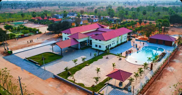
The vendor lists recreational and resort-style features, but the supplied evidence does not establish those as RERA-filed or delivered D3 Layout facilities; they are therefore not represented as project amenities in this section. Promoter website
Utilities, building services & safety
The RERA amenities record lists internal roads and footpaths, water supply, sewerage, storm-water drains, street lighting, green strip/park, community buildings, sewage and sullage treatment/disposal, solid-waste management, water conservation/rainwater harvesting, energy management, fire protection and safety requirements, electrical meter room/sub-station/receiving station, and recreational open space. The record shows 0% progress for the listed items; it does not independently verify that any are complete. RERA amenities
The layout drawing separately identifies an H.T. line area and states that specified plots cannot receive building permission until an L.T. electrical line is shifted along proposed roads. No capacities, engineering specifications, completion certificates, or operational verification for water, drainage, electrical, fire-safety, waste, accessibility or security systems are supplied.
Location, access & connectivity
The official revenue location is Pochannapet village, Bachannapet mandal, Jangaon district, Telangana, PIN 506167; the RERA filing also identifies Pachannapet as the locality. RERA record
The location record provides a cadastral parcel-centroid coordinate of 17.76962, 79.01132 and lists the nearest sampled Outer Ring Road interchange at approximately 50.0 km. This is a supplied mapped distance, not a travel-time estimate. No verified public-transport or local approach-road schedule is supplied. Location record
Developer & development status
The registered legal promoter is USM INFRASTRUCTURES PRIVATE LIMITED, identified as a company. Its RERA filing lists GSTIN 36AABCU1954F2ZE. The supplied incorporation certificate records a change of name from E2 INFRASTRUCTURES PRIVATE LIMITED to USM INFRASTRUCTURES PRIVATE LIMITED; it gives Corporate Identity Number 45209AP2010PTC067791 and also prints U45209AP2010PTC067791. RERA record Corporate record
The registration certificate names Srinivasa Rao Kondayyagari as representing the promoter. A filed board-resolution document records authorization of K. Srinivasa Rao for specified registration-related acts. Document index
The RERA filing identifies the project as new. The promoter’s Form B declares completion by 11 June 2027; no independent construction-progress verification or occupancy/completion certificate is included in the supplied evidence. RERA record Document index
Approvals, official records & documents
| Record | What the supplied evidence establishes |
|---|---|
| TG-RERA registration certificate | Form C for D3 Layout, registration P00600010183, promoter USM INFRASTRUCTURES PRIVATE LIMITED; validity from 11/06/2025 to 11/06/2027. |
| Layout plan / sanction reference | Plan identified as T.L.P. NO. 58/2025/W, DTCPO Jangaon reference 13804/1110/2025/W, dated 28-05-2025. The plan states that layout validity depends on release/approval by the concerned Gram Panchayat and includes an electrical-line-shifting condition for specified plots. |
| Extract of village map | Shows a proposed layout, roads and land-use labels including open space, school and convenient shops; it also records a condition concerning shifting the L.T. electrical line before building permission for listed plots. |
| Draft technical layout plan | Identifies residential plots in survey numbers 1032P, 1033P and 1034/P and states that validity depends on Gram Panchayat release approval. |
| Form B declarations | One declaration concerns allotment/agreement/conveyance terms; another identifies the promoter’s title basis, separate-account undertakings, approval obligations and completion undertaking. |
| Company name-change certificate | Registrar of Companies certificate recording the change from E2 INFRASTRUCTURES PRIVATE LIMITED to USM INFRASTRUCTURES PRIVATE LIMITED. |
| Completion / occupancy certificate | No completion certificate or occupancy certificate is included in the supplied project documents. Document index |
Project at a glance
Project identity
Registered project name: D3 Layout
Project type / phase: Plotted development; the registration identifies the project as D3 Layout. A separate phase designation is not disclosed.
TG-RERA registration number: P00600010183
Registration validity: 11 June 2025 to 11 June 2027. This is the registration-validity period, not a statement of the project’s completion date.
Registered promoter: USM INFRASTRUCTURES PRIVATE LIMITED
RERA status: The supplied Form C records the project as registered.
Land and geographic identity
Locality / revenue village: Pachannapet locality; Pochannapet revenue village.
Mandal / district / PIN: Bachannapet mandal; Jangaon district; 506167.
Project survey numbers as registered: 1032/P, 1033/P, 1034/P, 1035/P, 1037/P, 1038/P, 1051/P.
Total / net land area: RERA filing states total area 180591 sqmts, affected area 4661 sqmts, and net area 175930.00 sqmts.
Boundaries: East, west, north and south: “Neighbour Land.”
PIN-code address in the registration certificate: Pochannapet, Bachannapet, Jangaon, 506167.
Development identity
Sanctioning authority / principal plan reference: DTCPO Jangaon; reference 13804/1110/2025/W, dated 28-05-2025. The plan identifies T.L.P. NO. 58/2025/W.
RERA-filed plan reference: 13804/1110/2025/W.
Development form: Plotted layout; building count, building floors, parking levels and approved built-up area are not established in the supplied layout records.
Layout drawing figures: The supplied plan extraction labels total layout area as Ac:44,625 CENT.S., 215985.00 SQ.YDS and net layout area as A.C:O.437/50CENTS.. ZIOAOE9SQYD'S.; the latter is visibly difficult to read in the extraction. These are drawing-extracted labels, not a substitute for the RERA land figures above.
Facilities/land uses shown in layout material: The plan material identifies park/open space, roads, mortgage area, a tank buffer and H.T. line area; the village-map extraction also lists primary school, nursery school and convenient shops.
Offering and status
What is offered: Plots; RERA-filed plot count and plot-size schedule are not established by the supplied extracted records.
Construction / development stage: The RERA filing identifies the project as a new project. No independently verified site-progress assessment is supplied.
Promoter-declared completion: The Form B declaration states completion within two years, on or before 11 June 2027. This is a promoter declaration; it is separate from registration validity.
Occupancy / completion certificate: No occupancy certificate or completion certificate is supplied. The project is a plotted layout; the supplied material does not establish an OC status or its scope.
Booked / available plots: Not disclosed in the supplied structured records.
The project story
D3 Layout is a plotted development registered with TG-RERA under P00600010183. Its registered location is Pochannapet village, Bachannapet mandal, Jangaon district, PIN 506167, and its registered survey identifiers are 1032/P, 1033/P, 1034/P, 1035/P, 1037/P, 1038/P and 1051/P.
The filed plan material presents a residential plot layout with internal roads and areas marked for open space/parks, mortgage, a tank buffer and an H.T. line. It also identifies school and convenient-shop land uses in the village-map extraction. The materials supplied do not establish the number or size range of plots, plot-by-plot availability, completed works, or independently verified construction progress.
The promoter’s Form B states that the project will be completed on or before 11 June 2027. This is a declared target, not independent confirmation of progress or completion. Registration is recorded as valid through 11 June 2027; that validity and the completion undertaking are distinct dates with distinct meanings.
Master plan, architecture & building design
The supplied plan is for a plotted layout, not a residential building plan with apartment floors. The RERA-filed land figures are 180591 sqmts total, 4661 sqmts affected and 175930.00 sqmts net.
The plan extraction identifies the layout as T.L.P. NO. 58/2025/W, with DTCPO Jangaon reference 13804/1110/2025/W dated 28-05-2025. It labels total layout area as Ac:44,625 CENT.S., 215985.00 SQ.YDS and lists land uses including roads, park/open space, mortgage area, tank buffer and H.T. line area. The extracted values for some components are visibly corrupted or difficult to read; no corrected measurements are inferred here.
The village-map extraction also labels primary school, nursery school and convenient shops, and depicts proposed roads. It lists a 10% open-space figure, but the supplied extraction does not allow all associated area figures to be read consistently; the figure is reported as a drawing label, not independently validated. The plan materials state that specified plots cannot receive building permission until the L.T. electrical line is shifted along the proposed roads.
No reliable extracted schedule establishes plot count, plot dimensions, building footprint, apartment configuration, approved built-up area, or building/floor arrangement. The layout plan also states that its legal validity depends on release/approval by the concerned Gram Panchayat.
Homes, configurations & floor plans
This is a plotted development. The supplied RERA records do not provide a usable plot count, plot-size bands, plot-wise booked/available inventory, or a plot schedule suitable for a configuration table.
The promoter’s website/vendor data describes a “120 Sq Yards plot,” but this is a promoter-marketed claim rather than a RERA-filed plot-size schedule.
No measured carpet-area or room-dimension analysis is available: the two drawings noted in the evidence are scans pending measurement, and the project is plotted rather than an apartment offering.
Parking & vehicle circulation
The supplied plan records road widths of 39'-o', 48"-o', and existing roads of 33’-WIDEROAD, 23’-WIDEROAD and 30’-WIDEROAD. A separate village-map extraction labels a proposed road as 33-0" WIDE. These are plan-extracted labels; the supplied material does not provide a legible, consolidated road schedule.
The project records do not establish car or two-wheeler parking counts, visitor or accessible parking, parking levels, EV charging, or plot-specific parking allocation. The plan identifies a mortgage area, which is distinct from an allottee’s exclusive parking entitlement.
Amenities, recreation & open spaces
The layout material labels open-space/park areas, roads and school/shop land uses. The extracted plan also names primary school, nursery school and convenient shops; it does not establish their construction, delivery or operational status.
| Description / size | Plan labels include “SITE RESERVED FOR OPEN SPACE (PARK)” and a village-map extraction showing 10%; associated extracted area figures are not reliably legible. |
|---|---|
| Evidence source | RERA-filed plan extraction |
| Declared progress / verified status | Shown in layout material; completion not established. |
| Description / size | Listed as a layout land use; area labels differ in legibility across extracted plan material. |
|---|---|
| Evidence source | RERA-filed plan extraction |
| Declared progress / verified status | Shown/listed; completion not established. |
| Description / size | Listed as a layout land use; area labels are not reliably legible in the supplied extraction. |
|---|---|
| Evidence source | RERA-filed plan extraction |
| Declared progress / verified status | Shown/listed; completion not established. |
| Description / size | Listed in the village-map extraction; area figure is not reliably legible. |
|---|---|
| Evidence source | RERA-filed plan extraction |
| Declared progress / verified status | Shown/listed; completion not established. |
The vendor lists recreational and resort-style features, but the supplied evidence does not establish those as RERA-filed or delivered D3 Layout facilities; they are therefore not represented as project amenities in this section.
Utilities, building services & safety
The RERA amenities record lists internal roads and footpaths, water supply, sewerage, storm-water drains, street lighting, green strip/park, community buildings, sewage and sullage treatment/disposal, solid-waste management, water conservation/rainwater harvesting, energy management, fire protection and safety requirements, electrical meter room/sub-station/receiving station, and recreational open space. The record shows 0% progress for the listed items; it does not independently verify that any are complete.
The layout drawing separately identifies an H.T. line area and states that specified plots cannot receive building permission until an L.T. electrical line is shifted along proposed roads. No capacities, engineering specifications, completion certificates, or operational verification for water, drainage, electrical, fire-safety, waste, accessibility or security systems are supplied.
Location, access & connectivity
The official revenue location is Pochannapet village, Bachannapet mandal, Jangaon district, Telangana, PIN 506167; the RERA filing also identifies Pachannapet as the locality.
The location record provides a cadastral parcel-centroid coordinate of 17.76962, 79.01132 and lists the nearest sampled Outer Ring Road interchange at approximately 50.0 km. This is a supplied mapped distance, not a travel-time estimate. No verified public-transport or local approach-road schedule is supplied.
Developer & development status
The registered legal promoter is USM INFRASTRUCTURES PRIVATE LIMITED, identified as a company. Its RERA filing lists GSTIN 36AABCU1954F2ZE. The supplied incorporation certificate records a change of name from E2 INFRASTRUCTURES PRIVATE LIMITED to USM INFRASTRUCTURES PRIVATE LIMITED; it gives Corporate Identity Number 45209AP2010PTC067791 and also prints U45209AP2010PTC067791.
The registration certificate names Srinivasa Rao Kondayyagari as representing the promoter. A filed board-resolution document records authorization of K. Srinivasa Rao for specified registration-related acts.
The RERA filing identifies the project as new. The promoter’s Form B declares completion by 11 June 2027; no independent construction-progress verification or occupancy/completion certificate is included in the supplied evidence.
Approvals, official records & documents
TG-RERA registration certificate: Form C for D3 Layout, registration P00600010183, promoter USM INFRASTRUCTURES PRIVATE LIMITED; validity from 11/06/2025 to 11/06/2027.
Layout plan / sanction reference: Plan identified as T.L.P. NO. 58/2025/W, DTCPO Jangaon reference 13804/1110/2025/W, dated 28-05-2025. The plan states that layout validity depends on release/approval by the concerned Gram Panchayat and includes an electrical-line-shifting condition for specified plots.
Extract of village map: Shows a proposed layout, roads and land-use labels including open space, school and convenient shops; it also records a condition concerning shifting the L.T. electrical line before building permission for listed plots.
Draft technical layout plan: Identifies residential plots in survey numbers 1032P, 1033P and 1034/P and states that validity depends on Gram Panchayat release approval.
Form B declarations: One declaration concerns allotment/agreement/conveyance terms; another identifies the promoter’s title basis, separate-account undertakings, approval obligations and completion undertaking.
Company name-change certificate: Registrar of Companies certificate recording the change from E2 INFRASTRUCTURES PRIVATE LIMITED to USM INFRASTRUCTURES PRIVATE LIMITED.
Completion / occupancy certificate: No completion certificate or occupancy certificate is included in the supplied project documents.
Frequently asked questions
Is D3 Layout registered with Telangana RERA?
Yes. D3 Layout is registered with the Telangana Real Estate Regulatory Authority as P00600010183; the registration status is New Project.
Who is the developer of D3 Layout?
The promoter named in the RERA registration is USM INFRASTRUCTURES PRIVATE LIMITED.
Where is D3 Layout located?
D3 Layout is in Pachannapet, Pochannapet, Bachannapet, Jangaon, Telangana (506167).
When will D3 Layout be completed?
The promoter's proposed date of completion filed with RERA is 11/10/2027. This is the promoter's declaration, not a guarantee.
More projects in Bachannapet