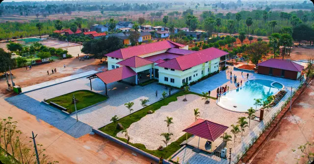
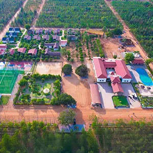
Sri Ramachandra Enclave
VALLALA · Jangaon · RERA P00600007753
SRI RAMACHANDRA ENCLAVE is a plotted development in Bachannapet, Bachannapet Mandal, Jangaon District. The project record identifies VALLALA as the registered promoter, and the registration certificate names Vallala Vikram as promoter. The registered site extent is 12,741.53 sq. m, and the approved layout has 36 plots; plot configurations and building floors are not disclosed in the supplied record. Its TG-RERA registration is P00600007753, and its proposed completion is 21/11/2024.
01What we found
Read from TG-RERA filings, approvals, land and registration records and court records. A court case is counted only when the court record states this project's survey number with its village, or names the project.
02Check before you pay
7 items to check before you pay, 5 high - from the title chain, court records and approvals, each with what to ask the builder or your advocate. An item may not be a problem with the project: records can be incomplete.
1. Project at a glance
Project identity
| Field | Project record |
|---|---|
| Registered project name | SRI RAMACHANDRA ENCLAVE RERA record |
| Project type | Plotted development RERA record RERA filing |
| Registered phase/portion | Not separately identified in the supplied record; the registration is for the project, with no phase name disclosed RERA record |
| TG-RERA registration | P00600007753 RERA record |
| Registration validity | 27 February 2024–21 November 2024, unless extended by the Authority; evidence of an extension is not supplied RERA record |
| Registered promoter | VALLALA in the project record; the registration certificate names Vallala Vikram as promoter RERA record |
| RERA status | The certificate records registration. The stated registration period has ended; current extension or registration status is not established by the supplied evidence RERA record |
Land and geographic identity
| Field | Project record |
|---|---|
| Locality / revenue village | Bachannapet (also rendered “Bachannapeta” in the supplied land-record extract); one revenue village is identified RERA record Land records |
| Mandal / district | Bachannapet Mandal, Jangaon District RERA record Land records |
| PIN | 506221 RERA record |
| Project survey numbers and subdivisions | 580/B/1/3, 580/B/1/1, 580/A2/A, 580/A/1/A and 580/A RERA record Land records |
| Registered site extent | 12,741.53 sq. m RERA filing |
| Total / net area | Total area: 12,741.53 sq. m; net area: 12,741.53 sq. m RERA filing |
| Boundaries | East: land of others; West: open land of others; North: open land of others; South: 100-wide road RERA filing |
Development identity
| Field | Project record |
|---|---|
| Sanctioning authority | Regional Deputy Director of Town and Country Planning, Warangal; layout proceedings also identify Bachannapet Gram Panchayat Approvals record |
| Principal layout approval | Technical Layout Pattern TLP No.02/2024/WRO, dated 21-04-2024 Approvals record |
| Earlier layout record | Draft-TLP No. 41/2021/WRO/W, with later extension/renewal proceedings dated 23/01/2024; these are distinct from the TLP No.02/2024/WRO approval Approvals record |
| Layout scale | 36 plots |
| Approved built-up area | 7,392.20 sq. m is recorded in the project fields; its specific application to plot buildings or a common structure is not explained in the supplied material RERA filing |
| Buildings, floors and parking levels | Building count, floor configuration and parking levels are not disclosed in the supplied project record. The layout approval is for plots, not a supplied building-floor plan Approvals record |
| Plot land-use figures in the approved layout | Plotted area: 8,841.00 Sq. Yards (58.03%); road area: 4,857.75 Sq. Yards (31.87%); open space: 1,540.00 Sq. Yards (10.10%) |
Offering and status
| Field | Project record |
|---|---|
| Offering | 36-plot layout; individual plot sizes and plot-wise availability are not established in the supplied material |
| RERA booked / available counts | Not disclosed in the supplied evidence RERA record |
| Construction / development stage | No independent site-progress record is supplied. The RERA certificate’s validity period has ended; current project completion status is not established |
| Completion date | The project header records proposed completion as 21/11/2024. Form B’s completion-period field is blank; no revised completion date is supplied RERA record |
| Occupancy / completion certificate | No occupancy or completion certificate is identified in the supplied documents. For a plotted layout, the evidence supplied instead concerns layout approval and infrastructure conditions Document index |
2. The project story
Sri Ramachandra Enclave is registered as a plotted development in Bachannapet, Bachannapet Mandal, Jangaon District. Its registration identifies the land across survey numbers 580/B/1/3, 580/B/1/1, 580/A2/A, 580/A/1/A and 580/A. The approved layout record describes 36 plots, with land designated for plots, roads and open space. RERA record Land records
The layout approval is not a record of completed works. Its conditions refer to infrastructure works—including roads and drains, avenue planting, rainwater-harvesting structures, street lighting, sewerage disposal and protected water supply—and to checks before final layout release. The supplied evidence does not establish which works are complete or independently verify current site conditions.
The project header records proposed completion as 21/11/2024. The supplied material does not establish a revised deadline, current construction progress, or an occupancy/completion certificate. These are separate from the RERA registration validity, which the certificate states ran from 27/02/2024 to 21/11/2024 unless extended. RERA record
3. Master plan, architecture & building design
The supplied approved layout record identifies a 36-plot residential layout in the five project survey numbers. It allocates 8,841.00 Sq. Yards (58.03%) to plotted area, 4,857.75 Sq. Yards (31.87%) to roads and 1,540.00 Sq. Yards (10.10%) to open space. The approval describes proposed 33-foot internal roads and a 100-foot-wide road.
The approval conditions state that building sites are for residential use and specify detached dwellings designed for single-family occupation. The evidence does not provide plot-by-plot dimensions, individual house designs, building footprints, floor configurations or a building arrangement. The recorded approved built-up area is 7,392.20 sq. m, but its scope is not further specified in the supplied fields. RERA filing
The RERA-filed site area is 12,741.53 sq. m. The layout documents also state an area of 15238.75 Sq. Yds.; no conversion or reconciliation is made here. RERA filing
4. Homes, configurations & floor plans
This is a plotted development, so the principal offering in the supplied layout approval is plots rather than a documented apartment-unit schedule. The approved layout lists 36 plots, but the available evidence does not give plot-size bands, plot-wise saleable area, booked/available counts or a RERA plot inventory.
The two supplied floor-plan drawings are scans pending measurement; no software-measured carpet areas or drawing-based room measurements are available. Vendor material lists “2 BHK” and “3 BHK” configurations, but it does not establish these as the RERA-filed offering for this plotted layout. Floor plans Promoter website
5. Parking & vehicle circulation
The supplied layout material does not establish a project-wide parking count, visitor or accessible spaces, parking allocation to individual plots, or parking arrangements for future houses. The approval describes internal roads, including proposed 33-foot roads and a 100-foot-wide road, but does not provide a vehicle-circulation plan, ramps or parking-level details.
Vendor material mentions dedicated bike parking, but no sanctioned count or plot-specific allocation is supplied. A documented parking entitlement for a purchaser cannot be confirmed from this evidence. Promoter website
6. Amenities, recreation & open spaces
| Description / size | 1,540.00 Sq. Yards (10.10%) in the approved layout |
|---|---|
| Declared progress / verified status | Layout allocation is recorded; handover and current condition are not independently verified |
| Description / size | Layout includes 4,857.75 Sq. Yards (31.87%) of road area; proposed road widths include 33 feet and 100 feet |
|---|---|
| Declared progress / verified status | Approval records the layout provision; completion is not independently verified |
| Description / size | RERA amenity record lists “YES” and 100%; the layout separately records open space |
|---|---|
| Evidence source | RERA amenities |
| Declared progress / verified status | RERA-filed amenity status; current delivery is not independently verified |
| Description / size | Required by layout conditions |
|---|---|
| Declared progress / verified status | Approval condition; completion not verified |
| Description / size | Not recorded as provided in the RERA amenity data |
|---|---|
| Evidence source | RERA amenities |
| Declared progress / verified status | No facility or completion evidence supplied |
| Description / size | Security, power backup, sewage treatment plant, waste management, fire safety and CCTV |
|---|---|
| Evidence source | Promoter website |
| Declared progress / verified status | Vendor claims only; not established as sanctioned or delivered project facilities |
7. Utilities, building services & safety
The layout approval conditions call for roads and drains, nala channelization, rainwater-harvesting pits, street lighting and electricity facilities, sewerage disposal, and protected water supply. These are approval-condition descriptions; the supplied evidence does not establish their present completion or capacities.
The RERA amenity record marks water supply, sewerage (chamber, lines, septic tank, STP), storm-water drains, street lighting, rainwater harvesting and an electrical meter room/sub-station/receiving station as available at 100%. It records fire protection and fire-safety requirements, energy management, solid-waste management and sewage/sullage treatment and disposal at 0%. These are filed amenity fields, not independent site verification. RERA amenities
Vendor material additionally lists borewell water supply, power backup, an STP, waste management, fire safety and CCTV; the supplied documents do not establish capacities, approved service designs or installed status for those claims. No lift, accessible-circulation or fire-clearance details are supplied. Promoter website
8. Location, access & connectivity
The registered location is Bachannapet Village, Bachannapet Mandal, Jangaon District, Telangana, PIN 506221. The project land is described as bounded to the south by a 100-wide road; the approved layout record also identifies proposed internal 33-foot roads and a 100-foot-wide road. RERA record RERA filing RERA filing
The supplied location record gives a cadastral parcel centroid of 17.789391994865834, 79.04302155641778 and an approximate distance of 53.9 km to the nearest sampled Outer Ring Road interchange. No public-transport routes, local landmark distances or travel times are supplied. Location record
9. Developer & development status
The project record identifies the promoter as VALLALA; the TG-RERA certificate names Vallala Vikram as promoter. The legal entity type and corporate identifier are not established in the supplied evidence. The certificate lists an address in Ranga Reddy District, while the project record gives a Bachannapet address; the supplied material does not identify an official promoter website or contact details. RERA record Corporate record
Form B is a promoter declaration by Vallala Vikram dated 21-11-2024. Its completion-period field is blank. The project header separately records proposed completion as 21/11/2024; no revised timeline or independently verified progress is supplied. RERA record
10. Approvals, official records & documents
| Identifier / date | P00600007753; 27/02/2024 to 21/11/2024 unless extended |
|---|---|
| What the supplied record establishes | Registration certificate for SRI RAMACHANDRA ENCLAVE, naming Vallala Vikram as promoter |
| Identifier / date | Draft-TLP No. 41/2021/WRO/W; 22-11-2021 |
|---|---|
| What the supplied record establishes | Draft layout record for 36 plots, subject to conditions and later release/final layout steps |
| Identifier / date | TLP No. 41/2021/WRO/W; 23/01/2024; stated validity to 21.11.2024 |
|---|---|
| What the supplied record establishes | Extension/renewal of the draft layout permission |
| Identifier / date | Layout Permit No. 1625/2483/2021/e-Panchayat; proceedings TLP No. 41/2021/WRO/W; 29/12/2023 |
|---|---|
| What the supplied record establishes | Bachannapet Gram Panchayat proceedings recording release of the draft technical layout pattern for 36 plots |
| Identifier / date | TLP No.02/2024/WRO; 21-04-2024; Lr.Roc.No.108/2024WROW |
|---|---|
| What the supplied record establishes | Approved 36-plot technical layout pattern, with land-use schedule and conditions |
| Identifier / date | Rc.Cl 2Sa3 / 2019; recorded date 05.12.20t9 |
|---|---|
| What the supplied record establishes | Conversion permission record for the listed land; the document expressly says it does not confer right, title or ownership |
| Identifier / date | Form B; 21-11-2024 |
|---|---|
| What the supplied record establishes | Promoter-filed declaration; completion-period field is blank |
No occupancy/completion certificate is identified in the supplied documents. The HMDA layout-status lookup is reported as unavailable from the public internet; that access limitation does not establish whether a record exists. Document index HMDA
1. Project at a glance
Project identity
Registered project name: SRI RAMACHANDRA ENCLAVE
Project type: Plotted development
Registered phase/portion: Not separately identified in the supplied record; the registration is for the project, with no phase name disclosed
TG-RERA registration: P00600007753
Registration validity: 27 February 2024–21 November 2024, unless extended by the Authority; evidence of an extension is not supplied
Registered promoter: VALLALA in the project record; the registration certificate names Vallala Vikram as promoter
RERA status: The certificate records registration. The stated registration period has ended; current extension or registration status is not established by the supplied evidence
Land and geographic identity
Locality / revenue village: Bachannapet (also rendered “Bachannapeta” in the supplied land-record extract); one revenue village is identified
Mandal / district: Bachannapet Mandal, Jangaon District
PIN: 506221
Project survey numbers and subdivisions: 580/B/1/3, 580/B/1/1, 580/A2/A, 580/A/1/A and 580/A
Registered site extent: 12,741.53 sq. m
Total / net area: Total area: 12,741.53 sq. m; net area: 12,741.53 sq. m
Boundaries: East: land of others; West: open land of others; North: open land of others; South: 100-wide road
Development identity
Sanctioning authority: Regional Deputy Director of Town and Country Planning, Warangal; layout proceedings also identify Bachannapet Gram Panchayat
Principal layout approval: Technical Layout Pattern TLP No.02/2024/WRO, dated 21-04-2024
Earlier layout record: Draft-TLP No. 41/2021/WRO/W, with later extension/renewal proceedings dated 23/01/2024; these are distinct from the TLP No.02/2024/WRO approval
Layout scale: 36 plots
Approved built-up area: 7,392.20 sq. m is recorded in the project fields; its specific application to plot buildings or a common structure is not explained in the supplied material
Buildings, floors and parking levels: Building count, floor configuration and parking levels are not disclosed in the supplied project record. The layout approval is for plots, not a supplied building-floor plan
Plot land-use figures in the approved layout: Plotted area: 8,841.00 Sq. Yards (58.03%); road area: 4,857.75 Sq. Yards (31.87%); open space: 1,540.00 Sq. Yards (10.10%)
Offering and status
Offering: 36-plot layout; individual plot sizes and plot-wise availability are not established in the supplied material
RERA booked / available counts: Not disclosed in the supplied evidence
Construction / development stage: No independent site-progress record is supplied. The RERA certificate’s validity period has ended; current project completion status is not established
Completion date: The project header records proposed completion as 21/11/2024. Form B’s completion-period field is blank; no revised completion date is supplied
Occupancy / completion certificate: No occupancy or completion certificate is identified in the supplied documents. For a plotted layout, the evidence supplied instead concerns layout approval and infrastructure conditions
2. The project story
Sri Ramachandra Enclave is registered as a plotted development in Bachannapet, Bachannapet Mandal, Jangaon District. Its registration identifies the land across survey numbers 580/B/1/3, 580/B/1/1, 580/A2/A, 580/A/1/A and 580/A. The approved layout record describes 36 plots, with land designated for plots, roads and open space.
The layout approval is not a record of completed works. Its conditions refer to infrastructure works—including roads and drains, avenue planting, rainwater-harvesting structures, street lighting, sewerage disposal and protected water supply—and to checks before final layout release. The supplied evidence does not establish which works are complete or independently verify current site conditions.
The project header records proposed completion as 21/11/2024. The supplied material does not establish a revised deadline, current construction progress, or an occupancy/completion certificate. These are separate from the RERA registration validity, which the certificate states ran from 27/02/2024 to 21/11/2024 unless extended.
3. Master plan, architecture & building design
The supplied approved layout record identifies a 36-plot residential layout in the five project survey numbers. It allocates 8,841.00 Sq. Yards (58.03%) to plotted area, 4,857.75 Sq. Yards (31.87%) to roads and 1,540.00 Sq. Yards (10.10%) to open space. The approval describes proposed 33-foot internal roads and a 100-foot-wide road.
The approval conditions state that building sites are for residential use and specify detached dwellings designed for single-family occupation. The evidence does not provide plot-by-plot dimensions, individual house designs, building footprints, floor configurations or a building arrangement. The recorded approved built-up area is 7,392.20 sq. m, but its scope is not further specified in the supplied fields.
The RERA-filed site area is 12,741.53 sq. m. The layout documents also state an area of 15238.75 Sq. Yds.; no conversion or reconciliation is made here.
4. Homes, configurations & floor plans
This is a plotted development, so the principal offering in the supplied layout approval is plots rather than a documented apartment-unit schedule. The approved layout lists 36 plots, but the available evidence does not give plot-size bands, plot-wise saleable area, booked/available counts or a RERA plot inventory.
The two supplied floor-plan drawings are scans pending measurement; no software-measured carpet areas or drawing-based room measurements are available. Vendor material lists “2 BHK” and “3 BHK” configurations, but it does not establish these as the RERA-filed offering for this plotted layout.
5. Parking & vehicle circulation
The supplied layout material does not establish a project-wide parking count, visitor or accessible spaces, parking allocation to individual plots, or parking arrangements for future houses. The approval describes internal roads, including proposed 33-foot roads and a 100-foot-wide road, but does not provide a vehicle-circulation plan, ramps or parking-level details.
Vendor material mentions dedicated bike parking, but no sanctioned count or plot-specific allocation is supplied. A documented parking entitlement for a purchaser cannot be confirmed from this evidence.
6. Amenities, recreation & open spaces
| Facility | Description / size | Evidence source | Declared progress / verified status |
|---|---|---|---|
| Open space | 1,540.00 Sq. Yards (10.10%) in the approved layout | Layout allocation is recorded; handover and current condition are not independently verified | |
| Internal roads | Layout includes 4,857.75 Sq. Yards (31.87%) of road area; proposed road widths include 33 feet and 100 feet | Approval records the layout provision; completion is not independently verified | |
| Green strip / tot lot / park | RERA amenity record lists “YES” and 100%; the layout separately records open space | RERA-filed amenity status; current delivery is not independently verified | |
| Avenue plantation / greenery | Required by layout conditions | Approval condition; completion not verified | |
| Community buildings | Not recorded as provided in the RERA amenity data | No facility or completion evidence supplied | |
| Vendor-listed facilities | Security, power backup, sewage treatment plant, waste management, fire safety and CCTV | Vendor claims only; not established as sanctioned or delivered project facilities |
7. Utilities, building services & safety
The layout approval conditions call for roads and drains, nala channelization, rainwater-harvesting pits, street lighting and electricity facilities, sewerage disposal, and protected water supply. These are approval-condition descriptions; the supplied evidence does not establish their present completion or capacities.
The RERA amenity record marks water supply, sewerage (chamber, lines, septic tank, STP), storm-water drains, street lighting, rainwater harvesting and an electrical meter room/sub-station/receiving station as available at 100%. It records fire protection and fire-safety requirements, energy management, solid-waste management and sewage/sullage treatment and disposal at 0%. These are filed amenity fields, not independent site verification.
Vendor material additionally lists borewell water supply, power backup, an STP, waste management, fire safety and CCTV; the supplied documents do not establish capacities, approved service designs or installed status for those claims. No lift, accessible-circulation or fire-clearance details are supplied.
8. Location, access & connectivity
The registered location is Bachannapet Village, Bachannapet Mandal, Jangaon District, Telangana, PIN 506221. The project land is described as bounded to the south by a 100-wide road; the approved layout record also identifies proposed internal 33-foot roads and a 100-foot-wide road.
The supplied location record gives a cadastral parcel centroid of 17.789391994865834, 79.04302155641778 and an approximate distance of 53.9 km to the nearest sampled Outer Ring Road interchange. No public-transport routes, local landmark distances or travel times are supplied.
9. Developer & development status
The project record identifies the promoter as VALLALA; the TG-RERA certificate names Vallala Vikram as promoter. The legal entity type and corporate identifier are not established in the supplied evidence. The certificate lists an address in Ranga Reddy District, while the project record gives a Bachannapet address; the supplied material does not identify an official promoter website or contact details.
Form B is a promoter declaration by Vallala Vikram dated 21-11-2024. Its completion-period field is blank. The project header separately records proposed completion as 21/11/2024; no revised timeline or independently verified progress is supplied.
10. Approvals, official records & documents
| Identifier / date | P00600007753; 27/02/2024 to 21/11/2024 unless extended |
|---|---|
| What the supplied record establishes | Registration certificate for SRI RAMACHANDRA ENCLAVE, naming Vallala Vikram as promoter |
| Identifier / date | Draft-TLP No. 41/2021/WRO/W; 22-11-2021 |
|---|---|
| What the supplied record establishes | Draft layout record for 36 plots, subject to conditions and later release/final layout steps |
| Identifier / date | TLP No. 41/2021/WRO/W; 23/01/2024; stated validity to 21.11.2024 |
|---|---|
| What the supplied record establishes | Extension/renewal of the draft layout permission |
| Identifier / date | Layout Permit No. 1625/2483/2021/e-Panchayat; proceedings TLP No. 41/2021/WRO/W; 29/12/2023 |
|---|---|
| What the supplied record establishes | Bachannapet Gram Panchayat proceedings recording release of the draft technical layout pattern for 36 plots |
| Identifier / date | TLP No.02/2024/WRO; 21-04-2024; Lr.Roc.No.108/2024WROW |
|---|---|
| What the supplied record establishes | Approved 36-plot technical layout pattern, with land-use schedule and conditions |
| Identifier / date | Rc.Cl 2Sa3 / 2019; recorded date 05.12.20t9 |
|---|---|
| What the supplied record establishes | Conversion permission record for the listed land; the document expressly says it does not confer right, title or ownership |
| Identifier / date | Form B; 21-11-2024 |
|---|---|
| What the supplied record establishes | Promoter-filed declaration; completion-period field is blank |
No occupancy/completion certificate is identified in the supplied documents. The HMDA layout-status lookup is reported as unavailable from the public internet; that access limitation does not establish whether a record exists.
Frequently asked questions
Is SRI RAMACHANDRA ENCLAVE registered with Telangana RERA?
Yes. SRI RAMACHANDRA ENCLAVE is registered with the Telangana Real Estate Regulatory Authority as P00600007753; the registration status is New Project.
Who is the developer of SRI RAMACHANDRA ENCLAVE?
The promoter named in the RERA registration is VALLALA.
Where is SRI RAMACHANDRA ENCLAVE located?
SRI RAMACHANDRA ENCLAVE is in BACHANNAPET, Jangaon, Telangana (506221).
When will SRI RAMACHANDRA ENCLAVE be completed?
The promoter's proposed date of completion filed with RERA is 21/11/2024. This is the promoter's declaration, not a guarantee.
More projects in Bachannapet