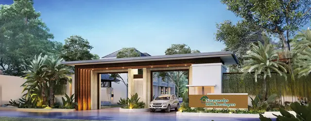
Skandhanshi Aarambh C Block Phase III
M/s.SKANDHANSHI INFRA PROJECTS INDIA PRIVATE LIMITED · Mahabubnagar · RERA P01400007337
SKANDHANSHI AARAMBH C BLOCK PHASE III is a plotted development in Mothighanapoor Grampanchayat, Balanagar Mandal, Mahabubnagar District. The registered promoter is M/s.SKANDHANSHI INFRA PROJECTS INDIA PRIVATE LIMITED. The project covers a RERA-filed total area of 34255.47 sqmts and is an approved layout of 114 open plots; drawing-derived plot sizes range from 122.63–349.52 sq.m. It is registered with TG-RERA under P01400007337, with a proposed completion date of 28/06/2025.
More from Skandhanshi Infra Projects India Pvt Ltd · 6 projects →
01What we found
Read from TG-RERA filings, approvals, land and registration records and court records. A court case is counted only when the court record states this project's survey number with its village, or names the project.
02Check before you pay
7 items to check before you pay, 4 high - from the title chain, court records and approvals, each with what to ask the builder or your advocate. An item may not be a problem with the project: records can be incomplete.
1. Project at a glance
Project identity
| Field | Record |
|---|---|
| Registered project name | SKANDHANSHI AARAMBH C BLOCK PHASE III RERA record |
| Project type / registered portion | Plotted development; C Block Phase III RERA record RERA filing |
| TG-RERA registration | P01400007337; registration certificate issued 08/12/2023, valid 08/12/2023 to 28/06/2025. The certificate says validity is unless extended by the Authority; no extension is recorded in the supplied certificate. RERA record Approvals record |
| RERA status in supplied record | Registered project. The stated registration period has ended; no extension is recorded in the supplied evidence. Registration validity is distinct from the project’s declared completion date. |
| Registered promoter | M/s.SKANDHANSHI INFRA PROJECTS INDIA PRIVATE LIMITED RERA record RERA filing |
Land and geographic identity
| Field | Record |
|---|---|
| Registered locality | Mothighanapoor Grampanchayat RERA record RERA filing |
| Revenue village | Mothighanapur; the layout approval describes “mothighanapur Revenue Village.” RERA record |
| Mandal / district / PIN | Balanagar / Mahabubnagar / 509202 RERA record RERA filing |
| Project survey number | 17P; the layout approval renders it Sy. Nos 17P. No project subdivision beyond 17P is stated in the registration certificate. RERA filing |
| RERA-filed land extent | Total area: 34255.47 sqmts; net area: 34255.47 sqmts; road-widening/FTL/nala-widening affected area recorded as 0. RERA filing |
| Drawing-measured layout area | 34255.19 sq.m in the layout’s area statement. This is a drawing-derived figure, not the RERA-filed extent. Layout record |
| Boundaries recorded in RERA | East: OTHERS LAND; West: OTHERS LAND; North: EXISTING ROAD AND OTHERS LAND; South: OTHERS LAND. RERA filing |
Development identity
| Field | Record |
|---|---|
| Sanctioning authority | MUDA Approvals record |
| Principal approval | Tentative Layout Plan approval 298249/LP/GP/204899/0012/2023, dated 28-06-2023; delegated to Mothighanapoor Grampanchayat. Approvals record |
| Approved development form | Plotted layout; approval records 114 plots. |
| Approved built-up area / building count / floor configuration | Not disclosed in the supplied project evidence. This is a plotted layout, and no building-level floor or tower schedule is supplied. |
| Layout land-use figures | The drawing’s area statement allocates 16898.36 sq.m to plots, 12620.52 sq.m to roads, 3090.06 sq.m to parks/open space, 785.96 sq.m to utilities and 860.28 sq.m to social infrastructure. These are software-read drawing figures. Layout record |
| Authority mortgage area | RERA form records 3231.51 sqmts. The approved layout drawing identifies plots 96 to 109 & 111 to 114 as mortgaged to the Grampanchayat and states an area of Ac 0.798 cents 3864.862 Sq.Yds. RERA filing |
Offering and status
| Field | Record |
|---|---|
| Offering | Open plots; the approved layout schedule contains 114 plots. RERA filing |
| Drawing-derived plot sizes | 114 plots with sizes read from the drawing: 122.63–349.52 sq.m (146.7–418.0 sq.yd); median 122.63 sq.m (146.7 sq.yd). Software-measured from the layout drawing; verify against the drawing. Layout record |
| Booked / available counts | Not disclosed in the supplied evidence. |
| Construction / development stage | RERA-filed amenity status records internal roads/footpaths at 50%, sewerage at 95%, park development with compound wall at 90%, water supply and storm-water drains at 100%, and several other listed items at 0%. These are filed progress figures, not independent site verification. RERA amenities |
| Declared completion date | 28/06/2025 in the RERA project record; the promoter’s Form B declares completion by 28 day of JUNE 2025. RERA record |
| Occupancy / completion certificate | No occupancy or completion certificate is identified in the supplied project documents. The record includes a tentative layout approval, not a completion certificate. Document index |
2. The project story
This is a registered plotted layout in Sy. No. 17P, at Mothighanapur village, Balanagar Mandal, Mahabubnagar District. The registration names it SKANDHANSHI AARAMBH C BLOCK PHASE III and records the promoter as M/s.SKANDHANSHI INFRA PROJECTS INDIA PRIVATE LIMITED. The layout approval is for 114 plots and shows land set aside for roads, parks/open space, utilities and social infrastructure. RERA record RERA filing Layout record
The available approval is expressly a Tentative Layout Plan. Its conditions call for infrastructure and amenity works, including roads and drains, storm-water channelization, avenue planting, rainwater-harvesting pits, street lighting, sewerage disposal and protected water supply; the approval also requires a work-completion certificate for final layout approval. The project file supplies no independently verified site-progress report or completion certificate. RERA-filed progress percentages are therefore reported as promoter-filed status, not as independently confirmed completion. RERA amenities
The approval requires specified open space, social infrastructure, utilities and roads to be handed over by registered gift deed before release of the Final Layout Plan. It also identifies a set of plots mortgaged to the Grampanchayat pending development conditions. The detailed conditions are part of the approval record.
3. Master plan, architecture & building design
This is a plotted layout, not a building or apartment development. The tentative approval records 114 plots in Sy. Nos 17P. The layout drawing’s software-read schedule likewise identifies 114 plots; the drawing-derived plot sizes range from 122.63 sq.m to 349.52 sq.m, with a median of 122.63 sq.m. Layout record
The layout’s own area statement, read from the drawing, allocates 16898.36 sq.m to plots, 12620.52 sq.m to roads, 3090.06 sq.m to parks/open space, 785.96 sq.m to utilities and 860.28 sq.m to social infrastructure, on a stated net layout area of 34255.19 sq.m. These are software-measured drawing figures, not RERA-filed land-extent figures. Layout record
The approval requires roads to remain accessible to neighboring sites and prohibits a compound wall or fencing around the overall site. It specifies handing over the developed open space, social infrastructure, utilities and roads by registered gift deed before final layout approval. It also states that only a detached dwelling house for a single family may be built on a site, with future development subject to competent-authority approval.
No building plans, tower or floor configuration, apartment distribution, or building-level architectural details are disclosed for this registered plotted phase. The two supplied drawing sheets are layout sheets and have no flats measured. Floor plans
4. Homes, configurations & floor plans
The offering is plots, not apartment configurations. The approved schedule records 114 plots. The drawing-derived size bands are:
| Plot size band | Number of plots |
|---|---|
| 100–150 sq.yd (84–125 sq.m) | 79 |
| 150–200 sq.yd (125–167 sq.m) | 12 |
| 200–250 sq.yd (167–209 sq.m) | 6 |
| 250–300 sq.yd (209–251 sq.m) | 14 |
| 300–400 sq.yd (251–334 sq.m) | 2 |
| 400–500 sq.yd (334–418 sq.m) | 1 |
These counts and sizes are software-read from the approved layout drawing; the source notes they should be verified against the drawing. The drawing records 114 plots, with the smallest at 122.63 sq.m, the median at 122.63 sq.m, and the largest at 349.52 sq.m. Layout record
Apartment saleable area, carpet area and loading figures do not apply to this plotted offering and are not disclosed. The supplied agreement-of-sale template leaves buyer and plot particulars blank.
5. Parking & vehicle circulation
- The layout approval provides for roads and road access, but the supplied project record does not establish a sanctioned count of parking spaces, visitor or accessible parking, or plot-specific parking allocations. Document index
- A promoter/vendor specification lists Open Parking (3090 sqm), Covered Parking (30); the supplied evidence does not establish these as approved or allocated provisions for this registered phase, so they are not treated here as sanctioned parking counts. Promoter website
6. Amenities, recreation & open spaces
The tentative layout approval identifies open space, social infrastructure, utilities and roads and sets conditions for their development and later handover. RERA-filed progress percentages are shown separately below; they are not independent verification of completion. RERA amenities
| Facility | Park / open space |
|---|---|
| Description / size | Approval states Ac0.764 cents 3695.712 Sq.Yds; layout drawing reports 3090.06 sq.m. |
| Evidence source | Layout record |
| Declared progress / verified status | RERA-filed park/open-space item: 0%; park development with compound wall: 90%. Not independently verified. RERA amenities |
| Facility | Green strip / tot lot / park |
|---|---|
| Description / size | No separate size disclosed. |
| Evidence source | RERA amenities |
| Declared progress / verified status | RERA-filed 0%. RERA amenities |
| Facility | No specific sports or recreation facility disclosed |
|---|---|
| Description / size | — |
| Evidence source | RERA amenities |
| Declared progress / verified status | Not disclosed. |
| Facility | Social infrastructure |
|---|---|
| Description / size | Approval states Ac 0.213 cents 1028.895 Sq.Yds. The listed amenities include pharmacy, clinic, school, play school, creche, dispensary and convenient shops, but the evidence does not establish that these have been built or are operating. |
| Declared progress / verified status | Handover required by registered gift deed before final layout approval; completion not independently verified. |
| Facility | Utilities area |
|---|---|
| Description / size | Approval states Ac0.194cents 940.008 Sq.Yds for items including water reservoir, septic tank/STP, electric transformer and solid-waste management. |
| Declared progress / verified status | Handover required by registered gift deed before final layout approval; no independent completion evidence. |
| Facility | Roads |
|---|---|
| Description / size | Approval states Ac3.118 cents 15094.142 Sq.Yds; drawing states 12620.52 sq.m. |
| Evidence source | Layout record |
| Declared progress / verified status | RERA-filed internal roads/footpaths: 50%. Not independently verified. RERA amenities |
| Facility | Street lighting |
|---|---|
| Description / size | No size or quantity disclosed. |
| Evidence source | RERA amenities |
| Declared progress / verified status | RERA-filed 0%. RERA amenities |
7. Utilities, building services & safety
- The tentative approval requires protected water supply, a water tank or sump, septic tank as applicable, sufficient harvesting pits, sewerage disposal, storm-water drains and channelization, street lighting and electricity facilities. It identifies a utilities area of Ac0.194cents 940.008 Sq.Yds and requires its handover by registered gift deed before final layout approval. These are approval requirements; the supplied record does not establish that all systems are complete or operational.
- The RERA-filed amenity status lists Water Supply 100%, Storm Water Drains 100%, Sewerage (Chamber, Lines, Septic Tank, STP) 95%, Water Conservation, Rain water Harvesting 0%, Electrical Meter Room, Sub-Station, Receiving Station 0%, and Solid Waste Management and Disposal 0%. These percentages are filed status, not independent verification; the supplied evidence gives no capacities, source details, treatment/reuse volumes, backup-power arrangements, fire-safety systems, security systems, or accessibility specifications. RERA amenities
8. Location, access & connectivity
The registered location is Mothighanapoor Grampanchayat, Mothighanapur village, Balanagar Mandal, Mahabubnagar District, Telangana 509202. The RERA-recorded north boundary is an existing road and other land; the other recorded boundaries are other land. RERA record RERA filing RERA filing
The cadastral parcel centroid is 17.00212, 78.17418. The supplied location record gives the nearest sampled Outer Ring Road interchange at approximately 37.2 km. No public-transport details, additional approach-road measurements or landmark distances are supplied. Cadastral map Location record
9. Developer & development status
The registered promoter is M/s.SKANDHANSHI INFRA PROJECTS INDIA PRIVATE LIMITED, a private limited company; the corporate record gives CIN U45205KA2015PTC082244 and GSTIN 36AAWCS0746E1Z2. RERA record Corporate record RERA filing
The RERA record gives the promoter address as 4-50/P-1/14,15, JAYABHERI ENCLAVE, GACHIBOWLI, with the project locality and district fields showing Mothighanapoor/Balanagar/Mahabubnagar. A project-specific official contact number, email address or website is not disclosed in the supplied evidence. RERA filing RERA record
The promoter’s Form B, dated 06.12.2023, declares that the project would be completed by 28 day of JUNE 2025. The registration certificate is valid through 28/06/2025 and states that an extension would require Authority action. No extension or occupancy/completion certificate is included in the supplied documents.
10. Approvals, official records & documents
| Record | What the supplied project file establishes |
|---|---|
| TG-RERA registration certificate | Form C registration P01400007337 for SKANDHANSHI AARAMBH C BLOCK PHASE III, issued 08/12/2023, valid through 28/06/2025. |
| Tentative Layout Plan approval | MUDA approval 298249/LP/GP/204899/0012/2023, dated 28-06-2023, for a plotted layout in Sy. Nos 17P, Mothighanapur Revenue Village; records 114 plots and development and handover conditions. |
| Promoter Form B declaration | Authorised signatory KRISHNAPURAM SURESH KUMAR REDDY signed the promoter’s declaration dated 06.12.2023, including the promoter’s completion undertaking and other statutory declarations. |
| Agreement-of-sale template | Filed template for open plots; buyer and plot particulars are blank. |
| Title-related filed documents | The project file includes a title search report, registered GPA and sale-deed/revenue-record materials. These are indexed in the project evidence for detailed review; this Overview does not determine title. |
| Completion / occupancy records | No completion or occupancy certificate is identified in the supplied project documents. Document index |
| Layout-plan drawings | Two layout sheets are available for software-read plot schedule and land-use measurements; no flats were measured from the supplied sheets. Layout record Floor plans |
1. Project at a glance
Project identity
Registered project name: SKANDHANSHI AARAMBH C BLOCK PHASE III
Project type / registered portion: Plotted development; C Block Phase III
TG-RERA registration: P01400007337; registration certificate issued 08/12/2023, valid 08/12/2023 to 28/06/2025. The certificate says validity is unless extended by the Authority; no extension is recorded in the supplied certificate.
RERA status in supplied record: Registered project. The stated registration period has ended; no extension is recorded in the supplied evidence. Registration validity is distinct from the project’s declared completion date.
Registered promoter: M/s.SKANDHANSHI INFRA PROJECTS INDIA PRIVATE LIMITED
Land and geographic identity
Registered locality: Mothighanapoor Grampanchayat
Revenue village: Mothighanapur; the layout approval describes “mothighanapur Revenue Village.”
Mandal / district / PIN: Balanagar / Mahabubnagar / 509202
Project survey number: 17P; the layout approval renders it Sy. Nos 17P. No project subdivision beyond 17P is stated in the registration certificate.
RERA-filed land extent: Total area: 34255.47 sqmts; net area: 34255.47 sqmts; road-widening/FTL/nala-widening affected area recorded as 0.
Drawing-measured layout area: 34255.19 sq.m in the layout’s area statement. This is a drawing-derived figure, not the RERA-filed extent.
Boundaries recorded in RERA: East: OTHERS LAND; West: OTHERS LAND; North: EXISTING ROAD AND OTHERS LAND; South: OTHERS LAND.
Development identity
Sanctioning authority: MUDA
Principal approval: Tentative Layout Plan approval 298249/LP/GP/204899/0012/2023, dated 28-06-2023; delegated to Mothighanapoor Grampanchayat.
Approved development form: Plotted layout; approval records 114 plots.
Approved built-up area / building count / floor configuration: Not disclosed in the supplied project evidence. This is a plotted layout, and no building-level floor or tower schedule is supplied.
Layout land-use figures: The drawing’s area statement allocates 16898.36 sq.m to plots, 12620.52 sq.m to roads, 3090.06 sq.m to parks/open space, 785.96 sq.m to utilities and 860.28 sq.m to social infrastructure. These are software-read drawing figures.
Authority mortgage area: RERA form records 3231.51 sqmts. The approved layout drawing identifies plots 96 to 109 & 111 to 114 as mortgaged to the Grampanchayat and states an area of Ac 0.798 cents 3864.862 Sq.Yds.
Offering and status
Offering: Open plots; the approved layout schedule contains 114 plots.
Drawing-derived plot sizes: 114 plots with sizes read from the drawing: 122.63–349.52 sq.m (146.7–418.0 sq.yd); median 122.63 sq.m (146.7 sq.yd). Software-measured from the layout drawing; verify against the drawing.
Booked / available counts: Not disclosed in the supplied evidence.
Construction / development stage: RERA-filed amenity status records internal roads/footpaths at 50%, sewerage at 95%, park development with compound wall at 90%, water supply and storm-water drains at 100%, and several other listed items at 0%. These are filed progress figures, not independent site verification.
Declared completion date: 28/06/2025 in the RERA project record; the promoter’s Form B declares completion by 28 day of JUNE 2025.
Occupancy / completion certificate: No occupancy or completion certificate is identified in the supplied project documents. The record includes a tentative layout approval, not a completion certificate.
2. The project story
This is a registered plotted layout in Sy. No. 17P, at Mothighanapur village, Balanagar Mandal, Mahabubnagar District. The registration names it SKANDHANSHI AARAMBH C BLOCK PHASE III and records the promoter as M/s.SKANDHANSHI INFRA PROJECTS INDIA PRIVATE LIMITED. The layout approval is for 114 plots and shows land set aside for roads, parks/open space, utilities and social infrastructure.
The available approval is expressly a Tentative Layout Plan. Its conditions call for infrastructure and amenity works, including roads and drains, storm-water channelization, avenue planting, rainwater-harvesting pits, street lighting, sewerage disposal and protected water supply; the approval also requires a work-completion certificate for final layout approval. The project file supplies no independently verified site-progress report or completion certificate. RERA-filed progress percentages are therefore reported as promoter-filed status, not as independently confirmed completion.
The approval requires specified open space, social infrastructure, utilities and roads to be handed over by registered gift deed before release of the Final Layout Plan. It also identifies a set of plots mortgaged to the Grampanchayat pending development conditions. The detailed conditions are part of the approval record.
3. Master plan, architecture & building design
This is a plotted layout, not a building or apartment development. The tentative approval records 114 plots in Sy. Nos 17P. The layout drawing’s software-read schedule likewise identifies 114 plots; the drawing-derived plot sizes range from 122.63 sq.m to 349.52 sq.m, with a median of 122.63 sq.m.
The layout’s own area statement, read from the drawing, allocates 16898.36 sq.m to plots, 12620.52 sq.m to roads, 3090.06 sq.m to parks/open space, 785.96 sq.m to utilities and 860.28 sq.m to social infrastructure, on a stated net layout area of 34255.19 sq.m. These are software-measured drawing figures, not RERA-filed land-extent figures.
The approval requires roads to remain accessible to neighboring sites and prohibits a compound wall or fencing around the overall site. It specifies handing over the developed open space, social infrastructure, utilities and roads by registered gift deed before final layout approval. It also states that only a detached dwelling house for a single family may be built on a site, with future development subject to competent-authority approval.
No building plans, tower or floor configuration, apartment distribution, or building-level architectural details are disclosed for this registered plotted phase. The two supplied drawing sheets are layout sheets and have no flats measured.
4. Homes, configurations & floor plans
The offering is plots, not apartment configurations. The approved schedule records 114 plots. The drawing-derived size bands are:
100–150 sq.yd (84–125 sq.m): 79
150–200 sq.yd (125–167 sq.m): 12
200–250 sq.yd (167–209 sq.m): 6
250–300 sq.yd (209–251 sq.m): 14
300–400 sq.yd (251–334 sq.m): 2
400–500 sq.yd (334–418 sq.m): 1
These counts and sizes are software-read from the approved layout drawing; the source notes they should be verified against the drawing. The drawing records 114 plots, with the smallest at 122.63 sq.m, the median at 122.63 sq.m, and the largest at 349.52 sq.m.
Apartment saleable area, carpet area and loading figures do not apply to this plotted offering and are not disclosed. The supplied agreement-of-sale template leaves buyer and plot particulars blank.
5. Parking & vehicle circulation
- The layout approval provides for roads and road access, but the supplied project record does not establish a sanctioned count of parking spaces, visitor or accessible parking, or plot-specific parking allocations.
- A promoter/vendor specification lists Open Parking (3090 sqm), Covered Parking (30); the supplied evidence does not establish these as approved or allocated provisions for this registered phase, so they are not treated here as sanctioned parking counts.
6. Amenities, recreation & open spaces
The tentative layout approval identifies open space, social infrastructure, utilities and roads and sets conditions for their development and later handover. RERA-filed progress percentages are shown separately below; they are not independent verification of completion.
| Facility | Park / open space |
|---|---|
| Description / size | Approval states Ac0.764 cents 3695.712 Sq.Yds; layout drawing reports 3090.06 sq.m. |
| Declared progress / verified status | RERA-filed park/open-space item: 0%; park development with compound wall: 90%. Not independently verified. |
| Facility | Green strip / tot lot / park |
|---|---|
| Description / size | No separate size disclosed. |
| Declared progress / verified status | RERA-filed 0%. |
| Facility | No specific sports or recreation facility disclosed |
|---|---|
| Description / size | — |
| Declared progress / verified status | Not disclosed. |
| Facility | Social infrastructure |
|---|---|
| Description / size | Approval states Ac 0.213 cents 1028.895 Sq.Yds. The listed amenities include pharmacy, clinic, school, play school, creche, dispensary and convenient shops, but the evidence does not establish that these have been built or are operating. |
| Declared progress / verified status | Handover required by registered gift deed before final layout approval; completion not independently verified. |
| Facility | Utilities area |
|---|---|
| Description / size | Approval states Ac0.194cents 940.008 Sq.Yds for items including water reservoir, septic tank/STP, electric transformer and solid-waste management. |
| Declared progress / verified status | Handover required by registered gift deed before final layout approval; no independent completion evidence. |
| Facility | Roads |
|---|---|
| Description / size | Approval states Ac3.118 cents 15094.142 Sq.Yds; drawing states 12620.52 sq.m. |
| Declared progress / verified status | RERA-filed internal roads/footpaths: 50%. Not independently verified. |
| Facility | Street lighting |
|---|---|
| Description / size | No size or quantity disclosed. |
| Declared progress / verified status | RERA-filed 0%. |
7. Utilities, building services & safety
- The tentative approval requires protected water supply, a water tank or sump, septic tank as applicable, sufficient harvesting pits, sewerage disposal, storm-water drains and channelization, street lighting and electricity facilities. It identifies a utilities area of Ac0.194cents 940.008 Sq.Yds and requires its handover by registered gift deed before final layout approval. These are approval requirements; the supplied record does not establish that all systems are complete or operational.
- The RERA-filed amenity status lists Water Supply 100%, Storm Water Drains 100%, Sewerage (Chamber, Lines, Septic Tank, STP) 95%, Water Conservation, Rain water Harvesting 0%, Electrical Meter Room, Sub-Station, Receiving Station 0%, and Solid Waste Management and Disposal 0%. These percentages are filed status, not independent verification; the supplied evidence gives no capacities, source details, treatment/reuse volumes, backup-power arrangements, fire-safety systems, security systems, or accessibility specifications.
8. Location, access & connectivity
The registered location is Mothighanapoor Grampanchayat, Mothighanapur village, Balanagar Mandal, Mahabubnagar District, Telangana 509202. The RERA-recorded north boundary is an existing road and other land; the other recorded boundaries are other land.
The cadastral parcel centroid is 17.00212, 78.17418. The supplied location record gives the nearest sampled Outer Ring Road interchange at approximately 37.2 km. No public-transport details, additional approach-road measurements or landmark distances are supplied.
9. Developer & development status
The registered promoter is M/s.SKANDHANSHI INFRA PROJECTS INDIA PRIVATE LIMITED, a private limited company; the corporate record gives CIN U45205KA2015PTC082244 and GSTIN 36AAWCS0746E1Z2.
The RERA record gives the promoter address as 4-50/P-1/14,15, JAYABHERI ENCLAVE, GACHIBOWLI, with the project locality and district fields showing Mothighanapoor/Balanagar/Mahabubnagar. A project-specific official contact number, email address or website is not disclosed in the supplied evidence.
The promoter’s Form B, dated 06.12.2023, declares that the project would be completed by 28 day of JUNE 2025. The registration certificate is valid through 28/06/2025 and states that an extension would require Authority action. No extension or occupancy/completion certificate is included in the supplied documents.
10. Approvals, official records & documents
TG-RERA registration certificate: Form C registration P01400007337 for SKANDHANSHI AARAMBH C BLOCK PHASE III, issued 08/12/2023, valid through 28/06/2025.
Tentative Layout Plan approval: MUDA approval 298249/LP/GP/204899/0012/2023, dated 28-06-2023, for a plotted layout in Sy. Nos 17P, Mothighanapur Revenue Village; records 114 plots and development and handover conditions.
Promoter Form B declaration: Authorised signatory KRISHNAPURAM SURESH KUMAR REDDY signed the promoter’s declaration dated 06.12.2023, including the promoter’s completion undertaking and other statutory declarations.
Agreement-of-sale template: Filed template for open plots; buyer and plot particulars are blank.
Title-related filed documents: The project file includes a title search report, registered GPA and sale-deed/revenue-record materials. These are indexed in the project evidence for detailed review; this Overview does not determine title.
Completion / occupancy records: No completion or occupancy certificate is identified in the supplied project documents.
Layout-plan drawings: Two layout sheets are available for software-read plot schedule and land-use measurements; no flats were measured from the supplied sheets.
Other registrations of Skandhanshi Aarambh C
Frequently asked questions
Is SKANDHANSHI AARAMBH C BLOCK PHASE III registered with Telangana RERA?
Yes. SKANDHANSHI AARAMBH C BLOCK PHASE III is registered with the Telangana Real Estate Regulatory Authority as P01400007337; the registration status is New Project.
Who is the developer of SKANDHANSHI AARAMBH C BLOCK PHASE III?
The promoter named in the RERA registration is M/s.SKANDHANSHI INFRA PROJECTS INDIA PRIVATE LIMITED.
Where is SKANDHANSHI AARAMBH C BLOCK PHASE III located?
SKANDHANSHI AARAMBH C BLOCK PHASE III is in Mothighanapoor Grampanchayat, Mothighanapur, Balanagar, Mahabubnagar, Telangana (509202).
When will SKANDHANSHI AARAMBH C BLOCK PHASE III be completed?
The promoter's proposed date of completion filed with RERA is 28/06/2025. This is the promoter's declaration, not a guarantee.
More projects in Mothighanapur